[China, Australia] P Anselm DesingBiblio.com

10 résultats
1730171311730. Very good condition. An early copper plate engraved b&w map extending from Egypt and the Middle East to southeast Asia with Australia at the extreme lower right "New Holland" and below that "Incognita". To the northeast is Nova Guinea drawn attached to Carpentaria. A rather crude general map of southeast Asia. Heraldic shields with author and title at the lower left. Desing was a Benedictine monk from Ensdorff & member of the Bavarian Academy of Sciences. 5 1/4 x 4 1/2" unknown
1759154745Canberra.: Government Printer. 1917-59. Collection of 11 reports for the years: <br> <br>For the Year ended 30th June 1916 - 8pp. <br>For the Year ended 30th June 1919 - 8pp. <br>For the Year ended 30th June 1920 - 4pp. <br>For the Year ended 30th June 1921 - 19pp. <br>For the Year ended 30th June 1935 - 11pp. <br>For the Year 1937-38 - 15pp. <br>For the Year ended 30th June 1952 - 14pp. <br>For the Year ended 30th June 1953 - 31pp <br>For the Years 1st July 1953 to 30th June 1956 - 34pp <br>For the Year 1956 - 57 - 27pp <br>For the Year 1957-58 - 24pp <br> <br>All in wrappers occasional light browning very good copies. 34 x 21cm. . Government Printer. unknown
1759154744Canberra.: Government Printer. 1917-59. Collection of 13 reports for the years: <br> <br>For the Year ended 30th June 1916 - 8pp. lightly and evenly browned. <br>For the Year ended 30th June 1918 - 8pp. lightly and evenly browned. <br>For the Year ended 30th June 1919 - 8pp. <br>For the Year ended 30th June 1920 - 4pp. <br>For the Year ended 30th June 1921 - 19pp. <br>For the Year ended 30th June 1929 - 12pp. <br>For the Year ended 30th June 1935 - 11pp. <br>For the Year 1937-38 - 15pp. <br>For the Year ended 30th June 1952 - 14pp. <br>For the Year ended 30th June 1953 - 31pp <br>For the Years 1st July 1953 to 30th June 1956 - 34pp lower wrapper stained and a little creased. <br>For the Year 1956-57 - 27pp <br>For the Year 1957-58 - 24pp <br> <br>All in wrappers occasional light browning very good. 34 x 21cm. This collection of reports offers a very detailed picture of Norfolk Island from World War I to the end of the 1950s. Agriculture trade tourism there were 793 visitors to Norfolk Island in 1929 sports purchase of a road grader roads on the island much improved wages and trade being just some of the areas reported on. . Government Printer. unknown
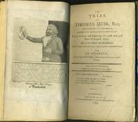
179327862Edinburgh: Alexander Scott - Gazetteer Office 1793. Third edition corrected and greatly enlarged. Hardcover. Very good condition. Muir was a Scottish political reformer and lawyer who was ultimately accused of sedition was the first political prisoner transported to Australia from which he later escaped. Muir was sentenced to 14 years transportation for the the crime of sedition; for campaigning for parliamentary reform and for distributing copies of Thomas Paine's 'The Rights of Man'. His trial became one of the great sensations of the day; he was one of the group known as the 'Scottish Martyrs' who were sentenced in Scotland in 1793-4. <br /> <br /> Large 12mo 4 128pp rebound in a later half cloth and marble boards leather spine label revised engraved portrait frontis of Muir showing him from the waist up by J. Kay. OCLC 17619597 recorded at 8 locations. Libraries Australia ID 62770710 cites one copy at Queensland Univ. of Technology. Alexander Scott - Gazetteer Office hardcover
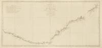
1774143635Paris: Chez Saillant et Nyon . chez Panckoucke 1774. Near fine. Paris Chez Saillant et Nyon . chez Panckoucke 1774 first thus. An original map printed surface 365 × 771 mm sheet size approximately 410 × 830 mm engraved under the direction of Robert Bénard. Trimmed outside the plate-mark leaving ample margins; vertical and horizontal folds; a couple of trifling spots of foxing; small production flaw to the edge of the right-hand margin; some very faint offsetting and other trifling signs of age; in near-fine condition. A map of the east coast of Australia from Point Hicks to Cape Cornwall by way of Botany Bay and Port Jackson as charted by Cook on his first voyage. It comes from the first French edition of the official account of the voyage 'Relation des voyages entrepris . pour faire des découvertes dans l'hémisphère méridional' 'Tome III. Pl. 16'. <p>Tooley 342; see Beddie 659. Chez Saillant et Nyon ... chez Panckoucke unknown
171023256Bordeaux: James l'Aveugle 1710. First edition. An important imaginary voyage to Australia: a 'landmark' in the development of the French voyage novel Atkinson in its original full calf decorated binding. <br /> <br /> A Robinsonade account which predates Defoe. It is complete with the ship wreck exploration conflict with local inhabitants stand off and final rescue by a passing ship. It is a reasonable representation of the Australian continent and its challenges along with a realistic estimation of the importance of mining and irrigation to Australia that "foreshadow what has actually come to pass in modern Australia." Friederich <br /> <br /> The title page is falsely dated 1710. In his deep analyses of Tyssot de Patot and his publications Aubrey Rosenberg has concluded that this 1710 printing with the armillary sphere device on the title page with the base pointing to the left is indeed the first edition and was published between 1714 and 1718. "Robinson Crusoe" first appeared in 1719.<br /> <br /> 12mo viii 508pp. Bound in the original full brown calf binding gilt spine in 6 compartments raised bands gilt device decoration on spine and outer dentelles. Bookplate of Sir John Dashwood King on the inside front pastedown. Rosenberg "A" Gove 217-219; Cioranescu 62587; Barbier IV 1103; Atkinson 'The Extraordinary Voyage in French Literature' p. 70; Rosenberg pp. 84-5. <br /> <br /> A handsome copy in its original binding. James l'Aveugle unknown
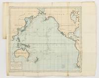
1790143934Paris: F. Dufart 1790. Very Good. Paris F. Dufart circa 1790. A hand-coloured engraved map printed surface 378× 415 mm sheet size approximately 420 × 540 mm. 'Gravée par Tardieu l'Ainé . Dessiné par Poirson . Ecrit par Beaublé'. Original folds as issued; some minor uneven tanning; in very good condition. An uncommon chart of the Pacific Ocean and Australia showing magnetic variation and dip drawing on observations made in the course of Pacific voyages after 1775 most notably Cook's third voyage. It is most likely from a duodecimo edition of Buffon's 'Histoire naturelle générale et particulière' around the end of the eighteenth century 'PL. III. Tome XVI' and 'Page 58' are printed in the top margin. It is based on a larger chart in four sheets attributed to Jean-Charles de Borda. The engraver Tardieu is one of half a dozen members of the family working as engravers at the period one of whom P.A.F. Tardieu would engrave the charts published in the official account of the Baudin voyage. F. Dufart unknown
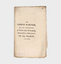
1789365069Paris 1789. 19 1pp. 8vo. Self-wrappers contemporary ink inscription on title "Aoust 1789. 19 1pp. 8vo. A rare satirical pamphlet written under the guise of the Count of Artois later King Charles X styled here as the 'King of Botany Bay'. The author through the voice of the count entreats all those who fled France during the Revolution and their supporters in France and England to join the future king of France in the penal colony of Botany Bay. He goes on to imply that these traitors to France are no better than the lowliest of English convicts being transported by the British government to what he considers 'a new country made especially for them' 'le vaste continent des Terres Australes leur offre un pays nouveau asyle fait pour eux.'. COPAC lists only two copies unknown
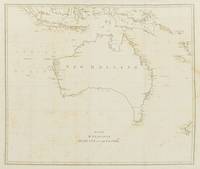
1800144429London: Printed by Luke Hansard . and sold by John White 1800. Very Good. London Printed by Luke Hansard . and sold by John White 1800. An engraved map printed surface 498 × 585 mm sheet size approximately 560 × 690 mm engraved by W. Palmer. Folded as issued; old repaired tear near the stub just encroaching on the printed surface; some moderate foxing; in very good condition with ample margins. A map of Australia labelled 'New Holland' noting but not showing the 'Supposed New discov'd Straits' between Tasmania and the mainland Matthew Flinders and George Bass had discovered Bass Strait in 1798. Bound as issued in the fourth volume of Pennant's 'Outlines of the Globe' titled 'The View of the Malayan Isles New Holland and the Spicy Islands' quarto contemporary quarter calf and marbled boards; edges uncut; covers worn; in very good condition overall with pages 97-147 devoted to New Holland. <p>See Ferguson 278; not in Tooley; Perry and Prescott 1800.11. Printed by Luke Hansard ... and sold by John White unknown
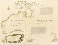
1744133907London: Printed for T. Woodward and others 1744. Very Good. London Printed for T. Woodward and others 1744. A hand-coloured engraved map visible image size 372 × 483 mm recently mounted and matted just outside the printed border using archival materials visible image size 372 × 483 mm external mat size 545 × 643 mm ready for framing or long-term storage in its custom-made Mylar sleeve. A long sealed clean tear to the blank area in the bottom right-hand corner mainly along the crease of the original fold; light central vertical crease; a few small insignificant light marks; in very good condition. The first dedicated English map of Australia originally issued as part of the second edition of John Harris's 'Navigantium atque Itinerantium Bibliotheca or a Complete Collection of Voyages and Travels' London 1744-1748; 'Vol. 1 page 325' is printed in the top right-hand corner. Clancy 'So They Came South' pages 136-37; Clancy 'Mapping of Terra Australis' page 91; Tooley 241: 'A reissue of Thevenot's map of 1663 but with title as above within cartouche bottom right. Bowen inserts the Tropic of Capricorn and two long legends. The first one is very exactly copied from the original . The second legend is a long laudatory account of the presumed riches of Terra Australis'. Printed for T. Woodward (and others) unknown