34 résultats
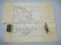
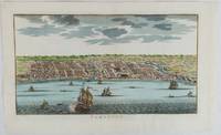
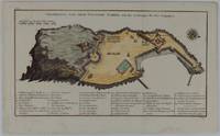
1748175859Leipzig.: Schwabe Johann Joachim. 1748. Engraved map on laid paper 20.5 x 36 cm plate -mark inc. captions 24 x 39 cm sheet size original fold later hand-colouring slight marginal spotting but in very good condition. Fine 18th century ground plan of Gorée Island off the coast of Senegal infamous for its association with slavery. The map shows encampments and forts with a detailed key. Originally published in Abbe Prevost's "Histoire générale des voyages." 1746 -1789 with maps and plans by the great cartographer Jacques-Nicolas Bellin this was prepared for volume two of the the German edition "Allgemeine Historie der Reisen." published in 1748. . (Schwabe, Johann Joachim) unknown
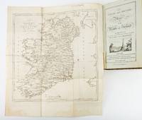
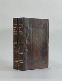
1783ST19355London: Engraved by G. Terry and Sold by T. Longman London and W. Wilson Dublin 1783. Second Corrected Edition. 260 x 155 mm. 10 1/4 x 6". XXVII 289 pp. 4 leaves index. <br/> Contemporary half calf over marbled boards flat spine divided into panels by gilt rules red morocco label very neat repair to head of front joint and top of spine. Engraved title page with vignette and dedication leaf large folding map of Ireland and 289 engraved maps. Title page with early ink signature of Jos. Sabine. Moreland & Bannister p. 190; Tooley "Maps and Mapmakers" p. 94. Small signs of age and wear to the binding including slight crackling and nicks to the spine folding map with faint dampstain to tail margin two negligible ink spots to blank area on the map of the Irish Sea but A VERY APPEALING COPY quite clean and remarkably fresh internally and in an entirely solid period binding.<br/> <br/> This is the second corrected edition of the first comprehensive road atlas of Ireland offered here in especially attractive condition. In response to increasing demand for accurate maps of the country's road system the Irish House of Commons commissioned George Taylor and Andrew Skinner who together had previously produced the first road atlas of Scotland among other works to undertake a survey of the land. Taylor and Skinner completed their work in 1777 and published the first edition of their findings in 1778. This second edition includes updates to the year 1783 as well as an additional map no. 289. Renowned for their precision and detail Taylor and Skinner's maps clearly show roads crossroads and bridges as well as topographical features such as hills lakes and rivers including the direction of the water flow; landmarks such as castles churches and ruins; and the names of local landlords and their homes. The maps appear either as half-page strips or in full-page and the distances are given in both Irish and English miles 11 Irish miles being equal to 14 British miles. The robust list of subscribers which includes a number of earls viscounts lords bishops and British and Irish army men demonstrates the great need for and widespread success of this important work. Our former owner may well be the famed and controversial naturalist Joseph Sabine 1770-1837 who often signed his name as "Jos. Sabine" as seen here. He certainly had good reason to own maps of Ireland. He was from an Anglo-Irish family himself and was Honorary Secretary of the Horticultural Society a position which at the time carried great clout in the botanical community and one that presupposed knowledge of geography across the realm. DNB tells us that "Sabine played a leading part in the establishment of the society's garden first at Hammersmith and afterwards at Chiswick; in sending out David Douglas and others as collectors; in starting local societies in connection with the Horticultural Society; and in growing and distributing new and improved varieties of flowers fruits and vegetables throughout the country." While not a rare book this is the kind of volume that would have normally encountered frequent and inevitably damaging use so to find a copy as well preserved as this one is a lucky occurrence. Engraved by G. Terry and Sold by T. Longman, London and W. Wilson, Dublin unknown
178425892London: Harrison & Co 1784. 1 vols. 10 x 7 3/4 inches. Extracted from a volume. Some light marginal discoloration folds else in very good condition. 1 vols. 10 x 7 3/4 inches. The first "A General Stereographic Map on the Plane of the Meridian" and the other showing a "Stereographic Projection on the Plane of the Horizon" and "Orthographic Projection on the pLane of the Meridian" Maps of the Hemispheres. <br/><br/> Harrison & Co unknown
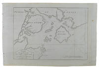
1749136827Paris. Circa1749. Engraved map on watermarked laid paper 20 x 27.3 cm of Fuzhou and coastline of Fujian Province original folds designed by the great French cartographer Jacques-Nicolas Bellin. This map is from the impressive 15-volume "Histoire Génèrale des Voyages" compiled by Antoine François Prévost map no. 2 Vol. 6. This map shows the estuary of Yangtze River Rivière de Chang. Very light browning on sheet edges but in very good condition. . unknown
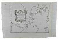
1749136826Paris. circa1749. Black and white engraved map on watermarked laid paper 20.9 x 32.7cm showing coastal area of Zhejiang Province Province de Che-kiang including Zhoushan Archipelago Isle de Chusan Zhoushan Bay Bay de Chusan and Xiangshan County Siang-chan-luen a walled city outside of upper border Ningbo Ning-po prefecture under Qing administration title cartouche lower left original folds. This map is No. 3 Vol. 6 from the impressive 15-volume "Histoire Generale des Voyages" compiled by Antoine François Prévost. Even browning mainly to the sheet edges in very good condition. . unknown
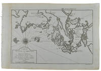
1749136795Paris. circa1749. Black and white engraved map of Quanzhou and Zhangzhou 21.1 x 30 cm here spelled Chin-chew and Chang-chew and both final words with added superscript "ou" on watermarked laid paper 25.6 x 38 cm original folds a few marginal spots simplified compass rose and a decorative fleur de lis bottom right in very good condition. Attractive map including the estuary of Quanzhou River Xiamen Emowi and Kinmen or Quemoy Quemowi island. The map was designed by the eminent French cartographer Jacques-Nicolas Bellin and here published as plate No. 22 in the impressive 15 volume compilation of voyages "Histoire Generale des Voyages" by Antoine François Prévost. . unknown
1749136781Paris. circa1749. Black and white engraved map on laid paper showing entrance to Pearl/Canton river Macao and the area which would become Hong Kong Sinn-gan-hien folded designed by the prominent French cartographer Jacques-Nicolas Bellin. This map is No. 16 Vol. 5 from the impressive 15-volume "Histoire Generale des Voyages" compiled by French novelist Antoine François Prévost. The walled city of Canton upper section is divided into areas of Tartar and Chinese. <br> <br>Some light even browning on paper added at margins good copy. Map measures 25.7 x 20.5. . unknown
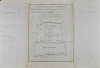
1749136794Paris. circa1749. Black and white engraved plan map of Peking on laid paper folded designed by the prominent French cartographer Jacques-Nicolas Bellin. This map is No. 18 Vol. 5 from the impressive 15-volume "Histoire Generale des Voyages" compiled by French novelist Antoine François Prévost. This city map shows two areas of walled cities: Ville Tartare Imperial city and the Forbidden City and Ville Chinoise ethnic Han residential area. <br> <br>Notes A and B represents buildings within the Forbidden City. A: Lieu de Plaisance ou l'on voit une Montagne faite a la main B: Grandes Cours du Palais de l'Empereur. Two missionary buildings French and Portuguese as well as the Tower of Mathematics illustrated within Ville Tartare. Two temples illustrated side by side near the south gate of the Ville Chinoise. <br> <br>Overall in good condition very light browning on edges and darker toning along the borders of the map. Text in French. Map measures 21 x 16.4cm. . unknown
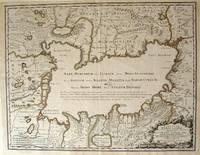
172354819Rainer Ottens. 1723. A most attractive map with early outline hand colour vertical fold barely visible diagonal crease upper half of map few very pale small brown spots otherwise a clean and bright image. Numbering in red pencil few annotations in pencil and light number stamp on reverse however not at all visible from front of map or affecting image. Sheet measures 46.6 x 60.2cm. . Rainer Ottens. unknown
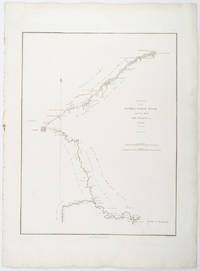
1796209283London.: George Nicol. 1796. Engraved copperplate map on Whatman paper 43.8 x 33.6 cm; 57 x 42 cm sheet including plate markscale in nautical and English miles; light undulation to sheet marginal toning and edgewear but in very good condition. Finely engraved and detailed map of two routes to Pekin Beijing along the White River Baihe from the Gulf of Petcheli and along the Imperial Highway from Jehol and includes commentary locating palaces and gardens type of cultivation "many barges" and "the road shaded by willow trees". The map elegantly drawn by Henry William Parish was published in George Staunton's account of Earl Macartney's embassy to China 1792-1794. . George Nicol. unknown
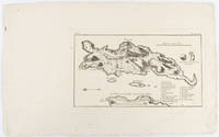
1703176390Amsterdam. circa1703. Engraved map on watermarked laid paper 16.5 x 26.5 cm plate-mark 26 x 42 cm sheet key in German inset detail of grave sites on the island of "Rhenee" Rineia and Apollonian relics lower corner creased and with a sealed tear to the verso no loss in very good condition. Fine engraving with large margins of the Greek island of Delos of great significance to classical antiquity and the mythological birthplace of the Greek deities Artemis and Apollo. . unknown
1750177186circa1750. Hand-coloured engraving 19.5 x 35.6 cm 25.5 x 41.6 cm sheet original folds two old paper repairs not affecting the image a trifle toned but in very good condition Attractive bird's-eye view town plan of Makassar in Sulawesi prepared for Abbé Prevost's monumental 'Histoire Générale des Voyages.' . unknown
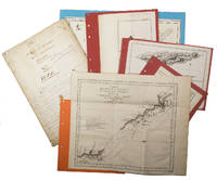
1755ABC_474521755. Manuscript of 24 pages 6 printed maps on cardboard. This wonderful logbook details the journey of a French captain from Manila to the Maluku Islands in todays Indonesia. The journey took place during the months of March to May of 1755. The captain of the ship recounted with great detail the events of every day of the journey with detailed daily accounts of the weather winds manoeuvres of the ship its departures anchorages and precise coordinates at every point of the journey. The captain furthermore had a keen eye for the geographical and nautical details along the journey. He recounted the exact locations of for example sandbanks and bays where ships and their crews can take provisions and fresh water. The accounts are detailed and captivating: "After our boats were back on board we set sail . in the afternoon to moor under the old Portuguese fort on the Solor island Indonesia the winds for the tide were fresh at 1:34 a.m. . sand and gravel and then I went back to mooring. The pavilion of the fort . the village is under the said fort at 3 cables from us .". The captain goes on to describe the geographical features of the islands as well as other places en route with great detail. Curiously we find inscriptions in Spanish and the names of one don Phelipe Qui who describes himself as el piloto and one Padre Don Estevan de Melo. The latter might be identical with Don Estevan Roxas y Melo a native of Lima Peru and secretary to the Archbishop of Manila Rodriguez since 1736. Roxas y Melo was part of the 1751 reconstruction of the Cathedral of Manila working under the auspice of the Italian architect Juan de Uguccioni.The logbook comes with six printed maps partly illustrating the journey of the captain pasted on contemporary cardboard. They depict the Bay of Sulavesi with the city of Bantang Pitcairn the coast of New Guinea the coast of Queensland the Santa Cruz Islands in the present-day Solomon Islands and Alejandro Selkirk Island. The plates stem from the French translation of James Hawkesworths An Account of the Voyages Hawkesworth Relation des voyages entrepris par ordre de sa Majesté Britannique actuellement regnante; pour faire des découvertes dans l'hemisphère meridional Paris 1774.Some holes on the first sheet not affecting the text. Small water damage some slighlty affecting the text. Remnants of seals on last page. Otherwise in good condition. unknown
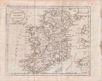
1796176602circa1796. Engraved map 18.3 x 22 cm 21.7 x 27 cm sheet original folds age toning and some offsetting inner edge darkened and discoloured but the map in good condition. Finely engraved map showing Ireland divided into counties lower coast of Scotland and Wales and the Isles of Man and Anglesea; also noting Nymph Bank 'discovered in 1735 by Capt. Doyle.' . unknown
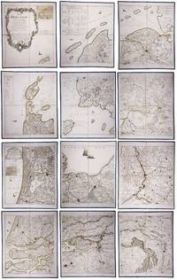
179023331Paris: Jean A. Dezauche successor of Delisle & Buache 1790. Each map in contemporary box with green morocco spines with titles 'Hollande' and 'Zelande' lettered in gold and green paper sides with ornamental gilt borders along the edges. Together ca. 230 x 155 cm. Engraved and etched map hand-coloured in outlines the cities coloured red. Printed on 12 sheets each divided into 4 segments numbered 1-48. The 48 segments are mounted on contemporary linen and folded the edges reinforced with blue ribbon. With: 2 LE ROUGE George Louis. Topographie de la Zelande en 9 feuilles traduitte de l'Hollandois. Second title: Partie orientale de la Flandre Hollandoise Paris Jean A. Dezauche 1790. Large engraved and etched wall map hand-coloured in outlines the cities coloured in red printed on 9 numbered sheets each divided in 4 segments numbered 1-36 size each sheet 48 x 56.5 cm; the 36 segments are mounted on contemporary linen the edges reinforced with blue ribbon. Two large complementary wall maps of the seven Dutch provinces covering 1 the provinces Holland Utrecht Friesland Groningen Overijssel and Gelderland and a part of Brabant bound to the line Steenbergen - Roermond and 2 Zeeland. Both are rare especially the map of Zeeland. They were the first maps of the Netherlands on such a large scale mostly about 1:105000 but with some eastern regions squeezed in at about 1:140000. Fully assembled the map of Hollande would measure about 230 x 155 cm and the map of Zeeland about 143 x 175 cm.Originally published in 1748 Le Rouge's 21 plates for the two maps were revised for publication in a second state by Jean Crepy ca. 1770. The map in its present third state was revised and published by Jean A. Dezauche in 1790. On the back of each sheet is an engraved label with the sheet number and the name of the region covered added in manuscript.From the library of Marco-Antonio III 1730-1800 Prince Borghese: on each box is the engraved armorial bookplate of the library of this Borghese Prince. Marc-Antonio's son Camillo Filippo Ludovico 1775-1832 married Napoleon's sister in 1803.Boxes are slightly scuffed. A remarkable copy with a princely provenance.l De Vries 'Een Franse wandkaart van Nederland uit 1748' in: Caert-Thresoor 1 1982 pp. 24-29; cf. BMC Printed maps VIII cols. 967 & 969 1748 edition; not in Donkersloot-de Vrij; Oehme A French world atlas in: Imago mundi 25 1971 pp. 55-64 on Le Rouge. Jean A. Dezauche, successor of Delisle & Buache, unknown
1800D7401unknown: unknown likely early 1800s. Ephemera. Very Good. A collection of 8 engraved maps 420 x 280 mm including wide margins numbered in Arabic or Roman numerals see below otherwise seemingly uniform. From an unknown source. It includes: 1 Bombardement de Lille par l'Armee Autrichienne en 1792 with the stamp of Depot de la Guerre Bibliotheque in the top margin; 2 Siege de la Citadelle d'Anvers par l'Armee Francaise en 1792; III Siege de Valenciennes par l'Armee Coalisee Anglaise Hannovrienne et Autrichienne en 1793; VIII Siege d'Ypres par l'Armee Francaise en 1794; IX Siege de Charleroy par les Francais en 1794; X Siege de Landrecies par les Francais en 1794; XI Siege du Quesnoy par les Francaise in 1794; and XIII Siege de Nieuport par l'Armee Francaise en 1794. A bit foxed; flattened crease down the middle from folding these were perhaps pulled from a book where they were mounted on stubs along the crease. <br/><br/> [unknown] unknown
17088917London: John Nicholson 1708. Full Leather. Very Good binding. Octavo. xxxviii 2 412; 2 382 2 ads 32 index pp. maps. First edition. Contemporary paneled-calf boards with modern reback. Title page to Volume 1 and four of the eight maps are lacking but are supplied in tasteful facsimile. The maps in facsimile are the North America New England Virginia and Maryland and Carolina. Bindings are solid and presently nicely; contents are clean and bright; but for the maps and title page this is an exceptional set. <br /> <br /> Of this work William Reese writes: "This basic 18th-century reference work on British America . . . offers an excellent comprehensive survey of Great Britain's American colonies at the point when those on the mainland of North America had grown past their initial phase and were expanding rapidly in population and productivity. . . . This important contemporary work would probably have been the first point of reference for any Englishman at the time" Reese Struggle for North America 1. Usually attributed to Oldmixon who penned the dedication but occasionally gets attributed to Moll according to Sabin. A significant work by the British historian. Howes O-61 "aa"; European Americana 1708/95; ESTC T45485; Sabin 57156. John Nicholson unknown
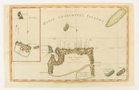
1784174895London.: Alexander Hogg at the King's Arms. circa1784. Engraved map on laid paper 21.4 x 33.7 cm inset of Gower's Simson's and Carteret's Island early outline hand colour trimmed to the plate mark at the top edge three small edge tears affecting the upper margin only slight paper toning but a most attractive map in very good condition. Fine impression of the Queen Charlotte's Islands Solomon Islands. It features the Swallow's track the ship's route taken by Captain Philip Carteret in 1767 the British naval officer and explorer who participated in two of the Royal Navy's circumnavigation expeditions in 1764–66 and 1766–69. . Alexander Hogg at the King's Arms. unknown
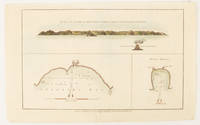
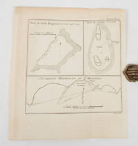
1784174896London.: Alexander Hogg at the King's Arms. circa1784. Engraved map in triptych on laid paper 20.1 x 32.7 cm three insets: cross section of the north side of Queen Charlotte's Islands Solomon Islands with detail of a volcano "6 leagues North"; Swallow's Bay Harbour; and Byron's Harbour early hand colour trimmed to the plate mark at the top edge neat sealed tear affecting the publisher's caption slight edge wear and paper toning but a most attractive map in very good condition. Attractive engraving of the Queen Charlotte's Islands Solomon Islands. The Islands were named for the consort of King George III by Philip Carteret the British naval officer and explorer who participated in two of the Royal Navy's circumnavigation expeditions in 1764–66 and 1766–69. His ship the Swallow gave her name to the Bay and Carteret's commanding officer on the first of his voyages John Byron to the Harbour depicted in this most attractive early chart. . Alexander Hogg at the King's Arms. unknown
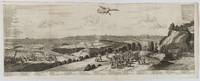
1720180201A Leide. Leiden.: Chez Pierre van der Aa. circa1720. Engraved panorama on watermarked laid paper 28.5 x 77.5 including captions; 31 x 79.5 cm sheet title cartouche engraved key in French and Dutch the upper margin trimmed to the platemark original folds edgewear and toning neat sealed tear to the outer edge barely visible 5mm intrusion to the image a very good dark impression. Finely composed and engraved panorama of Tokyo prepared for the monumental work "Galerie Agreable du Monde" by the master Dutch publisher Pieter Van de Aa 1659-1733. The detailed key in Dutch and French notes myriad buildings and temples on the horizon and in the foreground two processions converge: of nobles and their attendants dancers a trio of dogs and a priest or religious attending a suppliant. <br> <br>Pieter van der Aa 1659-1733 was born in Leiden Holland and started his own book publishing business when he was only twenty-three. His prolific output of highly decorated maps and atlases culminated in his magnum opus “Galerie Agreable du Monde” which illustrated the world known to Europeans in the early eighteenth century. Comprising 66 volumes it was the of plates published at that time it has been estimated that only 100 copies were published. . Chez Pierre van der Aa unknown
1788024356London: Printed for J. Walker 1788. Book. Very Good. Hardcover. First Edition. 12mo. A very good four volume set in contemporary full tree calf binding with double lettering pieces in red and green. Complete pp. iii-vii 1 222; 2 206; 2 238 & 2 198. No half-titles which may or may not be wanting but the pagination for the prelims to vol. I might suggest that one is required Very good bindings with a little rubbing a couple of volumes slightly chipped to the head/tail of the spines corners lightly bruised. Contents clean and tight manuscript Greek initials to title pages dated 1788 otherwise unmarked no foxing paper crisp. A very good set. A Rare Eighteenth Century Novel. We have managed to located just one other copy at auction in the last thirty years and that at Sotheby's sale of July 21 1993 where it made £1000 on the hammer though seemingly not such a nice copy. Referenced by: ESTC T068744. Printed for J. Walker Hardcover
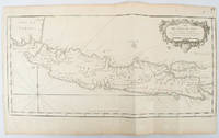
1750136782circa1750. Black and white copperplate engraving map of Java a little light even browning neat colour pencil highlighting of rivers and two settlements. Folded as issued. Good copy. 26 x 44cm. Issued in Prevost's Histoire Générale des Voyages ou nouvelle collection de toutes les relations de voyages par mer et par terre. . unknown
1774174260A Paris.: Chez Saillant et Nyon rue Saint-Jean-de-Beauvais Chez Panckoucke Hotel de Thou rue des Poitevins. 1774. Engraved map on laid paper 27.2 x 19.9cm 26.5 x 22.2cm sheet size edge fold slight marginal toning but in very good condition. Map of the treacherous coastal waters sandbars submerged rocks and reefs surrounding Mindanao and the Joseph Freewill Islands Mapia Atoll in the Philippines finely re-engraved for the French edition of Captain James Cook's First Voyage 1768-1771 "Relation des voyages.pour faire des decouvertes dans l'hemisphere meridional et successivement executes par le commodore Byron le capitaine Carteret le capitaine Wallis & le capitaine Cook.". . Chez Saillant et Nyon, rue Saint-Jean-de-Beauvais, [Chez] Panckoucke, Hotel de Thou, rue des Poitevins. unknown
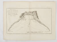
1774174257Paris.: Chez Saillant et Nyon rue Saint-Jean-de-Beauvais Chez Panckoucke Hotel de Thou rue des Poitevins. 1774. Engraved map on laid paper 18.5 x 31cm 25.6 x 34.4cm sheet size central fold slight marginal toning but a very good dark impression. Map of Bonthain Bay situated southeast of Macassar on the island of Celebes finely re-engraved for the French edition of Captain James Cook's First Voyage 1768-1771 "Relation des voyages.pour faire des decouvertes dans l'hemisphere meridional et successivement executes par le commodore Byron le capitaine Carteret le capitaine Wallis & le capitaine Cook.". . Chez Saillant et Nyon, rue Saint-Jean-de-Beauvais, [Chez] Panckoucke, Hotel de Thou, rue des Poitevins. unknown
179832540-440Paris Edme Mentelle 1798. C. 330 x 430 mm. Framed 510 x 610 mm. Paris Edme Mentelle 1798. Fine map of the mouth of the Gironde river with Cognac and Angoulème in the centre. On upper corner right the map bears the no. 41. GEOGRAPHY: MAPS ; KARTEN KARTOGRAPHIE ; FRANCE ; Paris, Edme Mentelle unknown