Biblio.com
387 résultats
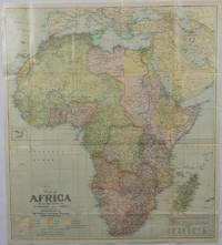
1922175918Washington D.C.: National Geographic Society. 1922. Large folding printed colour map 77.2 x 69.4 cm small inset map of Cape Verde Island note to the transliteration of place-names reference key to railways caravan routes as well as river systems waterways and deserts legend to Colonial or territorial control original folds slight toning in very good condition. Attractive large-scale map with countries and territories coloured according to the controlling colonial power. . National Geographic Society. unknown
190375062London: McCorquodale 1903. First edition of this atlas map folio 16 1/4 x 27 1/2 inches. 5 sheets of British Commission maps and index map; 13 sheets of United States Commission maps Alaska boundary atlas and index map. Total of 20 maps 19 folding and 5 in color Maps are 53 x 32 inches. All but the British index map folded and backed in linen. Quarter red morocco over red cloth. Gilt Royal Seal to front board and spine. Maps mounted on linen and sectioned as issued. Portfolio case with moderate rubbing chipping to leather. Does not include the 10 cards to accompany the U.S. Commission maps seems to be common that these smaller ones are missing. Old staining to cloth. Toning and edge wear to British Index map. Slight toning and offsetting to maps. Overall a very good copy; quite scarce. [McCorquodale] hardcover
191176478New York: Automobile Club of America 1911. First edition Tall octavo. 876 pp. plus 48 leaves of maps one folding. Original flexible calf with two-brad binding gilt cover lettering yellow endpapers. Leather with some professional restoration. Text complete and clean. OCLC only records 3 copies all east of the Mississippi.The very first coast-to-coast automobile guidebook was published in 1901 The Official Automobile Blue Book. One usually finds these early automobile road guides devoted to specific parts of the country New England West Coast etc. but this one covers the entire nation. In this guidebook the routes given for the West comprise the smallest section of the book. 1911 was before the official opening of all of the major early automobiles routes: The Lincoln Highway planned in 1912 officially opened in 1913; The National Old Trails Road 1912; The Yellowstone Trail 1912; Pacific Coast Highway began in 1913. Automobile Club of America hardcover
194071435Los Angeles: Automobile Club of Southern California ca. 1940. A fine grouping of 14 pre-freeway California maps from the Automobile Club of Southern California. Housed in the original box given to the subscriber when he received them at his local office one end missing but attractive nonetheless. A few slight separation fold splits but overall in very good condition with the majority appearing to have never been opened.Maps are; Eastern Section of Los Angeles; Central Section of Los Angeles; Southern Section of Los Angeles; San Fernando Valley Section of Los Angeles; Orange County; Metropolitan Los Angeles; Imperial County; San Diego County; Kern County; San Luis Obispo County; Tulare County; Ventura County; Riverside County; California. Automobile Club of Southern California unknown
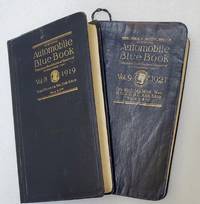
191974907Chicago: Automobile Blue Book Publishing 1919 & 1921. Vol. 8; Tall octavo. 776 pp. including numerous inserts maps photographic illustrations. Complete. Publisher's flexible blue cloth with gilt cover lettering. Expertly rebacked retaining the original spine. Ver good.Vol. 9; Tall octavo. 848 pp. including numerous inserts maps photographic illustrations. Complete but for the folding map at the rear often missing as they were used. The map is reproduced in smaller segments on pp. 2-21. Publisher's flexible blue cloth with gilt spine and cover lettering. Some creases and general rubbing but a good complete copy.Between these two books the entire West Coast is covered. Between them they detail 1783 driving routes across the arid west. These are exhaustive and comprehensive guides to early car touring in California and the West. With such instructions as 'turn left after the wooden bridge" we can infer that car travel in 1920 was a difficult proposition at best. There is an illustrated chapter on Yosemite with a full page map and five pages of texts with illustrations. While "Official Automobile Blue Books" are not rare one usually finds the guides for New York or the Midwest with Vol. 8 California and Vol. 9 Oregon and Washington rarely appearing on the market. Chances are that these particular volumes were just generally used to oblivion as California has always been the most car-friendly state in the Union and the Pacific Northwest was by and large empty of people. Automobile Blue Book Publishing hardcover
195615240Ottawa: Edmond Cloutier Queens' Printer and Controller of Stationery. Very Good in Very Good- dust jacket. 1956. First Edition. Hardcover. Volume I has no dust jacket the red coth covered boards dated 1956 some shelf soil to page edges top back corner bumped. Volume II dated 1953 has chipped DJ 1 inch tear bottom front panel and 2 inch tear top back panel.; Fold-out maps in Vol. I and map endpapers appear undamaged B&W and color illustrations in Vol II; Color Illustrations . Edmond Cloutier, Queens' Printer and Controller of Stationery hardcover
192076159Boston: Scarborough Motor Guide Company 1920. Narrow octavo. 676 pp. crammed with numerous textual maps and advertisements. Original folding map present and in very good condition. Publisher's stiff green wrappers lettered in black. Small 1/2 inch slit to upper front joint but a remarkably clean and nice copy with the map. Scarborough Motor Guide Company unknown
195676405San Jose: H.M. Gousha Co. on or before 1956. First edition of this gathering. Folio 13 1/4 x 18 inches. 62 unused road maps in color and with inserts each neatly divided by side tabs. All maps bound on stubs. Original red cloth portfolio with flap and snap fasteners the Shell logo stamped on front cover some soiling or darkening to extremities. The portfolio has some expected wear but the maps are fresh and clean. Shell maps of this era are notable for their high-quality cartography colorful graphics and often included travel tips local advertisements and information about Shell services. None located by OCLC. Harry Mathias Gousha a former Rand McNally went independent in 1926 and relocated to California in 1947. It was a propitious time as the 50s in most respects witnessed the onset of the great American phenomenon of the Road Trip. With the improvement in cars longer and longer trips became feasible. None of the great Interstates as we know them today were in existence at that time so road maps were essential for any successful road trip. The H.M. Gousha Company was one of the "Big Three" major producers of road maps and atlases in the United States during the 25 years following World War II General Drafting and Rand McNally were the other two. Shell maps of this era although free are notable for their high-quality cartography colorful graphics and often included travel tips local advertisements and information about Shell services. The H. M. Gousha Company produced millions of oil company road maps used as marketing tools distributed at no charge at gas stations by customers that included Gulf Oil Conoco Shell Standard Oil and dozens of others. Though most Gousha maps were produced for oil companies many others were issued for customers not related to the petroleum industry including automobile clubs state governments banks and realtors. Ironically the company was purchased by Rand McNally in 1996. H.M. Gousha Co. hardcover
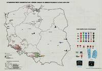
197941929Warszawa Warsaw: Pan´stw. Wydawn. Naukowe 1979. 1st Edition. Original black printed portfolio 8vo. Portfolio of seven large folding maps on on 4 sheets of heavy paper 3 are double sided 1 is singled sided. Primarily black and white with some color. Text in Polish. <br> Title translates to “Nazi camps in Poland 1939 - 1945. An Encyclopaedic Reference Book: Maps." Collection of 7 maps each 84 cm x 60 cm 33 x 24 inches produced by Jan Laskowski at the Main Commission for the Investigation of Nazi Crimes in Poland. The maps comprise Volume II of the work; Volume I is a heavily illustrated 676-page book of the same title which we offer separately. <br> The Seven maps all present are: <br> - Map 1 Single Sided: Hitlerowskie obozy na ziemiach polskich w latach 1939 - 1945. “Nazi camps in Poland in the years 1939 - 1945â€. Showing: concentration and extermination camps sub-camps of concentration camps extermination centers POW camps more important sub-camps working divisions commandos and temporary POW camps penal labor camps major labor camps prisons transit camps & ghettos. <br> - Map 2A: Getta na ziemiach polskich w okresie okupacji hitlerowskiej w latach 1939 - 1945 “Ghettos in Poland during the Nazi occupation in 1939 - 1945â€. <br> - Map 2B: Hitlerowskie obozy przejsciowe na ziemiach polskich w latach 1939 - 1945 “Nazi transit camps in Poland in 1939-1945â€. <br> - Map 3A: Hitlerowskie wiezienia i areszty na ziemiach polskich w latach 1939 - 1945 “Nazi prisons and arrests in Poland in 1939 - 1945â€. <br> - Map 3B: Hitlerowskie obozy pracy na ziemiach polskich w latach 1939 - 1945 “Nazi labor camps in Poland in the years 1939 - 1945â€. <br> - Map 4A: Hitlerowskie obozy jenieckie na ziemiach polskich w latach 1939 - 1945 “Nazi POW camps in Poland in 1939 - 1945â€. <br> - Map 4B: Hitlerowskie obozy koncentracyjne i osrodki zaglady na ziemiach polskich w latach 1939 - 1945 “Nazi concentration camps and extermination centers in Poland in 1939 - 1945â€. <br> Maps 2A & 2B have been described as a “Terrifying pair of maps showing the locations of German POW and internment camps in Poland during World War II highlighting the widespread locations of these establishments. In some parts of the map the information becomes so dense that three inset maps are shown. This map was designed by Jan Laskowski and printed in 1979 as part of a work on the Nazi extermination machine produced by PWN Warsaw a state-owned research-focused publishing house in Poland.<br> The map on the front is particularly interesting for its depiction of symbols used to classify internees in German camps. The uppermost of these depictions shows the combinations that can be made for different types of prisoners of different levels of importance. The armbands that would have been worn by these prisoners is shown as well as the prison uniforms. Other details are also shown. <br> The map lists hundreds of sites run by Nazi operators throughout the country. These include concentration camps death camps transitional camps and ghettos. The map is divided according to Poland's voivodeships with a key in the lower left. Names of cities too long to spell are also provided in the lower left. <br> This map was produced during a point in Poland's history during which it was actively revisiting the period during the Second World War. Leading social scientists devoted their time to trying to gather all the living as well as the recorded history of the events of the Holocaust and related atrocities before this information vanished. Leading these efforts particularly during the 1960s and 1970s was the Glówna Komisja Scigania Zbrodni przeciwko Narodowi Polskiemu known as the Chief Commission for the Prosecution of Crimes against the Polish Nation. They were active in publishing maps both for domestic educational purposes and for international remembrance and diplomatic efforts regarding the Holocaust. Jan Laskowski was a leading cartographer who produced a number of maps in this field. <br> These maps were produced as part of a series of maps that purported to combine to form an atlas of all of Hitler's crimes in Poland. Many of the large wall maps produced during this period could only show a fraction of the crimes or only the atrocities committed in one region. Thus a series of maps was needed to show all the points necessary which this present work contributes to. <br> Polish Reinterpretations of the Holocaust: Studying the effects of German occupation in Poland is a delicate subject. While it is certain that Poland suffered at least as badly as any other European nation during the Second World War reinterpretations of the Holocaust in the country have also been used to satisfy nationalistic tendencies. It has become evident to Western observers in the last several years that there is a strong nationalist movement in Poland that seeks to place blame for the Holocaust solely on the shoulders of non-Polish actors a movement originally fostered under Soviet rule. This movement has gone so far as to limit freedom of speech criminalizing with a three-year sentence the suggestion that Poland or its citizens in any form participated in the murders committed by Nazis. As such the term ‘Polish concentration camps’ has been deemed unacceptable with the government-approved term being ‘concentration camps on Polish territory.’ <br> All lines of evidence show that this map 2A & 2B was produced using the most accurate and impartial historical sources. The language on the map is simple naming only ‘Hitler's Atrocities’ and there is no evidence of a clear anti-German bias. However it is impossible to separate this map one of the most important productions of the remembrance movement during this period from the social situation in which it was produced. Maps like these can easily be converted into propaganda instruments and today's Polish leaders most of whom grew up during Soviet occupation will have formed their understanding of the Holocaust through maps like these. <br> Soviet Censorship: While the content of the map appears to have been produced free from bias the map still had to go through Soviet censorship. Mentioning prisoner of war camps in which primarily Soviet troops were interned would have been a prerequisite condition upon which the publication of the map rested. Further the lack of mention of any Soviet killings or camps requires no explanation….The map unlike many later maps makes no differentiation between the populations who suffered at the various camps. This represents the Soviet agenda that all nations suffered fought and won equally which sought to limit divisions in this post-identity state†Ruderman 2022. <br> SUBJECTS: World War 1939-1945 -- Prisoners and prisons German. -- Concentration camps -- Poland. Guerre mondiale 1939-1945 -- Prisonniers et prisons des Allemands. -- Camps d'internement -- Pologne. Obozy koncentracyjne -- Polska -- 1900-1945. OCLC: 830885973. <br> Light shelf wear to portfolio as expected. All maps in pristine condition with normal folds as issued. Very Good Condition. Complete and dramatic BR5 holo2-147-19-'cc. Warszawa (Warsaw): Pan´stw. Wydawn. Naukowe unknown
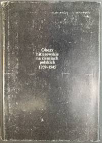
197941930Warszawa Warsaw: Pan´stw. Wydawn. Naukowe 1979. Pamphlet. 1st Edition. Original Cloth in dustjacket 8vo 678 2 pages 36 unnumbered leaves of plates with 164 illustrations. 25 cm. In Polish. Title translates to “Nazi camps in Poland 1939 - 1945. An Encyclopaedic Reference Book.†ISBN: 8301000651. <br> A massive encyclopedic record of Nazi camps prisons and ghettos in Poland based on extensive source material in Polish and foreign archives and research carried out by the General Commission for the Investigation of Nazi Crimes in Poland. The 5877 entries pages 87-601 are arranged in alphabetical order of location providing data on the period of existence character of and fundamental information about each site. Pages 11-86 comprise an introduction by Czeslaw Pilichowski "Hitlerowskie obozy i os´rodki przymusowego odosobnienia oraz ich rola w realizacji programu ludobo´jstwa i zaglady narodu polskiego" "Nazi Camps and Forced Detention Centers and Their Role in Implementing the Program of Genocide and Extermination of the Polish Nation". Includes a bibliography and indexes and summaries in Russian English French and German p. 657-676. The last 73 pages contain photographs. <br> SUBJECTS: World War 1939-1945 -- Prisoners and prisons German. -- Concentration camps -- Poland. Guerre mondiale 1939-1945 -- Prisonniers et prisons des Allemands. -- Camps d'internement -- Pologne. Obozy koncentracyjne -- Polska -- 1900-1945. OCLC: 5709074. <br> Top corners bumped some tears to dust jacket otherwise Very Good Condition in Very Good Dustjacket. Important Work. BK5 holo2-147-20. Warszawa (Warsaw): Pan´stw. Wydawn. Naukowe unknown
19522092902141000174Bijutsu shubbansha 1952. Soft Cover. Fine. Size: A3 Bijutsu shubbansha paperback
19392092902141000906Tokyo Mikuraku 1939. Soft Cover. Fine. The book is in fine condition. Tokyo Mikuraku paperback
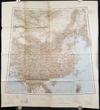
1945206545Calcutta: Compiled and drawn by the Survey of India. Second Edition. 1945. Large folding colour map 77.5 x 80cm; 95.5 x 86.2cm sheet including legend and small inset showing adjoining maps light toning and wear to upper margins and at corners and folds; but in very good condition. Very large clear map of China printed in 1945. The projection is noted as the "Lambert Conical Orthomorphic" a polyconic projection employed by the exhaustive Survey of India and the map includes surrounding countries: Taiwan Korea French Indo-China with a small inset key to Korean place-name abbreviations. As is typical of maps of this period Arunachal Pradesh is shown as Tibetan territory.The legend lists borders and provinces railways roads and canals with topography indicated with colouration. . Compiled and drawn by the Survey of India. unknown
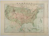
1911179415Tokyo.: 楠山正雄. Kusuyama Masao. Meiji 44 1911. Colour folding map 40 x 55cm inset maps showing the Philippines Alaska and Hawaii very good copy. This map was a supplement of October 1911 issue of a monthly magazine Shin Nippon 新日本 which was published between 1911 and 1918. The main map covers the contiguous United States with inset maps of the world showing the American territories of Alaska Hawaii and the Philippines. Curiously Cuba has been marked as an American territory having been directly occupied from 1906 to 1909 though at the time still beholden to the 1903 Cuban-American Treaty of Relations. . 楠山正雄. [Kusuyama Masao]. unknown
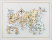
1964195995Pan American World Airways. 1964. Colour pictographic/pictorial map of Asia 23.2 x 30.1 cms gilt double-rule border printed on a folding decorative menu card 32 x 50 cms open highlighted in gilt text in English French and Japanese central fold and later central vertical crease in very good condition. Pan Am menu card for First Class passengers dubbed "The President Special" the deluxe cuisine by fabled Maxim's of Paris "Good food is the basis for true happiness". Passengers were feted with gourmet meals on bone china with silver cutlery. The witty pictorial cover-map of Asia was by French artist and commercial illustrator Jacques Liozu 1910-1974 also known for his larger scale maps. . Pan American World Airways. unknown
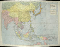
1940205763London.: Hutchinson & Co. Circa1940. Full colour folding map 70.7 x 93 cms; 76 x 101.2 cms sheet original folds short fold splits previous owner's neat title markings on the verso but the map in very good condition. A "Geographia" map of the war theatre in Asia and the Pacific including the northernmost coast of Australia. Showing railways and canals roads and steamer routes oilfields and pipe lines and a key to the unfederated states of Malaya. The Spratley Islands are marked as French and Thai territorial claims within French Indo China are marked. . Hutchinson & Co. unknown
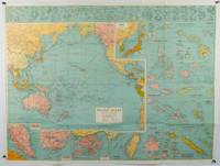
1945180206Sydney.: H.E.C. Robinson. Circa1945. Full colour inset maps principal cities and towns marked shipping routes international boundaries and railways. 99 x 73cm. Some small insect damage has been repaired on the verso visible on map as a few small lighter areas in the western Pacific. Pinpoint holes at folds paper repair along cover but a very good clean copy. From the Sydney publisher H.E.C. Robinson the firm founded in 1895 by Herbert Robinson 1857-1933 a founder of the Royal Geographical Society of Australasia. <br> <br>Although the map is undated North and South Korea are shown as divided which occurred in late 1945 and Manchuria is marked as still under Soviet occupation which only lasted until 1946 at which point it was handed over to Communist China. <br> <br>As well as what now would be considered Southeast Asia the main map shows the eastern half of India Tibet and parts of Mongolia the USSR and East Asia. Inset maps include: Caroline Islands Marshall Islands Federation of Malaya Singapore Hong Kong Taiwan Japan Hawaiian Islands Philippine Islands Midway Gaum and Wake Islands Fiji Islands Eastern & Western Samoa Santa Cruz and Solomon Islands New Caledonia Rabaul Tahiti Lord Howe etc. . H.E.C. Robinson. unknown
191363117New York: C.S. Hammond & Co. Schum Bros. Stationers and Printers 1913. 12mo. 3.5 x 7.5 double-sided colour lithograph map which folds out to 25.25 x 16.5 in. on 28 x 17.75 in. sheet very light dustsoiling slight shelfwear very slight age toning along the folds. Original printed gray-blue pocket portfolio folder blue lettering on recto & verso added affixed label of Schum Bros. over imprint minor age toning still a VG bright clean map. First edition thus of this very scarce Brass Era automobile travel map depicting Manhattan and portions of Long Island from Brooklyn across to Smithtown and Great River. Verso Map includes Long Island fro Great River up to Darlington across to Truman Beach and Bridgehampton with two inset maps: “Contination of North Shore†and “Continuation of South Shore†with “Good Roads†and “Fair Roads†differentiated as well as depiction of the Long Island Railway line and red dots tracing the electric interurban lines. As early as 1906 Hammond & Co. had produced a map for Good Roads enthusiasts and motorists but this updated issue documenting the improved roads was issued in 1913 and then regularly from 1914-1925. No copies in Worldcat. C.S. Hammond & Co., Schum Bros., Stationers and Printers, unknown
192862600Ottawa ONT: Natural Resources Intelligence Service 1928-1929. Four large folding colour maps. atlas folio w/ largest sized 45 x 35 in. w/ each sheet including an index map indicating there are 4 in total with outlines fold creases as issued minor age toning to fore-edges a few minor closed tears at fold creases still a VG set of maps. Early printing of this four sheet map depicting the automobile roads connecting Canada and the United States during the 1920’s as the Good Roads Movement rapidly expanded through the Northern Country following World War I. These maps depict the burgeoning highway and national road system which had been fostered by urban centers attempting to convince rural municipalities to replace their seasonal dirt roads with those of gravel or crushed stone and facilitate much greater movement of agricultural and manufacturing products across the continent and with the U.S. The Atlantic map stretches from the maritime provinces down to Washington D.C. and over to Niagara Falls and Buffalo NY; The Middle West map documents the main automobile roads and highways from Port Albert to Port Arthur and South from Denver to St. Louis indicating provincial federal and state roads and highways; The Great Lakes section tracks the extensive network of roads and highways surrounding the Great Lakes including those in Iowa Kentucky Wisconsin New York and the Canadian provinces of Quebec and Ontario; while the Pacific Map records the highways from San Francisco to Denver and up through Alberta and over to British Columbia. Uncommon with all four maps present. See: J.I. Little Confronting Rural Localism: The Good Roads Movement in Quebec’s Eastern Townships 1897-1920 Social History/Histoire sociale Vol. 57 No. 117 May 2024. Natural Resources Intelligence Service, unknown
193860338Marshfield OR: Oregon Coast Highway Association 1938. 4to. 16 pp unpaginated. numerous text illustrations double-page centerfold map by T.J. Greene small closed tear minor creasing self-printed photo-illustrated colour-softcovers center crease and printed in double-columns for folding slight soiling front cover still VG- copy w/ small rubber stamp of Breakers Motor Apts. Crescent City California on front cover. First edition thus of this automobile and bus travel tour guide to the newly completed US Highway 101 which finally had completed paved highway and bridges including the iconic Yaquina Bay bridge designed by Conde B. McCullough. Throughout the 1930’s with substantial support from the WPA and PWA projects as well as the U.S. Bureau of Public Works the highway became a scenic continuous drive. Oregon Coast Highway Association, paperback
193849584Chicago: Rand McNally Co. ca. 1938. Large colour map 26.5 x 19.5 in. which folds into 12 sections w/ several inset colour maps on verso colour-illustrated Art Deco cover art of couple driving from the front & back advertising Triton Oil minor shelfwear some dustsoiling still VG map. First edition thus including large Highway map on one side of Washington & Oregon along with smaller inset maps for Portland Everett Salem Seattle Spokane and Tacoma before World War II. Rand McNally Co., unknown
194962765London & Paris: British European Airways 1949. 4to. 20 pp unpagianted. colour-illustrated maps and red & black text throughout. Self-printed colour-illustrated maps w/ ad for BP Aviation Service and Anglo-Iranian Oil Co. Ltd. on back cover Dunlop tire ad verso of front center crease fold as issued w/ original BEA sleeve from the library of Archibald Angus MacDonald 1892-1977 stepson of famed southern California oil man William F. Byrne as well as oil company and drilling equipment owner and manager of MacDonald & Burns Oil Producers. First edition of this surprisingly scarce BEA route map book issued following World War II and prior to the establishment of the Western US UK and French Zones into the Federal Republic of German and the Soviet Zone into the German Democratic Republic East Germany. In 1946 BEA was established to feed short commuter flights across Europe and until 1950 used a fleet of Douglas DC-3 aircraft based out of Croydon and Northold Airports moving to Heathrow in 1950. No copies in Worldcat. British European Airways, unknown
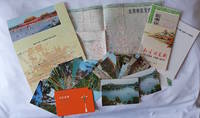
1970223347Beijing. 1970s. Collection of six items. <br> <br>Two postcard sets by the Peking Post Office: <br>北京风光 Bei jing feng guang: 8 postcards. <br>北京风景 Bei jing feng jing: 9 postcards. <br>Both in original envelope 8 x 15cm. <br> <br>Two copies of the large colour folding map "北京游览图 Beijing Youlantu" showing with detailed maps of major tourist destinations and bus routes in Beijing. Text in simplified Chinese characters 73 x 51cm folded 18 x 12.5cm. One in original paper case. <br> <br>A trifold brochure with colour map of Beijing text in English 25 x 12cm. <br> <br>"Visitors Guide to Peking" booklet in stapled wrappers folding maps one at rear and another loosely inserted 43pp 23.5 x 10.5cm. Prepared by members of the Australian Embassy for Australian tourists in Beijing. <br> <br>Some minor wear at extremities overall in very good condition. . unknown
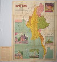
1951214601Delhi.: S.B. Makhija & Brothers. circa1951. Printed colour map 98.6 x 69 cms folding into pictorial wrappers 25.3 x 19.5 cms five pictorial colour inserts of pagodas and the Shwethalyaung reclining Buddha wrappers a little chipped marginal wear and three small fold splits in the map but overall in very good condition. Attractive large map of Burma with the provinces coloured steamship routes shown in red and printed in the booklet a range of information printed based on the 1951 census including climate agriculture and form of government "Burma became an independent nation completely outside the British Empire on January 4 1948 and is now a sovereign independent republic known as the Union of Burma". . S.B. Makhija & Brothers. unknown
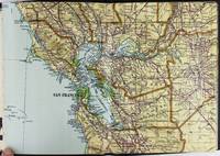
19282443San Francisco and Los Angeles: The Heald-Menerey Company 1928. Very good. Large color map measuring 44 x 64 inches cut into eight sections and folded into book form. Original black limp textured cloth yapp edges titled in pale yellow on front cover. Moderate edge wear titles on front cover almost completely worn away. Internally clean. A rare portable version of the large and impressive Heald-Menerey's Geographical Commercial and Recreational Map of California produced in the late-1920s. According to the sheet of instructions bound before the map: "The first of its kind ever devised for desk home or automobile use. It consists of the California Survey 44 x 64 inches in size cut into eight strips and folded to make a book of 64 pages. Page No. 1 is the extreme northwest corner of our Survey and page No. 64 is the extreme southwest corner." The instructions proceed to inform the user on how to locate points on the map given its form as a book. The verso of the instructions page is a county index keyed to the pages of the map. The cover title begins "California Survey" but the remainder is rubbed beyond readability.<br /> <br /> The map was produced by the Schmidt Lithograph Company of San Francisco. The legend of the map contains symbols representing roads trails railroads streams springs swamps aqueducts lighthouses county and state boundary lines national forests mountain peaks township and range lines base and meridian lines and more. There are also two inset maps - one showing San Francisco and vicinity and the other Los Angeles and its immediate surroundings. OCLC records just a handful of copies of this book-form map published between 1928 and 1933. The Heald-Menerey Company unknown