387 résultats
19732080502106904303Not Available 1973. Soft Cover. Fine. The book is in fine condition. Not Available paperback
197823102CReated & Publ. Gousha/Chek-Chart San Jose Mitock North Hollywood 1978. PBO Spiral Bound Softcover 1978 1st Edition Nice Condition You turn over Book to Back for different 2 Counties NF/NF- SOFTCOVER COVER light ruB wear Creases & Scuff Hotels ETC Orange County & Los Angeles Street Index. First Edition. Soft Cover. CReated & Publ. Gousha/Chek-Chart, San Jose Mitock North Hollywood paperback
19501749Vichy France: Société des Cartes Folkloriques de France 1950. Wraps. Near fine. R. MARGOTTON. FRENCH LANGUAGE POSTCARDS FASHION / TRADITIONAL DRESS. R. MARGOTTON illustrator. <br /> 6 1/8" x 4 1/8" ; 84 cards numbered; half-bound tweed cloth folder with ties marbled paper over board color paper label to front folder; 3 black cloth folder ties; hand-colored wood-engraved cards verso is a divided back postcard with labeling and numbering within the series and four printed lines on which to write an address; light age-toning of edges; near fine. OCLC locates 3 copies all in the U.S. The art on the post cards is signed R. Margotton and it is possible this was Rene Margotton 1915-2009 although by the early 1950s he was a major French painter and one of the cubists from the early part of the 20th century. The laid-in form in the rear pocket is a listing of the cards by area. Société des Cartes Folkloriques de France unknown
1984057032Eldon D. Weber 1984. Book. Near Fine. Hardcover. First Thus. 4to - over 9¾" - 12" tall. Brown leatherette lettered in gold foil. 3rd ptg. 1984 of facsimile reprint edition. Slightly soiled covers nearly as issued. Main text dates to 1895-96 Eby with 1931 supplement by Snyder every-name index and geographical index by Weber. Map in rear pocket as called for. Eldon D. Weber Hardcover
19862083002116201994Tokyo Maps Tony Buzan Translated by Tetsu Sato 1986. Soft Cover. Fine. The book is in fine condition. Tokyo Maps Tony Buzan Translated by Tetsu Sato paperback
19672090502113703439Not Available 1967. Soft Cover. Fine. The book is in fine condition. Not Available paperback
1935036820Los Angeles California: Title Guarantee And Trust / Title Insurance And Trust 1935 1936 1937 1938 1942 1946 1949 1951 1956 1957 1959 1961 1935. First Edition 1st Printing. Soft cover. Very Good/No Dust Jacket. 9 1/4" High. A Group Of 30 Different Booklets Including 19 Different First Printings 1935-1961 One With Second Issue Tipped In Slip 8Th Printing Of Old Spanish And Mexican Ranchos Of Orange County Six Are First Printings Of Later Revisions There Were Many Minor Revisions Usually Each Time They Were Re-Issued. Several Have Notations On Covers That They Were Gifts To Dr. George Hill Hastings From Arthur Mordan President Of Title Guaranty Who Employed Robinson. The Beverly Hills Book Has A Presentation Inscription From Mordan To Hastings The Island Of Santa Catalina Has A Long Notation By Hastings That It Was A Gift From Robinson Upon The Death Of Mordan A Dear Friend; Signed H. H. All Very Good To Near Fine Except Culver City Which Has Wear And Some Damp Spotting Centered On Spine And Extending Inwards Up To 1/4"; And The Forest And The People Is Only Good Worn And Some Small Light Water Spots. <br/> <br/> Title Guarantee And Trust / Title Insurance And Trust 1935 1936 1937 1938 1942 1946 1949 1951 1956 1957 1959 1961 paperback
19491807230045Kegan Paul Trench Trubner 1949-01-01. Hardcover. Good. 3 volume set. Bound in publisher's green cloth with gilt lettering. Very good bindings and covers. Spines slightly sunned. viii 667 viii 743 xvi 823 pp index many color folding maps. Light foxing. Contents: Vol. 1. From the origins to the arrival of the Portuguese in 1542 A.D.; Vol. 2. During the century of early foreign intercourse 1542-1651; Vol. 3. Tokugawa epoch 1652-1868. <br> Vol. 1-2 3rd impression. Vol. 3 1st impression. Vol. 3 revised and edited by Joseph H. Longford. At Longford's death the work was transferred to L.M.C. Hall. Maps by Isoh Yamagata. First published in 1903 Murdoch's work quickly became an important reference in Japanese history. <br> This is an oversized or heavy book which requires additional postage for international delivery outside the US. Kegan Paul, Trench, Trubner hardcover
19261808090055Kegan Paul Trench Trubner 1926. Hardcover. Very Good. 3 volume set. Bound in publisher's green cloth with gilt lettering. Very good bindings and covers. viii 667 viii 743 xvi 823 pp index many color folding maps. Light foxing. Contents: Vol. 1. From the origins to the arrival of the Portuguese in 1542 A.D.; Vol. 2. During the century of early foreign intercourse 1542-1651; Vol. 3. Tokugawa epoch 1652-1868. Vol. 3 revised and edited by Joseph H. Longford. At Longford's death the work was transferred to L.M.C. Hall. Maps by Isoh Yamagata. First published in 1903 Murdoch's work quickly became an important reference in Japanese history. <br> This is an oversized or heavy book which requires additional postage for international delivery outside the US. Kegan Paul, Trench, Trubner hardcover
19421372836Princeton: Princeton University Press 1942. Second Printing. Hardcover. Octavo x 291 pages. In Very Good minus condition. Spine is gray with a black box and gilt lettering. Boards have minor shelf wear and a library identification sticker on the spine. Text block has pen writing on the front end page and minor foxing on some pages. Ex-Library. Shelved in Room G. 1372836. Special Collections. Princeton University Press hardcover
191230210<p>HBDJ STATED 1ST PUBLISHED THIS EDITION 1912 SMALL PURPLE EMBOSSED CLOTH CVRLITE RUB WEAR VG/VG AS-IS BACK OF DJ MENTIONS OVER 960 VOLUMES ENDS WITH ZOLA 226 PGS INDEX LIST OF TITLES OUTER SPINE CVR HAS SMALL NICK DEALS WITH COUNTRIES OF ASIA WHOSE HISTORY & GEOGRAPHY ARE ALIKE RELECTED IN MAPS. & CHARTS THAT FOLLOW Philipine Islands JAVA EAST INDIES AUSTRALIA MADRAS CEYLON SIBERIA KOREA MANCHURIA JAPAN SINGAPORE FAR EAST ETC</p> J. M.DENT EVERYMAN’S LIBRARY LONDON hardcover
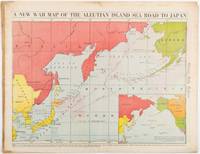
1942206849Chicago.: Chicago Daily Tribune. 28 January1942. Printed colour map 40.3 x 53.6 cm; 46.5 x 60 cm sheet inset map of the North Pacific back cover from a section of the Chicago Daily Tribune newspaper pages 21-34 January 28 1942; central fold edgewear and browning with a few minor tears not affecting the map in very good condition. Based on a Rand McNally map and issued less than two months after the bombing of Pearl Harbour by the Japanese. The Tribune briskly got to work issuing maps for readers showing the beginnings of the war with Japan. Later maps were also published for sale separately but remarkably few have survived. The map shows "the nearness of our Aleutian Island chain west of Alaska to the islands of Japan. At Dutch Harbor and other points in the Aleutians are actual and potential sea and air bases lying on the shortest route from northwestern United States to Japan." The inset map at lower right situates the areas in the larger map in respect to the countries bordering the North Pacific Ocean. <br> <br>Included with the map is the complete newspaper section from which it is the final full page. Covering sport and the market with half a dozen popular comic strips including "Dick Tracy" and "Little Orphan Annie" it shows a domestic United States a world away from what had been seen as a European War. <br> <br>". the historic Chicago Tribune was an innovator in color inks and printing but also a pioneer in bringing colorful art in the form of illustrations photographs cartoons and advertisements to the average person in an everyday medium." see The Janet A. Ginsburg Chicago Tribune Collection Michigan State University Libraries." . Chicago Daily Tribune. unknown
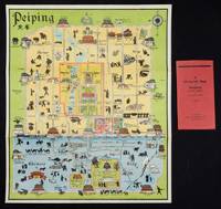
1934158433Peiping.: Peiyang Press. circa1934. Coloured folding plan of Peking with original envelope. 60 x 50cm. A few neat repairs at folds two panels evenly browned on reverse. A very good copy of a scarce pictorial plan with its envelope. This delightful and scarce pictorial map of Peking with landmarks and streets in romanised Chinese with occasional Chinese characters is surprisingly scarce. Although apparently issued in several editions in the 1920s and 30s it appears relatively infrequently on the market. The divisions of the Legation District are indicated by their flags - this edition shows the German Legation by use of the black white and red bands of the German flag. This flag which was no longer used after 1935 helps date this edition. Other landmarks and attractions shown included theatres foreign shopping area adjacent to the legations quarter Liu Li Chang Curio District the racecourse the many city gates etc. . Peiyang Press. unknown
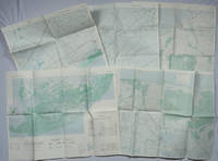
1967203843Washington D.C.: Army Map Service. 1967-1968. Five printed colour adjoining topographic maps folded legends to physical features including roads some including footpaths or trails railroads rivers streams lakes mountains boundaries and place names Route Markers Railroads airfields bridges and detailed terrain a few including tea plantations rice fields coffee and rubber plantations. glossary of Vietnamese terms in very good unused condition: <br> <br>1. Special Use S.E. Asia. Xuat-Banlan Thu. Sheet 6026. Series L607. <br>Map 57.3 x 73 cms sheet inset map of Hon Khoai Island; <br> <br>2. Special Use S.E. Asia. Sheet 5927. Series L607. Khoang Cach Deu Vong Cao-DQ. <br>Map 72.3 x 57.3 cms sheet. he Viet Cong stronghold of Quan Long Cà Mau is shown; <br> <br>3. Special Use S.E. Asia. Sheet 6027. Series L607. Vietnam. <br>Map 72.3 x 57.3 cms sheet legend showing boundaries villages elevation and hydrographic data glossary of Vietnamese terms in very good unused condition. Southeast Vietnam and the Mekong delta. The town of Vĩnh Lợi Bạc Liêu is at the mid right edge of map.; <br> <br>4. Special Use S.E. Asia. Sheet 6028. Series L607. Vietnam. Do Cao Toi-da Duoi 5 met. <br>Map 54.5 x 54.5 cms 73.3 x 56.6 cms sheet; <br> <br>5. Special Use S.E. Asia. Sheet 5928. Series L607. Vietnam. Hon Rai. <br>Map 55 x 55 cms 74.3 x 56.7 cms sheet inset map of Hon Rai. <br>The caption has the note: "Dense forest or jungle indicates more than 25% of ground is concealed by canopy with undergrowth generally impassable on foot". Detailed topographic maps in unusually fine condition of Central and Southern Vietnam issued during the Vietnam War by the United States Corps of Engineers. . Army Map Service. unknown
190952792Boston: The Bullard Co. Inc. 1909. Large folding accordion-style folded map printed in red & black sized 41 x 38 in. which when entirely folded into covers measures 5.5 x 11.25 in. Original burgundy-coloured boards small lozenge map of New York & Pennsylvania on front cover some edgewear rubbing minor tidemark to upper fore-edge of 1 corner still VG- copy. Second edition revised of this scarce and well documented map showing good roads for automobile travel railroads canals new Erie Barge Canal Steamship lines ferries lighthouses electric railway lines and more. First published in 1908 and then again in 1910 MacNair drew from US government surveys State surveys and other original commercial sources. Worldcat locates 2 copies. The Bullard Co., Inc., hardcover
194071435Los Angeles: Automobile Club of Southern California ca. 1940. A fine grouping of 14 pre-freeway California maps from the Automobile Club of Southern California. Housed in the original box given to the subscriber when he received them at his local office one end missing but attractive nonetheless. A few slight separation fold splits but overall in very good condition with the majority appearing to have never been opened.Maps are; Eastern Section of Los Angeles; Central Section of Los Angeles; Southern Section of Los Angeles; San Fernando Valley Section of Los Angeles; Orange County; Metropolitan Los Angeles; Imperial County; San Diego County; Kern County; San Luis Obispo County; Tulare County; Ventura County; Riverside County; California. Automobile Club of Southern California unknown
19294297Meadville PA: Keystone View Company 1929. 3rd Edition. Hardcover. Very Good. <br /> <br /> Third edition 1929 12mo 321pp ix pamphlet with three location maps in rear pocket. 3/4 black morocco over blue cloth gilt stamped on spine. Very good with moderate to heavy spotting and soiling to boards. Some moisture staining to fore-edge of page block mainly at the rear index else clean internally. Keystone View Company hardcover
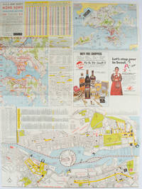
1977161880Hong Kong.: A-O-A Ltd. June/July1977. Coloured tourist maps of Hong Kong printed both sides on a sheet folded. One general area map of Hong Kong and three detailed street maps featuring Kowloon Peninsula Tsimshatsui and Central District. Generally in very good condition text in traditional Chinese English and Japanese. Sheet measures 58.2 x 43cm. The tourist maps include currency rate tourist advice advertisements for foreign and local brands and shops e.g. A-O-A Gambling Handbook for Macau Duty Free shopping centres Chinese Arts & Crafts centres acupuncture clinic etc. The maps of Central and TST have the names of many hotels businesses post offices etc marked on them. . A-O-A Ltd. unknown
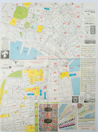
1976161881Hong Kong.: Walter K. Hoffman. January/February1976. Coloured tourist map brochure of maps of Hong Kong printed both sides six maps in total folded. Brochure also includes advertisements currency rates. Minor tears along folds otherwise in good condition. Text in traditional Chinese English and Japanese. Sheet measures 58.2 x 43.4cm. Sheet includes 6 individual maps: Map of British Crown Colony of Hong Kong Map of the Urban Area with routes for public transportation Map of Tsimshatsui large scale street map Map of Central District large scale street map Map of Wanchai large scale street map Map of Causeway Bay large scale street map Map of Portuguese Overseas Province of Macau. On the maps of Central and TST the names of many businesses hotels etc are marked. . Walter K. Hoffman. unknown
1995Q-0964540401Baywood Publishing 1995-01-01. paperback. New. In shrink wrap. Looks like an interesting title! Baywood Publishing paperback
194288863Boston: Little Brown and Company / An Atlantic Monthly Press Book 1942. Octavo 24cm; burgundy cloth-covered boards with titling in gilt on spine and illustration stamped in gilt and black to front cover; black topstain; map endpapers; 680pp; portrait frontispiece with illustrations throughout. Lacking dustwrapper. Modest shelf-wear and -soil light rubbing to board edges faint foxing to edges of textblock and 3" tear to fold of map at p.458; Very Good. Winner of the Pulitzer Prize for Biography. 88863. Little, Brown and Company / An Atlantic Monthly Press Book unknown
193691525Milano: Touring Club Italiano 1936. Very Good. 12 of 37 unbound sheets. 4p.center 2 pages are 34 cm. x 25 cm. map. Partly colored. Scale: 1:1000000. Italian text. Touring Club Italiano unknown
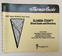
1994102220Irvine CA: Thomas Bros. Maps 1994. 1995 ed. Paperback. Very good to near fine-. 1 atlas 1 volume various pagings: color maps; 21 x 26 cm; color folding map attached to rear wrap verso; metal comb binding. Surprisingly scarce. Thomas Bros. Maps paperback
19702433190324008Colonial Dames of America 1970-01-01. Hardcover. Very Good. Signed by Author. Nice looking book has minor edge wear. Colonial Dames of America hardcover
1943144341943. Archive of nine large original World War II maps used by a United States Army soldier in the European Theater of Operations during the Allied liberation of Western Europe. Lithographed military maps variously issued by U.S. Army and War Office agencies 1943-1944. Large formats ranging from approximately 19" x 24" to 42" x 34". These maps document the cartographic infrastructure of Allied ground and air operations in the climactic campaigns of 1944-1945. The German sheets-many designated for "Army/Air" or restricted War and Navy Department use-reflect the intensive aerial reconnaissance bombing coordination and mechanized advance into the industrial and administrative heartland of the Third Reich. Cities such as Berlin Magdeburg Kassel and Düsseldorf were central to armaments production rail networks and military command making accurate and rapidly updated mapping indispensable. The Paris map corresponds to the Allied advance culminating in the Liberation of Paris in August 1944 marking the symbolic reclamation of a major European capital from Nazi control. Several sheets note reliance on prewar German cartography 1938 editions supplemented by wartime intelligence underscoring how Allied forces repurposed and revised enemy geographic data for invasion and occupation planning.<br /> <br /> Crucially these maps also capture a political geography that was almost immediately transformed by postwar settlement and Soviet expansion into Central and Eastern Europe. Within two years of their issue Germany was divided into occupation zones and by 1949 into separate states aligned with Western and Soviet blocs. Cities such as Berlin Halle Saale Magdeburg and Wernigerode fell within the Soviet zone and subsequently the German Democratic Republic fundamentally altering administrative boundaries transportation networks and the ideological framing of space. Cartographic production in these regions shifted accordingly with new editions reflecting socialist state structures and restricted internal mapping policies characteristic of the emerging Eastern Bloc. Thus these 1943-1944 sheets preserve a transitional moment: Nazi Germany still territorially intact on paper yet already subjected to Allied military penetration and poised on the brink of partition. As artifacts carried by an American soldier they embody both the tactical prosecution of total war and the immediate redrawing of Europe into Cold War spheres of influence. The archive includes operational maps of Magdeburg Sheet M.53 1:250000 "First Edition" 1943 with manuscript annotation Kassel Sheet L52 "Emergency Road Map" First Edition color based on 1938 mapping with wartime intelligence updates Düsseldorf Sheet K52 similar issue with fading highlighting and manuscript marks Hanover Sheet L53 1943 Berlin Sheet N53 "Army/Air" 1943 Halle Saale Sheet M52 marked "War and Navy Department Agencies only. Not for sale or distribution" 1943 Wernigerode Sheet 4130 First Edition War Office 1944 Jülich G.S.G.S. No. 4507 War Office 1944 35" x 30" and a large U.S.-issued map of Paris 42" x 34" 1944. All were retained by the soldier following his service.<br /> <br /> Very good overall with expected wartime folds and handling; several sheets with manuscript annotations highlighting fading or moderate water exposure notably Wernigerode stiffened from dampness; no major losses observed. A substantial and research-rich archive of original Allied operational maps materially linking frontline navigation aerial bombardment liberation campaigns and the swift geopolitical reconfiguration of Germany and Europe under the expanding Soviet Eastern Bloc. unknown