7 résultats
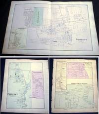
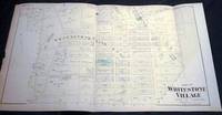
18738953New York NY: Beers Comstock & Cline 1873. Original Hand-colored Map of Part of Whitestone Village Southern Part from the Beers Comstock & Cline Atlas of Long Island New York. Three sections folded 15 1/2" x 27 1/2" approx. overall size; somewhat age-toned; top edge with a little scraping; old creasing; in very good condition. . First Edition. Not Bound. Very Good. Beers, Comstock & Cline Paperback books
18738957New York NY: Beers Comstock & Cline 1873. Original Hand-colored Map of Woodhaven with Inset Map of South Woodhaven from he Beers Comstock & Cline Atlas of Long Island New York. 15 1/2" x 24 1/4" approx. overall size; somewhat age-toned; on reverse are maps of Springfield Store Willow Tree Station Inglewood Freeport Greenwich Point; left margin edge-chipped right margin with a few nicks; in very good condition. PLEASE NOTE: Shipped rolled for safety. First Edition. Not Bound. Very Good. Beers, Comstock & Cline Paperback books
1861627311861. CARTOGRAPHY. CATALOGUE OF THE MANUSCRIPT: Maps Charts and Plans and of the Topographical Drawings in the British Museum. Volume III only. London: Printed by Order of the Trustees 1861. A photostat copy of Vol. 3 in two volumes i.e. a Complete Volume III the final volume of this catalogue. Tall 8vo. brown library binding. Ex-library sun to spine touch of soil dust soil to top-edge. unknown books
188225034Philadelphia PA: O.W. Gray & Son 1882. One sheet printed with 2 maps from the 1882 O.W. Gray National Atlas New York Edition: Gray's New Map of Australia by Frank A. Gray 1878 engraved by W.H. Holmes and Palestine. With hand-coloring in pastel tones; Approx. 14 3/8" x 17 1/4" overall size; a little even toning to the paper; in very good condition. . Map. Not Bound. Very Good. O.W. Gray & Son paperback books
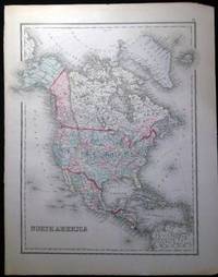
188225035Philadelphia PA: O.W. Gray & Son 1882. One sheet printed with 1 map from the 1882 O.W. Gray National Atlas New York Edition: North America. Copyright noted at bottom edge Colton 1855. With hand-coloring in pastel tones; Approx. 14" x 17 1/4" overall size; a little even toning to the paper right margin with a few little edge-nicks; in very good condition. Map. Not Bound. Very Good. O.W. Gray & Son paperback books
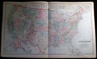
188225037Philadelphia PA: O.W. Gray & Son 1882. One sheet from the 1882 O.W. Gray National Atlas New York Edition: Double-page map of the United States with inset of the Territorial District of Alaska formerly Russian America and a smaller inset at top "Sketch Exhibiting the Westward Movement of the Centre of Population from 1790 to 1870."; text on back regarding U.S. population changes; at bottom margin of map copyright dated as 1879 O.W. Gray & Son. With hand-coloring in pastel tones; approx. 28 1/2" x 17 1/4" overall size; a little even toning to the paper with a few little edge-nicks; in very good condition. . Map. Not Bound. Very Good. O.W. Gray & Son paperback books
188527056Montreal Canada: Dawson Brothers 1885. Color map sectioned on linen; with insets showing the continuation of the map to the Pacific showing British Columbia & Manitoba; Manitoba & connecting territory; Environs of Montreal and an inset of Newfoundland. Front endpaper and a blank back panel of the map with the owner name-stamp of collector George R. Brush M.D. U.S. Navy; in service as a surgeon & medical inspector from 1861-1894. Bound in the original hardcover blue textured cloth boards gilt cover titles patterned-paper endpapers; covers are approx. 4" x 6" size. Map opens to approx. 23 1/2" x 33 3/4" overall; some edge tips wear and dustiness to the covers' binding inner endpaper scraped from linen backing at one corner; map in very good condition. First Edition. Hard Cover. Very Good. Dawson Brothers hardcover books