(ATLAS)Biblio.com
112 résultats
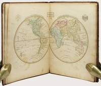
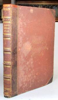
186552198Edinburgh: Adam and Charles Black 1865. Folio. 32 70 pp. Publisher's brown half morocco over cloth boards spine with raised bands gilt lettered direct to one panel cursive gilt lettering to the upper cover early owner's inscription to the front pastedown. Frontispiece of "The Flags of All Nations" plus 57 maps - 31 double page and 26 full page including a supplementary map of the borders of central Europe. Covers worn but sound some rudimentary repairs to the spine ends and the hinges similarly reinforced a number of maps with lightly pencilled 19th century annotations to the margins and/or their versos the contents mostly in decent shape. Edinburgh: Adam and Charles Black unknown
187357680Gotha Justus Perthes 1873-75. Folio-oblong. Contemp. hcalf. Titlelabel with gilt lettering. Spine somewhat worn and frontcover detached from spine. Stamp on title-page.Bound after title-page "Vorbericht zu Stieler's Hand-Atlas" 11 pp. Containing 89 engraved maps in outline colouring incl. title-page 1-24 26-90 A faint dampstain to some maps in upper right corners. Some underlining to German cities. Maps dated 1873 1874 a. 1875 mosly 1873. unknown
187961342Chicago: J.H. Beers & Co. Publishers Lakeside Building Cr. of Clarks & Adams 1879. Atlas folio. 15 x 17.5 in. 82 pp fairly continuous pagination including maps & lithographs. With 39 hand-coloured lithographed maps several double-page Indiana United States World Columbus Township Columbus Plat Sand Creek & Wayne numerous lithographed plates some large double-page tables charts. Quarter-sheep over black embossed publisher’s cloth gilt lettering stamped on front cover borders embossed in blind wear & bumping to corners some chipping head & foot of spine some wear to fore-edges somewhat shaken still a G copy. First edition of this uncommon original 19th-Century plat map atlas for Bartholomew County Indiana during the Gilded Age. J.H. Beers specialized in County Plat Map atlases and histories from 1878-1900 and also focused on producing municipal history and biographical history titles primarily in and around the Midwest. Their well-executed lithograph birds-eye views of businesses towns family farms and more were quite popular were generally pre-sold through subscription and prosperous towns businesses and farms who paid extra were able to secure a biographical section or view within the volumes. Bartholomew County located about 40 miles south of Indianapolis was originally established in 1821 and named for Lt. Col. Joseph Bartholomew a militia officer wounded at the battle of Tippecanoe. The County featured such companies as the Reeves Pulley Co. Ceraline Manufacturing Orinoco Furniture and others in the 19th Century and as of this publication the population was about 30000 inhabitants and today the County features approximately 82000 inhabitants. The atlas was later reprinted in 1969 1979 and 1986 in very poor smaller reproductions. J.H. Beers & Co., Publishers, Lakeside Building Cr. of Clarks & Adams, hardcover
182834844London Published by the Author 1828. Large 4to. 35x29 cm. Original worn hcalf part of back lacks. Orig. printed paperlabel with title on frontboard. Sewing loosening. Engraved title dedication-leaf a. Index-leaf. With 53 all engraved maps handcoloured in outline. Marginal tears to the 3 first leaves. 3 maps with marginal tears no loss. Some traces of use. Light scattered brownspotting. Maps loosening. Maps numb. 1-26 1-25 double-numb. unknown
1899867341899. ATLAS. ATLAS OF DORCHESTER WEST ROXBURY AND BRIGHTON CITY OF BOSTON in one volume. Boston: L. J. Richards 1899. Folio. 22" Street index plus 40 double page maps measuring 32" x 22". Bound in 1/2 leather which is largely absent. Front board is detached. Interiors are clean and free from staining with the exception of some light red or graphite pencil annotations on a few plates and soiled end-papers. Plates with pencil annotations: 28 29 30 37 39. Maps printed in as many as seven colors. A good copy. unknown
182957983Paris Leclerc Imprimé par Paul Renouard 1829. Folio. 53 x 375 c. Contemp. hcalf. Richly gilt spine. Original engraved titlelabel on upper board. Spine rubbed. Some wear to edges and corners. Title-page loose. Stamp on title-page. 6 pp. 35 doublefolio sheets partly with text and maps. Maps and some textsheets handcoloured. <br/><br/><em>Comprising maps from America Africa Asia Russia etc.etc. - See Phillips124-29 various editions. </em> unknown
187957673Gotha Justus Perthes 1879-80. Folio-oblong. Contemp. hcalf. Gilt spine. Gilt lettering. Spine somewhat worn. Corners bumped. Wear to edges.Bound in front is "Vorbemerkungen zu Stieler's Hand-Atlas" 8 pp. Inhalt 2 pp. and 95 incl. title-page engraved and coloured maps. Maps dated 1879/1880 some undated. Maps clean and fine only few minor marginal brownspots. unknown
183055689Hannover no printer 1830. Small folio-oblong. 24 x 375 cm. orig. marbled boards. Orig. printed titlelabel on upper cover. Lower part of spine with tape. 27 sheets: 1. printed title-page 2. engraved Massstab 3. engraved Tableau and 24 engraved maps coloured in outline. maps ca. 215 x 315 cm. Clean and fine. A paperlabel pasted on upper cover. hardcover
187551587Montreal Toronto & London: George N. Tackabury Printed by the Burland-Desbarats Lithographic Co. 1875. Folio. 14.25 x 17.75 in. 251 1 pp. Colour lithograph illustrated title page showing the Parliament Building in Ottawa Canada from photograph by W. Notman 53 colour lithograph maps many double-page many tables. Publisher’s plum-coloured embossed cloth gilt decorative lettering on front cover marbled endpapers nicely rebacked in simulated black calf corners renewed some wear & rubbing to corners 1 leaf w/ repairs to creases minor tidemark to upper right corner not affecting maps still G copy. First edition of this fine atlas of Victorian-era Canada including maps of climatology possessions provinces prior to Alberta Saskatchewan & Newfoundland becoming provinces plat maps of counties Railways as well as maps of the United States and Europe. Of particular interest are the city maps of Quebec Ottawa London Hamilton Kingston Toronto and Montreal. This excellent reference work also provides a comprehensive list of railways in Canada steamships in use lists post offices railway stations cities and populations as well as business cards located by city and town. George N. Tackabury, [Printed by the Burland-Desbarats Lithographic Co.], hardcover
184618561Folio. Bound in one cont. hcalf. gilt back. Back slightly rubbed. With 3266 fine steel-engraved maps made and drawn by Duvotenay and Defour. 2 maps handcoloured a few brownspots mostly marginal. unknown
1899867361899. ATLAS. ATLAS OF THE CITY OF BOSTON: SOUTH BOSTON. Philadelphia: G. W. Bromley Co. 1899. Folio 23". Street index and 33 double-page maps - outline and index map and 32 plates - measuring 32.5" x 22.5". Ffep missing. Outline and index map has tear near bottom where sheet folds. Plate 1 partly detached. Plates 29 30 31 are detached. Plates 2 and 32 have pencil annotations. Bound in 1/2 leather which is flaking. Interiors are bright some soil. Good. unknown
183553619New York: Published by Huntington and Savage 216 Pearl St. 1835. Imperial 4to. 16 x 14 in. 10 leaves 8 engraved plates 2 double-page 7 hand-coloured minor foxing edgewear faint tidemark to lower margin of first few leaves. Original printed yellow softcovers mounted on thicker paper stock cover art woodcut of astronomer gazing at the stars w/ telescope testimonials printed on back cover soiling edgewear rubbing tide-mark to lower margin bumping to corners pencil drawings by child on verso of some plates trying to reproduce some of the figures still G copy. First edition thus stated “New Edition†which in actuality was an updated and revised edition with new engraved plates executed by W.G. Evans of New York fl. 1830-1845 who also engraved the famed Map of Lewis & Clark’s Track Across the Western Portion of North America in 1842 revised by Archibald M’Vickar. Burritt 1794-1838 an American astronomer and mathematician created his textbook and the later atlas as a low-cost alternative to celestial globes which were often too expensive for many schools in Jacksonian America. The atlas could be purchased for $ 1.25 at the time and the Geography of the Heavens textbooks and Atlases would prove immensely popular in classrooms up until 1876. Adapting most of his constellation figures from Alexander Jamieson’s A Celestial Atlas 1822 Burritt included a plan of the Solar System Celestial maps of the skies in January-March October-December April-June July-September South Pole North Pole and Planisphere of the Whole Heavens on Mercator’s Projection. This was the last decorative celestial reference in the 19th century and even served as inspiration of H.P. Lovecraft who notes it as prized possession in letter to Maurice Moe in 1915. See: Kidwell Elijah Burritt and the Geography of the Heavens Sky & Telescope Vol. 69 January 1985 pp. 26-28; Boston University Art Gallery Celestial Images: Antiquarian Astronomical Charts and Maps from the Mendillo Collection 2005 75. Published by Huntington and Savage, 216 Pearl St., paperback
1849azgsWilliam Blackwood and Sons Edinburgh and London 1849. 5th or later Edition. Hardcover. Very Good/No Jacket. 14 volumes plus atlas complete. All fully bound in leather with gilt decoration - to fascias spines and edges - and titling. All have marbled papertrims and frontis and end papers. This is a FABULOUS set of this popular loquacious history of Europe with the first major account of the French Revolution. It is smart handsome gentlemanly and very clubbable. Some of the books have wear from shelving and are scuffed but this only adds a genial dignity and character. All have binder labels T. Sowler Manchester - the very model of a Victorian businessman on the front pastedowns. Spines have five ridges and six panels. The Atlas 108 pages - published 1850 contains maps of countries and towns and plans of 'battles and sieges &c.' The covers are worn and scuffed. Within there are some small storage marks about. The pages are clean startlingly bright and clear finely detailed and the colours for various regiments fresh. Volume 1 633 pgs; 1849: wear to edges and spine but dignified and secure. The contents are tight and clean. Covers 1774-1789. Vol 2 693 pgs; 1849. In very good handsome condition. Light wear bright gilt. Inside the contents are clean and fresh. There is a silk bookmark. 1789 - 1793. Vol 3 635 pgs; 1749. The stamped decoration as with all other volumes is neat and unworn. The spine has some wear but is benign and kindly. The pages are clean and comfortable. Covers 1795. Vol. 4 654 pages; 1849. A lovely atmospheric copy. At last the story moves on beyond France. The pages are fresh. 1795-1799. Vol V 658 pgs. Neat contented bright. 1799 -1801. Vol 6 670 pgs. Nelson Pitt Napoleon! The odd storage stain. Otherwise very clean. 1801-05. Vol 7 690 pgs. Some age related marks. Tidy and handsome. Fox Prussia Clive of India! 1805-07. Vol 8 696 pgs. Tight confident clean. Some cover wear. Wellesley Napoleon Peninsula Wars. 1807-09. Vol 9. A happy book. Some wear. Spain George III! Pages exceptional. Vol. 10 630 pgs. Some scuffing and wear. Wellington the Emperor South America Turks Russians! Pages very clean. 1810-12. Vol 11 637 pgs. Some wear to the covers. Contents are smart. Moscow Germany Generals! 1812-13. Vol 12 640 pgs. Confident benign copy with some spine wear. Pages very secure and certain. Wellington in France Blucher Napoleon on the run. 1813-14. Vol 13 664 pgs. Edge and spine wear. Pages vigorous and healthy. Come-uppances America Vienna decides! 1814-1815 1814 is the date when Alison had the idea of this history. Vol 14 644 pgs. Some aged wear to the covers. The pages are startlingly healthy. Waterloo St Helena The First Reform Bill contemporary judgements. 1815 and index. Oh happy person who owns this THRILLING story as told in these wonderful and REMARKABLE volumes. fk. Our orders are shipped using tracked courier delivery services. William Blackwood and Sons, Edinburgh and London hardcover
1896867391896. ATLAS. ATLAS OF THE CITY OF BOSTON VOLUME 6 WEST ROXBURY. Philadelphia: G. W. Bromley and Co. 1896. Second edition. Folio 22.5". Contains street index outline and index map and 30 double-page maps measuring 22.5" by 32". Maps have only minor soiling to margins and occasional pencil annotations plates 1 and 27. FFEP and title page have large chips. Bound in half leather now mostly chipping or absent. In need of rebacking front board detatched. unknown
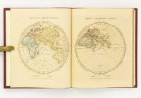
183533158Edinburgh: Oliver & Boyd ca. 1835. Early printing undated. Fully illustrated with 27 maps the map of the world double-page all hand-coloured. Two additional maps are affixed to the endpapers and are extra to those included in the book. These were sometime added by an owner of the volume. 4to publisher's original brown calf over brown cloth covered boards the spine lettered in gilt the upper cover with hand-printed titling label. vi 27 maps on 28 pages A very well preserved copy. The binding with some wear from time and use still strong and showing minor separation at the free-flies and pastedowns the maps all in good order clean and well coloured. EARLY PRINTING OF EWING'S GENERAL ATLAS. Now scarce as a complete book many copies have been broken up with the maps sold separately. The maps have been handcoloured and are preserved very well. A double-page world map is presented first and then the maps of the countries of European countries and Russia Asia Africa North America and South America. The U.S. map is quite interesting in that it includes only the states and territories recognized at the time of publication. The country is show bordering the Atlantic on the East but extending only into the Missouri Territory and Arkansas in the west. Oliver & Boyd hardcover
181832926Uden Sted ca. 1818-30. Lille 4to. 195x17 cm. Beskedent hshirtbd. Indre false itu men blokken som består af kortbladene intakt. Indeholder 44 af Holms kortblade skårne i træ og herefter grænsekolorerede i hånden. Her og der med lidt brunpletter og brugsspor. Et kort med rift repareret uden tab. Et kort med lidt tab i øverste venstre hjørne. <br/><br/><em>Det lidt naive men charmerende atlas er selvom det er produceret til skolebrug det første danske atlas. Det udkom med et varierende antal kort og sammensætning men ialt er der registreret 50 udgivne blade. Omfatter Danmark Slesvig og Holsten herefter kort over "Norge og Sverrig" "Rusland" "Tydskland" "Preussen" "Österrige Ungern og Gallicien" "Tÿrkiet" "Italien" "Spanien og Portugal" "Frankrige" "Nederlandene" "Storbrittanien" "Asien" "Afrika" "America" og "Australien". - Bibliotheca Danica II:391. </em> unknown
180855974Paris Didot L'Ainé 1808 1805-06. Folio. 54 x 39 cm. Contemp. hcalf. Wear to spine. Spine-ends repaired. Corners bumped.Titlelabel with gilt lettering on upper cover. 2 pp. recto: Atlas historique.- verso: Index listing 32 Engraved frontispiece: Les Fastes Napoléens de 1796 a 1808 with a small handcoloured map dated 1808. With 34 double-page uncut sheets ca. 53 x 72 cm. of which 16 are in letterpress text handcoloured 18 sheets are maps surrounded by text all handcoloured. Internally clean and fine in original colouring. Map-sheets dated 1805-06. The frontispiece having a dampstain. <br/><br/><em>Comprising maps from America Africa Asia Russia etc.etc. - See Phillips124-29 various editions. </em> unknown
1828142642London: The Author 1828. First Edition. Hardcover. Very Good. London The Author 1828. Large quarto 358 × 295 mm vi pages engraved title dedication and index printed rectos only plus 53 extensively hand-coloured maps all printed recto or verso only with all but the last one - the Western Hemisphere - presented as facing pairs modern followed by ancient. Later quarter red morocco and cloth spine lettered in gilt; top corners slightly bumped; all edges speckled red; a few small inkspots to the top edge with minimal bleeding into a few top margins; all maps offset; blotted ink marks to the top corner of the map of 'Terra Sancta' map 20; trifling signs of age and use; overall in excellent condition. The extensive hand-colouring would appear to be the exception rather than the rule hand-coloured in outline only. The Author hardcover
184927973Kjöbenhavn Chr. Steen & Søn 1849-61. Titelbladet uden år. Stor folio. Samt. hldrbd. Forperm med orig. bogtrykt omslag påsat. Udvendig noget slidt og med brugsspor. Litograferet titelblad med trykt indholdsfortegnelse over atlassets 20 dobbeltsidede foliokort alle litograferede og håndkoloreret hvert målende ca 52x64 cm. Her og der med lidt brunpletter særligt marginer men indvendigt iøvrigt i god stand. Kortene er litograferede hos Emil Bærentzen & Co. Lith. Institut og alle daterede mellem 1849 og 1861 opsat på false. <br/><br/><em>Prægtigt stort atlas af dansk oprindelse. Ikke anført i Dansk Bogfortegnelse - ikke hos Phillips. Indeholder: 1. Den östlige og vestlige Halvkugle. 2. Europa. 3. Asien. 4. Afrika. 5. Nordamerika. 6. Sydamerika. 7. Australien. 8. Danmark. 9. Norge og Sverrig. 10. Storbrittanien og Irland. 11. Frankrig. 12. Spanien og Portugal. 13. Schweitz. 14. Tyskland. 15. Preussen. 16. Nederlandene og belgien. 17. Italien. 18. österrig. 19. Rusland. 20. Tyrkiet og Grækenland. </em> unknown
181956069København 1819. Folio. 44 x 27 cm. Original blue wrappers with some dampstains and rear somewhat soiled. With the engraved oval title on upper wrapper. In a later hcloth portfolio. With 19 all engraved maps charts plans coastal profiles of which 7 are double-page. Maps numbered in letters A-K profiles numbered I-IX.The maps depicting the main harbours with townplans and anchorages. Maps with a few small marginal closed tears. <br/><br/><em>Extremely scarce Danish edition a compilation from Vicente Tofino's "Atlas Maritimo" where the sheets have Danish text. This maritime-atlas was probably intended to accompagny Løvenørn's "Beskrivelse til det voxende Kaart over Kysterne af Spanien og Portugal." 1818.Bibl. Danica II 362 a. 367. - Luisa Martín-Merás: Catálogo analítico de los Atlas del Museo Naval de Madrid 2007". No 232. </em> hardcover
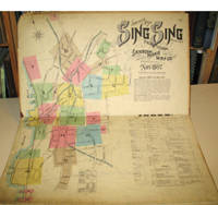
189715960New York: Sanborn-Perris Map Co. 1897. Third edition with additions. Hardcover. Good overall. Folio published in November 1897 with 18 hand colored maps including a title page on the key map. This is the third edition of the atlas according to the Library of Congress Census the first edition being published in 1886 but with only 13 sheets. The second edition was published in 1891 with an extra 2 sheet making a total of 16 sheets. Small private library stamp on the verso of the key map. There are very small pencil annotations on the maps obviously by F.J. Washburn the local insurance agent. <br /> Originating in London in the mid 18th century insurance maps had become invaluable in the US in the 1860's when Sanborn started work. The company started to standardize the maps and publish them in atlases under the town or city. Each map/sheet measures 21 x 25" and is drawn to a scale of 50 feet to an inch with color applied by hand at the time of publication. Every atlas records all town buildings shown to scale its construction material and use noted as well as fire-proofing thickness of walls elevators chimneys fire alarm boxes hydrants sprinkler systems and a wealth of other detail. Ultimately Sanborn produced maps and atlases for 12000 locations. Being so specific the demand was very slight. The Library of Congress estimates that there were usually fewer than twenty orders for a single sheet so production was small and usually produced for a specific Insurance company or agent. Because of this a very small number of copies of any atlas are offered on the market today. The maxim "if it turns up buy it because you won't find another copy" springs to mind. Folio maroon leather spine with printed hard boards rubbed but edges. Sanborn-Perris Map Co. hardcover
1837891931837. JAPANESE ATLAS Ichikawa Tokei. KOKUGUN ZENZU 2 volumes. Nagoya Edo Osaka Kyoto. Eirakuya Toshiro et al. Preface dated 1837. String-bound Japanese-style fukuro-toji printed paper title labels. Original yellow covers. Covers are a bit soiled with ownership labels. Internal occasional marginal worming. Printed in color woodblock throughout an interesting atlas of the traditional governing divisions of Edo-era Japan. unknown
181254863Paris Francois Buisson 1812. Large 4to. 34 x 25 cm. Contemp. hcalf. Gilt spine. Titlelabel with gilt lettering. Wear to spine and some leather at upper part of spine gone. Taped at foot of spine. 4111-errata pp. and 75 3 extra engraved maps all handcoloured in outline. The three extra inserted are: France Pologne Confederation Germanique. Scattered faint brownspots to textleaves. Maps clean with faint scattered marginal brownspots. <br/><br/><em>First edition. - Sabin 44159. </em> hardcover
184117957Paris J. Andriveau-Goujon 1841. Folio. Bound in full leather with a closing flap just like a briefcase. Slightly scratched and a few tears to binding. Titlepage with a tear no loss. Complete with 30 double-page ca 41x53 cm full handcoloured engraved maps. A few tears in centerfoldings very ligh brownspottings otherwise good. <br/><br/><em>Philipps No 324 listing an edition from 1838 but not this second edition . This fine engraved atlas comprises 10 historical maps and 20 recent 1841 among these Mappemonde North-and South America Asia Africa Europe etc. </em> hardcover
182054816Weimar 1820. Folio. Image of maps: ca. 35 x 44 cm. Paper size: ca. 46 x 56 cm. Engraved title with outline of the maps title-page in French numbered as Section I. Comprising the Sections I-XXXVI XXIX and XXXII with a and b all but the General map in 2 parts not present. Some maps with markings in red and blue. One with dampstain in lower margin a few with minor traces of use but all intact. In all 38 engraved sheets. unknown