119 résultats
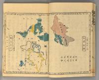
1871894281871. ATLAS Bridgeman E.C. translated by Mitsukuri Genpo 箕作阮甫. RENPO SHIRYAKU 連邦å²ç•¥ 2 vols. Tôkyô Zodiacal date of Meiji 4 1871. String-bound Japanese-style fukuro-toji. An interesting work by Bridgeman the Chinese missionary originally published in Chinese but here marked for reading as Japanese kanbun. Thus not a translation as we might understand the term but a long standing aid for literate Japanese to understand the original classical Chinese. With a number of bw and some color maps of the USA along with a text describing US history culture economics etc. A bit of cover soiling outside and the scattered signs of insect damage internally but overall a very good copy. Upon comparison to the original Japanese edition of 1861 there is not much to choose between them. unknown books
180828750Paris: P. Didot l'ainé 1808. Engraved frontispiece and 33 double-page hand-colored tables incorporating 21 smaller maps including a world map and a map of America. 1 vols. Folio. Contemporary quarter morocco and boards worn. Beautiful immaculate copy. Engraved frontispiece and 33 double-page hand-colored tables incorporating 21 smaller maps including a world map and a map of America. 1 vols. Folio. P. Didot l'ainé unknown books
1837891931837. JAPANESE ATLAS Ichikawa Tôkei. KOKUGUN ZENZU 2 volumes. Nagoya Edo Ôsaka Kyôto. Eirakuya Tôshirô et al. Preface dated 1837. String-bound Japanese-style fukuro-toji printed paper title labels. Original yellow covers. Covers are a bit soiled with ownership labels. Internal occasional marginal worming. Printed in color woodblock throughout an interesting atlas of the traditional governing divisions of Edo-era Japan. unknown books
189459354Springfield: L. J. Richards 1894. First Edition. folio bound in contemporary cloth stained especially the rear board and endpaper spine repaired by back tape. Little water stain in the margins of the title page but the maps are nice and clean and bright. 34 colored double page maps in all. L. J. Richards unknown books
18826274Chicago and Toledo: H.H. Hardesty & Co 1882. Hard Cover. Small Folio. Illustrated containing large scale copper plate maps of each state and territory of the United States and the provinces of Canada together with a complete reference map of the world topographical and railroad map of the United States thirteen comprehensive maps of Bible geography covering all the countries of Bible history with classified pronunciative index of each map printed in colors from plates secured by letters patent producing the clearest typographical effect of any known engraved plates accompanied by a general survey of the world history of the United States-History of each state and territory of the United States outline map and history of Lawrence County Ohio. Containing a condensed history of the County; Biographical sketches; general statistics; miscellaneous matters etc. Frontispiece depicts Geysers in the Yellowstone Valley 60 of 61maps present lacking #44 &45 which is the United States the five folding maps are on stubs and printed on a much thinner paper with the map of New York laid in closed tear on map #164 small loss at lower edge of map #165. Re-backed and cornered in brown leather retaining original gilt stamped brown cloth endpapers renewed. A very good copy with excellent maps. <br/><br/> H.H. Hardesty & Co hardcover books
1879781391879. Atlas volume. MAPS ACCOMPANYING PROCEEDINGS OF A BOARD OF OFFICERS APPOINTED TO EXAMINE INTO AND REPORT UPON THE CASE OF FITZ-JOHN PORTER. Washington: Government Printing Office 1879. Twenty-two folding maps and one folding letterpress description. Bound in contemporary three-quarter brown leather with marbled sides. Bookplate and ink stamp of William Crowninshield Endicott on front endpapers. The leather parts of the binding are very deteriorated and the top board is detached. One map no. 18 has a skillful paper repair at the inside margin. Another map no. 22 is just starting on a few folds. And a few maps have some occasional light foxing and splits along seams. Otherwise the plates are quite crisp and clean. Very good plates in an as-is binding. unknown books
1876010487London: George Philip & Son 1876. Hardcover. VG. 8vo publishers brown pebbled cloth gilt vignette and titles front gilt spine titles corners moderately worn binding firm all maps extant. Apparently unused internals near fine George Philip & Son hardcover books
1889262371889. WOLVERTON'S ATLAS OF MONMOUTH COUNTY. EATONTOWN MAP 1889. A 20-inch by 30-inch hand-colored map of Eatontown also showing Monmouth Park and Oceanport. Probably one of the best early maps of Eatontown ever made. $150.00. unknown books
1889262421889. WOLVERTON'S ATLAS OF MONMOUTH COUNTY. HOWELL TOWNSHIP 1889 MAP. A 20-inch by 30-inch hand-colored map of Howell Township showing West Farms Fairfield Farmingdale Jerseyville Turkey Blue Ball Greenville Runyons Bethel and Squankum. $150.00. unknown books
1889262381889. WOLVERTON'S ATLAS OF MONMOUTH COUNTY. MILLSTONE TOWNSHIP 1889 MAP. A 20-inch by 30-inch hand-colored map of Millstone Township also showing the Navesink section of Middletown Township. $150.00. unknown books
189927283Ottawa: issued by authority of Hon. Clifford Sifton 1899. Only edition English issue there was also an issue in Swedish; folio pp. 10; includes 5 color maps partly double-p.; original printed wrappers; inside wrappers with information on the trade centers of Canada population and agricultural statistics; some spotting and staining of the wrappers but generally very good. <br/><br/> issued by authority of Hon. Clifford Sifton unknown books
1877260751877. F.W. BEERS ATLAS OF MONMOUTH COUNTY. SPRING LAKE 1877: REIDS VILLA PARK. Upper picture frontal view of Reids Villa Park lower picture frontal view of the residence of Rev. A.A. Willits Spring Lake. Hand-colored. $125.00. <br/><br/> unknown books
1878274841878. WOOLMAN AND ROSE ATLAS OF THE NEW JERSEY COAST. ASBURY PARK 1878. THE COLEMAN HOUSE. An 11.5-inch by 14-inch hand-colored engraving depicting the Coleman House hotel and its surroundings in Asbury Park including boating on Wesley Lake. $125.00. <br/><br/> unknown books
1878314351878. WOOLMAN AND ROSE ATLAS OF THE NEW JERSEY COAST. ASBURY PARK 1878. THE GRAND AVENUE HOUSE. An 11.5-inch by 14-inch hand-colored print showing the Grand Avenue House Property of Sill & Ripley in Asbury Park. $125.00. <br/><br/> unknown books
183917778Boston & Paris: David H. Williams 1839. 10 maps some with several to the sheet; with handcolored maps including: Roman Empire; Italy; Greece; Asia Minor; The World exhibiting the Countries mentioned in the Old Testament; Journeyings of the Israelites from Egypt to Canaan; Judah and Israel with the Division of the Twelve Tribes; Palestine or the Holy Land; Ancient Jerusalem with its Environs; Map Illustrative of the Travels of St. Paul; approx. 9 1/2" x 11 1/2" size; yellow printed paper coverd paper stock binding; covers very worn chipped & stained; maps are on a softer paper; detached from the binding and occasionally foxed some edgewear; overall maps in good condition and an interesting early American Christian religion & education atlas. Improved Edition. Soft Cover. Good. David H. Williams Paperback books
1889262471889. WOLVERTON ATLAS OF MONMOUTH COUNTY. MATAWAN 1889 MAP. A 15-inch by 22-inch hand-colored map showing Matawan depicting the area from the Matawan Creek to Atlantic Avenue. $100.00. <br/><br/> unknown books
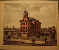
1878260561878. WOOLMAN AND ROSE ATLAS OF THE JERSEY COAST. LONG BRANCH 1878: GRADED SCHOOL. A hand-colored original 11.5-inch by 14-inch view of the Long Branch Graded School. $100.00. <br/><br/> unknown books
1878293021878. WOOLMAN AND ROSE ATLAS OF THE NEW JERSEY COAST. BELMAR/ OCEAN BEACH 1878. COLUMBIA HOUSE. An 11-inch by 14-inch hand-colored print showing the Columbia House a number of bathers and pedestrians and several horse and buggy or wagon teams. Ocean Beach is now known as Belmar. $100.00. <br/><br/> unknown books
1878261001878. WOOLMAN AND ROSE ATLAS OF THE NEW JERSEY COAST. WEST CREEK CRANBERRY PLANTATION 1878. Print showing the Stafford Forge Cranberry Plantation West Creek Ocean County the property of Daniel R. Gowdy. Hand-colored. $100.00. <br/><br/> unknown books
1878261941878. WOOLMAN AND ROSE ATLAS OF THE NEW JERSEY COAST. OCEAN GROVE: PARLORS OF THE ARLINGTON 1878. A hand-colored original 11.5-inch by 14-inch print showing the Parlors of the Arlington in Ocean Grove property of Charles E. Howland. $100.00. <br/><br/> unknown books
1878293041878. WOOLMAN AND ROSE ATLAS OF THE NEW JERSEY COAST. SPRING LAKE: REID VILLA PARK 1878. An 11.5-inch by 14-inch hand-colored print showing a side-view of the property of Wm. V. Reid people in period dress and a horse and buggy. $100.00. <br/><br/> unknown books
1865291856New York: J. H. Colton 1865. Second Edition. Colored engraved map with a bit of creasing at the fold. 11 3/4 x 9 1/2". From the second edition of Colton's Condensed Octavo Atlas of the Union. This map is darkened as if from newsprint. Wheat in Mapping the Transmississippi West notes of this map of Texas in the 1864 first printing that the eastern boundary of New Mexico is pushed too far to the east placing it in Texas proper; that appears to be the case with this second printing as well. J. H. Colton unknown books
1873260841873. F.W. BEERS ATLAS OF MONMOUTH COUNTY. LONG BRANCH 1873 MAP. A 13-inch by 24-inch hand-colored map of a portion of Long Branch. $85.00. <br/><br/> unknown books
1878261791878. WOOLMAN AND ROSE ATLAS OF THE NEW JERSEY COAST. ASBURY PARK 1878. An original print not a reproduction showing the Branch yard of Princeton Lumber and Improvement Co. Hand-colored. $85.00. <br/><br/> unknown books
1878314331878. WOOLMAN AND ROSE ATLAS OF THE NEW JERSEY COAST. BELMAR/ OCEAN BEACH 1878. NEPTUNE HOUSE. An 11.5-inch by 14-inch hand-colored print of the Neptune House in Ocean Beach. Property of J.L. Hoppock. Ocean Beach is now known as Belmar. $85.00. <br/><br/> unknown books