The Home Knowledge AtlasBiblio.com
112 résultats
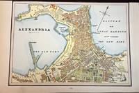
1888M5504Toronto: Home Knowledge Association 1888. Very Good upper margin trimmed closely. Notes: Detailed Map of Alexandria Egypt nicely hand coloured.<br>Alexandria is Egypt's principal seaport the second largest city after Cairo and the largest city on the Mediterranean coast. Founded in 331 BC by Alexander the Great Alexandria is one of the largest and most important cities of antiquity and a leading centre for science culture and scholarship. It’s nicknamed the "Bride of the Mediterranean" and "Pearl of the Mediterranean Coast". Size : 170x240 mm 6.75x9.5 Inches Coloring: Printed in Color with some hand colouring Category: Maps City Maps; Maps Africa North Egypt Home Knowledge Association unknown
189359779Bielefeld und Leipzig Velhagen & Klasing 1893. Folio. In contemporary half calf. Fine. 140 map 150 pp. unknown
189334377Bielefeld und Leipzig Velhagen & Klasing 1893. Folio. Cont. hcalf. Light wear to edges and spine. Gilt. Inhalt: 2 pp. - Abkürzungen u. geographischen Namen: 167 pp. 140 pp. of chromolithographed maps. unknown
188976491Uten sted. New York. Uten år. 1889. Oblong 8vo. Samtidig skinnryggbind med marmorerte dekler og tittelfelt i svart skinn på fordekkelen. Upaginert. 28 s. Med 50 kromolitograferte kart av U. S. A.’s stater. Med kartene er også andre motiver.8vo oblong. Contemporary half calf marbled boards title in blck on front cover. Not paginated. 28 pp. With 50 chromolithographed plates - maps and other motives . Engelsk. <br/><br/><em>Uvanlig i så god tilstand. A very good copy. </em> hardcover
1878314351878. WOOLMAN AND ROSE ATLAS OF THE NEW JERSEY COAST. ASBURY PARK 1878. THE GRAND AVENUE HOUSE. An 11.5-inch by 14-inch hand-colored print showing the Grand Avenue House Property of Sill & Ripley in Asbury Park. $125.00. unknown
1878274841878. WOOLMAN AND ROSE ATLAS OF THE NEW JERSEY COAST. ASBURY PARK 1878. THE COLEMAN HOUSE. An 11.5-inch by 14-inch hand-colored engraving depicting the Coleman House hotel and its surroundings in Asbury Park including boating on Wesley Lake. $125.00. unknown
1852feb1187581852. Used. For more details please contact me unknown
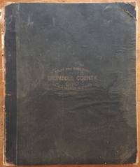
18994714Cleveland Ohio: American Atlas Company 1899. First Edition . Hardcover. Very good-. Atlas folio 236pp. illustrated. Front board and title page detached but present. Internally structurally sound with a sturdy nailed binding. Internally quite bright and clean especially the color maps which are all in excellent condition. A tide mark affects a nice chunk of pages in the directory not affecting readability or the maps. To call this turn of the century directory of Trumbull County exhaustive would be an understatement - truly a granular and visually appealing record of life in this area of northeast Ohio around the time of its manufacturing growth. Though the front board is regrettably detached this is still a very nice copy overall. American Atlas Company hardcover
180158754Nürnberg Schneideri-Weigeliana 1801. Folio. 405 x 26 cm. Recent hcloth. Stamp on title-page. 2 pp. 12 engraved and handcoloured maps. Title-page browned and with brownspots. Corners repaired. All 12 maps having some rather faint dampstaining and light browning. Some marginal brownspots and some corners repaired outside image. hardcover
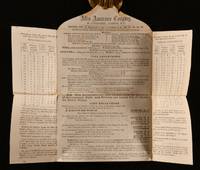
1869838G6London: Atlas Assurance Company 1869. Loose Pages Articles. Very Good Indeed. 8.5" by 10". None. An interesting letter from the Atlas Assurance Company in 1869 regarding their insurance policy. A scarce copy. In the original paper wraps. A letter addressed to one W. G. Bland stamped by the Atlas Fire & Life Assurance Office detailing their insurance policy. In addition the letter lists the company's directors and staff alongside the company's rates and accounts. The Atlas Assurance Company was a British life and fire insurance company established at the start of the nineteenth century. Although London based the company held branches in places as far as Buenos Aires Manila and Washington D.C. In the original paper wraps. Externally in smart condition. Some darkening to the edges and some light age-toning but otherwise generally bright and clean. Ink inscription detailing the address on the front. Some handling marks and pencil marks. Three postage stamps and one company ink stamp to the paper. Internally bright and clean with some light age-toning. Some edge wear. Light staining to the upper part of the letter which would have been stuck down. Very Good Indeed Atlas Assurance Company unknown
181254863Paris Francois Buisson 1812. Large 4to. 34 x 25 cm. Contemp. hcalf. Gilt spine. Titlelabel with gilt lettering. Wear to spine and some leather at upper part of spine gone. Taped at foot of spine. 4111-errata pp. and 75 3 extra engraved maps all handcoloured in outline. The three extra inserted are: France Pologne Confederation Germanique. Scattered faint brownspots to textleaves. Maps clean with faint scattered marginal brownspots. <br/><br/><em>First edition. - Sabin 44159. </em> hardcover
184458335Paris Au Dépôt Gén.al de la Guerre 1844. Large folio. The 14 engraved maps are engraved by Pelet and each measuring ca. 75 x 100 cm. Engraved folded title-page Table des Cartes et Plans. de 18051806 et 7 1809. Listing 17 maps. One of the extra inserted is a large engraved map of Northern Germany Allemagne Septentrionale with part of Denmark Holland etc. measuring 67 x 130 cm. The measures are paper sizes. Comprising Nos. 3. Théâtre des opérations de l'Empereur Napoléon sur le haut Danube en Octobre. - 4. Bataille d'Ulm ou du Michelsberg 14 et 15 Octobre 1805. - 6. Bataille d'Austerlitz 2 Décembre 1805. - 7. Bataille d'Iéna 14 Octobre 1806. - 8. Places de la Vistule et de la Narew en 1807. - 9. Théatre des opérations de l'Empereur Napoléon entre la Passarge et la Prégel 1807. - 10. Bataille de Preuss-Eylau 8 Février 1807. - 11. Bataille de Friedland 14 Juin 1807. - 12. Théàtre des opérations de l'Empereur Napoléon sur les bords de la Laaber Avril 1809. - 13. Bataille d'Eckmühl 22 Avril 1809. - 14. Combat d'Ebersberg 3 Mai 1809. - 15. Bataille d'Essling et travaux de l'Ille de Lobau Mai Juin et Juillet 1809. - 16. Bataille de Wagram 5 et 6 Juillet 1809. - 17. Bataille de Znaïm 11 Jullet 1809. Faint scattered brownspots. <br/><br/><em>First edition. "Jean-Jacques Germain Pelet-Clozeau 15 July 1777 - 20 December 1858 became a French general in the Napoleonic Wars and later was a politician and historian. He joined the French army in 1800 and became a topographic engineer. He joined the staff of Marshal André Masséna and was wounded at Caldiero in 1805. He served in southern Italy in 1806 and Poland in 1807. He was wounded at Ebelsberg and fought at Aspern-Essling and Wagram in 1809." Wikipedia. </em> unknown
183553619New York: Published by Huntington and Savage 216 Pearl St. 1835. Imperial 4to. 16 x 14 in. 10 leaves 8 engraved plates 2 double-page 7 hand-coloured minor foxing edgewear faint tidemark to lower margin of first few leaves. Original printed yellow softcovers mounted on thicker paper stock cover art woodcut of astronomer gazing at the stars w/ telescope testimonials printed on back cover soiling edgewear rubbing tide-mark to lower margin bumping to corners pencil drawings by child on verso of some plates trying to reproduce some of the figures still G copy. First edition thus stated “New Edition†which in actuality was an updated and revised edition with new engraved plates executed by W.G. Evans of New York fl. 1830-1845 who also engraved the famed Map of Lewis & Clark’s Track Across the Western Portion of North America in 1842 revised by Archibald M’Vickar. Burritt 1794-1838 an American astronomer and mathematician created his textbook and the later atlas as a low-cost alternative to celestial globes which were often too expensive for many schools in Jacksonian America. The atlas could be purchased for $ 1.25 at the time and the Geography of the Heavens textbooks and Atlases would prove immensely popular in classrooms up until 1876. Adapting most of his constellation figures from Alexander Jamieson’s A Celestial Atlas 1822 Burritt included a plan of the Solar System Celestial maps of the skies in January-March October-December April-June July-September South Pole North Pole and Planisphere of the Whole Heavens on Mercator’s Projection. This was the last decorative celestial reference in the 19th century and even served as inspiration of H.P. Lovecraft who notes it as prized possession in letter to Maurice Moe in 1915. See: Kidwell Elijah Burritt and the Geography of the Heavens Sky & Telescope Vol. 69 January 1985 pp. 26-28; Boston University Art Gallery Celestial Images: Antiquarian Astronomical Charts and Maps from the Mendillo Collection 2005 75. Published by Huntington and Savage, 216 Pearl St., paperback
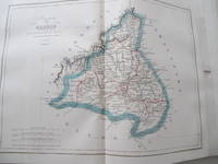
184810230AB1848. Parte primera. Barcelona Imprenta Hispana 1848. 355 : 30 cm. 2 hojas 46 tablas de doble página 2 hojas 32 mapas grabadas de doble página coloreado en los limites. Encuadernación de media piel. Primera edición. - Raro atlas con mapas detalladas de las provincias de España. Cada mapa con un cuadro con explicaciónes e estatisticas de la correspondiente provincia. Buen ejemplar con grandes margenes. - Fue publicado un segundo volumen en 1850 que solo tenia 14 mapas. - Palau III 107. unknown
184458482Paris Chez l'Auteur - Saint-Petersburg Issakoff 1844-48. Small folio. 35 x 27 cm. In a worn contemp. hcalf. Spine cracked and broken. Boards detached. All parts stitched a few loose. All parts uncut and unopened. All parts clean and fine. Each part separately paginated and with own title-page. Text to each part from 8-12 pp. Each part having a large folded engraved general map and from 11 to 27 engraved folio-maps. In all 292 textpages and 441 engraved maps. <br/><br/><em>The parts volumes comprises: 1. Turquie. 2. Afrique. 3. Grèce et Iles Ioniennes. 4. Portugal. 5. Mer des Indes 1ere Division. 6. Autriche Mer Adriatique. 7. Espagne Cotes N. Mer de Biscaye. 8. Espagne Mer Méditerranée. 9. Sardaigne. 10. Brésil. 11. Amérique Équatoriale Colonies européennes 1re Section. 12. Amérique Équatoriale et Continentale. 13. Prusse. 14. Russie Mer Blanche. 15. Russie Mer Baltique. 16. Russie Mer Noire. 17. Norvège. 18. Suéde. 19. Deux Siciles 1re Section. 20. Deux Siciles 2e Section. 21. Danemarck. 22. Hanovre. 23. Pays-Bas. </em> hardcover
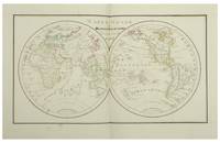
182812553Paris Julie Bouesche 1828. In-folio 323 x 226 cm 2 ff 8 double maps 10 plates each with a page of explanations 1 f table of geographical & spherical figures contained in this Atlas. The maps show the world map Europe the Kingdom of France 2x Asia Africa North America and South America. The plates show the terrestrial globe celestial globe Ptolomean system Copernican sphere right sphere parallel sphere Copernican system Ticho-Brahé system eclipses and phases of the moon. The atlas is entirely manuscript in brown ink and hand-coloured. Contemporary binding red chagrin spine green cardboard boards gilt framing with the crowned figure of Miss Julie Bouresche on the first board gilt edges. Paris, Julie Bouesche hardcover
1851D6GE1B01U79OMontpellier 1851. Contemporary bindings: vol. 1 red half goatskin with binder's/stationer's ticket of "Papeterie Sijas Montpellier" red textured paper sides "E.M." in gold on front board marbled endpapers Wolfe 159; vol. 2 black half goatskin black embossed paper sides "C. du M." in gold on front board marbled endpapers Wolfe 112; vol. 3 black sheepskin "C. du M." in gold on front board white watered-silk endleaves. Folio vol. 1 and large 4to 32 x 25.5. cm. vols. 2-3. Neatly written manuscripts on paper with 23 graphically vibrant maps coloured in outline with subtly shaded washes in grey for the coasts and numerous bright colours for political boundaries and with calligraphic headings. 3 volumes. A 3-volume historical manuscript atlas with beautiful manuscript maps the volumes titled: Atlas historique Souvenirs historiques and Tableaux et cartes. The Atlas historique contains finely calligraphed chronological tables displaying events in ecclesiastical history the history of the Roman Empire and France from the first century to 1850 followed by coloured double-page maps of France the Ottoman Empire Europe and the Roman Empire. The Souvenir historiques has the same structure but is solely devoted to the history of England Spain Germany and Italy covering the period from the fifth century to 1850 with coloured double-page maps of the British Isles the Iberian Peninsula the German states and Italy. The Cartes et tableaux is the most ambitious volume containing no fewer than 14 coloured double-page maps including two world maps maps of Africa Asia America Oceania Europe etc. and numerous chronological tables.The ink has sometimes left a browned shadow on the back of the leaves or facing leaves and occasionally eaten a small hole in the paper but the atlas is otherwise in very good condition. Bindings slightly chafed. A graphically vibrant French historical manuscript atlas. unknown
180855974Paris Didot L'Ainé 1808 1805-06. Folio. 54 x 39 cm. Contemp. hcalf. Wear to spine. Spine-ends repaired. Corners bumped.Titlelabel with gilt lettering on upper cover. 2 pp. recto: Atlas historique.- verso: Index listing 32 Engraved frontispiece: Les Fastes Napoléens de 1796 a 1808 with a small handcoloured map dated 1808. With 34 double-page uncut sheets ca. 53 x 72 cm. of which 16 are in letterpress text handcoloured 18 sheets are maps surrounded by text all handcoloured. Internally clean and fine in original colouring. Map-sheets dated 1805-06. The frontispiece having a dampstain. <br/><br/><em>Comprising maps from America Africa Asia Russia etc.etc. - See Phillips124-29 various editions. </em> unknown
182957983Paris Leclerc Imprimé par Paul Renouard 1829. Folio. 53 x 375 c. Contemp. hcalf. Richly gilt spine. Original engraved titlelabel on upper board. Spine rubbed. Some wear to edges and corners. Title-page loose. Stamp on title-page. 6 pp. 35 doublefolio sheets partly with text and maps. Maps and some textsheets handcoloured. <br/><br/><em>Comprising maps from America Africa Asia Russia etc.etc. - See Phillips124-29 various editions. </em> unknown
187961342Chicago: J.H. Beers & Co. Publishers Lakeside Building Cr. of Clarks & Adams 1879. Atlas folio. 15 x 17.5 in. 82 pp fairly continuous pagination including maps & lithographs. With 39 hand-coloured lithographed maps several double-page Indiana United States World Columbus Township Columbus Plat Sand Creek & Wayne numerous lithographed plates some large double-page tables charts. Quarter-sheep over black embossed publisher’s cloth gilt lettering stamped on front cover borders embossed in blind wear & bumping to corners some chipping head & foot of spine some wear to fore-edges somewhat shaken still a G copy. First edition of this uncommon original 19th-Century plat map atlas for Bartholomew County Indiana during the Gilded Age. J.H. Beers specialized in County Plat Map atlases and histories from 1878-1900 and also focused on producing municipal history and biographical history titles primarily in and around the Midwest. Their well-executed lithograph birds-eye views of businesses towns family farms and more were quite popular were generally pre-sold through subscription and prosperous towns businesses and farms who paid extra were able to secure a biographical section or view within the volumes. Bartholomew County located about 40 miles south of Indianapolis was originally established in 1821 and named for Lt. Col. Joseph Bartholomew a militia officer wounded at the battle of Tippecanoe. The County featured such companies as the Reeves Pulley Co. Ceraline Manufacturing Orinoco Furniture and others in the 19th Century and as of this publication the population was about 30000 inhabitants and today the County features approximately 82000 inhabitants. The atlas was later reprinted in 1969 1979 and 1986 in very poor smaller reproductions. J.H. Beers & Co., Publishers, Lakeside Building Cr. of Clarks & Adams, hardcover
1899867341899. ATLAS. ATLAS OF DORCHESTER WEST ROXBURY AND BRIGHTON CITY OF BOSTON in one volume. Boston: L. J. Richards 1899. Folio. 22" Street index plus 40 double page maps measuring 32" x 22". Bound in 1/2 leather which is largely absent. Front board is detached. Interiors are clean and free from staining with the exception of some light red or graphite pencil annotations on a few plates and soiled end-papers. Plates with pencil annotations: 28 29 30 37 39. Maps printed in as many as seven colors. A good copy. unknown
1896867391896. ATLAS. ATLAS OF THE CITY OF BOSTON VOLUME 6 WEST ROXBURY. Philadelphia: G. W. Bromley and Co. 1896. Second edition. Folio 22.5". Contains street index outline and index map and 30 double-page maps measuring 22.5" by 32". Maps have only minor soiling to margins and occasional pencil annotations plates 1 and 27. FFEP and title page have large chips. Bound in half leather now mostly chipping or absent. In need of rebacking front board detatched. unknown
1890867351890. ATLAS. ATLAS OF THE CITY OF BOSTON Vol. 7 BRIGHTON MASS. Philadelphia: G. W. Bromley & Co. 1890. Folio. 22" Contains 30 double page maps - outline and index map and 29 plates - measuring 32" x 22" with only slight marginal staining near spine at head. Maps are drawn at scale of either 600 100 or 150 ft/inch. Bound in 1/2 leather missing much of leather covering and has detached and chipped FFEP. Front hinge very weak. unknown
1899867361899. ATLAS. ATLAS OF THE CITY OF BOSTON: SOUTH BOSTON. Philadelphia: G. W. Bromley Co. 1899. Folio 23". Street index and 33 double-page maps - outline and index map and 32 plates - measuring 32.5" x 22.5". Ffep missing. Outline and index map has tear near bottom where sheet folds. Plate 1 partly detached. Plates 29 30 31 are detached. Plates 2 and 32 have pencil annotations. Bound in 1/2 leather which is flaking. Interiors are bright some soil. Good. unknown
1896867401896. ATLAS. ATLAS OF THE CITY OF CHELSEA AND THE TOWNS OF REVERE & WINTHROP MASS. Philadelphia: G. W. Bromley and Co. 1896. Folio 22.5". Contains street index outline and index map and 22 double-page maps measuring 22.5" by 32". Maps have only minor soiling to margins and occasional pencil annotations plates 12 17 18 21 and 22. Bound in half leather now mostly chipping or absent. In need of rebacking front board detached. As is. unknown