Picturesque Atlas Publishing CompanyBiblio.com
112 résultats
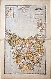
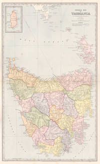
18875951887. Chromolithograph. 645mm by 425mm sheet. Detailed map of Tasmania with inset map of 'King Island'. From 'Picturesque Atlas of Australasia'. <br /> Central horizontal fold as issued. Key on reverse.A little light foxing. unknown
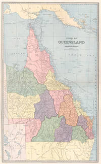
18875571887. Chromolithograph. 610mm by 370mm image. Detailed map of Queensland with counties marked in colours. <br /> From 'Picturesque Atlas of Australasia'. Central horizontal fold as issued. Index on reverse. unknown
188861874Sydney.: The Picturesque Atlas Publishing Company. 1888. A large and detailed map of Tasmania from The Picturesque Atlas Publishing Company showing railroads existing as well as under construction and coloured regions dividing the island into districts. Hachures depict landforms detailed index to place names on verso small inset upper left corner showing Kind Island printed colour 70 x 45.5 cm. . The Picturesque Atlas Publishing Company. unknown
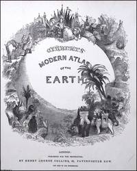
1840373394Henry George Collins London c.1840. Unframed Print. Very Good Condition. TITLE PAGE ONLY. Atlases of this era werent just functional they were status objects designed to project worldliness and imperial reach. The title page illustration operates like a microcosm of Victorian ideals: order exploration dominion and grandeur. Engraving 22 x 29 cms sheet 25 x 32 cms. This Title Page has no publisher's details at the foot. Category: PRINTS : Antiquarian Interest; PRINTS : Historic Interest; This item may require more postage than the rates shown for delivery outside the UK. If extra postage is required we will contact you before processing your order and you will be given the details and option to decline the extra cost. Henry George Collins unknown
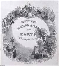
1840373393Henry George Collins London c.1840. Unframed Print. Very Good Condition. TITLE PAGE ONLY. Atlases of this era werent just functional they were status objects designed to project worldliness and imperial reach. The title page illustration operates like a microcosm of Victorian ideals: order exploration dominion and grandeur. Engraving 22 x 29 cms sheet 25 x 32 cms. Category: PRINTS : Antiquarian Interest; PRINTS : Historic Interest; This item may require more postage than the rates shown for delivery outside the UK. If extra postage is required we will contact you before processing your order and you will be given the details and option to decline the extra cost. Henry George Collins unknown
1878293111878. WOOLMAN AND ROSE ATLAS OF THE NEW JERSEY COAST. GREAT EGG HARBOR 1878. A 14-inch by 22-inch map showing the Atlantic Ocean coastline from Great Egg Harbor south to the Townsend Inlet. $65.00. unknown
188736764Warsaw: Y. Goldman 1887. Hardcover. g. 8to. 340pp. 2 164pp. 8pp. Modern green leather binding with gold borders and raised bands. Illustrated title-page with images of a vineyard children playing and a globe. Scholarly anthology edited by the Eastern European maskil Eleazar Atlas. Includes essays by Samuel Joseph Fuenn Jacob Reines and Israel Tropp. Topics include the rabbinic yeshiva and Hebrew grammar. There are also stories songs and information about the world. Atlas was heavily involved in Hebrew journalism which led to his association with the Zionist historian Nahum Sokolow. Text in Hebrew. Stamp from previous owner. Wear to cover. Foxing to leaves. Overall in good condition. Previously owned by the rabbi and historian Meyer Abraham Halevy. Y. Goldman hardcover
1831D19539Karlsruhe: Verlag Von Gottlieb Braun 1831. Neue Ausgabe. Hardcover. Good. Two volumes bound in one. Oblong with cloth spine and corners marbled paper boards printed label to upper board. 45 21 & 24 hand-colored lithographed maps some folding. Rubbing and wear to boards spotting throughout but hardly untypical. A rather scarce student atlas. <br/><br/> Verlag Von Gottlieb Braun hardcover
187957673Gotha Justus Perthes 1879-80. Folio-oblong. Contemp. hcalf. Gilt spine. Gilt lettering. Spine somewhat worn. Corners bumped. Wear to edges.Bound in front is "Vorbemerkungen zu Stieler's Hand-Atlas" 8 pp. Inhalt 2 pp. and 95 incl. title-page engraved and coloured maps. Maps dated 1879/1880 some undated. Maps clean and fine only few minor marginal brownspots. unknown
187357680Gotha Justus Perthes 1873-75. Folio-oblong. Contemp. hcalf. Titlelabel with gilt lettering. Spine somewhat worn and frontcover detached from spine. Stamp on title-page.Bound after title-page "Vorbericht zu Stieler's Hand-Atlas" 11 pp. Containing 89 engraved maps in outline colouring incl. title-page 1-24 26-90 A faint dampstain to some maps in upper right corners. Some underlining to German cities. Maps dated 1873 1874 a. 1875 mosly 1873. unknown
187642075Gotha Justus Perthes Maps dated 1876. Folio. Orig. full cloth blindstamped and gilt frontboard. Corners bumped edges worn covers with scratches. 2 pp. and 31 steel-engraved double-page coloured maps. Light browning to lower margins of some maps otherwise clean. <br/><br/><em>With maps of all the Continents Europe The Hemispheres etc. </em> hardcover
1849azgsWilliam Blackwood and Sons Edinburgh and London 1849. 5th or later Edition. Hardcover. Very Good/No Jacket. 14 volumes plus atlas complete. All fully bound in leather with gilt decoration - to fascias spines and edges - and titling. All have marbled papertrims and frontis and end papers. This is a FABULOUS set of this popular loquacious history of Europe with the first major account of the French Revolution. It is smart handsome gentlemanly and very clubbable. Some of the books have wear from shelving and are scuffed but this only adds a genial dignity and character. All have binder labels T. Sowler Manchester - the very model of a Victorian businessman on the front pastedowns. Spines have five ridges and six panels. The Atlas 108 pages - published 1850 contains maps of countries and towns and plans of 'battles and sieges &c.' The covers are worn and scuffed. Within there are some small storage marks about. The pages are clean startlingly bright and clear finely detailed and the colours for various regiments fresh. Volume 1 633 pgs; 1849: wear to edges and spine but dignified and secure. The contents are tight and clean. Covers 1774-1789. Vol 2 693 pgs; 1849. In very good handsome condition. Light wear bright gilt. Inside the contents are clean and fresh. There is a silk bookmark. 1789 - 1793. Vol 3 635 pgs; 1749. The stamped decoration as with all other volumes is neat and unworn. The spine has some wear but is benign and kindly. The pages are clean and comfortable. Covers 1795. Vol. 4 654 pages; 1849. A lovely atmospheric copy. At last the story moves on beyond France. The pages are fresh. 1795-1799. Vol V 658 pgs. Neat contented bright. 1799 -1801. Vol 6 670 pgs. Nelson Pitt Napoleon! The odd storage stain. Otherwise very clean. 1801-05. Vol 7 690 pgs. Some age related marks. Tidy and handsome. Fox Prussia Clive of India! 1805-07. Vol 8 696 pgs. Tight confident clean. Some cover wear. Wellesley Napoleon Peninsula Wars. 1807-09. Vol 9. A happy book. Some wear. Spain George III! Pages exceptional. Vol. 10 630 pgs. Some scuffing and wear. Wellington the Emperor South America Turks Russians! Pages very clean. 1810-12. Vol 11 637 pgs. Some wear to the covers. Contents are smart. Moscow Germany Generals! 1812-13. Vol 12 640 pgs. Confident benign copy with some spine wear. Pages very secure and certain. Wellington in France Blucher Napoleon on the run. 1813-14. Vol 13 664 pgs. Edge and spine wear. Pages vigorous and healthy. Come-uppances America Vienna decides! 1814-1815 1814 is the date when Alison had the idea of this history. Vol 14 644 pgs. Some aged wear to the covers. The pages are startlingly healthy. Waterloo St Helena The First Reform Bill contemporary judgements. 1815 and index. Oh happy person who owns this THRILLING story as told in these wonderful and REMARKABLE volumes. fk. Our orders are shipped using tracked courier delivery services. William Blackwood and Sons, Edinburgh and London hardcover
1889262421889. WOLVERTON'S ATLAS OF MONMOUTH COUNTY. HOWELL TOWNSHIP 1889 MAP. A 20-inch by 30-inch hand-colored map of Howell Township showing West Farms Fairfield Farmingdale Jerseyville Turkey Blue Ball Greenville Runyons Bethel and Squankum. $150.00. unknown
1878NF1958Illustrated Historical Atlas of the County of York and the Township of West Gwillimbury & Town of Bradford in the County of Simcoe Ont. Toronto: Miles & Co. 1878. Mika Studios N.d. a near fine copy of this reprint elephant folio facsimile edition with gold gilt stamping and lettering on the front cover. Mika Studios unknown
189056329Yamada Village Japan: n.p. ca. 1890. 4to. 7.5 x 11 in. 354 pp index maps & sections separately paginated. entirely in original manuscript with over 250 plat and section maps many double-page some folding many w/ additions tipped-in or laid-in as supplemental overlays and many w/ additional manuscript annotations most hand-coloured throughout. Original beige limp boards punch-sewn at gutter margin title in manuscript on front cover some scuffing wear occasional internal worming mildly affecting some maps still a VG- exemplar. An extraordinary Meiji-era manuscript real estate plat map atlas for the Yamada Village and environs of the Keta District in present-day northern Hyogo Prefecture. Traditionally ruled over by descendants of the Miwabe-no-Atai clan this real estate atlas volume encompasses hundreds of plat maps tied to outline maps with the plats all numbered and many colour-coded with colour coding to the opening index. The creator of this map atlas appears to have been commissioned by local land agents following the economic expansion after the opening of the Hyogo Harbor in 1867 for foreign trade while quickly became one of the largest trading ports in Japan. The Tajima province is perhaps best known as the birthplace of Kobe Beef or Tajima Wagyu traditionally compact working cattle with a calm nature but which quickly came into high demand as Kobe Beef in the late 1880s as the large foreign trading and tourist community desired beef and the Tajima cattle were especially desired. This also contributed to a rising demand for land in which to raise the Tajima Wagyu cattle and land prices. At the same time the nearby coast also began slowly developing a small tourist trade and coastal resorts. The map sections include No. 5 -- Kitakami no machi; No. 11 -- Sampo no matsu; No. 12 - Shita takimiya; No. 13 - Okawahara; No. 14 - Takimiya; No. 30 - Kita shitaya as well as No. 36 - Kawahara. In April 1896 the Keta District was dissolved and merged into the Kinosaki District along with the Mikumi District and became the Hyogo Prefecture anchored by the city of Kobe. The additional supplemental pieces tipped-in others laid-in and the many add-ons to the folding map with many bearing annotations indicate that this was a meticulously maintained working document for Meiji land agents. We have been unable to locate any similar manuscript or printed real estate atlases for this era and geographical location. See: Mochizuki Kotaro Japan To-Day: A Souvenir of the Anglo-Japanese Exhibition Held in London 1910 Special Number of the “Japan Financial and Economic Monthly;†Mike Buchanan Hyogo Prefecture Tajima Wagyu History Australian Wagyu Forum 2018; Masanobu Suzuki Development and Dispersal Process of Ancient Japanese Clans 2003. [n.p.], hardcover
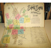
189715960New York: Sanborn-Perris Map Co. 1897. Third edition with additions. Hardcover. Good overall. Folio published in November 1897 with 18 hand colored maps including a title page on the key map. This is the third edition of the atlas according to the Library of Congress Census the first edition being published in 1886 but with only 13 sheets. The second edition was published in 1891 with an extra 2 sheet making a total of 16 sheets. Small private library stamp on the verso of the key map. There are very small pencil annotations on the maps obviously by F.J. Washburn the local insurance agent. <br /> Originating in London in the mid 18th century insurance maps had become invaluable in the US in the 1860's when Sanborn started work. The company started to standardize the maps and publish them in atlases under the town or city. Each map/sheet measures 21 x 25" and is drawn to a scale of 50 feet to an inch with color applied by hand at the time of publication. Every atlas records all town buildings shown to scale its construction material and use noted as well as fire-proofing thickness of walls elevators chimneys fire alarm boxes hydrants sprinkler systems and a wealth of other detail. Ultimately Sanborn produced maps and atlases for 12000 locations. Being so specific the demand was very slight. The Library of Congress estimates that there were usually fewer than twenty orders for a single sheet so production was small and usually produced for a specific Insurance company or agent. Because of this a very small number of copies of any atlas are offered on the market today. The maxim "if it turns up buy it because you won't find another copy" springs to mind. Folio maroon leather spine with printed hard boards rubbed but edges. Sanborn-Perris Map Co. hardcover
1837891931837. JAPANESE ATLAS Ichikawa Tokei. KOKUGUN ZENZU 2 volumes. Nagoya Edo Osaka Kyoto. Eirakuya Toshiro et al. Preface dated 1837. String-bound Japanese-style fukuro-toji printed paper title labels. Original yellow covers. Covers are a bit soiled with ownership labels. Internal occasional marginal worming. Printed in color woodblock throughout an interesting atlas of the traditional governing divisions of Edo-era Japan. unknown
1873260841873. F.W. BEERS ATLAS OF MONMOUTH COUNTY. LONG BRANCH 1873 MAP. A 13-inch by 24-inch hand-colored map of a portion of Long Branch. $85.00. unknown
1878320301878. WOOLMAN AND ROSE ATLAS OF THE NEW JERSEY COAST. LONG BRANCH 1878: DR. T.G. CHATTLE. An 11.5-inch by 14.4-inch hand-colored engraving depicting a side-view of the residence of Dr. T.G. Chattle Long Branch. With a small portrait Chattle above the image. $85.00. unknown
1878428811878. WOOLMAN AND ROSE ATLAS OF THE NEW JERSEY COAST. MANASQUAN 1878: DR. ROBERTLAIRD. A hand-colored print showing the residence of Dr. Robert Laird in Squan. Squan is now known as Manasquan. $75.00. unknown
1878330461878. WOOLMAN AND ROSE ATLAS OF THE NEW JERSEY COAST. MANASQUAN 1878: JOHN S. ROGERS RESIDENCE. An 11.5-inch by 14-inch hand-colored print showing the property and residence of John S. Rogers several strollers and three horse and buggy teams. Squan is now known as Manasquan. $85.00. unknown
1878325761878. WOOLMAN AND ROSE ATLAS OF THE NEW JERSEY COAST. MANASQUAN 1878: OSBORN HOUSE. A hand-colored print depicitng the Osborn House in Squan. Property of T. Fields. Squan is now known as Manasquan. $85.00. unknown
184110715Philadelphia - New York: Published by H.S. Tanner 1841. Good . Map Only 19"x14" Outside Margins. Some closed tears at outer edges to the folds. One closed tear about 2-3 inches to the map near the outside margin. -- Overall Condition of map. Published by H.S. Tanner unknown
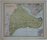
1888M5511Toronto: Home Knowledge Association 1888. Very Good. Notes: Late 19th century city map of Istanbul Turkey. Size : 250x300 mm 9.875x11.75 Inches Coloring: Printed in Color with some hand colouring Category: Maps City Maps; Maps Asia Near East Turkey Home Knowledge Association unknown
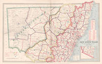
18876011887. Chromolithograph. 425mm by 645mm sheet. Detailed map of New South Wales. From 'Picturesque Atlas of Australasia'.<br /> Central vertical fold as issued. unknown