4 résultats
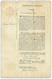
1799707161799. 1799 Document Appointed a Judge to the Kennebeck County Maine Court of Common Pleas Judges. Maine. Dummer Nathaniel 1755-1815. To All Unto Whom These Presents Shall Come Greeting. Boston February 28 1799. 17" x 11" part-printed document inscribed in neat hand docketed on verso large embossed Massachusetts seal to upper-left corner signed by Governor Increase Sumner countersigned by John Avery first Massachusetts Secretary of the Commonwealth. Light browning and edgewear light soiling and a few minor spots vertical and horizontal fold lines a few minor years along folds with no loss to text. An interesting item. $350. Dummer resided in Hallowell Maine and was judge of the Kennebeck County Court from 1799 until his death in 1815. He was also Hallowell's postmaster from 1792 to 1802. The docket note witnessed by Joseph North and William Howard attests that Dummer took his oath of office on April 2 1799. unknown books
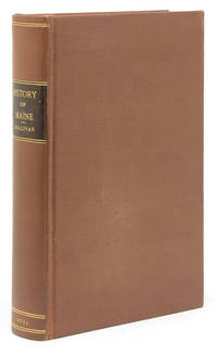
1795101339Boston: Printed by I Thomas and E.T. Thomas 1795. First edition. Engraved frontispiece foldng map drawn by Osgood Carleton. 8vo. Rebound in modern buckram with brown leather spine label with "Index of Names and Places in Sullivan's History of Maine" bound in at rear separately pubished by A.J. Huston Portland Maine. n.d. Map with 2-inch tear into image from inner margin uniform toning to text and map. Overall though very good. First edition. Engraved frontispiece foldng map drawn by Osgood Carleton. 8vo. The First General History of the State with Map. Howes S- 1122 "First general history of this state"; Evans 29589 Printed by I Thomas and E.T. Thomas unknown books
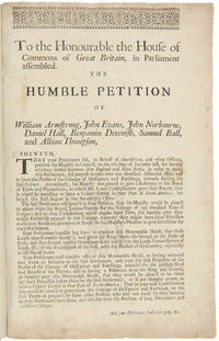
1715WRCAM39807London 1715. 1p. with printed docket title on verso. Small folio. Antique-style three-quarter calf and marbled boards spine gilt leather label. Ornamental upper border. Minor foxing. Very good. A rare and early petition relating to British settlement in the eastern part of present-day Maine. The authors refer to petitioning "his Majesty in Council on the 6th Day of December last for having a Colony settled between New England and Nova Scotia" with "over one thousand disbanded men" and to be funded with the proceeds of a proposed coinage operation. The only copy of this document listed by OCLC and ESTC is at the New-York Historical Society which estimates merely that the document was printed during the 1700s. The historical context the text cited above and discovery of this broadsheet among similar petitions dating almost exclusively to 1714 and 1715 however make 1715 an extremely likely date of printing. In the Treaty of Utrecht 1713 the French ceded the land east of the Kennebec River presumably the area in question here to the British; this event and the reference to "disbanded soldiers" suggest that the War of the Spanish Succession had recently ended which it finally did in 1714. George I succeeded Queen Anne in late 1714 which means the petitioning of "December last" could not have been earlier than that year. With the new monarchy and a major upheaval in the House of Commons following the general election of 1715 petitionary literature distributed in the lobby of Parliament surged with this document almost certainly among the examples from that year. <br> <br> The petitioners evidently officers who had served in the recent war call attention to the fact that the lands they hope to settle "were formally survey'd and given by King Charles the Second to the Duke of York" and that the area has been confirmed as rich for farming. They ask that Parliament allow them to present their formal proposals for the settlement or "if not thought proper to have a Colony settled in that part of North- America" at least still to grant them a contract to coin 1000 tons worth of half- pence and farthings. <br> <br> A very important Maine document one of only two surviving copies. hardcover books
176726308Newport R.I. 1767. Manuscript map in ink and wash on a single folio sheet 15 1/4 x 19 inches. Docketed in manuscript on verso "Map of Leveretts Patent alias Muscongus." With two manuscript documents one being 3pp. on folio sheets dated at Boston May 19 1787; the other being 3pp. on folio sheets dated at Providence R.I. on May 30 1787. Also with a half-page of manuscript dated Boston March 28 1768. All three documents relating to the lands depicted on the map. Map with minor separations along horizontal fold. The half-page document being only the beginning portion of a longer letter otherwise the manuscripts in near fine condition. A highly important manuscript map of Colonial Maine: heavily annotated by William Ellery a signer of the Declaration of Independence from Rhode Island.<br/> <br/>An attractive eighteenth century manuscript map of Penobscot Bay Maine heavily annotated by William Ellery a signer of the Declaration of Independence from Rhode Island who made claims to some of the lands depicted on the map. The map was drawn by British Rear-Admiral Jahleel Brenton who commanded the HMS Queen during the Revolution and whose family lost much of its property as a result of the Revolution. The map is skillfully rendered as would be expected of a British naval officer and is done on a scale of about three miles to the inch. The map depicts the coastline from the Damariscotta River in the southwest to the Penobscot River in the northeast and shows and names the many islands of the Bay as well as many inlets harbors rivers ponds etc. The location of a fort and settlements have also been added. This information was all added by William Ellery 1727-1820 a signer of the Declaration of Independence from Rhode Island. Ellery explains in a manuscript note in the lower right corner of the map dated at Newport Rhode Island in 1767: "This map of Leverett's Patent &c was copied from a copy by Jahleel Brenton Esq. one of the Proprietors; and presented by his son Samuel Brenton to William Ellery who wrote the References Names of Places &c. William Ellery." In the upper left corner of the sheet Ellery has added a long manuscript note explaining the survey and the boundaries of Leverett's Patent as depicted on the map. This map and the accompanying manuscript documents were found among William Ellery's papers and were part of Ellery and his brother Benjamin's attempts to claim lands in Maine that they believed belonged to their family. "Leverett's Patent" also known as the Waldo Patent or the Muscongus Patent was issued in 1629 to Thomas Leverett and John Beauchamp. It granted land and trading rights for a thirty-six square mile area along the Penobscot Bay in present-day Maine between the Muscongus River and Penobscot River. According to the documents present here Leverett inherited the full patent upon Beauchamp's death and at his own death divided the grant among his ten children who then divided the land again amongst the next generation. Around 1720 Gen. Samuel Waldo of Boston acquired a large portion of the patent and began recruiting immigrants from Germany to settle the area. The letter fragment present here dated March 28 1768 and addressed to Benjamin and William Ellery asserts that the Ellerys have an "undoubted right to a half share" of the Muscongus lands as a result of a purchase made by their grandfather. The unidentified author of the letter goes on to describe the Waldo heirs as "exceeding difficult to deal with." Also present are two manuscripts one being a 1787 copy of the original 1629 grant of the Muscongus Patent from the Council of Plymouth the other being a manuscript deed of sale signed by James Green for a portion of the original patent. A handsome colonial era manuscript map of the coast of Maine drawn by a British Rear-Admiral and used by a signer of the Declaration of Independence to defend his family's claims to the land. Significant manuscript maps of this early date are virtually unknown in the market. unknown books