Le Ragois (Duc du Maine)Biblio.com
11 résultats
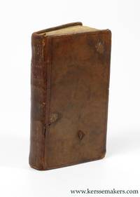
176161013Amsterdam: Aux Dépens de la compagnie 1761. Hardcover Duodecimo. Hardcover. Acceptable. full brown leather 527 pp gilt illustrations to spine label at spine missing impressed lettering barely visible significant rubbing and wear to boards corners heavily bumped and worn back to internal boardings rear bottom left corner chipped back certain signatures from first third loosening from binding crayon drawing to half title page previous owner's signature to full title page and notes to rear end paper; text in French <br /> <br /> Standard shipping no tracking / Priority with tracking / Custom quote for large or heavy orders. Aux Dépens de la compagnie hardcover
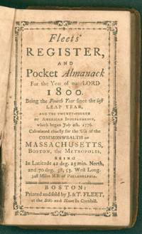
179928756Boston: Published by Printed and sold by J. & T. Fleet 1799. Hardcover book. Previous owner signature of Elisha Shaw. This could be Elisha Shaw 6 Mar 1758 - 6 Aug 1839 son of Elisha Shaw Sr and Susannah Clark who relocated to Bath Maine in 1761. He is buried in Union Cemetery Leeds Maine. According to Find a Grave Susannah was "famed for shooting a bear as it was carrying off one of the family's sheep." Also from FaG - "Elisha was a sergeant in Capt. Benjamin Lemont's co. Col. John Allen's regt. He enlisted Oct. 2 1777 and was discharged Dec. 31 1777; service 3 mos. 10 days including 12 days 240 miles travel home. The regiment was raised for defense of Machias. He was also an ensign in Capt. Jordan Parker's co. Col. Samuel McCobb's regt. He enlisted May 15 1781 and was discharged Dec. 1 1781; service 6 mos. 15 days. Elisha was married to Lucy Lombard."<br /> Light scattered foxing period full leather worn with front board detached. The first couple pages are the Courts in Connecticut and Rhode Island. Includes extensive lists of government officials educational and religious institutions postal rates duties laws etc. Drake 3613; Evans 35487. 12mo 20 172pp. First 20 pages of the months of the year etc. are interleaved with blank pages presumably for notes. Published by Printed and sold by J. & T. Fleet hardcover
1764312885Kittery ME 1764. 1 p. pen and ink on paper. Oblong 12mo. Very Good. 1 p. pen and ink on paper. Oblong 12mo. A receipt from Caleb Emery to his brother Daniel Emery Jr. 1697-1778 reading: "Received of Daniel Emery junr. Five Shillings Lawfull sic money in Full of all accounts Debts Dues & Demand of any sort whatsoever to the Date hereof - By me" Caleb Emery 1710-1793 son of Daniel Emery Sr. and Margaret Gowen Emery married Jane Frost of Berwick where he was a lawyer farmer and tanner. "He read law with his brother Noah and was admitted to the Court of Common Pleas in 1750. He was a man of plain manners of strict integrity of peaceful character discouraging litigation among his neighbors even after he had entered the legal profession. He had the confidence of all with whom he came in contact and was highly esteemed by his relatives and clients." Genealogical records of descendants of John and Anthony Emery of Newbury Mass. 1590-1890 Emery Rufus 1827-1913. A Brother's Debt Paid. <br/><br/> unknown
176338819Amsterdam: Chez Marc-Michel Rey 1763. 2 parts in 1 vol. Small 8vo 14x8 cmContemporary leather spine gilt faded with morocco title-label covers with loss of small pieces of leather marbled endpapers. xl128;ii189iii pp. First title soiled otherwise good copy. Barbier I171 mentions 2 editions: This first edition and Londres 1789 Chez Marc-Michel Rey hardcover
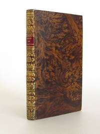
178466690à Amsterdam: S. n. 1784. Fine. S. n. à Amsterdam 1784 9 x 14.7 cm relié Several editions appeared the same year in Paris London Berlin. Full brown flamed sheep binding late 19th century. Smooth spine richly decorated in Restoration style. Red morocco title label. Fine copy. Armorial bookplate engraved from a private library. Satirical and cynical description of Parisian life and customs. The author discusses theaters prisons fashions promenades the Tuileries. S. n. unknown
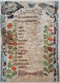
18003722<b><i>Family Register of Seward Porter circa 1800</i></b><br /><br /><br />A nicely accomplished though primitive family register of the Seward and Eleanor Porter family. Two colorful plants with birds in their top branches fill the sides of the register. At the top hover two angel-like figures one bearing an hour glass the other blowing a horn. <p>Seward and Eleanor Porter were from Weymouth Massachusetts but relocated to Falmouth in the District of Maine in about 1777 and then to Freeport in about 1782. This family register lists the names birth places and birth dates of the Porter's 13 children from 1778 to 1797. </p>Their fourth son on the list -- also named Seward Porter -- would become a prominent Maine mariner and entrepreneur. He brought the first steamboat to Maine in 1823. In 1837 he published a now-highly-prized set of charts of the Maine coast. For Seward Porter the son see:<i>Tooley's Dictionary of Mapmakers</i>: Vol 3 p. 453 and Guthorn <i>United States Coastal Charts 1783-1861</i>: p. 29. <br /><br /><b>Condition:</b> Approximately 14 x 10." Iron gall ink on wove sheet with colored decorations. The sheet is mounted on a ca. 1815 newspaper and strips of wallpaper about 1" wide have been applied along the left and right sides. The piece is in fair condition with overall cockling and some water damage. There is a small puncture on the left edge. The ink notations of the birth dates and locations are faded but legible.<br /><br />ICN 3198.
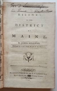
17953732This is the first general history of Maine written in the post-Revolutionary War time period that saw several state histories published including those by Belknap Jefferson and Ramsay. Despite its distinctly chilly initial reception and the less than impressive editorial standards Sullivan's <i>History</i>is a cornerstone work in any collection of Maine material. <p>The <i>History</i>includes as the frontispiece Osgood Carleton's <i>A Map of the District of Maine Drawn from the latest Surveys and other best Authorities by Osgood Carleton</i>. The map measuring 20 5/16 x 16 3/8" includes an inset titled <i>A Map of those parts of the Country most famous for being harassed sic by the Indians</i>. Carleton's map was the most detailed done of Maine to that time. </p><p>At the head of the title page is an inscription which has been lined out: "For D. Laincourt from his Friend the Author."</p><p><b>References:</b> Evans: 29589. Howes <i>USiana:</i> S-1122. Sabin: 93499. Williamson <i>A Bibliography of the State of Maine</i>: 9608. Thompson: <i>Important Maine Maps Books Prints and Ephemera</i>: 18A. For the map: Wheat & Brun <i>Maps and Charts Published in America before 1800</i>: 171. McCorkle <i>New England in Early Printed Maps 1513-1800</i>: Me795.1. </p><p><b>Condition: </b>vii iv 421 pp. With folding map frontispiece.Original full calf with worn red title label. Boards scuffed and bumped with areas of abrasion; joints cracked. Text block is very tight. Occasional light foxing and staining throughout. The map is in remarkably good condition especially in comparison to the usual state in which it is found. Trimmed close as usual along the binding edge. A sharp dark impression with minimal foxing or offsetting. <br /></p><p>ICN 7660.3.</p> Printed by I. Thomas and E.T. Andrews hardcover
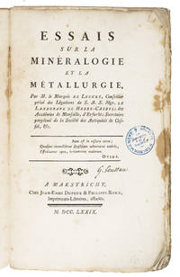
1779K89BNAR73VU7Maastricht 1779. 8vo 22.5 x 13.5 cm. J.E. Dufour & P. Roux Contemporary decorated paper wrappers. 3 parts in 1 volume. 4 XXVII 1 232 pp. Very rare first edition printed in Maastricht of a mining manual by a French enlightened marquis who worked as chief librarian at the Hessen-Kassel court of Friedrich II 1720-1785. Although mentioned reference literature the book is very rare on the market and we found no copy in auction records. Luchet was an acquaintance of Voltaire and in fact had a letter of recommendation from him that helped him obtain his position at the Hessen-Kassel court. Luchet's other writings concerned literature and theatre which makes this mining manual a curious standout. It is unclear why this work was printed in Maastricht except that the Maastricht south Limburg region does have a long history of mining. In a lengthy discourse on mining in the preliminaries Luchet makes a strong pro-mining statement. This is followed by reflections on several aspects of mining often in a question and answer form. He goes into the medical consequences of mining and names several minerals and metals such as coal quartz lead tin gold silver copper and more.A second edition appeared in 1797 often bound with H. Struve Methode analytique des fossils Lausanne 1797.Bookplate on front paste-down owner's name on title-page small stamp on title-page and pages 9 99 199 and 232. First few pages with marginal stains. Binding worn. Otherwise in good condition and wholly untrimmed.l Geology emerging 1404; Hoover 549; Wellcome III p. 451; Worldcat 3 copies; not in Margerie. unknown
171521151London 1715. Broadsheet. 1p. plus printed docket title on verso. Small folio. Bound to style in half calf over marbled paper-covered boards. Ornamental border. Minor foxing. Very good. A project for colonizing Maine in 1715. One of only two surviving copies.<br/> <br/> A rare early petition relating to British settlement in the eastern part of present-day Maine. The authors refer to petitioning "his Majesty in Council on the 6th Day of December last for having a Colony settled between New England and Nova Scotia" with "over one thousand disbanded men" and to be funded with the proceeds of a proposed coinage operation. The only copy of this document listed by OCLC and ESTC is at the New-York Historical Society which estimates merely that the document was printed during the 1700s. The historical context the text cited above and discovery of this broadsheet among similar petitions dating almost exclusively to 1714 and 1715 however make 1715 an extremely likely date of printing. In the Treaty of Utrecht 1713 the French ceded the land east of the Kennebec River presumably the area in question here to the British; this event and the reference to "disbanded soldiers" suggest that the War of the Spanish Succession had recently ended which it finally did in 1714. George I succeeded Queen Anne in late 1714 meaning that the petitioning of "December last" could not have been earlier than that year. With the new monarchy and a major upheaval in the House of Commons following the general election of 1715 petitionary literature distributed in the lobby of Parliament surged with this document almost certainly among the examples from that year. The petitioners evidently officers who had served in the recent war call attention to the fact that the lands they hope to settle "were formally survey'd and given by King Charles the Second to the Duke of York" and that the area has been confirmed as rich for farming. They ask that Parliament allow them to present their formal proposals for the settlement or "if not thought proper to have a Colony settled in that part of North-America" at least still to grant them a contract to coin 1000 tons' worth of half-pence and farthings. A very important Maine document one of only two surviving copies. unknown
176611625Amsterdam and Paris: P.-F. Gueffier 1766. Contemporary cat’s paw sheep neatly restored slightly defective gilt spine and label red edges pink silk marker; interleaved throughout — a vertical crease divides the interleaves in two columns. <p>With: Jousse Daniel-Charles.       1742-1769.<br />        Lettre D’Un Orléanois…Sur La Nouvelle Histoire De L’Orléanois. Bruxelles and Paris E. Flon and J. Debure 1766. 12mo 173 x 110 mm. inlaid in blank quarto sheets for binding. 40p.</p> <br /> <p>      Ad I-II: This volume belonged to the local historian and Orléans Cathedral canon Louis-Eusèbe Loiseau 1721-95.<br />       Ad I: ALL PUBLISHED SUPPRESSED. Only Edition. Luchet believed “Good history is a long fable†p. iv tr. Immediately upon publication of this first volume of a projected five Luchet’s fanciful account of the history of Orléans and environs 52 B.C.E. to 1428 C.E. came under fire. He had manufactured personal information abandoned the facts cloven to the marvelous and doubted Jeanne d’Arc’s divine mission pp. 307-419. This last angered the clergy and THE DUC D’ORLÉANS FORCED THE AUTHOR TO BUY UP AND DESTROY THE EDITION.<br />       COUNTERING LUCHET’S FANTASIES LOISEAU COMPILED HIS OWN THIRTY THOUSAND WORD DOUBLE-COLUMN CHRONOLOGY filling 115 interleaf pages. Its preface summarizes Luchet’s History — “detestable in substance and form†tr. lists errors and sketches a damning biography of Luchet. One column of the manuscript chronology draws on Polluche’s Essais historiques sur Orléans 1778 and the other on articles in Calendrier historique d’Orléanois by the Orléans Maurist librarian Louis Fabre 1710-98.<br />       The longest and earliest inserted manuscript is A FIFTEEN-PAGE ESSAY UNFAVORABLE TO LUCHET’S HISTORY identifying still more inaccuracies nine concern Jeanne d’Arc. The Mémoire takes a statistical and economic perspective on Orléans its architecture and exports. Signed by Loiseau the Observations treats the by-laws of the new Orléans learned society born of the 1786 merger of two earlier groups. Loiseau was secretary of one for 25 years 1761-85.<br /> ¶Lanéry d’Arc Le Livre d’or de Jeanne d’Arc. Bibliographie 700; Lelong Bibliothèque historique de la France III: 35603-4; Brainne et al. Les Hommes illustres de l’Orléanais I: 250-2.<br />       Ad II: Only Edition the author’s sole book and the first published attack on Luchet’s History. Exposing 108 blunders with context and secondary source proof Jousse used material gathered by his father 1710-81 who supplied all the entries related to Orléans in Lelong’s Bibliothèque historique 1768-78.<br /> ¶Lanéry d’Arc 700; Lelong III: 35604; Conlon Le Siècle des Lumières 66:976.<br />       All items are in good condition.</p> P.-F. Gueffier unknown
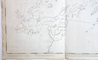
17763748<b>Striking Casco Bay Chart from the Atlantic Neptune 1776</b><br /><br />This is an exceptional chart of the coast of Maine between Cape Elizabeth and Popham from the early Revolutionary War period. It is from Des Barres' monumental <i>Atlantic Neptune</i> a sea atlas published by the British Admiralty during the last quarter of the 18th century. The <i>Atlantic Neptune</i> has been called "the most splendid collection of charts plans and views ever published." <br /><br />The present chart includes all of Casco Bay naming the larger islands and extends east to include Seguin "Segevin Island" and Georgetown Islands. Among the numerous geographic features named are Great Jebieg Chebeague Merrymeeting Bay Segadahock River Arrowsick Island and Halfway Road i.e. Rock. Roads are shown on the chart as are individual buildings. <br /><br />The chart is dated July___ 1776 i.e. with a prominent space after the month as if a date were going to be inserted. There is no type-stamped "15" at the upper right as called for in some copies of state "b" of the Stevens Catalogue. <br /><br />The chart was folded into four vertical panels about 30 1/4 x 12" to accommodate being "bound up in tall narrow form" Stevens' Catalogue p. vii. The chart paper has the LVG watermark consistent with the earlier issues of the chart. <br />A scarce early state of a desirable chart. <br /><br /><b>References:</b> Stevens <i>Catalogue of the Atlantic Neptune</i>: 105 State: b. Sellers & Van Ee <i>Maps and Charts of North America and the West Indies</i> 1750-1789: 855. <br /><br /><b>Condition: </b>A wonderfully clean example of a striking chart of Casco Bay.<br /><br />ICN 3763. From The Atlantic Neptune.