175 résultats
19091361241909. Softbound. VG old inked name on cover at top. Greenish wraps. 42 pp. 14 bw plates. 164 paintings and 9 sculptures. Rare. Artists biographies at rear. Great copy with many prominent Boston artists represented. Some of the artists represented include Frank Benson William John Bixbee Anne Blake Dwight Blaney J.G. Brown Adelaide Cole Chase Colin Campbell Cooper Emma Lambert Cooper Charles Courtney Curran Leon Dabo John Enneking Ben Foster Henry Gallison Abbott Graves Robert Vonnah Childe Hassam Jean N. Oliver Hugh Bolton Jones Cullen Yates Isidore Konti Bela Lyon Pratt Philip Little Rhoda Holmes Nicholls Adelaide Palmer Ben Foster Alexander Pope etc. paperback
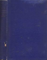
190130294Maine: n/a 1901. Journal. Good. 12mo. Blue cloth hardcover titled "U.S. Navy Regulations 1870" repurposed and used for 11 signed dated tipped in correspondence between Ms. Lila P. Harden and "My Dear Friend" My Dear Mr. Hersey" and "My Dear Will." <br /> <br /> On the front paste down is an ex-library label from Freeport High School library Maine. Locations signed at the end of the letters include So. Paris Maine; 49 Waverly Street and "Smuggery." Letters were written on blue-green paper and are not stamped or come with envelopes possibly these were copy letters or from a diary. <br /> <br /> The first letter consists of 6 pages and dated March 30th 1901 and signed "Lila P. Harden So. Paris Maine";<br /> Second letter is dated April 12 1901 and has 8 pages of content; <br /> April 27 third letter has 10 pages; <br /> May 3 fourth letter has 8 pages; <br /> May 10 fifth letter has 8 pages <br /> May 18th sixth letter 8 pages; <br /> May 25th letter has 12 pages; <br /> June 8th has 15 pages;<br /> June 15 letter has 15 pages;<br /> June 22 letter has 10 pages; <br /> and 4 pages of correspondence dated June 27. <br /> <br /> Contents of the letters are personal and infer a close relationship between the couple. Ms Harden in the last correspondence discusses plans to meet Mr. Hersey. Letters also include observations of daily life activities heath weather Church going New England travels etc. There is one letter discussing watching a 'football' game. The blue-green paper is faded a bit but the writing is clean and neat. <br /> <br /> Following the letters are pages 205 to 379 of Navy Regulations. Some faded and worn spots to blue cloth binding. n/a unknown
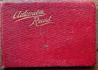
192036670Maine: n.p. 1920. Leather bound. Good. Oblong soft red leather ledger. Approximately 6.5" x 4.5." 64 leaves. Printed title page and explanation page. 60 pages used for writing down records. Several blank pages. Front cover shows light scratches a small stain and light creases. Small ink stain on a couple of blank pages towards the back else contents are clean. <br /> <br /> Records are written in columns for the first 56 pages. Column heading include date start time cyclo arrival time cyclo distance delays net running time average miles per hour roads party and remarks. Several empty pages until 4 pages of manuscript written in the memoranda section. The last note in this section is dated 1927. Alphabetical thumb index for expense records towards the back was not used. Title page does not have the name of the driver. However written at the bottom of the page is "1917 Ford #1750755 1921 Reg # 49290 Maine."Early trips recorded to Plymouth New Bedford Concord Boston Harvard Boothbay Harbor etc. Last driving record recorded August 1926. Although a date of 1927 recorded in the Memoranda section. A presentation card to "Uncle Charlie" enclosed with the inscription "may the roads be good the pleasure great and the blowouts few. n.p. unknown
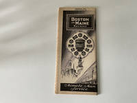
1935248<p>1935 Boston & Maine Railroad Motor Coach Service pamphlet published by the Boston & Maine Railroad. It outlines motor coach routes introduced on March 8 1935 as part of their passenger network. It was produced by the railroad's marketing department. It focuses on bus services complementing their rail lines and it's considered a collectible piece of railroad ephemera.</p><p>It's tan inside and out has a small nick on the bottom right corner of the pamphlet. Overall it's in very actually some edge wear on the right side. Yes it's in very good condition." See Photos</p> Boston & Maine Railroad paperback
19841411110049Maine Lodge of Research 1984. Facsimile reprint of 1820 editio. Hardcover. Very good/no dust jacket. Facsimile reprint of 1820 edition Maine Lodge of Research hardcover
1990Q-0935447075Maine Historic Preservation 1990. Paperback. New. In shrink wrap. Looks like an interesting title! Maine Historic Preservation paperback
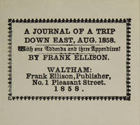
1981316097Dallas: The Somesuch Press 1981. Limited edition no. 56 of 200 copies signed by the printer and the publisher. vii 10 33 9 pp. 1 vols. Miniature 2-5/8 x 3 inches. Printed wrappers. As new. Limited edition no. 56 of 200 copies signed by the printer and the publisher. vii 10 33 9 pp. 1 vols. Miniature 2-5/8 x 3 inches. Facsimile of a rare and curious miniature book printed in 1858 reporting on a hunting trip to Maine. The Somesuch Press unknown
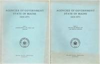
1965SKU1017994Maine State Archives 1965. Very Good. Maine State Archives; Augusta 1965. Softcover. First edition. Complete in 2 volumes A Very Good some offsetting/fading to covers and soiling to page edges else tidy in printed blue Oversize Wraps. 4toquarto or approx. 9.5 x 12 inches 313232pp. We pack securely and ship daily with delivery confirmation on every book. The picture on the listing page is of the actual book for sale. Additional Scans are available for any item please inquire. Maine State Archives paperback
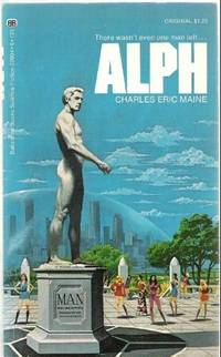
1972Q-0345029046Ballantine Books 1972-01-01. Paperback. New. In shrink wrap. Looks like an interesting title! Ballantine Books paperback
198242692Legal Classics Library. As New with no dust jacket. 1982. Special Edition. Hardcover. Imitation leather bound hardcover gold trim Appears to have never been read very little shelf wear. Has a name sticker on the inside of the front cover as show in the picture the rest of the book is unmarked.; Ex-Library; Large 8vo 9" - 10" tall; 435 pages . Legal Classics Library hardcover
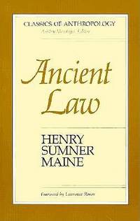
1986Q-0816510067University of Arizona Press 1986-09-01. Paperback. New. New. In shrink wrap. Looks like an interesting title! University of Arizona Press paperback
1901225953London: John Murray 1901. 17th Impression . Hardcover. Good-/No Jacket. Hardcover; 8vo; 415 pages. Pencil notes lines in margins and some underlining. Pages very readable. Foredges soiled. Endpapers fairly foxed with pencil note on 4 pages at back of book and previous owner's name top of ffep. . Endpapers worn at spine. Brown cloth with gilt title on spine. Boards and spine show wear. Head/tail of spine and corners worn and bumped some board exposed. G-/-- <br/> <br/> John Murray hardcover
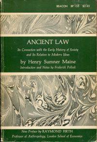
19632594AB1963 . Boston: Beacon Press 1963. 8°. XXXI 462 S. broschiert Besitzervermerk auf Titelblatt; Einband leicht berieben und leichten Gebrauchsspuren; Papier leicht gebräunt; sonst gut erhalten =Beacon Series in Classics of the Law. unknown
1982273789Birmingham: Legal Classics Library 1982. Reprint. hardcover. fine. viii 415 pages 32 pages of ads. Thick 8vo full burgundy leather with ornate gilt decorations. Birmingham: Legal Classics Library 1982. A fine copy.<br/> <br/> A facsimile of the original 1861 London edition.<br/> <br/> Legal Classics Library unknown
1901039604London: John Murray 1901. 1st Edition. Hardcover. Fine/No Dust Jacket. Octavo. pp VI 415. Fully bound in crimson Morocco. 17th printing. AEG. Law Society prize plate to FPD and crest in gilt to upper board. John Murray hardcover
192041293Washington D.C.: Published by the United States Coast and Geodetic Survey 1920. Large folding nautical chart printed on heavy paper stock. Colored. A rare original coastal survey of the approach to Penobscot Bay including Matinicus Island and an inset map of Matinicus Harbor in the bottom right corner.<br/> <br/> Established by President Thomas Jefferson in 1807 as the Survey of the Coast the U.S. Coast and Geodetic Survey was the United States' first civilian scientific agency. This agency has followed its mission to survey the U.S. coastline create nautical charts of the coast and help increase maritime safety since its founding and has often played fascinating roles in significant chapters of U.S. history. It served in all theaters of the Civil War in the service of the Union Army and Navy pioneered acoustic exploration in the wake of the sinking of the Titanic and during WWI it worked to detect enemy submarines. In addition this agency worked to survey and produce detailed maps and renderings of the U.S. coast. These nautical survey maps commonly referred to as "T-sheets" provide fascinating insights into the history of the United States coastline which has and will continue to shift. These maps are the most important data source for understanding the physical and ecological characteristics of the U.S. shoreline. The present map is a highly detailed and accurate sea chart of Penobscot Bay and an important historical view of developing Maine. Published by the United States Coast and Geodetic Survey unknown
192041278Washington D.C.: Published by the United States Coast and Geodetic Survey 1920. Large folding nautical chart printed on heavy paper stock. Colored. A rare original coastal survey of Blue Hill Bay including Swans Island Deer Isle Mt Desert and Tremont.<br/> <br/> Established by President Thomas Jefferson in 1807 as the Survey of the Coast the U.S. Coast and Geodetic Survey was the United States' first civilian scientific agency. This agency has followed its mission to survey the U.S. coastline create nautical charts of the coast and help increase maritime safety since its founding and has often played fascinating roles in significant chapters of U.S. history. It served in all theaters of the Civil War in the service of the Union Army and Navy pioneered acoustic exploration in the wake of the sinking of the Titanic and during WWI it worked to detect enemy submarines. In addition this agency worked to survey and produce detailed maps and renderings of the U.S. coast. These nautical survey maps commonly referred to as "T-sheets" provide fascinating insights into the history of the United States coastline which has and will continue to shift. These maps are the most important data source for understanding the physical and ecological characteristics of the U.S. shoreline. The present map is a highly detailed and accurate sea chart of Blue Hill Bay and an important historical view of developing Maine. Published by the United States Coast and Geodetic Survey unknown
1902101618Collection of over 30 letters many with original envelopes and stamps a few empty envelopes letters folded some staining soiling and aging a few tears at folds; generally very legible. This collection of letters belonged to Bernard Jordan who lived in Maine. A few different addresses in Maine but the 1940 Census shows him living in Raymond Cumberland Maine which is the address on many of the letters. While the archive spans many years most of the letters are from the 1920s or earlier. Oddly last item in the group is a phone bill from 1962. Most of the content is family related and a letter from June 6 1914 wishes him happy eighteenth birthday. The lot includes one postcard.
1904301550Augusta: Kennebec Journal 1904. hardcover. very good. 95 pages 45 muster rolls. Slim 8vo navy blue cloth neatly re-backed in plain cloth. Augusta: Kennebec Journal Print 1904. First Edition. Very good.<br/> <br/> Kennebec Journal unknown
198370692Augusta ME: Mallar Development Services and Maine tomorrow 1983. Paperback. Fine. 31 pp; plus appendicies; with 5 b & w illustrations and 1 chart; feasability study prepared for the cities of Augusta Gardiner and Hallowell on ways to best take advantage of the array of attractiuons that exist on the lower Kennebec River type written pages printed on recto only; in illustrated wraps with plastic comb binding. <br/><br/> Mallar Development Services and Maine tomorrow paperback
1966A107343London: Hodder & Stoughton 1966. 1st edition. As New. small octavo. hardback with dust jacket 190pp. Superb dust jacket. Designed by Studio Stead. Only the tiniest wear to peripheries o/w unusually fine copy Hodder & Stoughton hardcover
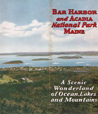
192945531Bar Harbor: Sherman Publishing Co. 1929. 1929. MAINE. 9" x 8" pictorial wrappers n. p. 16 pp. illustrated maps. The covers when fully extended provide a 9" x 16" view of Bar Harbor and Acadia National Park in the background. Views of Kebo Valley Club House Thunder Hole the Shore Drive the YWCA building the high school the Robert Abbe Memorial Museum Sieur de Monts Spring views in Acadia National Park views from Cadillac Mountain Road etc. Map show location of Bar Harbor and how to get there and another map is of Mount Desert Island showing Bar Harbor and Acadia National Park. Originally named Lafayette National Park the park changed to Acadia National Park in 1929. It is still one of the country's most visited parks. Lightly rubbed at spine else a very good copy. Sherman Publishing Co., 1929]. unknown
191941297Washington D.C.: Published by the United States Coast and Geodetic Survey 1919. Large folding nautical chart printed on heavy paper stock. Uncolored. A rare original coastal survey of Bath and Boothbay Harbor including Bath Georgetown Boothbay and Westport and Southport Islands.<br/> <br/> Established by President Thomas Jefferson in 1807 as the Survey of the Coast the U.S. Coast and Geodetic Survey was the United States' first civilian scientific agency. This agency has followed its mission to survey the U.S. coastline create nautical charts of the coast and help increase maritime safety since its founding and has often played fascinating roles in significant chapters of U.S. history. It served in all theaters of the Civil War in the service of the Union Army and Navy pioneered acoustic exploration in the wake of the sinking of the Titanic and during WWI it worked to detect enemy submarines. In addition this agency worked to survey and produce detailed maps and renderings of the U.S. coast. These nautical survey maps commonly referred to as "T-sheets" provide fascinating insights into the history of the United States coastline which has and will continue to shift. These maps are the most important data source for understanding the physical and ecological characteristics of the U.S. shoreline. The present map is a highly detailed and accurate sea chart of Bath and Boothbay Harbor and an important historical view of developing Maine. Published by the United States Coast and Geodetic Survey unknown
192041267Washington D.C.: Published by the United States Coast and Geodetic Survey 1920. Large folding nautical chart printed on heavy paper stock. Uncolored. A rare original coastal survey of Blue Hills Bay in Maine including Ellsworth Surry Tremont Southwest Harbor Swans Island Blue Hill and Acadia National Park.<br/> <br/> Established by President Thomas Jefferson in 1807 as the Survey of the Coast the U.S. Coast and Geodetic Survey was the United States' first civilian scientific agency. This agency has followed its mission to survey the U.S. coastline create nautical charts of the coast and help increase maritime safety since its founding and has often played fascinating roles in significant chapters of U.S. history. It served in all theaters of the Civil War in the service of the Union Army and Navy pioneered acoustic exploration in the wake of the sinking of the Titanic and during WWI it worked to detect enemy submarines. In addition this agency worked to survey and produce detailed maps and renderings of the U.S. coast. These nautical survey maps commonly referred to as "T-sheets" provide fascinating insights into the history of the United States coastline which has and will continue to shift. These maps are the most important data source for understanding the physical and ecological characteristics of the U.S. shoreline. The present map is a highly detailed and accurate sea chart of Blue Hills Bay and an important historical view of developing Maine. Published by the United States Coast and Geodetic Survey unknown
1999Q-0936077344Gurze Books 1999-08-01. Paperback. New. New. In shrink wrap. Looks like an interesting title! Gurze Books paperback