KUWAIT; OILBiblio.com
159 résultats
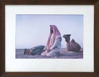
1958163043Kuwait: 1958. A fitting gift for a veteran oil man This evocative image was likely captured at dawn and shows two Bedouin engaged in the daily Fajr prayer both wearing the traditional shemagh headdress . Although not marked as such this was presented to William K. Whiteford 1900-1968 president of Gulf Oil in 1958 - the 20th anniversary of the discovery of oil in Kuwait. In 1934 Gulf Oil formed an alliance with the Anglo-Persian Oil Company to create the Kuwait Oil Company. It received concession rights in 1934 started drilling in 1936 and discovered oil two years later in the massive Burgan oil field. In 1957 Whiteford was described by Time magazine as "burly aggressive Bill Whiteford who started as an oilfield roughneck out of Stanford University was brought into Gulf in 1951 from the presidency of Canada's British American Oil Co. Ltd. made chief administrative officer in 1953 under Sidney A. Swensrud who moved up from president to board chairman. Whiteford shook up Gulf's management strengthened its domestic and Western Hemisphere holdings firmly but unofficially took over much of the executive authority". 1958 was also the year in which Whiteford published a short in-house history Gulf and the World Oil Industry. The image of Bedouin at their sunrise prayers may be an intentional hommage to the dawn of the Kuwaiti oil industry. Original colour photograph measuring 232 x 347 mm; mounted and glazed in brown wood frame by the Kendrick Bellamy Company Denver overall 407 x 507 mm. Pencilled date below framer's label "5-14-57". Light damp staining to bottom edge of mount a few scratches to frame and minor loss to backing. Overall in excellent condition. Time 25 March 1957. unknown
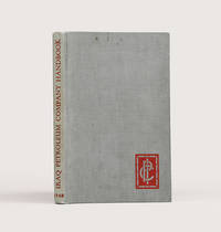
1948183725London: Compiled in the Companies' Head Office 1948. An informative survey of the Middle East and its oil industry First edition of this excellent handbook for IPC employees outlining the operations and expanding importance of the petroleum industry and surveying the history and current condition of states in Arabia the Gulf and the Levant. Chapter 1 describes the IPC's formation the mechanisms for opening a new concession the history of its prospecting and extraction projects and the Mediterranean pipeline. A chapter on the culture of the Arab world is followed by regional breakdowns that draw on company and government reports. Concerning the Gulf the handbook emphasizes the potential of oil exploration to transform the region. In Qatar where an oil field was discovered in the late 1930s "the population is scanty and wretchedly poor. The Company's present operations supply almost the sole source of wealth. The building of necessary roads jetties dwellings offices workshops stores and the like has advanced simultaneously with drilling" pp. 15 & 69. Accompanying the text are valuable plates showing IPC operations in Kirkuk and near Tripoli views of Qatar and Bahrain from the air and a well with head fittings and flow lines. The folding regional map details oil fields refineries and pipelines both built and projected. A useful tabular appendix summarizes the present state of the IPC's concessions including the area they cover and the rights granted as well as current exploration licenses. Octavo. Half-tone portrait frontispiece of King Faisal and 26 plates folding area map at rear maps in text. Original grey cloth spine lettered in red company logo in red on front board. Ownership inscription "L. B. Griffiths Tripoli 21.11.1948" on front free endpaper. Light sunning marking at head of front board top edge foxed: very good. hardcover
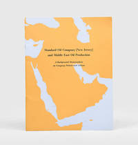
1954170939New York: Standard Oil Company New Jersey 1954. A new era in Middle East oil Revised and updated edition following the first of 1947 of this glossy guide illustrated with three colour maps of the Arabian Peninsula showing oil fields and concessions pipelines and refineries. Recognizing the potential of Saudi Arabia's vast oil reserves in 1946 Standard Oil Company New Jersey acquired a 30 percent stake in the Arabian American Oil Company. A colour bar chart illustrates Saudi Arabia's rapid growth as an oil producer after 1946. The introduction stresses the region's importance to emerging Cold War geopolitics: "Middle Eastern oil is a major element in the economies of Europe and the East. It is essential to the defence of the free world" p. 5. Quarto. Colour reference maps in text as well as photographic half-tones. Original wrappers front cover lettered in black against outline of Arabian Peninsula wire-stitched as issued. Front cover bright rear wrapper lightly soiled a little internal creasing from handling: a near-fine copy. unknown
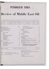
1948L2EG76GNBQ6GLondon: Brettenhem house 1948. Later cardboard binder. 30 x 23.5 cm. With many reproductions of photographs ground plans maps and cross-sections. Extract from the periodical The Petroleum Times containing an extensive article on oil in the Middle East. It opens with a list of Middle East oil companies and their concessions accompanied by a map showing their oil fields followed by a section on the future of Middle East oil. Individual chapters are devoted to the oil industry in Iran Iraq Bahrein Saudi Arabia Haifa Israel and Kuwait describing the area's geology oil fields reservoirs and more illustrated with photographs and cross-sections of the soil. The first 25 and last 16 pages consist of advertisements. Lacking the first 4 leaves of the preliminaries probably advertisements but the article itself complete some leaves slightly creased otherwise in very good condition. Brettenhem house, unknown
1970ABC_50132Iran 1970. The collection is housed in a plastic file folder with each photograph also separately kept in a plastic folder. Various sizes. With 10 photographs. Collection of ten beautiful press photographs of the oil industry in Abadan Iran which was home to the largest oil refinery in the world at the time these photographs were taken. They show various parts of the industry such as the oil refinery oil tankers pipelines and fire department. The photographs were take by various French and German news agencies.With the stamps of various French and German news agencies on the back of each photograph. Some of the photographs are slightly creased. Otherwise in good condition. unknown
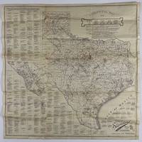
192012758Fort Worth: Standard Blue Print Map & Eng. Co 1920. Very good. Folding map 25.75 x 25.75 inches on thin paper. Old folds minor edge wear several short closed edge tears a couple of small areas of loss at crossfolds. Overall good condition and a wonderful display item. A rare and detailed Texas oil map produced by a Fort Worth firm just after World War I and here present in the larger 25-x-25-inch issue advertised in the promotional text on the map itself. The map shows the distribution of oil wells and derricks across the Lone Star State in 1920 prints the names of the most prominent oil fields and lists the names of Texas counties along with the oil companies active in each county. The map also shows the types of soil and rock deposits encountered throughout Texas counties with a legend of abbreviations for each at bottom right. The area of the map is crowded in places but still quite attractive and legible and is a good encapsulation of the rapidly developing oil industry in Texas at the time. Contemporary advertisements for the publisher of this map Standard Blue Print Map and Engineering promote the availability of over 200 oil maps of Texas Oklahoma New Mexico Louisiana and Arkansas from the firm. A rare map rarer still in this larger size; we locate just two copies at SMU one issued with a slightly later "May 1920" copyright notice with a larger "photocopy" reported at Denver Public Library and the Colorado School of Mines. Standard Blue Print Map & Eng. Co unknown
1952ABC_46142Al Ahmadi: Kuwait Oil Company 1952. Loose sheets stapled together at the left top corner with holes punched in the left margin. Small folio 33 x 20.5 cm. Duplicated typescript printed on the rectos only in purple ink probably with a spirit duplicator. Unrecorded information guide for new employees of the Kuwait Oil Company KOC who would be residing in Al Ahmadi headquarters of the Company. The Kuwait Oil Company was founded in 1934 a joint venture between the British Anglo-Persian Oil Company and the American company Gulf Oil. In the same year the sheik of Kuwait Ahmad Al-Jaber Al-Sabah reigned 1921-1950 granted them rights to the oil concession which they were to retain until 1975. The first oil was discovered in 1938 in Burgan field followed by discoveries in Magwa in 1951 Al Ahmadi in 1952 and many more regions. In 1946 the first commercial shipment took place. Because the initial development of the KOC coincided with the end of the British Raj in India many British and Indian people in its service were transferred to Kuwait in particular to Al Ahmadi. Al Ahmadi was set up to house these workers.This unrecorded guide is quite rare especially because it seems to be a quite cheaply produced and ephemeral document which was issued only in small numbers for in-house circulation.At some places very slightly frayed and creases along the edges and corners staple a little rusted leaves slightly toned some leaves a little cut short at the foot with no loss except for some of the catch-words but overall in remarkably good condition. A rare and unrecorded guide for employees of the Kuwait Oil Company in Ahmadi. Kuwait Oil Company, unknown
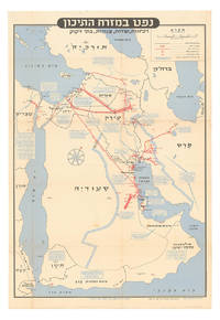
1957ABC_46260Tel Aviv: Israel Defence Forces General Staff 1957. Folded. 56 x 82.5 cm. Chromolithographic map of the Arabian Peninsula from Turkey in the north to the Indian Ocean in the south and covering Saudi Arabia Egypt Israel Palestine Jordan Syria Lebanon Iraq Iran Kuwait Bahrain Qatar United Arab Emirates Oman North and South Yemen. Scale 1:5000000. Scale and key in Hebrew inset to top-right inset explanatory panels in Hebrew and English compass rose in Saudi Arabia. Extremely rare Israeli strategic map of the Arabian Peninsula showing oilfields and associated infrastructure. Printed in black red and blue the map demarks the political boundaries of the time along with the areas covered by oil companies concessions. Pipelines form a web across the northern part of the Arabian Peninsula shown in an uncommon vertical orientation while oilfields and refineries large and small are also marked. The IDF probably made the map in responce to the 1956 Suez Crisis and its associated geopolitical shifts. With the Egyptians operating the Suez Canal and the USA forcing Britain and France to abandon their post-imperial plans Israel now counted in both U.S. and Soviet plans for their control of Middle Eastern politics. Britain had to anchor its Middle Eastern influence in Cyprus Aden and Iraq while the increased American influence can be seen in the huge swathe of territory assigned to Aramco. We have located only one institutional copy of this map in the National library of Israel.With traces of pins from former wall mounting. A couple of small light stains some uneven creasing and tears at the edges of some folds and a couple tiny holes where the folds cross. Otherwise in good condition. Israel Defence Forces, General Staff, unknown
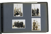
1931ABC_46004Greece Palestine Iran Iraq Egypt 1931. Oblong photograph album 20.5 x 32 cm. With 72 sepia photographs ca. 6 x 8.5 cm. Album of personal photographs commemorating a journey in 1931-1932 to the oilfields in modern Iran and Iraq by a trio of travellers which included the Reverend Philip "Tubby" Clayton 1885-1972 the founder of the Toc H movement. Several photographs show Galilee Jerusalem Rutbah Wells Ar-Rutbah and about 10 show "fields" mostly the main oilfield at Masjed Soleyman and its gas separator.In 1931 Clayton was invited by the director of the Anglo-Persian Oil Company the predecessor of the British Petroleum Company "to inspect the work among the Company units in Persia and the Middle East generally" Harcourt. Accompanied by two friends he travelled by plane train and boat to Lake Tiberias and further by plane to Rutbah Wells a British airfield where the group spent Christmas Eve with British Dutch and German travellers. On Christmas Day they reached Abadan and from there visited the oilfields near Tehran Ahvaz Haftkel Mohammerah Basra and Masjed Soleyman. After a journey to Cairo and Alexandria they boarded an oil tanker for the return journey to Britain. This journey inspired Clayton to plead passionately for improvements to the life of the crews of oil tankers. He described "carrying oil by sea" as "the most lonely job on the world's waters" Clayton. In 1940 he became chaplain of Anglo-Saxon Petroleum's tanker fleet and would subsequently sail on multiple tankers.The photographs must have been taken by Henry Pegg Chappell 1909-1997 since the other members appear he is the only member not present in the photographs and he does not and only Clayton who completed the journey by oil tanker. A carbon copy of a typed list describing all photographs is inserted in the album. Since typed and handwritten additions to the carbon paper refer to Clayton in the third person he probably typed the original list and gave Chappell this carbon copy to insert in his album.With an inscription probably by the three travellers on the title page. Binding slightly worn at the extremities. Paperclip and staple on the typescript rusted. In very good condition.l Clayton "In a tanker" in: The Times 9 March 1932 p. 15; Harcourt The impudent dreamer pp. 216-219. unknown