Route, Anthony JBiblio.com
491 résultats
1995Q-1555661505Johnson Books 1995-06-01. Paperback. New. In shrink wrap. Looks like an interesting title! Johnson Books paperback
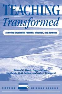
2000Q-0813322693Routledge 2000-01-12. Paperback. New. In shrink wrap. Looks like an interesting title! Routledge paperback
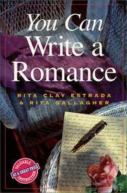
1999Q-0898798620Writer's Digest Books 1999-07-15. Paperback. New. In shrink wrap. Looks like an interesting title! Writer's Digest Books paperback
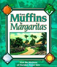
1998Q-0966590708Inn Route 1998-11-01. Hardcover. New. In shrink wrap. Looks like an interesting title! Inn Route hardcover
2000Q-0738504734Arcadia Publishing 2000-10-14. Paperback. New. In shrink wrap. Looks like an interesting title! Arcadia Publishing paperback
2000mon0004053361Silver Sprocket 11/10/2021 12:00:01. cards. Like New. 1.7300 4.3300 3.0300. Silver Sprocket unknown
2000mon0004112882Bloomsbury Academic 7/9/2026 12:00:01 AM. paperback. Like New. 0.5500 8.9500 6.0500. Bloomsbury Academic paperback
1986g8301Dordrecht: Dr W. Junk Publishers. VG : in very good condition without dust jacket. Minor chip at spine head. 1986. First Edition. Green hardback cover. 270mm x 200mm 11" x 8". 392pp. Heavy item - shipping supplement may apply for overseas. . Dr W. Junk Publishers hardcover
1998SBS-9780854047383ROYAL SOCIETY OF CHEMISTRY 1998. Hardcover. New. ROYAL SOCIETY OF CHEMISTRY hardcover
1998SBS-9780854047383ROYAL SOCIETY OF CHEMISTRY 1998. Hardcover. New. ROYAL SOCIETY OF CHEMISTRY hardcover
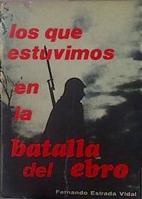
197245825JANZER 1972. Tapa blanda. 2ª Mano. . . Guerra CIVIL. Bélico. Memorias. -- Rústica con solapas 22x15 cm. 451 pp. ilustrado con fotografias y planos de la campaña. JANZER unknown
194073032AB1940. Ninth Edition. Glasgow Brown Son & Ferguson Ltd 1940. 12 cm x 18 cm. 155 pages plus additional unnumbered pages of publisher's advertising. Original Hardcover/ Very good condition with only very minor signs of external wear. Includes for example the following essays: International Regulations for Preventing Collisions at Sea / Extracts from the Merchant Shipping Act / Flashing Sound Signalling Morse / Range of Lights / To Determine the Direction in Which a Steam Vessel is Heading / Terms Associated with Sailing Vessels / Distress Signals / and many more. hardcover
194073060AB1940. London Geographia No Date c.1940. 10 cm x 15 cm. 40 Pages. Original Softcover. Excellent condition with only very minor signs of external wear. Covers slightly stained by water. Some traces of rust through pages. Includes for example the following essays: 15 Special Maps of 100 Miles Round London / Comprehensive Guide to 149 Routes / Index to Routes of 100 Miles Round London. paperback
1999Q-0787947938Jossey-Bass 1999-11-17. Paperback. New. In shrink wrap. Looks like an interesting title! Jossey-Bass paperback
1920040036New York: Houghton Mifflin. 1920 Book. Very Good . Cloth. 1st US Edition. Greek and Balkan politicsWorld War I and the various contributions of Eleftherios Venizelos up to the Peace Conference at Versailles and the Greek claims in Asia Minor.Foldout coloured ethnographical map of "Turkey in-Europe" 384p. illus platesmaps index. Crispclean tight text.Spine a little faded and scuffed else fine. Only later copies of this US edition found in in WorldCat . Houghton Mifflin. hardcover
1997mon0000106688New York : Morrow 1997-01-01. Hardcover. New. in x in x in. New York : Morrow hardcover
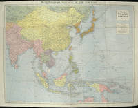
1940205763London.: Hutchinson & Co. Circa1940. Full colour folding map 70.7 x 93 cms; 76 x 101.2 cms sheet original folds short fold splits previous owner's neat title markings on the verso but the map in very good condition. A "Geographia" map of the war theatre in Asia and the Pacific including the northernmost coast of Australia. Showing railways and canals roads and steamer routes oilfields and pipe lines and a key to the unfederated states of Malaya. The Spratley Islands are marked as French and Thai territorial claims within French Indo China are marked. . Hutchinson & Co. unknown
1955173072Washington D.C.: Army Map Service U.S. Army. 1955. Large colour map. 1:250000 scale. Transverse mercator projection. 23°00'N 91°30'E-22°00'N 93°00'E. Series U502 Sheet NF 46-6 Edition 1-AMS. Map measures 57.3 x 75.8cm. Slight wear creasing even light browning small closed tears on edges upper-right corner little foxed. Shows signs of use but map is clean and complete. Corps of Engineers Army Map Service map of Chittagong and surrounds compiled in 1955. Based on the British Indian one-inch and half-inch map series from 1938-43 and 1936-43 respectively. . Army Map Service, U.S. Army. unknown
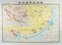
1978171343北京. Beijing.: 地图出版社.Di tu chu ban she. 1978. Large Chinese map in colour showing southern part of China and northern Vietnam folded in original envelope scale 1: 150000 inset map upper left corner scale 1:800000. Both maps show the battles between Qing court and French army between 23 Aug 1884 and 25 Mar 1885. Original paper envelope repaired with acidic free tape map in very good condition. Text in Chinese. Sheet measures 76.8 x 107.1cm. . 地图出版社.[Di tu chu ban she]. unknown
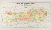
1912177249Sydney.: W.A. Gullick Govt. Printer. 1912. Large lithographed folding county map 78.8 x 45.4 cm the parishes highlighted in colour two small fold splits slight toning in very good bright condition. Attractive map from the Report on the first Interstate Conference on Artesian Water Sydney 1912 showing boundaries of water trust districts proposed boundaries with position and length of drains for the counties of Denham and Jamison in northern New South Wales boundaried by the Namoi River to the South. . [W.A. Gullick, Govt. Printer] unknown
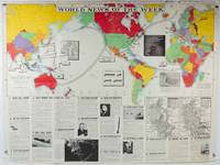
1942202620Army Orientation Course. / News Map of the Week Inc. Volume 4 No. 32. 13 April1942. Folding colour pictorial map on sheet 88 x 119 cms blank on verso inset maps two photographic diagrams and black and white photographic illustrations descriptive text top edge chipped a few short edge tears and lower corner torn no loss pinholes at the corners inoffensive tidemark at a lower corner in good condition. Colour world map showing political boundaries and military events of World War II from April 3 to 9 1942. with descriptive text beneath including: the loss of two British Cruisers off Ceylon; the occupation of Bataan by the Japanese and their landing on Manus; Japanese war tactics revealed by Malay prisoners and the increasing importance of Central Africa to the Allied war effort. The. Map is indexed according to these notes. Two inset maps of Europe chart Hitler's gains in 1941 and activity on the Russian Front. Additional diagrams on the main world map show war spending and the civilian and war output of US industries. . Army Orientation Course. / News Map of the Week, Inc. unknown
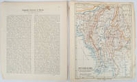
1903173709Gotha: Justus Perthes. 1903. Map printed in colour 24.7 x19.4cm and leaf of descriptive text in German 26.5 x 22.5cm slight toning and edges of the map worn with two small tears no loss. Geopolitical map of Burma with railways and railways under construction highlighted. The accompanying text is by the German Tibetologist linguist and orientalist Dr Emil Schlagintweit. . Justus Perthes unknown
1996ZB1038096Universidad Nacional Autonoma de Mexico Centro de Investigaciones Human 1996. 157 pp. Paperback fine. - If you are reading this this item is actually physically in our stock and ready for shipment once ordered. We are not bookjackers. Buyer is responsible for any additional duties taxes or fees required by recipient's country. Universidad Nacional Autonoma de Mexico, Centro de Investigaciones Human paperback
1996mon0000410025Wiley 1996-04-19. Hardcover. Very Good. 1.1800 in x 8.9800 in x 6.0600 in. Wiley hardcover
19822092902141202343Shanhai shoten 1982. Soft Cover. Fine. Volume: 1 Shanhai shoten paperback