Conway, Gerry; Estrada, Ric and othersBiblio.com
491 résultats
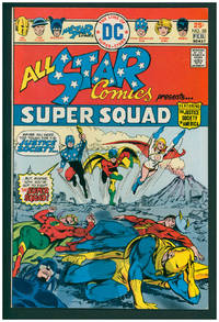
197638001New York: DC Comics 1976. First Edition. Stapled wraps. First appearance of Power Girl. Very Fine 8.5. ; 17 x 26 cm. DC Comics unknown
2000CBS-9780817640859Sp Springer 2000. New. Sp Springer unknown
2000CBS-9780817640859Sp Springer 2000. New. Sp Springer unknown
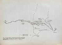
193859631Portland OR: Works Progress Administration of Oregon ca. 1938. 4to. 4 pp. 41 leaves unnumbered. including mimeograph map embossed “Mimeograph†paper watermark at fore-edges of some leaves. Contemporary quarter simulated calf over embossed “Writing Portfolio†boards fuzzy textured brown endpapers light interior uniform toning scuffing edgewear very faint off-gassing odor still VG exemplar from library of Alfred Powers. First edition of No. 5 in the Historical Records Survey of Oregon series reproducing and detailing the intricacies of the preserved original abstract of the Willamette Valley & Cascade Wagon Road Co. held in Prineville OR. WV & CWR Co. The Wagon Road co. was originally incorporated in March 1864 by Luther Elkins D.W. Balland Morgan Kees John Settle and others opening a route connecting Albany OR with the bunchgrass range in Central Oregon. The toll road was finally finished by 1868 using Chinese-American labor with Jason Wheeler overseeing construction and later J.A. White. In 1884 C.E.S. Wood began practicing law in Portland OR specializing in maritime and corporate law as well as serving as land agent for Lazard Freres the New York banking firm controlling the WV & CWR Co. wagon road grant stretching from Albany OR to the Idaho border. Subsequent to the details included in this abstract Wood would negotiate the sale of the wagon road to Louis HIll son of railroad tycoon James J. Hill and the million-dollar commission allowed him to retire and relocate to northern California with Sara Bard Field. The wagon road was converted to US Highway 20 the Santiam Highway and completed in September 1939. Worldcat locates 8 copies LA Nat Hist. Mus Boise SU OR Hist. Soc. Lib. U of W Wash State Lib. Yale OR State Lib. U of O; See: Bingham Charles Erskine Scott Wood 1990 pp. 8-9 47; See: Griffith Works Progress Administration Oregon June 1936 p. 10. Works Progress Administration of Oregon, hardcover
191213113Monmouth Illinois:: Western Road Tool Company 1912. loose sheets as issued. Fine. Approx. 10-1/2 x 14 inches. Illustrated from photographs heightened in red and line drawings. Offering the "Perfection Gang" Road Drag horse gang drags scrapers plows grader blades and other road machines with order form. Western Road Tool Company, unknown
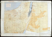
1942207841London.: Royal Engineers. July1942. Printed colour topographical map mounted on linen 56.7 x 79.2 cms; 64.6 x 89. 5 cms sheet original folds edgewear small marginal chips a little dusty but in good condition. Detailed World War II operational map of Egypt and the Middle East issued by 512 Army Field Survey Company of the Royal Engineers. The map is marked "Not to be Published" in the upper right margin. Railways roads camel tracks telegraph lines boundaries altitudes towns and villages are marked. . Royal Engineers. unknown
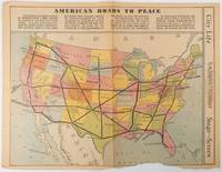
1938215547Los Angeles.: Los Angeles Examiner. Sunday 1 May1938. Printed colour pictorial map 33 x 48 cms; 41.8 x 54.5 cms sheet central fold sheet toned corners chipped with some loss to the bottom border and at the central fold in good condition; and on the verso "Movie-Go-Round" by Louella O. Parsons black and white photos and advertisements. Pictorial map printed for the weekend supplement of the Randolph Hearst owned newspaper the Los Angeles Examiner. The map-maker and artist Howard Burke had also worked for the San Francisco Examiner and was known for pictorial maps many with a persuasive or rhetorical edge and as here were designed to shore up American patriotism and defences against a wider world in the increasingly turbulent pre-war 1930s. The caption to this map outlines a multi-billion dollar 25 year proposal by Congressman J. Buell Snyder for a network of coast to coast transcontinental highways "in case of an attack by a foreign power at any point along the border". Buell Snyder earned the soubriquet "the father of superhighways" and during the War he was assigned to a Congressional Committee in charge of appropriations for the War Department. Scarce. . Los Angeles Examiner. unknown
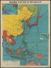
1944205765London.: George Philip & Son. 1944. Full colour folding map 101.5 x 76cm sheet inset maps legend folding into title wrapper 25.7 x 19.4 cms covers a little dusty and discoloured a few short fold splits without loss but the map in very good bright condition. Map of the Pacific Theatre of World War II with borders drawn as they stood in 1937 - complete with Chinese claims on Mongolia Tuva and Tibet. <br> <br>Shows transportation routes principal railways oil fields Allied naval bases territory occupied by the British Empire French Empire and the United States. This map shows only the northernmost section of Australia which allows for much better detail of the countries of East Asia. Small inset map of the Hawaiin Islands at mid right. Inset map of the Pacific Ocean at upper left. . George Philip & Son. unknown
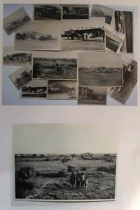
19300559431930. Photographic Image. Very Good. No Binding. A collection of 15 black and white photographic prints 1 Drigh Road RAF camp 1921 8x6 ins; 2 ms note on the back " Imperial Airways machine crashed at Jack Persia Sept 1929 3 killed" 8x5 ins; 3 plane with personnel and buildings ms note "Long distance flight French Drigh Road 14/12/29"; 4 crashed plane ms note "First Wapiti crash Drigh Road 8x5 ins; 5 Farey-Napier monoplane; 6 Iris biplane on water 8x5 ins; 7 West Camp shops RAF Cranwell; 8 plane "Pride of Detroit" in hanger ms note Drigh Road air base Sept 4th 1927" 5x3 ins; 9 plane with ground crew and hangers ms note Drigh Road Sept 15th 1927"; 10 biplane GB-EKBU with onlookers ms note "first Moth to fly to India Leake & Stark 10.1.27 5x3 ins; 11 Blackburn Dart at Cranwell with 4 other photographs of Drigh and unidentified locations. All in very good condition. T.E. Shaw was at Drigh Base from 7.1.27 until 26.5.28. A nice collection. unknown
1993CBS-9780817637163Sp Springer 1993. New. Sp Springer unknown
1993CBS-9780817637163Sp Springer 1993. New. Sp Springer unknown
19092111902160200634Higashi-Tsukima-gun Office 1909. Soft Cover. Fine. Volume: 1 Higashi-Tsukima-gun Office paperback
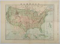
1911179415Tokyo.: 楠山正雄. Kusuyama Masao. Meiji 44 1911. Colour folding map 40 x 55cm inset maps showing the Philippines Alaska and Hawaii very good copy. This map was a supplement of October 1911 issue of a monthly magazine Shin Nippon 新日本 which was published between 1911 and 1918. The main map covers the contiguous United States with inset maps of the world showing the American territories of Alaska Hawaii and the Philippines. Curiously Cuba has been marked as an American territory having been directly occupied from 1906 to 1909 though at the time still beholden to the 1903 Cuban-American Treaty of Relations. . 楠山正雄. [Kusuyama Masao]. unknown
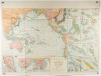
1945180206Sydney.: H.E.C. Robinson. Circa1945. Full colour inset maps principal cities and towns marked shipping routes international boundaries and railways. 99 x 73cm. Some small insect damage has been repaired on the verso visible on map as a few small lighter areas in the western Pacific. Pinpoint holes at folds paper repair along cover but a very good clean copy. From the Sydney publisher H.E.C. Robinson the firm founded in 1895 by Herbert Robinson 1857-1933 a founder of the Royal Geographical Society of Australasia. <br> <br>Although the map is undated North and South Korea are shown as divided which occurred in late 1945 and Manchuria is marked as still under Soviet occupation which only lasted until 1946 at which point it was handed over to Communist China. <br> <br>As well as what now would be considered Southeast Asia the main map shows the eastern half of India Tibet and parts of Mongolia the USSR and East Asia. Inset maps include: Caroline Islands Marshall Islands Federation of Malaya Singapore Hong Kong Taiwan Japan Hawaiian Islands Philippine Islands Midway Gaum and Wake Islands Fiji Islands Eastern & Western Samoa Santa Cruz and Solomon Islands New Caledonia Rabaul Tahiti Lord Howe etc. . H.E.C. Robinson. unknown
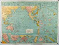
1930205997Sydney: H.E.C. Robinson. Circa1930s. Printed colour maps in all 65.5 x 99cm the main map roughly 50 x 65 cms on a single sheet 76 x 101.3 cms; a little carelessly folded decorative blue title cover a little dusty and a few fold splits and edgewear but in good condition. The exceptional feature of this map are the twenty six large scale inset maps of Pacific islands including: Malay States Singapore Hong Kong these at lower left Japan Philippine Islands Hawaiian Islands Fiji Solomon Islands Western and Eastern Samoa Tahiti Saipan New Caledonia and Dependencies and many others. <br> <br>The main map of the Pacific Ocean stretches from Southeast Asia including all of Australia and New Zealand the west coast of the Americas the Kamchatka Peninsula Manchukuo Manchuria and most of China. Korea and Taiwan are marked as Japanese Territory. Possessions of Britain France the Netherlands and the United States are highlighted. <br> <br>An incredibly rich source of information on the Pacific theatre during the years leading up to World War II. From the Sydney publisher H.E.C. Robinson the firm founded in 1895 by Herbert Robinson 1857-1933 a founder of the Royal Geographical Society of Australasia. . H.E.C. Robinson. unknown
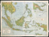
1940211106Sydney.: H.E.C. Robinson Pty. Ltd. circa1940. Full colour folding map 71 x 97 cms; 76.2 x 10² cms sheet blank on verso save for a neat inked stamp "East Indies" inset map of New Guinea and Papua heights shown by colour very good clean condition. Large scale World War II era map by Sydney publisher H. E. C. Robinson. Extremely detailed map it is coloured according to height above sea level and showing naval bases railways shipping routes air routes. Includes smaller inset map of "New Guinea & Papua" showing the eastern part of the island. . H.E.C. Robinson Pty. Ltd. unknown
19792111902160307575Okajima Natural Health Dojo 1979. Soft Cover. Fine. Number of books: 10 Okajima Natural Health Dojo paperback
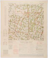
1945200411Washington D.C.: Army Map Service. First edition - revised AMS4. 1945. Army survey map printed in colour 36.7 x 36.7 cm; 58 x 48 cm sheet conversion graph glossary and administrative index to the inner margin; scale three column legend index to adjoining sheets and notes re grid references and mean declination to the foot; sheet toned a very few edge tears the map in very good condition. Wartime map produced by the US Army Map Service AMS who formed in 1942 and were at the forefront of military mapping campaigns during WWII and the post-war years. The very detailed map shows residency and administrative boundaries transportation ground and water features vegetation cultivation ruins religious sites "Graves; Chinese native" and "Cemetery; heathen Christian" walls hedges populated places built-up areas and buildings with those of iron stone wood and bamboo differentiated by colour; fishponds plantations and much more. . Army Map Service. unknown
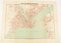
1925174961Constantinople.: The Anglo-American Book & Newsagency. 1925. Printed folding colour map 36 x 49.2 cm street grids for Stambul Pera Galata and Skutari railways and landing places marked small fold splits affecting the margins only now repaired with archival material two small holes at central folds pin-holes to the four corner some age-toning but in very good condition. A scarce map of the historic peninsula soon after the Republic of Turkey was founded and the capital moved to Ankara. Printed for the tourist market this map is a rare survival. . The Anglo-American Book & Newsagency. unknown
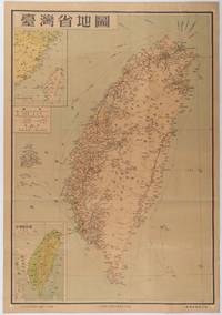
1954215869地圖出版社. Reprint. 1954. Colour folding map of Taiwan showing all major cities towns and villages railways highways roads rivers and sea routes. Topographical inset map at lower left Taiwan Straits with mainland coast inset map at top left. Each map has its own scale. Text in traditional Chinese characters. Washi repairs along some folds on reverse pin marks at corners evenly browned and a little faded. A nice map of Taiwan in fair condition. 77 x 53.8cm. . 地圖出版社. unknown
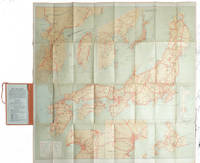
1927215711Tokyo.: Japanese Government Railways. Circa1927. Large folding colour map 78.5 x 80 cm of Japan and Korea 6 inset maps one of which shows Taiwan scale 1:1640000 for Hondo Shikoku and Kyushu 1:2340000 for Chosen; tipped into the original orange cloth covered case with orange ties text in 31 panels on the verso one a little age-toned a few very small fold splits without loss a very good copy. Attractive tourist map for the English-speaking traveller issued by the Japanese Government Railways with extensive notes for tours and points of interest on the verso short descriptions of cities and sites to visit principal theatres with suggestions for cafes restaurants and department stores. . Japanese Government Railways. hardcover
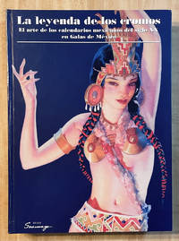
200033694<p>Museo Soumaya 2000 First Edition stated in colorful illustrated boards no markings NOT ex-lib binding tight pages and plates bright orange endpapers slight shelf/edge wear to heavy boards else Fine unread copy no dust jacket as issued; Texts in Spanish; folio; 303pp colophon fully illus in color. First Edition. Hard Cover. Near Fine.</p> Museo Soumaya hardcover
198180651Santa Barbara: Ross-Erickson Inc 1981. Paperback. Very Good. Covers show some rubbing. ; Translation and commentaries by Henry Munn. With a retrospective essay by R. Gordon Wasson preface by Jerome Rothenberg. Covers show slight rubbing. This is New Wilderness Poetics Volume I. ; 6 x 9 "; 239 pages. Ross-Erickson Inc paperback
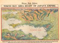
1945209335Chicago.: Chicago Daily Tribune. 28 July1945. Colour bird's eye view map 22.4 x 39.3 cms on a newspaper leaf trimmed to a half sheet 29.8 x 41.6 cms including caption slight toning at an old central fold the map in very good condition. <br>Unrelated black and white photographic illustrations on the verso "Pre-flight Trainers used in Chicago to give ground instruction to would-be pilots" and "New rekindled Montauk Light Long Island N.Y." Map published in the Chicago Daily Tribune days before the bombing of Hiroshima on August 61945. <br>"Perspective map of Tokyo bay and contiguous land and sea areas showing Tokyo Yokohama the Yokosuka naval base industrial sections and other features .In this map north is at the right instead of at the top - an expedient adopted to show all of the bay as large as possible in half page space." caption . Chicago Daily Tribune. unknown
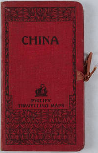
1920161936no date. circa1920. Linen backed colour folding map of China insets of Peking and Environs and Hongkong and Canton in lower left corner. 54 x 63.8cm. Table of place names at upper left gives the cities that "By a recent ordinance of the Republic all 'Fu' 'Chow'' and 'Ting' cities have been nominally reduced to the rank of 'Hsien'. The following parallel list gives the 'Fu' cities the names of which have been officially changed together with the new form adapted." Map folds into a red cloth covered case with ribbon ties 19 x 10.3cm. Title and decoration printed in black on upper cover. Trifle foxed on linen backing a little insect damage case in a few small places otherwise a very good clean map. . hardcover