[ZHU, YULIAN]. (CARTOGRAPHER). 朱育蓮 繪.Biblio.com
491 résultats
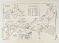
1955172396No publication details. Circa1955. Chinese black and white military map of Japan based on a map issued by 赤旗報 Shimbun Akahata on 24 June 1953. No scale given inset map of Hokkaido upper left corner legend lower section showing air and navy bases military exercise bases ammunition dump shooting ranges for the air force and navy headquarters of the coast guard etc. Text upper section provides details of the different types of US military bases and infrastructure. Text in traditional Chinese. 25.8 x 35.8cm. . No publication details. unknown
1986SONG9061935431Springer 1986-06-30. 1. hardcover. Used: Good. 7.00x0.94x10.00. Buy with confidence. Excellent Customer Service & Return policy. Springer hardcover
19812091502135413297Hubangi Publishing House 1981. Soft Cover. Fine. Number of books: 5 Hubangi Publishing House paperback
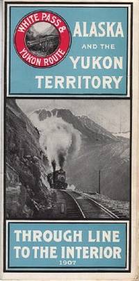
1907110968Seattle Wash.: White Pass & Yukon Route 1907. Softcover. very good. 24 Columnspp. Square Octavo folded once into narrow Octavo. Illustrations from photos and double-paged centrefold "Map of White Pass & Yukon Route. Original pictorial wrappers stapled as issued - minor rusting with map on rear cover. very good 1907 White Pass & Yukon Route paperback
192125.0468Buenos Aires : Talleres Gráficos de Alfredo de Martino 1921. 2ª ed. Rústica. 13.5x18. Talleres Gráficos de Alfredo de Martino paperback
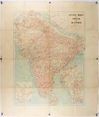
1940211089Bombay.: Joshi & Co. circa1940. Colour lithographic map 66 x 50 cms; 81.x 68.5 cms sheet two inset maps and on the verso a full sheet "Relief Map of India" original folds with fold splits archivally strengthened several city names have been neatly underlined “Agartala” inked in the margin overall in good condition. Scarce Bombay-published map of the pre-Partition Indian sub-continent with two small inset maps one showing roads around Karachi and the other Burma. Through Routes Other Main Roads and Motorable Roads Subject to Weather are marked. The "Relief Map of India" on the verso includes Railway Lines Canals Steamer Routes Rivers Air Routes Navigable Canals and Broadcasting Stations. . Joshi & Co. unknown
1910175858Calcutta.: E. I. R. Press. circa1910. Folding engraved map 33.5 x 73.5 cm river systems in blue attractively bursting the borders of the map inset map of the network into Calcutta legend noting stations lines under construction and foreign railways; original folds two small fold splits with no loss slight overall toning more noticeable at the folds in very good condition. Attractive map capturing one of the busiest areas of a staggeringly vast railway network. The Barharwa-Azimganj-Katwa loop is marked under construction. Scarce. . E. I. R. Press unknown
19092111902160201132Higashi-Tsukima-gun Office 1909. Soft Cover. Fine. Volume: 1 Higashi-Tsukima-gun Office paperback
1998DBS-9780854047383RSC 1998. 1st. Hardcover. New. RSC hardcover
1998DBS-9780854047383RSC 1998. 1st. Hardcover. New. RSC hardcover
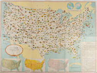
1955172003Washington D.C.: 国務省. Kokumishō. No date. circa1955. Large folding Japanese coloured map of the United States with 3 inset maps at foot of map showing main railways air and highway routes and hemispheres at the top right. Some browning mainly visible on reverse still a good copy. 66 x 81cm. An intricate and detailed pictorial map of the United States published in Japanese by the US State Department. The same type of map had been published since 1945 in English and subsequently in other languages. The Japanese language map is hard to find. The map is undated but was probably produced in the 1950's. The images include depictions of women board riders in two piece swimsuits of the sort popular in the 1950s but the inset text lists Alaska and Hawaii as external territories of the US indicating that the map was produced before they attained statehood in 1959. <br> <br>An inset panel provides information on the area and population of the US the population of major American cities mineral and other resources climate and topography. A note at the bottom right hand corner of the map states that copies of the map can be obtained free of charge from your nearest US Information Office. <br> <br>Every region of the country is decorated with an illustration of the natural resources industries or cultural or historical resources associated with that particular place. These include images of early colonial settlers the birthplaces of Mark Twain and Woodrow Wilson Booker T. Washington's house and Abraham Lincoln's grave; images of major dams oil fields coal mines cotton plantations etc. various animals and crops and images of ships cars and public buildings including the Statue of Liberty located rather oddly far out at sea. . 国務省. [Kokumishō]. unknown
1943206908Chicago.: Geographical Publishing Company. 1943. 10 printed colour maps on a large single sheet 91 x 71 cms small inset map of the European theatre chronology of events original folds a few short fold splits archivally sealed; in very good condition. A suite of numbered U.S. war maps with Allied action overstamped in red by the publisher that for Germany and France with pictorial stamps for strategic targets including "Chemical Factories" and "Airplane Factories". The maps numbered 1 to 10: English Channel; Italy; Southern Greece; Western Mediterranean Sea; Germany and France; Baltic Sea and Scandinavia; China Burma India; Japan; Tokyo; and Greater Pacific Battle Zone: a large half sheet map noting the placement of US and Japanese bases. The "Chronology of Important War Events" lists action from the bombing of Pearl Harbour: "Japan's day of Infamy: Japanese air attack cripples American Fleet at Pearl Harbour" to March 21 1944 "Germans take over key political posts in Bulgaria and Romania". <br> <br>Issued by the Geographical Publishing Company of Chicago this educational sheet includes an advertisement for WLS Chicago "The prairie farmer station" with a list of their war broadcasts and a world clock. . Geographical Publishing Company. unknown
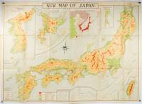
1935214827Tokyo.: Nihon-Kenkyusha. 1935. Large folding colour map of Japan 74.3 x 10⁵ cms; folding into printed card covers 27 x 19.5 cms: 9 insets: Chosen Korea; Hokkaido; Chisima Islands; General Map of Japan and Manchuokuo; Karafuto Saghalien; Okinawa Loochoo; Taiwan Formosa; Micronesia; Ogasawara; Hajijoshima; the covers a litle worn and marked and the sheet slightly toned but the map is in very bright clean condition. Scarce World War II era map of Japan including Korea published in English by Kenkyusha. Founded in 1907 it had a history of publishing for students of English and the English market. An attractively composed map in remarkbable condition; with the insets circled around the islands of Japan heights marked in graduations from green to red and showing provinces railways roads steamer routes Buddhist and Shinto Temples. . Nihon-Kenkyusha. unknown
1998SONG0471977136Wiley 1998-06-29. 1. hardcover. Used: Good. 6.22x0.63x9.25. Buy with confidence. Excellent Customer Service & Return policy. Wiley hardcover
19872080302106809575Nagasaki City Civil Engineering Department Road Maintenance Section 1987. Soft Cover. Fine. Number of pages: 136 pages Size: A4 version Nagasaki City Civil Engineering Department Road Maintenance Section paperback
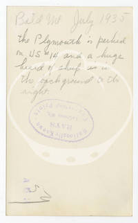
1935152267N.p.: N.p. 1935. Archive of 24 vernacular photographs documenting a 1935 summer road trip through the badlands of South Dakota Idaho and Wyoming. Each photograph with manuscript ink annotations identifying location to the margins and manuscript pencil annotations to the verso noting locations and dates along with the stamp of Rays photography studio in LaCrosse WI. <br /> <br /> Captured in the archive are various natural landmarks including Shoshone Canyon IXL Ranch and Bighorn Mountains in Wyoming Bald Mountain in Idaho and the Black Hills Badlands and Missouri River in South Dakota. Also included are a few photographs taken along US Route 14 one of the original US highways of 1926 an east-west route running 1398 miles. An alternately charming and chilling collection of Depression-era travel photography in the Midwest and Mountain West. <br /> <br /> 23 photographs 4.5 x 2.17 inches 1 photograph 3.5 x 2.75 inches. Generally Very Good plus some with light fading and age toning. N.p. unknown
1998DADAX0471977136Wiley 1998-06-29. 1. hardcover. New. 6.22x0.63x9.25. Buy with confidence. Excellent Customer Service & Return policy. Wiley hardcover
198114307Ross-Erikson 1981. Hardback. Good. Good condition. There are scuffs and wear to the edges and corners of the dust cover as well as the remnants of a sticker around the base of the spine and some light damage there also. There are 5mm and 1cm tears to the top corners of the front and a 5mm tear to the top corner of the back of the dust cover and a black marker scribble on the top corner of the inside front flap. There are some marks to the page edges but otherwise in very good condition with pages crisp and clean. Ross-Erikson hardcover
1986Q-9061935431Springer 1986-06-30. Hardcover. New. New. In shrink wrap. Looks like an interesting title! Springer hardcover
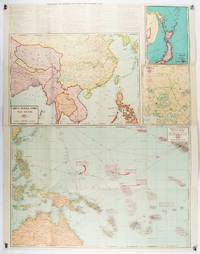
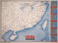
1945194660New York.: Army Information Branch. Volume III No. 51F. 9 April1945. Folding colour map and six inset maps in a vertical panel 88 x 119 cms sheet and on the recto circular map of Europe smaller inset map of Asia and of the Ryukyu Islands descriptive text original folds in very good bright condition. Scarce Newsmap of "China Southeast Coast" from Shanghai to French Indochina with the islands of Formosa and Hainan. At the right edge are inset maps of the vicinities of Shanghai Wenchow Foochow Swatow Canton and Hong Kong. On the verso is a large map of the European theatre of operations centred on Berlin a map of the Pacific area noting the American occupation of Okinawa with a detailed map of this island. In unusually fine bright condition. . Army Information Branch. unknown
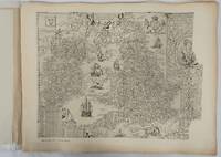
1932176499London.: Royal Geographical Society. 1932. Twenty one loose maps with tissue guards printed on sheets 49.5 x 63.5 cm in the original folio title-wrappers the maps with some edge wear and toning but on the whole in very good condition the wrappers browned and stained torn with minor loss at the foot of the title wrapper small closed edge tears now re-enforced with archival material and sound. Lacking the introductory notes by Edward Heawood. The complete suite of maps: an impressive production. The first map is a general map of England and Ireland by an unknown author 1594; nineteen county maps; and a final sheet of miniature county maps printed as a deck of playing-cards. The county maps proper vary in date from Saxton's “Southamtonia” of 1575 to John Speed's version of Norden's map of Sussex dated 1610. A contemporary reviewer dubbed it " a rich cartographical feast" allowing easy access to rare and valuable maps and comparison of maps by different cartographers for the same county. <br>The county maps reproduced include five by Christopher Saxton three by John Norden Philip Symonson's map of Eastern Kent published in 1596 a series of seven maps dating from the early years of the seventeenth century two maps prepared for Camden and two published by John Speed. . Royal Geographical Society unknown
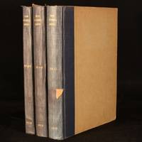
1950996W42London and Beccles: The International Road Federation 1950-1956. Hardback. Very Good Indeed. 11.5" by 8.5". Not Stated. An incredibly scarce collection of richly illustrated magazines published by the International Road Federation. A scarce collection of 3 volumes featuring numerous issues of this publication which was released twice a year.All three volumes feature a great number of vignette monochrome illustrations illustrations with colour detail and contemporary advertisements.Volume 1 features 1 double sided monochrome plate and frequent vignette illustrations in both colour and monochrome.Volume 2 features a tipped in plate welcoming Sir Donald St. Clair Gainer to the role of Chief Executive in 1951.Including an article on the 'coronation route' used by the newly-crowed Queen Elizabeth II and a feature on the Golden Gate Bridge.No other collation record available. Rebound in half cloth. Externally smart. Slight fading to spines. Light marks to vol2 rear cloth. Moderate damp staining to vol3 boards. Light scuffing to vol3 rear board. Slight chipping and rubbing to board extremities. Small pieces of tape to vol1 and 3 spines. Library stamp to front endpapers and tipped-in library bookplates to vol1 and 3 front endpapers. Internally firmly bound. Pages generally bright and clean. Slight spotting to text block edges. Very Good Indeed The International Road Federation hardcover
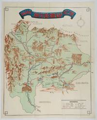
1930206841Kofu.: Onkodo Printing Co. circa1930s. Colour pictorial map 70.2 x 56 cms; 75.5 x 59.5 cms sheet light wear along the inner margin some soft creases from folding short split at center fold; in very good clean condition. An appealing and decorative map of Yamanashi Prefecture which while a process print has the attractive soft look of a lithograph adorned with vignettes of key attractions landmarks such as Mt. Fuji and industry such as silk and wine. The legend lists Railways 'Footing' Roads Hot Springs Hotels and National Parks. A scarce and attractive English language map for the tourist market. . Onkodo Printing Co., unknown
1967203843Washington D.C.: Army Map Service. 1967-1968. Five printed colour adjoining topographic maps folded legends to physical features including roads some including footpaths or trails railroads rivers streams lakes mountains boundaries and place names Route Markers Railroads airfields bridges and detailed terrain a few including tea plantations rice fields coffee and rubber plantations. glossary of Vietnamese terms in very good unused condition: <br> <br>1. Special Use S.E. Asia. Xuat-Banlan Thu. Sheet 6026. Series L607. <br>Map 57.3 x 73 cms sheet inset map of Hon Khoai Island; <br> <br>2. Special Use S.E. Asia. Sheet 5927. Series L607. Khoang Cach Deu Vong Cao-DQ. <br>Map 72.3 x 57.3 cms sheet. he Viet Cong stronghold of Quan Long Cà Mau is shown; <br> <br>3. Special Use S.E. Asia. Sheet 6027. Series L607. Vietnam. <br>Map 72.3 x 57.3 cms sheet legend showing boundaries villages elevation and hydrographic data glossary of Vietnamese terms in very good unused condition. Southeast Vietnam and the Mekong delta. The town of Vĩnh Lợi Bạc Liêu is at the mid right edge of map.; <br> <br>4. Special Use S.E. Asia. Sheet 6028. Series L607. Vietnam. Do Cao Toi-da Duoi 5 met. <br>Map 54.5 x 54.5 cms 73.3 x 56.6 cms sheet; <br> <br>5. Special Use S.E. Asia. Sheet 5928. Series L607. Vietnam. Hon Rai. <br>Map 55 x 55 cms 74.3 x 56.7 cms sheet inset map of Hon Rai. <br>The caption has the note: "Dense forest or jungle indicates more than 25% of ground is concealed by canopy with undergrowth generally impassable on foot". Detailed topographic maps in unusually fine condition of Central and Southern Vietnam issued during the Vietnam War by the United States Corps of Engineers. . Army Map Service. unknown
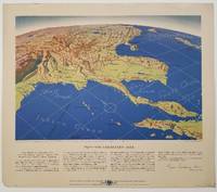
1944200808Remington Rand. 1944. Five printed colour maps each: 31.4 x 47 cms; 46.3 x 53.3 cms sheet central fold marginal edge wear chips and a few small edge tears tidemark affecting the ocean at the outer edge of Map VII but all the maps in very good condition. From a series of World War II battlefront maps "for the delight of arm-chair strategists" published by the Library Bureau of Remington Rand seven were published. Taken from a bird's eye view of the globe and with relief artistically rendered by artist Kenneth Thompson 1907-1996 and descriptive text by George Fielding Eliot 1894-1971. Eliot spent his youth in Australia attending Melbourne University serving with distinction in the Australian Infantry in WWI. Moving to the United States after a short stint in Canada serving with the RCMP her served as a reserve officer in the U.S. Army reserve in military intelligence from 1922 to 1933 and during WWII Eliot famously broadcast the first extended television coverage following the attack on Pearl Harbor. He continued to write books and articles about military strategy and world politics into the 1960s. <br> <br>In keeping with the "aviation-age" cartography of Richard Edes Harrison the unusual perspective of the maps--from above and often with a direction other than north at the top of the map--challenges the viewer to reconsider the geopolitical situation with the text of Eliot as a further prompt his captions below: <br> <br>Map III Italy & South France "Hannibal Caesar and Napoleon made their reputations here" <br>Map IV The Western Front "Will the cockpit of 1918 see the decisive battles of 1944" <br>Map V Southeastern Asia "The road to Mandalay -- and to China --along which bombs for Tokyo must travel" <br>Map VI The Southwest Pacific "Island-hopping toward Japan -- in short and long hops" <br>Map V11 The North Pacific "Here the enemy trusts in the protection of vast ocean distances" . Remington Rand. unknown