491 résultats
19962092902143902049Shunju-sha 1996. Soft Cover. Fine. Number of books: 1 book Shunju-sha paperback
19962092902143802085Shunju-sha 1996. Soft Cover. Fine. Number of books: 1 book Shunju-sha paperback
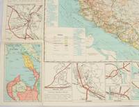
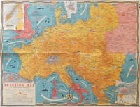
1944206781Toronto.: C.C. Petersen. 1944. Colour pictorial map 51 x 67 cms two small inset maps of Scandinavia and the Baltic and South Greece and the Dodecanese on the verso a black and white world map showing the Pacific Theatre marking keys events of the war and in European world history folding into the original pictorial pocket a little toned and marked 25.8 x 17.7 cms small fold split but in very good condition. A scarce map in the "Dated Events" series published by C.C. Petersen in Canada and distributed throughout North America commemorating D-Day. The colour map by Stanley Turner encompasses the area from England as far south as the French border with Spain and as far east as the USSR and Turkey. "With this invasion map you will be able to follow the progress of the Allied troops on their way to smash Germany.". The text at lower left goes on to elaborate on the features shown on the map from elevation "major battles are seldom fought on the tops of mountains" to pictographs of bombs falling. <br> <br>The black and white map on the verso shows the Far Eastern theatre of war centring on the Pacific Ocean with the Asian landmass including India and the USSR at upper left Australia at lower left and North America and the coast of South America at right of the map. Naval bases are shown and significant events in the war are noted in text boxes. <br> <br>A handsome production of a scarce map rarely seen with the original pictorial pocket. . C.C. Petersen. unknown
19722090202122600218Not Available 1972. Soft Cover. Fine. The book is in fine condition. Not Available paperback
192859837Chicago IL: The Austin-Western Road Machinery Co. 1928. Oblong 4to. 11.2 x 8.25 in. 60 pp. Colour-tinted decorated title colour-tinted borders throughout some illustrations w/ colour-tinting 100s of photo & text illustrations some full page. Colour-illustrated softcovers cover art illustration of beautifully built highway with towering trees and Austin-Western road grader smoothing road in front of picturesque bungalow w/ mountains in the distance minor shelfwear rubbing still NF copy w/ promotional sheet detailing the equipment in this catalogue on Austin-Western Road Machinery Co. letterhead. First edition of this scarce catalogue of equipment which played a crucial role in road building driven by the Good Roads Movement during the opening decades of the 20th century. At the end of the 19th century less than 50% of roads within American cities were paved and the very few highways and turnpikes connecting cities and towns were little more than crushed rock macadam dirt roads or even paths. Sidewalks were nearly unknown and unlike Europe road construction was not primarily managed by national or local governments. Although founded in the 1880s by bicycling enthusiasts the Good Roads Movement at the beginning of the 20th century began to be driven largely by advocates of the automobile. In 1901 the F.C. Austin Manufacturing Co. and the Western Wheeled Scraper Co. which had been fierce competitors formed a selling corporation known as Austin-Western Road Machinery Co. The company specialized initially in building scrapers but during the opening decades of the 20th century began producing wheel graders patrol graders self motor graders snow plows rollers dump wagons gutter cleaners and even asphalt hot patch outfits all shown in this catalogue. In 1916 just 12 years before President Wilson had signed the Federal Aid Road Act enabling America to embark on a truly national highway and road construction campaign that continued to the end of the 1920s. No copies located in Worldcat; See: Austin-Western Road Machinery Grader History 2017; Thomas Berry Austin-Western Road Machinery Company 1905-1936 Historical Construction Equipment Association 2005. The Austin-Western Road Machinery Co., paperback
1980KOS00600224Taisho Nichinichi Shimbun 1980. Soft Cover. Fine. KOS00600224 Taisho Nichinichi Shimbun paperback
1998x-0471977136John Wiley & Sons Inc 1998. Hardcover. New. 194 pages. 9.00x6.00x0.75 inches. John Wiley & Sons Inc hardcover
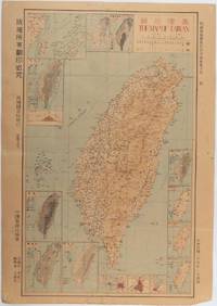
1945215871Taiwan.: 禹甸圖書局. Yudian tushuju. 1945. 1945 Ministry of Interior map of Taiwan published in the 34th year of the Republic of China with inset title and key top right. Romanised Japanese names for some areas and cities written in capital letters on main map which is surrounded by 15 small inset maps at edges each with its own scale. Paper browned wear at folds and edges repaired with archival washi on reverse some light stains and a few marks. 1 x 3cm chip bottom right corner. 77.4 x 54 cm. Text in traditional Chinese characters. Inset maps show clockwise from right edge; 1. Distribution of inhabitants according to ethnic background or minority group 2. Qing Dynasty prefectures and counties 3. Japanese administrative regions during the occupation 4. Strategic industrial and military places three city maps - 5.Chilung or Keelung port 6. Taipei city and 7. Tainan city 8. Geological formations 9. agricultural metallurgical and mineral products 10. Soil types 11. Topography of the island including sea currents and altitude diagram 12. Taiwan's position in relation to the mainland coast provinces of Fujian and Zhejiang as well as the Liuqiu Ryukyu Islands including Okinawa 13. Okinawa detail 14. Climate and rainfall in January 15. Climate and rainfall in July. . 禹甸圖書局. [Yudian tushuju]. unknown
1962174808Kuala Lumpur.: Survey Department Federation of Malaya. 1962. Very attractive large coloured folding map 108 x 83cm showing all the major hotels and rest houses throughout the country. Coloured references show rubber rice coconut and oil palm areas pineapple and miscellaneous cultivation areas mining land jungle built-up areas and shopping centres along with major features such as rivers principal roads minor roads and cart tracks railways lighthouses district state and international boundaries and triganometrical stations with heights. Scale 18 miles to an inch mile. Two inset maps of Northern Malaya and South Western Malaya are 9 miles to an inch. There are smaller inset maps of Ipoh; Malacca Singapore & Johor Bahru Penang Sungei Patani Kuala Lipis Kuantan Alor Star Kota Bharu Petaling Jaya Seremban Klang Batu Pahat Muar Segamat Johore Bahru and a small inset map of Malaya and adjacent territories. There is a large black & white table of approximate mileages. When folded the map is encased in the original printed manila covers measuring 21 x 14cm with a printed price of $2.50. A crisp bright map in very good condition. Survey Department Federation of Malaya No. 23. . Survey Department Federation of Malaya. unknown
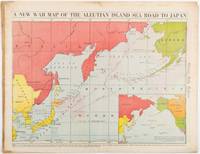
1942206849Chicago.: Chicago Daily Tribune. 28 January1942. Printed colour map 40.3 x 53.6 cm; 46.5 x 60 cm sheet inset map of the North Pacific back cover from a section of the Chicago Daily Tribune newspaper pages 21-34 January 28 1942; central fold edgewear and browning with a few minor tears not affecting the map in very good condition. Based on a Rand McNally map and issued less than two months after the bombing of Pearl Harbour by the Japanese. The Tribune briskly got to work issuing maps for readers showing the beginnings of the war with Japan. Later maps were also published for sale separately but remarkably few have survived. The map shows "the nearness of our Aleutian Island chain west of Alaska to the islands of Japan. At Dutch Harbor and other points in the Aleutians are actual and potential sea and air bases lying on the shortest route from northwestern United States to Japan." The inset map at lower right situates the areas in the larger map in respect to the countries bordering the North Pacific Ocean. <br> <br>Included with the map is the complete newspaper section from which it is the final full page. Covering sport and the market with half a dozen popular comic strips including "Dick Tracy" and "Little Orphan Annie" it shows a domestic United States a world away from what had been seen as a European War. <br> <br>". the historic Chicago Tribune was an innovator in color inks and printing but also a pioneer in bringing colorful art in the form of illustrations photographs cartoons and advertisements to the average person in an everyday medium." see The Janet A. Ginsburg Chicago Tribune Collection Michigan State University Libraries." . Chicago Daily Tribune. unknown
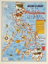
1945204557U.S.A.: Mem-O-Map Co. 1945. Colour pictographic / pictorial map 32.1 x 23.8 cms; 35.4 x 26.6 cms sheet very good condition. Rare pictorial map published in 1945 by John G. Drury aTechnical Officer who served with the 214th Ordnance Battalion to mark the end of World War II as souvenirs for the military. Military personnel could fill in banners "came in on good ship." and "departed on good ship." their name organisation and "Line of Advance or movement" blank in this example. Pictographs mark various memorable spots and wildlife including larger-than-life insects. A "Terrible Tillie Typhoon" looms over the coast at Luzon. <br>Drury published a series of five maps: Philippines and Okinawa in 1945; Japan and Korea Oahu and Europe in 1946. They are all scarce. “These almost whimsical maps are designed to support the creation of personalised geographies. At a time when digital mapping is beginning to experiment with the creation of personalised content that would render the same map in different ways for different users Mem-O-Maps demonstrate the principle in action." Kenneth Field ICA Commission on Map Design. . Mem-O-Map Co. unknown
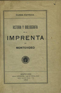
191235822Montevideo: Libreria Cervantes 1912. First edition. Cloth. A very good copy original wrappers lightly worn. 318 pp. Sm. 4to. Palau 84328. Jones 2829. Libreria Cervantes hardcover
1992047410Pachuca Mexico: Consejo de Recursos Minerales 1992 Book. As New. Hardcover. 1st US Ed. The state of Zacatecas is one of Mexico's most historically and economically significant mining regions often highlighted in specialized geological reports including this comprehensive Geological-Mining Monograph of the State of Zacatecas with its detailed text stratigraphic charts and geological maps often in 1:250000 scale that serve as a guide for exploration and academic study of this major mining region. Published by the Consejo de Recursos Minerales now part of the Mexican Geological Survey - SGM 155 p. illus charts col large format fold out maps in rear pockets. As new except for an ownerhip stamp NOTE : Very Heavy 1.5 kg/ large format volume. 35 x24 x24 cm. Consejo de Recursos Minerales hardcover
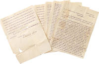
1901325474Central Valley N.Y. 1901. 5 pp. 4to. Some splitting at folds with minor loss more on last leaf. Fragile. 5 pp. 4to. Palma 1832-1908 was the president of the Cuban Republic in Arms during the Ten Years' War and the first President of Cuba between 1902-1906. He worked with José Martí to gather support for a revolution in Cuba and was the head of the Cuban Revolutionary party. He was elected while living in the United States at his homebase in Central Valley NY where he founded a multilingual co-ed private school licensed by New York State. <br /> <br /> Written to a newspaper during his presidential campaign the letter outlines the siutuation in Cuba and his hopes for the country. He was media-savy and used Hearst newspapers to spread his message and worked with the US Congress to pass a resolution renouncing the Spanish colonial hold on Cuba and announcing support for the creation of an independent Republic of Cuba. Upon his election in absentia at age 67 he returned to a Cuba from which he'd been effectively exiled a quarter-century before. He was elected to a second term in 1905 and died in 1908. unknown
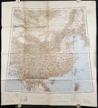
1945206545Calcutta: Compiled and drawn by the Survey of India. Second Edition. 1945. Large folding colour map 77.5 x 80cm; 95.5 x 86.2cm sheet including legend and small inset showing adjoining maps light toning and wear to upper margins and at corners and folds; but in very good condition. Very large clear map of China printed in 1945. The projection is noted as the "Lambert Conical Orthomorphic" a polyconic projection employed by the exhaustive Survey of India and the map includes surrounding countries: Taiwan Korea French Indo-China with a small inset key to Korean place-name abbreviations. As is typical of maps of this period Arunachal Pradesh is shown as Tibetan territory.The legend lists borders and provinces railways roads and canals with topography indicated with colouration. . Compiled and drawn by the Survey of India. unknown
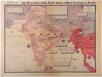
1944214362Los Angeles.: Los Angeles Examiner. April 31944. Colour pictorial map on a single newspaper leaf 37 x 50 cms; 41.5 x 54.6 cms sheet unrelated text on the verso although with an interesting account from a soldier's letter about an air raid in China toning more marked at the central fold two small splits no loss to the map edge wear with several small marginal edge tears neatly repaired on the verso with archival washi map unaffected in good condition. A dynamic map prepared and illustrated by the Examiner's art critic and editor Howard Burke covering the area surrounding India and Central Asia showing Japanese conquered territory in Malaya Thailand Indo-China and Burma; and in India British-controlled states and native feudal and protected states. <br> <br>Text boxes and pictographs give an overview of the geopolitical situation from the Allied perspective. One box notes "Chanda Bose has many adherents and fanatical followers in Bengal. They may prove to be a powerful fifth column in India". Text at lower edge opines "The situation in India is critical and has grown more so as the all-out offensive against Japan has been delayed. If the Allies do not act at once and with great force all our gains may be wiped out and the war in the Pacific prolonged indefinitely." <br> <br>The decisive and devastating bombings that were to signal such an end were four months away. <br> <br>Rare on the market. . Los Angeles Examiner. unknown
1996__0471960128John Wiley & Sons Inc 1996. Hardcover. New. 1st edition. 375 pages. 9.50x6.25x1.00 inches. John Wiley & Sons Inc hardcover
1986x-9061935431Dr W Junk Pub Co 1986. Hardcover. New. 406 pages. 11.34x8.58x1.10 inches. Dr W Junk Pub Co hardcover
1996DADAX0471960128Wiley 1996-04-19. 1. hardcover. New. 6.26x1.13x9.09. Buy with confidence. Excellent Customer Service & Return policy. Wiley hardcover
1981mon0000977443Ross Erikson 1981T. paperback. Very Good. 0.7008 in x 8.9016 in x 5.7008 in. Rubbing on front cover. Water marks on spine and small part of back cover. Ross Erikson paperback
19992080302106809654Toei Kawagoe Road Residential Ruins Survey 1999. Soft Cover. Fine. Number of books: 6 Toei Kawagoe Road Residential Ruins Survey paperback
19702091202133106272Ministry of Construction Road Bureau Kinki Regional Construction Bureau 1970. Soft Cover. Fine. Number of books: 2 Ministry of Construction Road Bureau Kinki Regional Construction Bureau paperback
195676405San Jose: H.M. Gousha Co. on or before 1956. First edition of this gathering. Folio 13 1/4 x 18 inches. 62 unused road maps in color and with inserts each neatly divided by side tabs. All maps bound on stubs. Original red cloth portfolio with flap and snap fasteners the Shell logo stamped on front cover some soiling or darkening to extremities. The portfolio has some expected wear but the maps are fresh and clean. Shell maps of this era are notable for their high-quality cartography colorful graphics and often included travel tips local advertisements and information about Shell services. None located by OCLC. Harry Mathias Gousha a former Rand McNally went independent in 1926 and relocated to California in 1947. It was a propitious time as the 50s in most respects witnessed the onset of the great American phenomenon of the Road Trip. With the improvement in cars longer and longer trips became feasible. None of the great Interstates as we know them today were in existence at that time so road maps were essential for any successful road trip. The H.M. Gousha Company was one of the "Big Three" major producers of road maps and atlases in the United States during the 25 years following World War II General Drafting and Rand McNally were the other two. Shell maps of this era although free are notable for their high-quality cartography colorful graphics and often included travel tips local advertisements and information about Shell services. The H. M. Gousha Company produced millions of oil company road maps used as marketing tools distributed at no charge at gas stations by customers that included Gulf Oil Conoco Shell Standard Oil and dozens of others. Though most Gousha maps were produced for oil companies many others were issued for customers not related to the petroleum industry including automobile clubs state governments banks and realtors. Ironically the company was purchased by Rand McNally in 1996. H.M. Gousha Co. hardcover
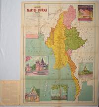
1951214601Delhi.: S.B. Makhija & Brothers. circa1951. Printed colour map 98.6 x 69 cms folding into pictorial wrappers 25.3 x 19.5 cms five pictorial colour inserts of pagodas and the Shwethalyaung reclining Buddha wrappers a little chipped marginal wear and three small fold splits in the map but overall in very good condition. Attractive large map of Burma with the provinces coloured steamship routes shown in red and printed in the booklet a range of information printed based on the 1951 census including climate agriculture and form of government "Burma became an independent nation completely outside the British Empire on January 4 1948 and is now a sovereign independent republic known as the Union of Burma". . S.B. Makhija & Brothers. unknown
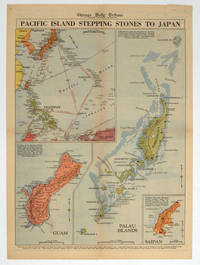
1944208880Chicago.: Chicago Daily Tribune. 28 September1944. Colour pictorial map on a single newspaper leaf archivally laid down on linen 50 x 39.2 cms; 59.3 x 43.3 cms sheet including captions faint toning to fold lines very good condition. Vivid colour maps of the Palau Islands Guam and Saipan in the Marianas and an inset location map published in the "Chicago Daily Tribune" in September 1944 months after the landing of US and Allied Forces in the offensive against the Japanese during the Pacific War. . Chicago Daily Tribune. unknown