Biblio.com
491 résultats
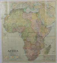
1922175918Washington D.C.: National Geographic Society. 1922. Large folding printed colour map 77.2 x 69.4 cm small inset map of Cape Verde Island note to the transliteration of place-names reference key to railways caravan routes as well as river systems waterways and deserts legend to Colonial or territorial control original folds slight toning in very good condition. Attractive large-scale map with countries and territories coloured according to the controlling colonial power. . National Geographic Society. unknown
19822092902141202343Shanhai shoten 1982. Soft Cover. Fine. Volume: 1 Shanhai shoten paperback
193872459Chicago: Rand McNally & American Hotel Register Co. 1938. First edition of this merging of two American atlases. Folio 10 1/2 x 16 inches. The Rand McNally section is pp. 1-52 at the beginning and pp. 52-105 at the end. All maps printed in blue and red. The Leahy section starts in the middle and runs from p. 1 to p. 112 and with two more pages. These maps are entirely printed in black and much of the section is take up with listing for hotels in various states. Publisher's green cloth with gilt cover lettering Leahy's. The text block was originally stapled into the covers but has since come loose from the staples but the text block is entirely secure. A very good copy of an unusual publication.As both companies were headquartered in Chicago it is easy to imagine a friendly lunch at which this was discussed. Rand McNally & American Hotel Register Co. hardcover
195676405San Jose: H.M. Gousha Co. on or before 1956. First edition of this gathering. Folio 13 1/4 x 18 inches. 62 unused road maps in color and with inserts each neatly divided by side tabs. All maps bound on stubs. Original red cloth portfolio with flap and snap fasteners the Shell logo stamped on front cover some soiling or darkening to extremities. The portfolio has some expected wear but the maps are fresh and clean. Shell maps of this era are notable for their high-quality cartography colorful graphics and often included travel tips local advertisements and information about Shell services. None located by OCLC. Harry Mathias Gousha a former Rand McNally went independent in 1926 and relocated to California in 1947. It was a propitious time as the 50s in most respects witnessed the onset of the great American phenomenon of the Road Trip. With the improvement in cars longer and longer trips became feasible. None of the great Interstates as we know them today were in existence at that time so road maps were essential for any successful road trip. The H.M. Gousha Company was one of the "Big Three" major producers of road maps and atlases in the United States during the 25 years following World War II General Drafting and Rand McNally were the other two. Shell maps of this era although free are notable for their high-quality cartography colorful graphics and often included travel tips local advertisements and information about Shell services. The H. M. Gousha Company produced millions of oil company road maps used as marketing tools distributed at no charge at gas stations by customers that included Gulf Oil Conoco Shell Standard Oil and dozens of others. Though most Gousha maps were produced for oil companies many others were issued for customers not related to the petroleum industry including automobile clubs state governments banks and realtors. Ironically the company was purchased by Rand McNally in 1996. H.M. Gousha Co. hardcover
19802110502150415153chance comic company 1980. Soft Cover. Fine. Volume: 1 chance comic company paperback
19602110502150410278Ie no hikari kyokai 1960. Soft Cover. Fine. Volume: 1 Ie no hikari kyokai paperback
19642110502150415295Futabasha 1964. Soft Cover. Fine. Volume: 1 Futabasha paperback
19872090502113716658Not Available 1987. Soft Cover. Fine. The book is in fine condition. Not Available paperback
19912090502113716694Not Available 1991. Soft Cover. Fine. The book is in fine condition. Not Available paperback
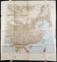
1945206545Calcutta: Compiled and drawn by the Survey of India. Second Edition. 1945. Large folding colour map 77.5 x 80cm; 95.5 x 86.2cm sheet including legend and small inset showing adjoining maps light toning and wear to upper margins and at corners and folds; but in very good condition. Very large clear map of China printed in 1945. The projection is noted as the "Lambert Conical Orthomorphic" a polyconic projection employed by the exhaustive Survey of India and the map includes surrounding countries: Taiwan Korea French Indo-China with a small inset key to Korean place-name abbreviations. As is typical of maps of this period Arunachal Pradesh is shown as Tibetan territory.The legend lists borders and provinces railways roads and canals with topography indicated with colouration. . Compiled and drawn by the Survey of India. unknown
192063120Chicago: White Pass & Yukon Route Rathbun-Grant-Heller Co. ca. 1920. 8vo. 4 x 9 in. 16 pp. in 46 2 triple-column format on 9 x 12 in. sheets with numerous photo illustrations double-column route map w/ White & Pass & Yukon line logo. Self-printed softcovers beautiful cover art of Alaskan Native Americans in canoe watching a Yukon River steamer minor shelfwear some rubbing still VG copy. First edition thus of this very scarce travel brochure detailing the trip by steamship and railroad along the White Pass & Yukon Route from Skagway Alaska through Ketchikan Atlin Lake district and through the Skagway Valley to Dawson City on the Yukon River Yukon Territory. White Pass & Yukon Route, Rathbun-Grant-Heller Co., paperback
192846131Chicago: Poole Bros. Inc. 1928. Oblong 16mo. 59 1 pp. Photo illusts. 1 map. Photo-illust. self-printed wrappers slight shelfwear NF copy stapled as issued. First edition thus of this travel brochure detailing the trip by steamship and railroad along the White Pass & Yukon Route from Skagway Alaska to Dawson City on the Yukon River Yukon Territory. Poole Bros., Inc., unknown
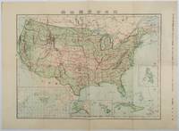
1911179415Tokyo.: 楠山正雄. Kusuyama Masao. Meiji 44 1911. Colour folding map 40 x 55cm inset maps showing the Philippines Alaska and Hawaii very good copy. This map was a supplement of October 1911 issue of a monthly magazine Shin Nippon 新日本 which was published between 1911 and 1918. The main map covers the contiguous United States with inset maps of the world showing the American territories of Alaska Hawaii and the Philippines. Curiously Cuba has been marked as an American territory having been directly occupied from 1906 to 1909 though at the time still beholden to the 1903 Cuban-American Treaty of Relations. . 楠山正雄. [Kusuyama Masao]. unknown
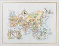
1964195995Pan American World Airways. 1964. Colour pictographic/pictorial map of Asia 23.2 x 30.1 cms gilt double-rule border printed on a folding decorative menu card 32 x 50 cms open highlighted in gilt text in English French and Japanese central fold and later central vertical crease in very good condition. Pan Am menu card for First Class passengers dubbed "The President Special" the deluxe cuisine by fabled Maxim's of Paris "Good food is the basis for true happiness". Passengers were feted with gourmet meals on bone china with silver cutlery. The witty pictorial cover-map of Asia was by French artist and commercial illustrator Jacques Liozu 1910-1974 also known for his larger scale maps. . Pan American World Airways. unknown
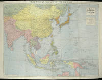
1940205763London.: Hutchinson & Co. Circa1940. Full colour folding map 70.7 x 93 cms; 76 x 101.2 cms sheet original folds short fold splits previous owner's neat title markings on the verso but the map in very good condition. A "Geographia" map of the war theatre in Asia and the Pacific including the northernmost coast of Australia. Showing railways and canals roads and steamer routes oilfields and pipe lines and a key to the unfederated states of Malaya. The Spratley Islands are marked as French and Thai territorial claims within French Indo China are marked. . Hutchinson & Co. unknown
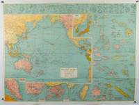
1945180206Sydney.: H.E.C. Robinson. Circa1945. Full colour inset maps principal cities and towns marked shipping routes international boundaries and railways. 99 x 73cm. Some small insect damage has been repaired on the verso visible on map as a few small lighter areas in the western Pacific. Pinpoint holes at folds paper repair along cover but a very good clean copy. From the Sydney publisher H.E.C. Robinson the firm founded in 1895 by Herbert Robinson 1857-1933 a founder of the Royal Geographical Society of Australasia. <br> <br>Although the map is undated North and South Korea are shown as divided which occurred in late 1945 and Manchuria is marked as still under Soviet occupation which only lasted until 1946 at which point it was handed over to Communist China. <br> <br>As well as what now would be considered Southeast Asia the main map shows the eastern half of India Tibet and parts of Mongolia the USSR and East Asia. Inset maps include: Caroline Islands Marshall Islands Federation of Malaya Singapore Hong Kong Taiwan Japan Hawaiian Islands Philippine Islands Midway Gaum and Wake Islands Fiji Islands Eastern & Western Samoa Santa Cruz and Solomon Islands New Caledonia Rabaul Tahiti Lord Howe etc. . H.E.C. Robinson. unknown
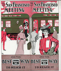
190151617N.P.: Privately printed 1901. 1901. 9 1/4" x 8" in clorful pictorial wrapper folded at center. 12 pp. Illustrations. Schedule. Overview of San Francisco along with information on its climate Chinatown The Cliff House Golden Gate Park Sutro Baths and Museum Nob Hill and side trips from San Francisco to include brief information on Monterey San Jose Paciic Grove Lake Tahoe Los Angeles etc. Information on the Burlington Route train and its railroad cars. Finally a schedule for the trip from Omaha .by way of Denver and Salt Lake City and onto San Francisco. Light soiling and light wear to the extremities. Very good. Privately printed, 1901. unknown
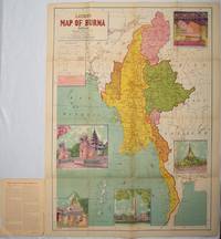
1951214601Delhi.: S.B. Makhija & Brothers. circa1951. Printed colour map 98.6 x 69 cms folding into pictorial wrappers 25.3 x 19.5 cms five pictorial colour inserts of pagodas and the Shwethalyaung reclining Buddha wrappers a little chipped marginal wear and three small fold splits in the map but overall in very good condition. Attractive large map of Burma with the provinces coloured steamship routes shown in red and printed in the booklet a range of information printed based on the 1951 census including climate agriculture and form of government "Burma became an independent nation completely outside the British Empire on January 4 1948 and is now a sovereign independent republic known as the Union of Burma". . S.B. Makhija & Brothers. unknown
192544354Chicago IL: Engineering and Contracting Publishing Co. 1925. 4to. 320 pp. 100s of photo illusts. diagrams text illusts. Embossed & decorated gray cloth lettering & decorated border red & black lettering on spine minor shelfwear light rubbing to corners VG copy w/ former ownership markings on ffep. First edition numbered on verso of title of this fascinating work illustrating the equipment and materials needed to build the roads and highways in the early automobile era. Included are asphalt companies oil burning equipment for road building and repairs expansion joint steel fencing companies steam rollers graders cranes excavators and much more. Engineering and Contracting Publishing Co., hardcover
193358148Chicago: Chicago Burlington & Quincy Railroad Printed by Poole Bros. Inc. 1933. Tall 8vo. 4 x 9 in. which folds out into 8 x 9 in. 4to. 20 pp unpaginated illustrated & printed in red & black throughout numerous photo illustrations text illustrations 1 double-page maps 1 double-page. Colour-illustrated softcovers cover art on front of the Hall of Sciences back cover w/ pictorial map of Burlington Routes slight shelfwear NF copy. First edition of this very scarce promotional brochure advertising the low round trip rates being offered by the Burlington Route for tourists to the 1933 Chicago World’s Fair. Detailed descriptions are included of the Exposition exhibits a birds-eye view of the Century of Progress grounds amenities in Chicago and the Travel & Transport Building which held a special Burlington Route exhibit. Kaufmann & Fabry was an active commercial photographic firm specializing in architectural photography in Chicago from before 1910 and are still in existence. No copies located in Worldcat. Chicago, Burlington & Quincy Railroad, [Printed by Poole Bros., Inc.,] paperback
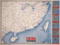
1945194660New York.: Army Information Branch. Volume III No. 51F. 9 April1945. Folding colour map and six inset maps in a vertical panel 88 x 119 cms sheet and on the recto circular map of Europe smaller inset map of Asia and of the Ryukyu Islands descriptive text original folds in very good bright condition. Scarce Newsmap of "China Southeast Coast" from Shanghai to French Indochina with the islands of Formosa and Hainan. At the right edge are inset maps of the vicinities of Shanghai Wenchow Foochow Swatow Canton and Hong Kong. On the verso is a large map of the European theatre of operations centred on Berlin a map of the Pacific area noting the American occupation of Okinawa with a detailed map of this island. In unusually fine bright condition. . Army Information Branch. unknown
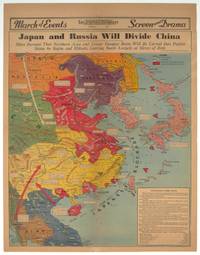
1940209821Los Angeles.: Los Angeles Examiner. 1940. Printed colour pictorial map on a single newspaper leaf 42.3 x 39.9 cms; 54.3 x 42.5 cms sheet archivally laid down on linen slight discoloration to lower centrefold and sheet slightly age-toned but in very good condition. A striking geopolitical map by Los Angeles Examiner artist Howard Burke covering China Japan Southern Russia and the northern part of French Indochina and Siam showing how the "Aggressors Divide China." Areas under Japanese occupation are shown in red and their naval blockade shown by an arc of naval vessels with vivid arrows indicating lines of supply. Text labels including sources of agricultural and raw materials provide a dynamic overview of the geopolitical situation and show the influence of American scientific illustrator and cartographer Richard Edes Harrison who argued for examining geographic issues from multiple perspectives and Los Angeles Times artist Charles Owens. . Los Angeles Examiner. unknown
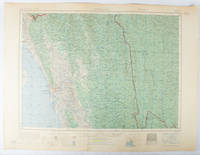
1955173072Washington D.C.: Army Map Service U.S. Army. 1955. Large colour map. 1:250000 scale. Transverse mercator projection. 23°00'N 91°30'E-22°00'N 93°00'E. Series U502 Sheet NF 46-6 Edition 1-AMS. Map measures 57.3 x 75.8cm. Slight wear creasing even light browning small closed tears on edges upper-right corner little foxed. Shows signs of use but map is clean and complete. Corps of Engineers Army Map Service map of Chittagong and surrounds compiled in 1955. Based on the British Indian one-inch and half-inch map series from 1938-43 and 1936-43 respectively. . Army Map Service, U.S. Army. unknown
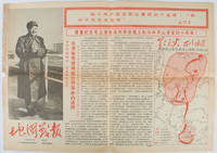
1967169746Beijing.: 地图戰報.Di tu zhan bao. September1967. Maps printed in red and black single sheet printed on both sides folded scale not given photographic image of Mao Zedong. Some light browning at edges with tears and losses on left edge still good. Text in Chinese. Sheet measures 26.5 x 38.4cm. Includes a map of Autumn Harvest Uprising and also shows the routes of the military advancing towards Jinggangshan between September and October 1927. On reverse left section a map shows the route along which Chairman Mao led the Fourth Army of the Chinese Red Army marching towards south of Anhui and Jiangxi Provinces in 1929. On reverse right section a map titled "The Long March of The Chinese Workers' and Peasants' Red Army October 1934-October 1935". Quotations of Chairman Mao about the Long March insert on corners of the map. <br> <br>Issue no. 6 of a series of maps with text issued by the Red Guards organisations in the form of Cultural Revolution tabloid-sized newspaper. This issue is designed to celebrate the 40th anniversary of the Autumn Harvest Uprising which was one of the earliest armed uprisings organised by the Chinese Communist Party. . 地图戰報.[Di tu zhan bao]. unknown
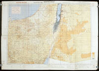
1942207841London.: Royal Engineers. July1942. Printed colour topographical map mounted on linen 56.7 x 79.2 cms; 64.6 x 89. 5 cms sheet original folds edgewear small marginal chips a little dusty but in good condition. Detailed World War II operational map of Egypt and the Middle East issued by 512 Army Field Survey Company of the Royal Engineers. The map is marked "Not to be Published" in the upper right margin. Railways roads camel tracks telegraph lines boundaries altitudes towns and villages are marked. . Royal Engineers. unknown