York and Cumberland Rail Road CoBiblio.com
WELLER, EDWARD (1819-1884).Biblio.com
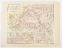
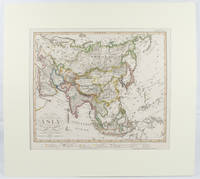
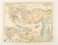
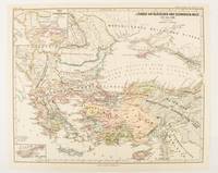
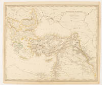
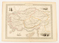
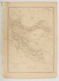
Persia. Map.
1863177017London.: Cassell Petter and Galpin. circa1863. Engraved map 43.1 x 30.3 cm 50.7 x 34.5 cm sheet central fold small edge tears one neatly repaired lower corner chipped slight age toning but in very good condition. Impressive large map of Persia Iran by noted map maker Edward Weller in original uncoloured state re-issued by the publisher for inclusion as map 26 in Cassell's Atlas. . Cassell, Petter and Galpin. unknown
Asia Bookroom · Australie175,00 $AU≈ 115,34 €