Route Guide and AtlasBiblio.com

491 résultats
194073060AB1940. London Geographia No Date c.1940. 10 cm x 15 cm. 40 Pages. Original Softcover. Excellent condition with only very minor signs of external wear. Covers slightly stained by water. Some traces of rust through pages. Includes for example the following essays: 15 Special Maps of 100 Miles Round London / Comprehensive Guide to 149 Routes / Index to Routes of 100 Miles Round London. paperback
19092111902160200634Higashi-Tsukima-gun Office 1909. Soft Cover. Fine. Volume: 1 Higashi-Tsukima-gun Office paperback
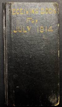
1914H23063Pittsburgh: Pennsylvania Rail Road Employee 1914. Hardcover. Good. Cloth backed boards 7.5 x 4 inches good. Titled "Receiving Book for July 1914" the employee who kept these records is not noted but is based in Pittsburgh. Approximately 75 pp. filled in in pencil for the most part detailing the date particular number of the train what was received sometimes the quantity & measurements with lot numbers assigned and to whom the items were going. General wear to binding recent cloth over spine. Pennsylvania Rail Road (Employee) hardcover
19912090202118107456Shueisha Young Jump Comics 1991. Soft Cover. Fine. The book is in fine condition. Shueisha Young Jump Comics paperback
19952090202118100515Nihonbungeisha 1995. Soft Cover. Fine. The book is in fine condition. Nihonbungeisha paperback
19842080502106504165Not Available 1984. Soft Cover. Fine. Volume: 1 Not Available paperback
199715772JOsceola Wisconsin: Motorbooks Internationa 1997. First Edition. First Printing. From the collection of motor sport photographer Jesse Alexander with a certificate of authenticity laid in. On page 67 is a very atmospheric full page color photograph by Jesse Alexander which is a close up of a driver in helmet which had been published in the magazine in May 1971. The caption below reads “This character shot was used to inspire readers to enter the ‘Road & Track Photography Contest’. It worked: More than 10000 photos were submittedâ€. 264 pages. Large coffee table book filled with numerous color photographs. Fine copy in a bright dust jacket Motorbooks Internationa unknown
19972110502150900800Japan Road Association 1997. Soft Cover. Fine. Volume: 1 Japan Road Association paperback
193358148Chicago: Chicago Burlington & Quincy Railroad Printed by Poole Bros. Inc. 1933. Tall 8vo. 4 x 9 in. which folds out into 8 x 9 in. 4to. 20 pp unpaginated illustrated & printed in red & black throughout numerous photo illustrations text illustrations 1 double-page maps 1 double-page. Colour-illustrated softcovers cover art on front of the Hall of Sciences back cover w/ pictorial map of Burlington Routes slight shelfwear NF copy. First edition of this very scarce promotional brochure advertising the low round trip rates being offered by the Burlington Route for tourists to the 1933 Chicago World’s Fair. Detailed descriptions are included of the Exposition exhibits a birds-eye view of the Century of Progress grounds amenities in Chicago and the Travel & Transport Building which held a special Burlington Route exhibit. Kaufmann & Fabry was an active commercial photographic firm specializing in architectural photography in Chicago from before 1910 and are still in existence. No copies located in Worldcat. Chicago, Burlington & Quincy Railroad, [Printed by Poole Bros., Inc.,] paperback
20002091502133905460Kei Jin bunka-sha 2000. Soft Cover. Fine. Volume: 1 Kei Jin bunka-sha paperback
192846131Chicago: Poole Bros. Inc. 1928. Oblong 16mo. 59 1 pp. Photo illusts. 1 map. Photo-illust. self-printed wrappers slight shelfwear NF copy stapled as issued. First edition thus of this travel brochure detailing the trip by steamship and railroad along the White Pass & Yukon Route from Skagway Alaska to Dawson City on the Yukon River Yukon Territory. Poole Bros., Inc., unknown
19892092902141201713shaanxi people 1989. Soft Cover. Fine. Volume: 1 shaanxi people paperback
19752080302106807157arrow publisher 1975. Soft Cover. Fine. Number of pages: 270 pages Size: B6 size Number of books: 1 volume arrow publisher paperback
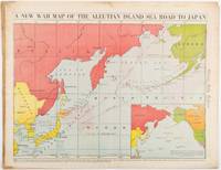
1942206849Chicago.: Chicago Daily Tribune. 28 January1942. Printed colour map 40.3 x 53.6 cm; 46.5 x 60 cm sheet inset map of the North Pacific back cover from a section of the Chicago Daily Tribune newspaper pages 21-34 January 28 1942; central fold edgewear and browning with a few minor tears not affecting the map in very good condition. Based on a Rand McNally map and issued less than two months after the bombing of Pearl Harbour by the Japanese. The Tribune briskly got to work issuing maps for readers showing the beginnings of the war with Japan. Later maps were also published for sale separately but remarkably few have survived. The map shows "the nearness of our Aleutian Island chain west of Alaska to the islands of Japan. At Dutch Harbor and other points in the Aleutians are actual and potential sea and air bases lying on the shortest route from northwestern United States to Japan." The inset map at lower right situates the areas in the larger map in respect to the countries bordering the North Pacific Ocean. <br> <br>Included with the map is the complete newspaper section from which it is the final full page. Covering sport and the market with half a dozen popular comic strips including "Dick Tracy" and "Little Orphan Annie" it shows a domestic United States a world away from what had been seen as a European War. <br> <br>". the historic Chicago Tribune was an innovator in color inks and printing but also a pioneer in bringing colorful art in the form of illustrations photographs cartoons and advertisements to the average person in an everyday medium." see The Janet A. Ginsburg Chicago Tribune Collection Michigan State University Libraries." . Chicago Daily Tribune. unknown
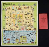
1934158433Peiping.: Peiyang Press. circa1934. Coloured folding plan of Peking with original envelope. 60 x 50cm. A few neat repairs at folds two panels evenly browned on reverse. A very good copy of a scarce pictorial plan with its envelope. This delightful and scarce pictorial map of Peking with landmarks and streets in romanised Chinese with occasional Chinese characters is surprisingly scarce. Although apparently issued in several editions in the 1920s and 30s it appears relatively infrequently on the market. The divisions of the Legation District are indicated by their flags - this edition shows the German Legation by use of the black white and red bands of the German flag. This flag which was no longer used after 1935 helps date this edition. Other landmarks and attractions shown included theatres foreign shopping area adjacent to the legations quarter Liu Li Chang Curio District the racecourse the many city gates etc. . Peiyang Press. unknown
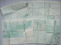
1967203843Washington D.C.: Army Map Service. 1967-1968. Five printed colour adjoining topographic maps folded legends to physical features including roads some including footpaths or trails railroads rivers streams lakes mountains boundaries and place names Route Markers Railroads airfields bridges and detailed terrain a few including tea plantations rice fields coffee and rubber plantations. glossary of Vietnamese terms in very good unused condition: <br> <br>1. Special Use S.E. Asia. Xuat-Banlan Thu. Sheet 6026. Series L607. <br>Map 57.3 x 73 cms sheet inset map of Hon Khoai Island; <br> <br>2. Special Use S.E. Asia. Sheet 5927. Series L607. Khoang Cach Deu Vong Cao-DQ. <br>Map 72.3 x 57.3 cms sheet. he Viet Cong stronghold of Quan Long Cà Mau is shown; <br> <br>3. Special Use S.E. Asia. Sheet 6027. Series L607. Vietnam. <br>Map 72.3 x 57.3 cms sheet legend showing boundaries villages elevation and hydrographic data glossary of Vietnamese terms in very good unused condition. Southeast Vietnam and the Mekong delta. The town of Vĩnh Lợi Bạc Liêu is at the mid right edge of map.; <br> <br>4. Special Use S.E. Asia. Sheet 6028. Series L607. Vietnam. Do Cao Toi-da Duoi 5 met. <br>Map 54.5 x 54.5 cms 73.3 x 56.6 cms sheet; <br> <br>5. Special Use S.E. Asia. Sheet 5928. Series L607. Vietnam. Hon Rai. <br>Map 55 x 55 cms 74.3 x 56.7 cms sheet inset map of Hon Rai. <br>The caption has the note: "Dense forest or jungle indicates more than 25% of ground is concealed by canopy with undergrowth generally impassable on foot". Detailed topographic maps in unusually fine condition of Central and Southern Vietnam issued during the Vietnam War by the United States Corps of Engineers. . Army Map Service. unknown
1995282751PN. New. 1995. Soft Cover. Date is original print. This is a reprint edition . PN paperback
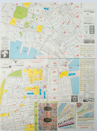
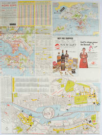
1977161880Hong Kong.: A-O-A Ltd. June/July1977. Coloured tourist maps of Hong Kong printed both sides on a sheet folded. One general area map of Hong Kong and three detailed street maps featuring Kowloon Peninsula Tsimshatsui and Central District. Generally in very good condition text in traditional Chinese English and Japanese. Sheet measures 58.2 x 43cm. The tourist maps include currency rate tourist advice advertisements for foreign and local brands and shops e.g. A-O-A Gambling Handbook for Macau Duty Free shopping centres Chinese Arts & Crafts centres acupuncture clinic etc. The maps of Central and TST have the names of many hotels businesses post offices etc marked on them. . A-O-A Ltd. unknown
1976161881Hong Kong.: Walter K. Hoffman. January/February1976. Coloured tourist map brochure of maps of Hong Kong printed both sides six maps in total folded. Brochure also includes advertisements currency rates. Minor tears along folds otherwise in good condition. Text in traditional Chinese English and Japanese. Sheet measures 58.2 x 43.4cm. Sheet includes 6 individual maps: Map of British Crown Colony of Hong Kong Map of the Urban Area with routes for public transportation Map of Tsimshatsui large scale street map Map of Central District large scale street map Map of Wanchai large scale street map Map of Causeway Bay large scale street map Map of Portuguese Overseas Province of Macau. On the maps of Central and TST the names of many businesses hotels etc are marked. . Walter K. Hoffman. unknown
2000Q-0738504734Arcadia Publishing 2000-10-14. Paperback. New. In shrink wrap. Looks like an interesting title! Arcadia Publishing paperback
2000DADAX0738504734Arcadia Publishing 2000-10-14. paperback. New. 6.50x0.30x9.25. Buy with confidence. Excellent Customer Service & Return policy. Arcadia Publishing paperback
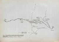
193859631Portland OR: Works Progress Administration of Oregon ca. 1938. 4to. 4 pp. 41 leaves unnumbered. including mimeograph map embossed “Mimeograph†paper watermark at fore-edges of some leaves. Contemporary quarter simulated calf over embossed “Writing Portfolio†boards fuzzy textured brown endpapers light interior uniform toning scuffing edgewear very faint off-gassing odor still VG exemplar from library of Alfred Powers. First edition of No. 5 in the Historical Records Survey of Oregon series reproducing and detailing the intricacies of the preserved original abstract of the Willamette Valley & Cascade Wagon Road Co. held in Prineville OR. WV & CWR Co. The Wagon Road co. was originally incorporated in March 1864 by Luther Elkins D.W. Balland Morgan Kees John Settle and others opening a route connecting Albany OR with the bunchgrass range in Central Oregon. The toll road was finally finished by 1868 using Chinese-American labor with Jason Wheeler overseeing construction and later J.A. White. In 1884 C.E.S. Wood began practicing law in Portland OR specializing in maritime and corporate law as well as serving as land agent for Lazard Freres the New York banking firm controlling the WV & CWR Co. wagon road grant stretching from Albany OR to the Idaho border. Subsequent to the details included in this abstract Wood would negotiate the sale of the wagon road to Louis HIll son of railroad tycoon James J. Hill and the million-dollar commission allowed him to retire and relocate to northern California with Sara Bard Field. The wagon road was converted to US Highway 20 the Santiam Highway and completed in September 1939. Worldcat locates 8 copies LA Nat Hist. Mus Boise SU OR Hist. Soc. Lib. U of W Wash State Lib. Yale OR State Lib. U of O; See: Bingham Charles Erskine Scott Wood 1990 pp. 8-9 47; See: Griffith Works Progress Administration Oregon June 1936 p. 10. Works Progress Administration of Oregon, hardcover
1997TK241448Galer¡a Jorge Mara Madrid and 7 Other Galleries 1997. 1st Edition. SOFTCOVER. Inscribed and signed by Adolfo Estrada as Adolfo on the front fly-leaf no other marks or inscriptions. Extra Large 4to. in stiff card covers with colour printed dust jacket and printed clear plastic over-wrapper unpaginated approx. 56pp on thick glossy art paper colour plates etc. Text in English German Spanish French and Portuguese __CONDITION : A well preserved AS NEW unmarked copy in an AS NEW Dust Jacket and an almost AS NEW plastic cover. An excellent copy. . To see more of our Art Monographs etc type DbbARTIST in the Keywords search box __We always ship in PROTECTIVE CARD PARCELS Galer¡a Jorge Mara, Madrid and 7 Other Galleries paperback
198020915021354142092Gatsu-sha 1980. Soft Cover. Fine. Number of books: 1 2Gatsu-sha paperback
191515663Chicago: Franklin Co. Near Fine. 1915. Soft Cover. Clean soft pictorial cover travel pamphlet. White Pass & Yukon Route. 9"x12" with two folds. Photograph illustrations. Voyage to Skaguay; Summit of White Pass; Lake Bennett; Lake Atlin; Caribou to White Horse; Lake Labarge & Five Finger Rapids; Midnight Sun; Down the Mighty Yukon to Dawson; Crossing the Arctic Circle to Fairbanks; St. Michael and Nome. Alaska; Photographs; 8vo 8" - 9" tall; 30 pages . Franklin Co. paperback