SPEED John 1551/2-162Biblio.com
121 résultats
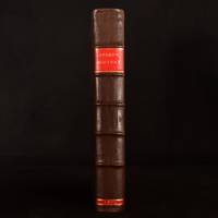
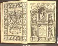
1676008029London: at the George in Fleet-street and at the Rose and Crown in St.Paul's Church-yard: Thomas Bassett & Richard Chiswell 1676. Hardcover. Very Good. Elephant Folio - over 15 - 23" tall. SPEED John. Regarded as a landmark in the history of British topography In 18 century sheep gilt edge tooling tips repaired. Re-spined to style raised bands decorative gilt tooling contemporary gilt/calf title label. Internally engraved armorial frontispiece and additional decorative title letterpress general title printed in red & black part titles to books two three and four printed in black Wales Scotland and Ireland and letterpress title to 'Prospect' also printed in black preliminary text leaves including dedication present 'A New and Accurat Map of the World.' erroneously bound in after the contents page of 'The Theatre' ninety-six complete uncoloured engraved maps 68 in the Theatre and 28 in the Prospect 16 2 126 5-6 5-8 Civil wars 10 leaves of roads 1 Scotland tp 1 129-146 pp. Prospect f the World 1676 2 3-56 pp 11 index several maps trimmed with slight loss to the strap-work margin very occasional marginal closed tears and staining lacking the maps of Berkshire Derbyshire and Shropshire but replaced with examples from the first edition of 1611 map of Derbyshire stained and toned Spain torn with loss to the upper left right corner tip Denmark torn with small area of loss to the right hand margin each map with descriptive text to the verso index bound at rear additional armorial frontispiece and decorative title trimmed to neat line and attached to recto and verso of blank leaf and additional title page both loosely inserted 18th-century bookplate of James Norman and old auction catalogue entry to the front paste down front free endpaper with ink stamp of I. Pickersgill ink name to tp Cha Hillear. 415274 mm.ESTC R13825 . Wing S4886. Chubb XXVII. John Speed's 'Theatre' is regarded as a landmark in the history of British topography. It was the first English attempt to produce a grand scale atlas including the first maps of the provinces of Ireland. The 'Theatre' evolved into a world atlas with the addition of the 'Prospect' in 1627. The 1676 edition of the Prospect includes seven new maps which were not present in the 1627 edition: Virginia and Maryland New England Carolina Jamaica and Barbados East India Russia and Canaan. Signatures: 9 B2-D2 E A F-R H1 T V-2O S1 Q2-3U -3 10 3X-3Z1 4A-4E. Prospect 1 B-2e 4f-4h2 with all maps printed on the inner forme of the register and text printed on the outer forme. <br/> <br/> Thomas Bassett & Richard Chiswell hardcover
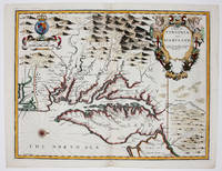
16769394London 1676. No Binding. Near Fine. 14 3/4 x 19 ¼ inches. Fine hand color; wear to bottom of centerfold else fine condition. A very attractive near-mint example. Speed's handsomely engraved work is one of the earliest English maps of the area and one of the first to demarcate the borders of colonial Virginia and Maryland. Just three years before the publication of Speed's map Augustine Herrman had conducted the first thorough surveys of Maryland at the behest of Lord Baltimore. Speed's was one of the first maps to adopt this groundbreaking cartography. However in general outline Speed still followed the prototype of Captain John Smith who conducted the first European survey of Chesapeake Bay. Speed's map "is the last major derivative of the Smith map and it is unique as an example of the transition from one basic prototype map to another. The delineation of the land area follows Smith while the toponymic prototype was the Herrman map of 1673." Verner in Tooley Mapping of America p.170 A particularly important feature derived from Herrman by Speed is the boundary line indicated by a double row of trees between Virginia and Maryland on the Eastern Shore. English text on the verso contains extensive descriptions of Virginia and Maryland. unknown
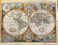
1659M9858London 1659. Very Good backed on acid free tissue paper for long term preservation. Notes: Scarce third state of Robert Walton's decorative map of the World based upon the earlier edition of John Speed's World map.<br>Double hemisphere map of the World with portraits of the four great explorers of the era Sir Francis Drake Thomas Candish Oliver Van Noort and Ferdinand Magellan.<br>California is depicted as an Island with an unusual Northwest Coast of America. The map is surrounded by smaller celestial hemispheres and the four elements with notes on the South Pole & Straits of Magellan. <br>Walton's map is rarer than John Speed's map and is of equal artistic and cartographic importance.<br> Size : 398x530 mm 15.67x20.87 Inches Coloring: Hand Colored Reference: Shirley #397. Category: Maps World; unknown
1614655K5London: William Hall and John Beale 1614. Leather. Very Good. 16.5" by 11". Christoph Schweitzer. A very scarce edition of this highly historically significant work of British history written by an extremely influential historian and cartographer and offering a thorough exegesis of early British history from Julius Caesar to King James. A reissue of the 1611 first edition with imprint date altered as called for. ESTC Citation No. S122020. Folio. The work is very scarce with the 1614 reissue being a particularly scarce edition. Collated lacking errata leaf to the rear of the work and front and rear blank. Leaf 802 is misnumbered as leaf 801 as called for. Pagination is continuous from 'The Theatre of The Empire of Great Britaine' but the work is considered complete as a single volume. Contains the exceptionally scarce three leaves between pi 1 and Mm2 containing the author's preface. This is not present in the ESTC copy. Engraved title page has been trimmed and mounted with slight loss to fore edge. With an engraved title page and vignette engravings throughout by Christoph Schweitzer. John Speed is renowned for his work as both a leading English cartographer and historian and is considered one of the best known English mapmakers of the early modern period. Following encouragement from English antiquarian and historian William Camden Speed began this work published first in 1611 as the 'Historie of Great Britaine'. Many of the historical sources utilised for the work remain unknown although they do include the work of cartographers Christopher Saxton and John Norden. The work is considered a continuation of The Theatre of the Empire of Great Britaine first published between 1611 and 1612 within which is contained the first set of individual county maps of England and Wales. Speed himself considered his History of Great Britaine his major work the majority of which was funded by Sir Fulke Grevillean the Elizabethan poet dramatist and statesman. The work offers a highly detailed summary of Early English history and whilst the work has been criticised for a number of inaccuracies the subsequent frequent citations of the work in later historical pieces reflect its historical significance. Among others the work offers detailed information regarding the early successors and founders of English institutions including The Saxons Henry VIII and Edward IV. Written by one of the most influential historians and cartographers of the early modern period this extremely scarce 1614 edition of The History of Great Britaine is a sought after piece of significant historical and literary non fiction. Rebacked with the original contemporary calf boards preserved. Externally very smart with professional repair to the extremities. Slight rubbing and marking to the boards. Hinges slightly strained but firm. Evidence of bookplate removal to rear pastedown. Internally firmly bound. Engraved title page has been trimmed and mounted with slight loss to fore edge. Lacking front and rear blank and errata leaf to the rear of the work. The occasional light tidemark to the extremity of the occasional leaf. Handling marks and the occasional spot. The occasional contemporary ink annotations heavier to the final leaf. The occasional closed tear. Professional repair to leaf 5A2. Very Good William Hall and John Beale hardcover
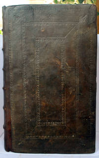
1611031042Popes-head alley at y signe of y White Horse: Imprinted by William Hall and John Beale. Sold by John Sudbury and Georg Humble. 1611 A good copy of the extremely rare 1st edition of Speed's comprehensive work. In full leather binding which has been rebacked retaining the original boards which have blind tooled decoration and replacing the spine which has raised bands and gilt title label. This work continued Speed's 'Theatre of Great Britaine' - and the page numbering is continuous with it - the text starting at p155 and finishing at p 894 although the book is complete on its own. With engraved decorative title page; 4 page preface and text completing at p 894; Summary conclusion of the whole - 4 pp; The Second Index - 46 pp; and a one page 'Faults etc Sped'. The work has numerous engravings of coins seals and coats of arms; and is embellished throughout with decorative head and tailpieces and decorated initial capitals. The binding has been expertly repaired with some building up to one of the corners which had been lost. With new endpapers. The title page has been relaid on tissue. There is light nibbling to page edges up to the end of the preface but overall the paper is extremely thick and well-preserved. There is loss to the Faults page bottom corner and p 755 has a corner missing without loss of text. The pages vary from being completely clean to having spotting to having browning. There are occasional water stains to page margins - most usually the bottom margin - occasionally with a pinkish tinge at the page edge. A few pages have small repaired tears without loss. Imprinted by William Hall and John Beale. Sold by John Sudbury and Georg Humble. hardcover
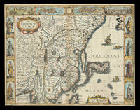
162621928<p>London: Are to be sold in pops-head Alley by G. Humble 1626 but 1627-1632. 405 by 515mm. 16 by 20.25 inches. Speed's map of China Double-page engraved map with hand-colour. A map of China also encompassing Korea and some of the islands of Japan from the first atlas compiled and published by an Englishman Speed's 'Prospect'. Along the top of the map is a decorative border with bird's-eye views of the islands of Macao after de Bry and Quinzay modern-day Hangzhou as well as dubiously accurate vignettes showing 'ye Manner of their Travelling by land' and 'the Manner of their Execution'. Along the sides of the map are depicted figures including one of the earliest European depictions of a Japanese soldier. Korea is shown as a long island and Japan is drawn after Ortelius and Teixeira. The Great Wall of China "built by ye King of China against ye breaking in of ye Tartars" separates China from the 'Desert Lop' which divides it from Russia. Here small diabolical figures are illustrated accompanied by the warning that "men are thought to be seduced by wonderfull illusions and divilish spitting". Accompanying text in English 'The Description of the Kingdome of China' is printed on the reverse. John Speed 1552-1629 was the outstanding cartographer of his age. By trade a merchant tailor but by proclivity a historian it was the patronage of Sir Fulke Greville poet and statesman that allowed him to pursue this interest in earnest. His 'Theatre of Great Britain' first published in 1611 or 1612 was the first large-scale printed atlas of the British Isles. The 'Prospect of the Most Famous Parts of the World' from which the present work is drawn appeared in 1627 bound with the 'Theatre' and is the first world atlas compiled by an Englishman to be published in England. Engraved in Amsterdam many of the maps are anglicized versions of works by Dutch makers in distinctive carte-à-figure style featuring borders with figures in local costume and city views. Chubb XXV; Shirley Atlases T.SPE-2a.</p> Are to be sold in pops-head Alley by G. Humble,
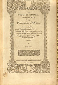
1611007684London: John Sudburie and George Humble 1611. Hardcover. Very Good. Elephant Folio - over 15 - 23" tall. SPEED John. Speed's Principality of Wales with Fourteen Double Page Maps In modern full black morocco by Bayntun decorative edge tooling. Spine raised bands gilt tooling & titles. Internally 1 ff Royal Stemme & verso County names 1 ff title page verso Royal Arms 99-124 pp 14 maps all double page maps dated 1610 but no date to tp some old professional gutter repairs new endpapers. Signatures: Z3 1 Bb1 Cc1-Cc2 Bb2 Dd1 Ee1-Ee2 Ff1 Ff1 Gg1-Gg2 Ff2 Hh1 Ii1. The pagination is complicated with double page illustrations maps printed on the verso and recto of numbered pages. 439279 mm. Chubb p29/30. <br/> <br/> John Sudburie and George Humble hardcover
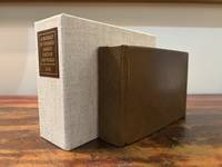
16466182London: M. F. for William Humble/George Humble 1646. First Thus. Very Good. An original travel atlas containing an early map of the world maps of the continents several countries and detailed maps of Ireland Wales Scotland and the counties in England. Bound in modern full grain leather over boards with new endpapers. Housed in a custom clamshell box using archival cloth and with a leather and gilded label on the spine. A few names on first blank in 19th century/early 20th century ink dated. Pages are toned some trimmed very close to the plate. Some infrequent soiling all text and maps are legible. With 1 folding map; a short tear to the folded part of the map. General wear to page edges. Complete with an engraved double-hemisphere map of the world 4 maps of the continents 15 other global maps and 63 maps of England Scotland Wales and Ireland. A 64th map is called out in the table of maps but Midia seems to be missing from all examples. This a miniaturized version of John Speed's folio edition.<br /> <br /> Pages: 4 206; 2; 378 Dimensions: 65/16 x 43/16 x 2. M. F. for William Humble/George Humble unknown
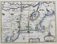
1676M8290London. : Tho: Basset; Richard Chiswell c. 1676. Very Good. Notes: A significant map of the British colonies in North America covering the east coast from Maryland and New Jersey northward through New York and New England to the French possessions in Canada. It depicts the territories acquired by the British with the capture of New Amsterdam in 1664 which changed European influence in the colonies from the Dutch to the English. It is the first appearance of name Boston and the first map to use the term New York for both Manhattan and the colony. It is also one of the first maps to show New Jersey. The map is decorated with various animals in the interior of the map two compass roses two cartouches and a coat of arms. With English text on verso that provides interesting information on the colonies. Size : 381x497 mm 15.00x19.55 Inches Coloring: Hand Colored Category: Maps United States East; Tho: Basset; Richard Chiswell unknown
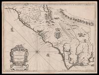
167615098London: Thomas Bassett and Richard Chiswell 1676. 380 by 505mm. 15 by 20 inches. Sheet size 408 by 530mm 19 x 21 inches. Engraved map with text on verso. A fine and attractive map of the Carolina colony. Publishers Thomas Bassett and Richard Chiswell republished English cartographer John Speed's 1552-1629 popular 1611 atlas "The Theatre of the Empire of Great Britain" in 1676. As a supplement they included new section "A Prospect of the most Famous parts of the World" which contained maps engraved by Francis Lamb of the English colonies of New England and New York Virginia and Maryland Carolina and Florida and Jamaica and Barbados. This map depicts the Carolina colony in 1676 drawing from the Lord Proprietor's Map by royal geographer John Ogilby and the explorations of John Lederer fl. 1670-1675. The map orients the West to the top and depicts the coastline from Cape Charles at the mouth of the Chesapeake Bay to the north and St Augustine Florida to the south. Looking inland the Appalachian Mountains marked as "Apalathean Mountains" cut across the top right section of the map. The present map features a cartouche where the Ogilby publication had an inset map of the Ashley and Cooper Rivers. This map is one of the first to name Charleston "Charles Town" on the banks of the Ashley River. The map correctly identifies the town on the south bank of the Ashley River whereas Speed's smaller format map of Carolina incorrectly places the town on the north banks of the river. King Charles II granted eight Lord Proprietors land in North America that extended between 31 and 36 degrees latitude later extended to 29 degrees. Lederer was a German explorer who travelled West from the East coast of Virginia in hopes of finding the Pacific and the "Sea of China" with its associated riches. He never did reach the Pacific - unsurprisingly - but his personal records of his travels influenced contemporary maps. His description of the "Arenosa Desert" reflects Lederer's memory of crossing the Carolina pine barrens in the blistering summer heat. The "Great Lake" is likely the Catawba flooded which he mistook as permanent. In total Lederer traipsed across Virginia and the Eastern coast three times making it as far as the Blue Ridge mountains. Lederer's discoveries are recorded in Sir William Talbot's translation of the explorer's account from Latin to English and published in London in 1672 as "The Discoveries of John Lederer in three several Marches from Virginia To the West of Carolina." On the verso the text describes Lederer's journeys and discoveries. Burden 457 Cumming 77 Thomas Bassett and Richard Chiswell, unknown
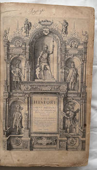
1611008199London in Popes-head alley at ye signe of ye white Horse: John Sudbury & George Humble. 1611. 1st Edition . Hardcover. Very Good. Elephant Folio - over 15 - 23" tall. SCHWEITZER Christoph wood engraver. First edition 1611. 14 years in the making! In contemporary calf with gilt arabesque to center of boards neatly rebacked with portions of original spine compartments relaid corners refurbished lacks ties. Internally engraved title with 18th-century manuscript note to verso of title regarding the volume numerous woodcut illustrations of seals & coins etc. many woodcut head & tail-pieces & initial letters errata leaf at rear margins to initial leaves lightly frayed some toning and scattered spotting endpapers renewed 18th-century monogram bookplate to fpd ms ink name to tp Lizerghe 2 tp 151-786 pp 787-801 ie 802 ff 803-894 pp 2 conclusion 23 tables 1 errata a few leaves bound in the wrong order. Folio 473x287 mm. STC 23045. Thomson - Illustrations of the History of GB XCIII The pagination is continued from The Theatre of the Empire of Great Britaine STC23041. <br/> <br/> John Sudbury & George Humble. hardcover
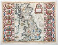
1676141841London: Basset and Chiswell 1676. Highly decorative map of the Saxon Heptarchy is from the 1676 edition of John Speed's famous atlas of 1610-12 "The Theatre of the Empire of Great Britain" published in London by Bassett and Chiswell. The most striking features of the map are the borders that flank the main body of the map. On one side they graphically portray and illustrate the seven ancient Saxon kingdoms together with their kings at the time of their own respective conversions to Christianity. The opposite side depicts the seven Saxon kingdoms with their respective kings when first established. Shields of the kingdoms a compass rose and a delightful title cartouche further enhance and embellish this most wonderful and interesting map. Copperplate engraving with hand colour. Plate mark size: 38.5 x 51. cm. Very good condition. Nicolson; The Counties of Great Britain A Tudor Atlas by John Speed p29. unknown
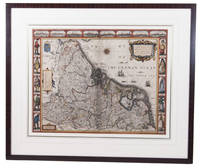
1626ACH8NIO8K9DULondon: George Humble 1626. Framed. 41 x 53 cm. Engraved map with hand coloured borders probably by Pieter van den Keere 1571-after 1646. Incorporating a fine compass-rose with 32 rhumb lines and names of the wind-directions a coat of arms of France a title-cartouche a legend "A catalogue of the cities et ! villages in everie Province" and an indication of scale ca. 1:1.120.000. The map is topped by 8 hand coloured miniature profiles of major cities and bordered by hand coloured figures in local costume at the left 5 male figures and right 5 female figures. Very fine and attractive map in its first edition as published in John Speed's A Prospect of the most famous Parts of the World London 1627. The very successful map was republished in 1654 in two different states and 1674. Its decorative border incorporates profiles of Amsterdam Antwerp Ghent Middelburg Groningen Zutphen Utrecht and Atrecht and figures depicting "a Gentle woman" "a Brabanders wiffe!" "a Hollanders wiffe !" "a Fishers wiffe!" "a Contreywoman!" and their male counterparts.Slightly creased with restored tears along the head and foot of the central fold. Otherwise a very good copy.l Van der Heijden 88 first state of 4. George Humble, unknown
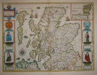
16767572London: Basset & Chiswell 1676. Copper engraving 38.5 x 51.5 cms recent hand-colour light crease in the lower right hand corner but generally a very good example; English text on verso. Cartographically Speed follows Mercator but his is one of the most distinctive and decorative early maps of Scotland. The portraits in the borders originally represented James VI and I and his family including a young Prince Charles. The royal family was burnished from the copper plate during the Interregnum and replaced with the commoners seen here: a Scotch man and woman and a Highland man and woman notable as early depictions of tartan. John Speed 1552-1629 is unquestionably the most significant British map-maker of the seventeenth-century. A brief note from Granger's Bibliographical History of England 1779 contains most of the information we have about Speed's life: "John Speed who was bred a Tailor was by the generosity of Sir Fulk Grevil his patron set free from a manual employment and enabled to pursue his studies to which he was strongly inclined by the bent of his genius. The fruits of them were his Theatre of Great Britain containing an entire set of maps of the counties drawn by himself his History of Great Britain richly adorned with seals coins & medals from the Cotton collection; and his Genealogies of Scripture first bound up with the Bible in 1611 which was the first edition of the present English translation. His maps were very justly esteemed & his History of Great Britain was in its kind incomparably more complete than all the histories of his predecessors put together ." The first edition of Speed's "Theatre" was published in 1612. It was the first atlas of the British Isles and the first attempt made by an Englishman to match the achievements of the great continental publishing houses - although much of the engraving of the copper plates was performed in Amsterdam by Jodocus Hondius. Speed was an antiquary and intended that his atlas should be read in conjunction with his history of Britain. He managed to include a great deal of historical detail on his 'modern' county maps and the inset town plans some surveyed by himself together comprise the first collection of town plans of the British Isles all in all making the Theatre a highly decorative as well as a useful volume. It was a great success and there were editions printed throughout the seventeenth-century. Map Basset & Chiswell unknown
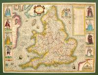
1614M7656London: Sudbury & Humble c.1614. Very Good some skillful reinforcement of the folds. Notes: StolenRare first state of the map. This handsome map from Speed's "Theatre of the Empire of Great Britaine" after Jodocus Hondius 1610 engraving was described by Christopher Saxton and augmented by John Speed in 1612. This striking map of England has along its side decorative costume figures and a detailed table of all the Shires and other important location of England. Size : 385x515 mm 15.16x20.28 Inches Coloring: Hand Colored Category: Maps Europe United Kingdom; Sudbury & Humble unknown
16231701800Published by George Humble 1623. Hardback. Very Good. Very good condition with no wrapper. Their Originals Manners Habits Warres Coines and Seales: with the Successions lives acts etc. of the English Monarchs. Second Edition. Revised and enlarged. Contents lists 10 books; this binding contains the following: Contents plus 8 page proeme; Books 5 - 10 plus Summary of the whole and 78 page index table. Very large format. Leather binding with raised bands to spine and black title labels and gilt titles. Contains woodcuts. Leather binding is a modern binding which is faded to spine. NO frontis. Book reads complete with in itself - but starts at book 5. A rare survivor of this historical book! Published by George Humble hardcover
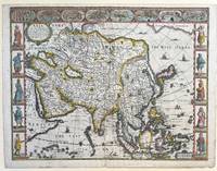
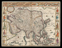
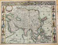
1627337000London: George Humble 1627. unbound. Map. Engraving with hand coloring. Image measures 15 3/8" x 20".<br/> <br/> This fascinating 1626 map of Asia by John Speed is the first British map of Asia. The map presents the entire continent from the Mediterranean east to include Japan and the East Indies. The map presents many speculations and common conventions found at a time when parts of Asia were largely unexplored by Europeans.<br> <br> Korea is presented as an elongated peninsula while the Kamchatka Peninsula is entirely absent. The map shows Japan and a fairly detailed depiction of the East Indies. Further west the Caspian Sea is presented along its East-West axis as per the practice at the time. The Great Wall of China is depicted in a grand style. Throughout several kingdoms important cities rivers lakes islands mountains and other topographical features are noted.<br> <br> One of the most interesting cartographic feature on this map is the appearance of Lake Ciamay or Lake Chiamay near northeast India. This mythical lake appeared on maps from the 16th to late 18th century and was believed to be the source of the great rivers of Southeast Asia.<br> <br> Illustrations of ships and sea monsters are included. The map is surrounded on the left and right with illustrations of the costumes and people from various parts of the continent. Along the top border eight city views are included detailing Candy Goa Damascus Jerusalem Ormus Bantam Aden and Macao.<br> <br> Engraved by Abraham Goos 1590 - 1643 a master engraver was the son of Pieter Goos and Margareta van den Keere which were both from map families. Appears in Speed's important "Prospect of the Most Famous Parts of the World". The map is in good condition. Archival repair to closed tear at lower margin near centerfold. Minor staining at edges not affecting the image. English text on verso.<br> <br> John Speed 1552-1629 is widely considered to be the most famous English cartographer of the 17th century. His atlas "The Theatre of the Empire of Great Britaine" contained the first set of individual county maps of England and Wales as well as significant town plans that are in many cases the first visual records of their subjects. This important map of Asia is a wonderful example of his work.<br/> <br/> George Humble unknown
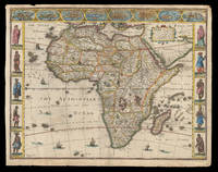
162621913<p>London: published at the charges of G. Humble 1626 but 1627-1632. 390 by 500mm. 15.25 by 19.75 inches. The first English map of Africa Double-page engraved map with hand-colour. The first English map of Africa from the first atlas compiled and published by an Englishman Speed's 'Prospect'. The map was engraved by Abraham Goos for Speed's 'Prospect of the Most Famous Parts of the World'. Along the top border are eight inset views of cities mainly in North Africa for example Alexandria Tangier and Tunis; along the side margins are inset engravings of people from different regions. The map is dense with place names rivers mountains and lakes many fictitious. While ships and sea-monsters populate the sea inland are depicted animals including zebras elephants lions and monkeys. The source of the Nile is given to the Lakes Zaire and Zaflan as according to Ptolemy. Accompanying text in English 'The Description of Africa' is printed on the reverse. John Speed 1552-1629 was the outstanding cartographer of his age. By trade a merchant tailor but by proclivity a historian it was the patronage of Sir Fulke Greville poet and statesman that allowed him to pursue this interest in earnest. His 'Theatre of Great Britain' first published in 1611 or 1612 was the first large-scale printed atlas of the British Isles. The 'Prospect of the Most Famous Parts of the World' from which the present work is drawn appeared in 1627 bound with the 'Theatre' and is the first world atlas compiled by an Englishman to be published in England. Engraved in Amsterdam many of the maps are anglicized versions of works by Dutch makers in distinctive carte-à-figure style featuring borders with figures in local costume and city views. Norwich 30; Shirley Atlases T.SPE-2a.</p> published at the charges of G. Humble,
162621912<p>London: Are to be sold in pops-head alley against the Exchange by G. Humble 1626 but 1627-1632. 400 by 510mm. 15.75 by 20 inches. The first English printed map of Asia Double-page engraved map with hand-colour. The first English printed map of the continent of Asia from the first atlas compiled and published by an Englishman Speed's 'Prospect'. The map is heavily influenced by Hondius' 1623 map and inherits the gaps in his geographical understanding of Asia: Korea is presented as a peninsula and an anonymous stretch of water separates Asia from America identified only as a blending of 'The Tartarian Sea' and 'The West Ocean'. In India one finds the mythical 'Lake Ciamay' a common feature of European maps of Asia from the 16th to the 18th c. the imagined source of the major rivers of south-east Asia. The map is not without topographical accuracy however. In China the Great Wall of China is depicted described as 'a bulwarke against the suddaine infall of ye Tartars on this side'. Vignettes in the border at the top of the map depict bird's-eye views of important towns among them 'Goa' and 'Aden'. Illustrated in the borders along the sides of the map are costumed figures. Accompanying text in English 'The Description of Asia' is printed on the reverse. John Speed 1552-1629 was the outstanding cartographer of his age. By trade a merchant tailor but by proclivity a historian it was the patronage of Sir Fulke Greville poet and statesman that allowed him to pursue this interest in earnest. His 'Theatre of Great Britain' first published in 1611 or 1612 was the first large-scale printed atlas of the British Isles. The 'Prospect of the Most Famous Parts of the World' from which the present work is drawn appeared in 1627 bound with the 'Theatre' and is the first world atlas compiled by an Englishman to be published in England. Engraved in Amsterdam many of the maps are anglicized versions of works by Dutch makers in distinctive carte-à-figure style featuring borders with figures in local costume and city views. Chubb XXV; 'Mapping the Continent of Asia' 30; Shirley Atlases T.SPE-2a; Suárez 200.</p> Are to be sold in pops-head alley against the Exchange by G. Humble,
16643551London: Rowland Reynolds. Very Good. 1664. First Edition. Rebacked with new endpapers; early twentieth century blind & gilt embossed spine over contemporary full ruled sheep. Fore edge corners renewed. Four full page engravings: incl. frontis of James Howell standing in a wood; his coat of arms to the left which seems to be borrowed form his 'Dendrologie' Paris1641; Charles II of Britain Louis XIV of France & Philip IV of Spain with chapters corresponding to each monarch.; Folio; Additional images and further information provided upon request. ; All shipments through USPS insured Priority Mail. . Rowland Reynolds
1626M10939London c.1626. Very Good. Notes: English text on verso.<br>First British map of Asia the map has 8 town plans in upper border and costumes of inhabitants of Asia in side borders. Size : 395x514 mm 15.55x20.24 Inches Coloring: Original Hand Coloring Category: Maps Asia Continent; unknown
1632129648At London : Printed By Iohn Dauuson For George Humble And Are To Be Sold In Popes-Head Pallace At The Signe Of The White Horse 1632. Third Edition. Hardback. Finely and period sympathetically bound in modern aniline calf over marble boards. Raised bands with a dark morocco gilt-blocked label. An uncommonly good example - scans and additional bibliographic detail on request. ; 1237 pages; With sundry descents of the Saxons kings their marriages and armes. Signatures: par. 6 -par. 1 A8 B-2H6 2I4 2K-4S6 4T4 4V-4Z6 5A8 5B-5Y6 5Z4. Physical desc. : 20 1237 i. E. 1281 85 p. : ill. geneal. Tables. This third edition has been reissued enlarged and newly corrected. Subject: Great Britain - History - To 1485. Referenced by: STC 2nd ed. 23049. At London : Printed By Iohn Dauuson, For George Humble, And Are To Be Sold In Popes-Head Pallace, At The Signe Of The White Hors hardcover
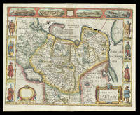
167621929<p>London: and are to be sold by Tho: Bassett in Fleet Street & Richard Chiswell in St. Pauls Churchyard 1676. 395 by 510mm. 15.5 by 20 inches. Speed's map of 'Tartary' Double-page engraved map with hand-colour. A map of Tartary encompassing parts of modern-day Siberia and Central Asia from the 1676 edition of the first atlas compiled and published by an Englishman Speed's 'Prospect'. The decorative border that runs along the top of the map depicts views of major cities as well as the house built on 'Nova Zemla' Novaya Zemlya by the explorer Willem Barentsz and his crew stranded there in 1596 here presented fending off a polar bear. Along each side are illustrated figures in regional costume. Accompanying text in English 'The Description of the Kingdom of Tartary' is printed on the reverse. John Speed 1552-1629 was the outstanding cartographer of his age. By trade a merchant tailor but by proclivity a historian it was the patronage of Sir Fulke Greville poet and statesman that allowed him to pursue this interest in earnest. His 'Theatre of Great Britain' first published in 1611 or 1612 was the first large-scale printed atlas of the British Isles. The 'Prospect of the Most Famous Parts of the World' from which the present work is drawn appeared in 1627 bound with the 'Theatre' and is the first world atlas compiled by an Englishman to be published in England. Engraved in Amsterdam many of the maps are anglicized versions of works by Dutch makers in distinctive carte-à-figure style featuring borders with figures in local costume and city views. This map is from the 1676 edition of the 'Prospect' published by Thomas Bassett and Richard Chiswell. While not as rare as the earlier publications this edition is perhaps the most important given that it is the first to include the nine new maps: among them Virginia and Maryland Barbados and Russia. It is also the last time that the 'Prospect' was printed as an atlas. Shirley Atlases T.SPE-2f.</p> and are to be sold by Tho: Bassett in Fleet Street & Richard Chiswell in St. Pauls Churchyard,
162764885London. 1627. A handsome early Sudbury and Humble edition of John Speed's map of Oxfordshire in colour. Towns and cities are highlighted in red decorative college arms and the supposed years of their foundation are found on either side of the map. A detailed inset map of the city of Oxford is in the upper right corner with a separate key with 28 listed city landmarks. The arms of the earl of Oxford to the right. Two academic university figures are seen standing with a pair of compass dividers either side of a striking globe representing the scale of miles. A strapwork border design and the royal coat of arms complete this map wonderfully well. Size: 395 x 535 mm. Copperplate engraving with later hand colouring. Fair condition. Some old repairs to lower central fold. Slight discolouration to the central fold. unknown
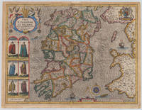
161038006London: John Sudbury and George Humble 1610-27. In very good to excellent condition. 38.5 x 51 cm 15.25 x 20 inches. Original antique copper engraving hand colored in outline and wash very likely old colored. Engraved by Jodocus Hondius. Published 1627 English text edition. Very decorative map of the County of the kingdom of Ireland. At the top left is the title cartouche on which two putti are sitting holding a harp. Below are six engraved costume prints depicting three couples: Gentleman / Gentlewoman of Ireland Civil Irish woman / Civil Irish Man Wild Irish man / Wild Irish woman. In the top right corner we the coat of arms with the inscription 'God and my right' in French language. In the Irish Sea next to the compass rose and mileage scale a sailing ship and a sea monsters are engraved. Below the imprint with the publisher John Sudbury and George Humble and the privileg dated 1610. An early edition of this rare map of Ireland with strong engraved waves in the sea. John Speed 1551 oder 1552 – 28. Juli 1629 war ein englischer Kartograf Chronologe und Historiker mit Wurzeln in Cheshire. Als Sohn eines Bürgers und Schneiders in London verließ er den Beruf seiner Familie um die Aufgabe anzunehmen die Geschichte Topografie und Karten der Königreiche Großbritanniens zusammenzustellen und zu überarbeiten um die Vereinigung ihrer Monarchien in der Person von König James I. und VI. darzustellen. Er erreichte dies mit bemerkenswertem Erfolg mit der Unterstützung und Hilfe der führenden Altertumsforscher seiner Generation. Er stützte sich auf die Shire-Karten von Christopher Saxton John Norden und anderen und verbesserte sie indem er als Erster die Hundertgrenzen in sie einfügte und er war der Landvermesser und Urheber vieler der darin enthaltenen Stadtpläne. Seine Arbeit trug dazu bei frühneuzeitliche Konzepte der britischen Nationalidentität zu definieren. Seine biblischen Genealogien wurden auch offiziell mit der Erstausgabe der King-James-Bibel in Verbindung gebracht. Er gehört zu den berühmtesten englischen Kartografen. Wikipedia.A minor marginal light staining in very good to excellent condition. 2nd English edition 1616 P. 255 John Sudbury and George Humble unknown