18 résultats
1877264527London : Printed by order of the Trustees 1877. First Edition. Hardcover. Binding copy with wear tear and dust-dulling as with age. Text remains clear and without blemish. Physical description; xii 155 p ; 23 cm. Subject; Crustacea Fossil. London : Printed by order of the Trustees hardcover
1851076142Phillips Sampson and Co. 1851. 1st Edition . Hardcover. Very Good/No Jacket. Very good clean tight condition. First edition. Text free of marks. Professional book dealer since 1999. All orders are processed promptly and carefully packaged with tracking. <br/> <br/> Phillips, Sampson, and Co. hardcover
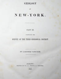
184254245Albany: W. & A. White & J. Visscher 1842. First Edition. First printing. Quarto 30cm. In original publisher's cloth signed binding by Warner & Boynton of New York stamped in gold and blind with crinoid and trilobite ornaments in gilt to front board and base of spine; yellow coated endpapers; errata at rear; 2 1-5 6-306 2 pp; engraved series title page and 80 in-text wood engravings. One volume from a longer series. A sound and fresh copy with some gentle wear to joints head and tail; boards bumped and rubbed; heavy foxing to engraved series title and occasional light foxing throughout: Very Good. <br /> <br /> Vanuxem initiated certain practices adopted by other geological surveys including "anchoring rock units to specific type localities" and dating strata "on the basis of fossils" ANB. This volume was part of a larger geological survey which in turn was part of a series on the Natural History of New York. The Third Geological District here included the counties of Montgomery Fulton Otsego Herkimer Oneida Lewis Oswego Madison Onondaga Cayuga Cortland Chenango Broome Tioga and eastern Tompkins County. HAZEN & HAZEN 10589. SABIN 53782. W. & A. White & J. Visscher unknown
185071486London: The Society for Promoting Christian Knowledge 1850. Small 8vo. xii 305 pp. Hand coloured folding map frontis and chart at rear with wood engravings throughout. Cloth with blind stamped decoration to boards and gilt lettering to spine. Wear and bumping to extremities particularly at spine which has darkened. Light marking to binding. Folding pages have wear to fore-edges. Pencil ownership mark to ffep otherwise quite clean internally. . Good. Publisher's Cloth. 1850. The Society for Promoting Christian Knowledge 1850 hardcover
181146339London W. Bulmer and Co. 1811. 4to. No wrappers as extracted from "Philosophical Transactions" 1811 - Part II. Pp. 242-256 a. 1 engraved map "A Sketch of the principal Faults or Dislocations of the Strata in and near Derbyshire" A faint dampstain tothe map in upper left and lower right corner. <br/><br/><em>Famous early geological survey of the Derbyshire area and its strata. </em> unknown
186942834London Taylor & Francis 1869 Large 4to. Without wrappers. Extracted from "Philosophical Transactions of the Royal Society of London.". 1868. Vol. 158. Pp. 333-345 a. 3 fine lithographed plates. <br/><br/><em>First appearance of this paper in which Phillips summarizes his importen work on the moons surface."In 1852 John Phillips brought maturee geological experience to his own personal observations of the physiocal features ofthe surface of the moon using first the great telescope belonging to the Earl of Rosse.The drawings of surfaces of the moon were to be made under a set of standard conditions of representation and on a uniform scale.By 1853 he was recording his observations photographically on collodion palets and employing his great artuistic skill in accurate and detailled drawings.In a summary of his findings published in 1868 the paper offered Phillips drew vivid analogies between many of the features seen on the surfaceof the moon and those known to him intimately by observation and measurement on the earth."DSB X p. 584. </em> unknown
182943602Leipzig Johann Ambrosius Barth 1829. Without wrappers as issued in "Annalen der Physik und Chemie. Hrsg.von Poggendorff" Bd. 16 Fünftes Stück. Halftitle to vol. 16. Pp. 1-192 a. 2 engraved plates. Entire issue offered. Hoffmann's paper: pp. 1-40 and 1 folded engraved handcoloured plate "Geognostische Skizze von Rom". Clean and fine. <br/><br/><em>Importent early investigations into the geological structures of the underground of Rome. </em> unknown
1887111111114632Providence Franklin Society 1887. Hardcover. Good. Providence Franklin Society; Providence 1887. Hardcover. A Good brown cloth binding with gilt lettering on front board and spine some handling/scuffing to boards rubbing along board edges crimping to spine edges ink name stamp front pastedown age toning to pages cracked front hinge few pages with some pencil markings small abrasions to board corners mild spine lean rubbing along joints without Dust wrapper. A good copy. 8vooctavo or approx. 6 x 9 inches. 130pp. indexed. We pack securely and ship daily with delivery confirmation on every book. The picture on the listing page is of the actual book for sale. Additional Scans are available for any item please inquire. Providence Franklin Society hardcover
187848089Paris Gauthier-Villars 1878. 4to. No wrappers. In: "Comptes Rendus Hebdomadaires des Séances de L'Academie des Sciences" Tome 85 No 12 14 a. 15. Pp. 733- 776 841- 908 909- 984. Entire issues offered. Daubrée's paper: pp. 733-39 864-69 a. 928-931. <br/><br/><em>First apperance of this classic paper in experimental geology."Gabriel Daubrée describes the apparatus and results of experiments simulating the folding and faulting of strata through the exertion of horizontal and vertical pressures on beds of wax or metal. Daubrée finds that fairly uniform folds form when homogenous beds under spatially uniform vertical pressures are subjected to sufficient horizontal pressure the amount of the pressure indfluencing the number and shape of the folds. Continued pressurein such a case results in a regular series of synclines and anticlines. By contrast spatial nonuniformities in the bed thickness or in the vertical pressure can produce marked asymmetries in the resulting folds with for instnace fewer folds in regions of greater vertical pressure."Parkinson "Breakthroughs" 1878. </em> unknown
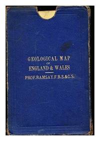
1876344916London: Edward Stanford 1876. Fourth Edition. Hardcover. Near fine folding map in the original stiff cloth backing. Includes a gilt titled and blind-boarded buckram slip-case. Some wear and tear to the slip-case. Remains well preserved overall; bright tight clean and sharp-cornered. Physical description; 1 folding map. Subjects; Geological Maps. Geological Map of England. Geological Map of Wales. Andrew C. Ramsay. 19th century maps. London: Edward Stanford hardcover
1879048310New Zealand: The "Times" Office Printers 1879. Green cloth on boards with quarter leather; few only patches of specks and marks. Spine: gilt title over red label gilt bands and three blindstamped decoratives; light scuffing; wear to head of rearside corner. Boards fore corners with small bumping and light wear. Edges: lightly browned and old foxing. Eps: marbled; some paperpeel to fep. Splitting to front & rear hinges. Penciled names to second eps. Frontis: fldg illustration by R.V.Waldheim Wiem of Canterbury Museum Christchurh NZ. Light few only foxings to a few pages albeit mostly to the margins. All fldg b/w & coloured maps/ illustrations are present. One with white tape repair on the reverse side. Binding is As New. 486p followed by illustrated References to Sections 2 to 9. First Edition. Hb. VG/None. The "Times" Office, Printers Hardcover
183742877New Haven A.H. Maltby and Herrick & Noyes 1837. Contemp. hcalf. Gilt spine. Light wear to titlelabel with gilt lettering. Slightly rubbed. In: "The Amrican Jounal of Science and Arts. Conducted by Benjamin Silliman" Vol. 31.- January 1837. Engraved portrait Dr. Prince. VIII428 pp. and 1 folded map 4 engraved plates partly folded. The entire volume offered. Hildreth's paper: pp. 1- 84 a. 20 woodengraved textillustrations maps fossils startigraphy. Apart from a brownspots in upper margin of the first 7 leaves a fine clean copy. <br/><br/><em>First appearance of this classic travel account from Ohio mainly describing the geology and teh fossils of the area. - Sabin: 31796. </em> unknown
185842300London Taylor and Francis 1858. 4to. No wrappers as extracted from "Philosophical Transactions" Vol. 148 - Part II pp. 703-786 and 3 lithographed plates. Map of Etna - Craters and Lava of 1852 & 1853 - Fossil leaves from Etna 23 textillustrations. <br/><br/><em>Firs printing of this importent investigation of the processes involved in the creation of volcanoes. Lyell had been convinced in his study of Madeira and the Canaries that the evidence on which Leopold von Buch had founded his his theory of craters of elevation 1825 was completely fallacious. Lyell "found that Etna had neither a linear axis nor a single center of upheaval. Instead he found two earlier centers of eruption in the Val del Bove. From each center the beds of lava sloped away in all directions but beds of lava arising from Etna's modern center of eruption had flowed over and buried those from the earlier centers. Lyell considered this to be decisive evidence against the crater-of-elevationn theory because "although one cone of eruption may envelope and bury another cone of eruption it is impossible for a cone of upheaval to mantle round and overwhelm another cone of upheaval so as to reduce the whole mass to one conical mountain.". He concluded that the conical form of Etna as of all volcanoes was entirely the result of the long-continued process of volcanic eruption."DSB.Charles Lyell 1797-1875 probably accomplished more in the advancement of geological knowledge than any other one man. The world-wide influence of his treatises and textbooks established the principle of uniformitarianism. </em> unknown
182346664Baltimore: N.G. Maxwell 1823. First Edition. 12mo 18.5cm.; calf-backed marbled boards gilt-lettered spine; xv214-211pp. Boards a bit scuffed with brief exposure at corners leather somewhat dried and mottled endpapers toned faint dampstaining to first half of textblock else a Very Good sound copy. Theory on the formation of the earth dedicated to Andrew Jackson. Early chapters cover general natural phenomena such as "strata" and "The various colours of Marble" while the latter half of the text focuses on the North American continent describing "A Flood that was produced by the rise of northeast rise of North America" the formation of the Delaware Schuylkill and Susquehanna Rivers; the formation of the North American prairies; and the "Insects Vegetation &c. of America." The author later published another work titled "Antiquities of America Explained" 1831 arguing that a group of Tyrians and Jews crossed the Atlantic 3000 years ago creating a colony in Nova Scotia that eventually spread across the entire continent. This title missed by Sabin. SHOEMAKER 12827. N.G. Maxwell unknown
183759116Paris Bachelier 1837. 4to. Without wrappers. In "Comptes rendus hebdomadaires des séances de l’Académie des sciences" Vol. 5 No 14. Pp. 491- 514. Entire issue offered. Agassiz's paper: pp. 506-508. <br/><br/><em>First printing in France of Agassiz' founding paper - starting the the study of ancient glaciation - in glaciology in which he outlines his thesis that there was an earlier geological period with widespread ice-age conditions extending from the North Pole to the Mediterranean and Caspian Seas. he concluded that the Alpine ice now restricted to the higher valleys once extended into the central plain crossed it and even mounted to the southern summits of the Jura chain. Agassiz here adopts the term "ice age" coined in 1836 by Karl Schimper as 'Eiszeit'. Agassiz submitted the offered paper to the French Academy after he in his opening address as President of the Swiss Society of Natural History in 1837 its Séance July 1837 in his famous "Discourse at Neuchatel" gave an exposition of the evidence of glaciation. The paper offered is his own but briefer exposition of the famous address to the Swiss Society.Parkinson "Breakthroughs" 1837 G. </em> unknown
18839696Staunton VA: Printed by S. M. Yost & Son for Jed Hotchkiss 1883. Hard Cover. Good binding. Quarto. xi 1 196 192; 6 196; 1 iii 196 pp. maps illus. First edition. Volume 1 & 2 bound together in library buckram; Volume 3 in marbled boards with modern bonded leather spine and corners; Volume 4 in library buckram. Volume II is lacking volume title page and index. All volumes trimmed some closer than others. Ex-library with typical markings; bindings are a trifle worn but sturdy; contents are a bit brittle with some closed tears to the folds of the maps a couple of maps have cleanly separated along those tears; occasional early tape repairs to a few leaves and a few maps. Rogers’s geological map is quite crisp and bright. Relatively well-preserved volumes from this landmark publication. <br /> <br /> An important periodical that ran from 1880 through Volume VI 1885 before being merged into the Industrial South. Jedediah Hotchkiss the editor and publisher is perhaps most remembered as the staff officer of Stonewall Jackson and employed his topographical and cartographical skills to the great benefit of Jackson during the Civil War. After the war Hotchkiss established himself in Staunton VA as a consulting engineer and geologist among other endeavors eventually editing and publishing this present periodical. Given the wealth of information related to natural resources it's easy to imagine that these efforts brought significant funding into the commonwealth at a time it was greatly needed. <br /> <br /> While there are contributions by most significant geologists of the day as well as maps and sections by Hotchkiss J. Peter Lesley James P. Kimball R. O. Currey John L. Campell and others. But certainly the most notable inclusions is William Barton Rogers’s 1841 geological map of Virginia. This first systematic geological survey of Virginia began in 1835 when Rogers a recognized expert was engaged by the Virginia General Assembly to undertake the task. The manuscript of the map was largely complete when funding for the project was cut off in 1841. This map languished for decades until a version of it Marcou 592 was published in Virginia: A Geographical and Political Summary. Hotchkiss a friend and colleague of Rogers further added to the map and issued it in Vol. I No. 6 of The Virginias 1880. Of this map E. M. Sanchez-Saavedra writes: "The geological map of Virginia is modest in appearance but it contains more information than first meets the eye. Its topography was based on the 1827 Boye nine-sheet map altered to emphasize natural drainage and erosion patterns. The large patches of color representing different formations were the result of Rogers's years in the field—digging climbing and analyzing rock strata." Finally noting that this color coding seems to have been of Roger's invention it would be employed to some degree in subsequent years by John Wesley Powell as he embarked on his ambitious undertaking to map the entirety of the country. This map remains an important piece of Virginia geologic and cartographic history. Sanchez-Saavedra A Description of the Country: Virginia's Cartographers and Their Maps 1607-1881. pp. 103-118. Marcou 612. Printed by S. M. Yost & Son for Jed Hotchkiss unknown
18591293943London: John Murray 1859. Third Edition. Hardcover. Octavo 429 pages with two fold outs and pages of advertisements. In Good plus condition. Rebacked in green cloth with gilt lettering to spine with original boards and preserved and parts of original spine laid on. Boards show wear along the edges; corners bumped and beginning to fray. Pages are age toned as is typical with some minor spotting mostly at the beginning and on the fold outs. Interior otherwise clean and free of marking. An ex-library copy with usual markings including a bookplate from the Royal Navy on front paste down and faded ink stamp on title page. <br /> <br> <br /> <br> <br /> Darwin's contribution present and corrected on page 268. The first edition of 1849 had a transposition error in Darwin's essay some later states included a corrected text in a rear pocket. The second edition was issued in 1851 with no offprint of Darwin's article. This is the third edition complete. Fold out maps are present with some slight tears to the rear map. Shelved in Case 10. 1293943. Shelved Dupont Bookstore. John Murray hardcover
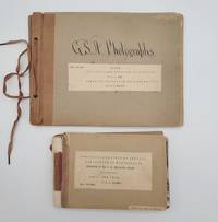
1898693921898. Two odd volumes of Geological Society of America photo books. Small oblong quarto 20 cm x 27 cm; Oblong duodecimo 13 cm x 18 cm. <br /> <br /> First book: Cover title and seven photographs on 1/4 brown cloth with gray card boards held together with a string tie binding. In calligraphy on the front board: "G. S. A. Photographs." The photographs measure 16.5 cm wide x 11.5 cm tall. Caption titles on paper strips mounted below the photographs. Numbers on small strips mounted in top fore-edge corners. With the following photographs present: 495- "28. Terraces of Tertiary Lake Beds near Salmon City Idaho on the Lemhi River."; 496- "29. Terraces of Tertiary Lake Beds on Lemhi River near Salmon City Idaho."; 497- "30. Old Gold diggings - work 1859-65. Leesburg Idaho on Napias Creek."; 498- "32. Rocky cut for sluice California Bar Idaho."; 499- "33. Discharge sluice California Bar Idaho."; 500- "31. Hydraulic Mining at California Bar Idaho."; 501- "No. Basal Cambrian sandstones of section at mouth of Two-mile Canyon 2 miles south of Malad City Idaho 562 C.D.W. 1898." Condition: Very good. Light wear and waviness to boards. Numerical notations crossed out in top fore-edge corners.<br /> <br /> Second book: Thirty-seven linen-backed photographs mounted between gray card boards with 1/4 brown cloth. Front board completely detached but present. The photographs measure 16.5 cm wide x 11.5 cm tall. With typed titles and some notations in pencil/pen on the reverse. Numbers mounted in the top fore-edge corners of the photographs. With the following photographs present: 747- "Shore of lake Ontario Niagara county New York. Illustrated mode of origin of beach shingle by showing rock in place and rocks recently detached."; 748- "Beach of flat shingle. Shore of lake Ontario at Golden Hill Creek New York." 749- "Beach of well rounded shingle. Shore of lake Ontario at Golden Hill Creek New York."; 750- "Cemented shingle in spit of glacial lake Iroquois at Lewiston New York."; 751- "Section of spit of glacial lake Iroquois at Lewiston N.Y. The dip is landward indicating growth on the inside of the spit."; 752- "Section of spit of glacial lake Iroquois at Lewiston. The dip is landward indicating growth on inside of spit." 753- "Cut terrace of the Iroquois shore line 2 miles west of Dickensonville N.Y. Lacustrine plain bed of lake Iroquois near Jeddo N.Y. The water edge was at base of cliff. The cliff is carved from Medina shale."; 754- "Till plain 1/2 mile south of Jedoo Niagara county N.Y."; 755- "Cross bedding and unconformity in sand kame 3 miles east of Lockport N.Y."; 756- "Till Shore of lake Ontario Wilson N.Y."; 757- "Deposit by torrent of Erian water on the withdrawal of the ice sheet from the escarpment at Lewiston N.Y. Unassorted and unworn alluvi."; 758- "Section of talus Niagara gorge."; 759- "Angular gravel in kame south of Royalton Niagara county N. Y."; 760- "Solitary gravel kame 3 miles south of Middleport N. Y."; 761- Escarpment of the Niagara limestone; looking west from a point on the talus near Lewiston N.Y."; 762- "Niagara escarpment capped by niagara limestone; looking east from a point 5 miles west of Lockport N.Y."; 763- "Niagara escerpment sic without capping of Niagara limestone; looking west from a point near Middleport New York."; 764- "Drowned valley of Twelve-mile creek Niagara county N.Y. near Wilson. Water lilies grow on submerged alluvial plain."; 765- "Head of estuary of Twelve-mile creek Niagara county N.Y. Submerged alluvial plain supports rushes."; 766- "Estuary of Eighteen-mile creek near Olcott Niagara county N.Y. Channel deep current slow. Submerged alluvial plain supports rushes."; 767- "Valley of Eighteen-mile creek Niagara county N.Y. above head of estuary. Channel shallow current rapid; alluvial plain supports rushes."; 768- "Post-Glacial anticline Hopkins creek Niagara county N.Y. The displacement of the rocks is accompanied by a superficial ridge traversing an alluvial terrace." 769- "Section of Niagara limestone Cooks quarry near La Salle Niagara county N.Y. Shows structure described by James Hall Geology of 4th district N.Y. pages 93 and 94."; 770- "Section in cut of Erie Railroad Niagara falls N.Y. Shows structure described by James Hall Geology of the 4th district N.Y. pages 93 and 94."; 771- "Weathering of Niagara limestone by solution. A joint face exposed in quarrying southwest of Middleport N.Y."; 772- "Weathering of Niagara limestone by solution; old quarry southwest of Middleport N.Y."; 773- "Unconformity by erosion. Sandstones and shales of the Medina format Niagara gorge."; 774- "Isolated limestone mass at base of Niagara shale containing 'transition fauna' of Ringueberg."; 775- Section of ripplemark on Medina sandstone Lockport N.Y. From crest to crest 23 feet; depth of trough 29 inches.";776- "Flagstone in court-house yard Elyria Ohio. Shows reticulated ripplemarks."; 777- "Trough of large ripplemark in Medina sandstone Niagara gorge N.Y."; 778- "Crest of large ripplemark in Medina sandstone quarry near Lewiston N.Y."; 779- "Crest of large ripple-mark in Medina sandstone. Quarry in Lockport N.Y."; 780- "Diverse cross-bedding associated with large ripplemarks in Medina sandstone. Quarry near Lewiston N.Y."; 781- "Quarry dace in Medina sandstone Lockport N.Y."; 782- "Quarry face in Niagara limestone Lockport N.Y. The joint face shows weather fracture."; 783- Shore of lake Ontario at Wilson N.Y. Train of shore drift from right being arrested by bew-pin begins to accumulate and partly protects bluff from wave attack. Dearth of shore drift under lee of pier fevors wave attack; bluff eaten back 45 feet. Bluff contains two tills and cover of laminated clay a deposit from lake Iroquois. Boulder pavement at top of lower till indicated by arrow." Condition: Good only due to the detached cover. The photographs are in very good condition. Two photo books with forty-four photographs extremely well identified with detailed captions containing the geological characteristics of the wide variety of locations and with the numbers of Gilbert's negatives clearly listed. It could be that these images appeared or were intended to appear in USGS publications.<br /> <br /> The Geological Society of America GSA was founded in 1888. It is a global scientific society with members from academia government and industry in over one hundred countries. The aim of the GSA is to support the professional growth of geoscientists and encourage cooperative research among earth life planetary and social scientists foster public dialogue on geoscience issues and promote the geosciences in the service of humankind.<br /> <br /> James Furman Kemp 1859-1926 was mostly known for his work in igneous petrology and on the origin of ore deposits. He served as the President of the Geological Society of America in 1921. Charles Doolittle Walcott 1850-1927 was the third director of the U.S. Geological Survey the fourth Secretary of the Smithsonian Institution and a contributor to the "Bulletin of the Geological Society of America."<br /> <br /> The lion's share of the photographs are reproduced from the negatives of U.S. explorer geographer and geologist Grove Karl Gilbert 1843-1918 whose life spanned an age of heroic geology and who was one of the founders of modern geomorphology the study of landforms. He helped launch the U.S. Geological Survey USGS and was its chief geologist under the famed explorer and second USGS director John Wesley Powell. In addition Gilbert was a founding member of the National Geographic Society as well as president twice of the Geological Society of America. Gilbert was first exposed to the American West when he participated in the Wheeler Survey one of the four great surveys of the American West headed by George Wheeler Clarence King Ferdinand Vandeveer Hayden and Powell. Gilbert's monumental works were "Report on the Geology of the Henry Mountains" 1877 and "Lake Bonneville - Department of the Interior Monographs of the United States Geological Survey Volume 1" 1890. He is credited with naming ancient Lake Bonneville whose raised shorelines he used to demonstrate crustal isostasy.<br /> <br /> "Gilbert had a knack for harnessing the geography of the land in the cause of something greater: extraction of knowledge about the processes at work." - R. S. Anderson https://eos.org/features/reflections-on-the-legacy-of-grove-karl-gilbert-1843-1918.<br /> <br /> A collection featuring the investigative research of three prominent U.S. geologists who were the top field geologists of their time. A spectacular portrait of late nineteenth century / early twentieth century field geology. unknown