[Geology] [Wallace Walter Atwood]Biblio.com

55 résultats
1937347621937. Hardcover. Very good. Quartos. 5 volumes of 134 collected writings with typed table of content pages half title pages and occasional additional type script. Volume one is bound in drab green cloth with leather title label on the spine. Volumes II III IV and V are bound in three quarter Moroccan leather with marbled paper covered boards. Raised bands and gilt lettered title labels on the spines. Top edges gilt. Marbled end papers for volumes 2-5. Leather is rubbed and scuffed on the edges spines and raised bands. <br /> <br /> A variety of the pamphlets are illustrated. In volume 1 is an inscription from father to son - "To my son Wallace Jr. with my most sincere good wishes and affection signed Wallace W Atwood June 7 1928." This collection is one of a kind and possibly compiled by Wallace Atwood himself. Atwood's writings are taken from government publications and articles from scientific journals and magazines. Most of the works are bound in the volumes with their original covers. Some articles were taken in part from magazines. Other articles are pasted down on the pages. Occasional hand written information in the volumes. A very nice display of the Professor's works. <br /> <br /> A list of the works are recorded in the typed table of contents for each volume. A complete list for volumes 1 and 2 are provided in this description for examples of the Professor's works in the variety of publications. The entire list of papers for the remaining 3 volumes is not provided. <br /> <br /> Volume I 1900-1910<br /> <br /> Contains 6 of 11 pamphlets listed in the contents the 5 missing pamphlets are noted as "missing" in the typed contents thus these dated writings were never bound in the volume:<br /> <br /> 1. The Geography of the Region About Devil's Lake and the Dalles of the Wisconsin. Wisconsin Geological and Natural History Survey Bulletin 5. No. 1 1900. 151 pages. Illustrated with 38 plates 47 figures. Original printed covers included;<br /> 2. Glaciation of San Francisco Mountain Arizona. Reprinted from the Journal of Geology April-May 1905. Printed by University of Chicago Press. Pages 276-279;<br /> 3. Red Mountain Arizona. Journal of Geology Vol. 14 1906 Missing;<br /> 4. Glaciation of the Unita Mountains. Journal of Geology Vol. 15 1907 Missing;<br /> 5. Lakes of the Unita Mountains. Reprinted from Bulletin of the American Geographical Society January 1908. 6 pages. Illustrated. Original covers present;<br /> 6. Geologic Studies in the Alaska Peninsula Abstract. Bulletin of the Geological Society of America Vol. 20 1908. 1 page;<br /> 7. Alaska and its Wealth Missing "The World Today" June 1908;<br /> 8. Physical Geography of the Evanston-Waukegan Region Missing. Illinois State Geological Survey Bulletin No. 7 University of Illinois 1908;<br /> 9. Mineral Resources of Alaska. Report on Progress of Investigations in 1908. C--Prince William Sound Kenzai Peninsula Southwestern Alaska. United States Geological Survey Bulletin 379-C 1909. Pages 87-152. Illustrated. Original covers present;<br /> 10. Physical Geography and Geology. Educational Department Keystone View Company 1910. 28 pages plus extra catalogs pages;<br /> 11. Prospecting in Alaska Missing. University of Chicago Magazine December 1910;<br /> Additional typed manuscript inside a pocket folder on the rear paste down includes biographical material concerning Dr. Wallace W. Atwood President of Clark University; published papers to January 1 1924. <br /> <br /> Volume II 1911-1920<br /> <br /> Contains 17 of 19 listed papers. The two "missing" papers in the table of contents have a hand corrected mark through with a written note "See Supp. Vol. 1". Note: Supplement for Volume I is NOT PRESENT. <br /> 1. Geology and Mineral Resources of Parts of the Alaskan Peninsula. USGS Survey Bulletin 467 1911. 137 pages. Illustrated fold-outs. Original covers present with an inscription by Atwood written top of the front cover. <br /> 2. The First Year Science Course in High School. The School Review February 1911. Pages 119-123.<br /> 3. Physiographic Studies on the South Slope of the San Juan Mountains Colorado. Journal of the Washington Academy of Sciences July 1911. 1 page;<br /> 4. Physiographic Studies in the San Juan District of Colorado Missing. Journal of Geology July 1911;<br /> 5. The Evidence of Three Distinct Glacial Epochs in the Pleistocene History of the San Juan Mountains Colorado. The Journal of Geology July-August 1912. Pages 385-409. Illustrated. Original covers present;<br /> 6. Some Triassic Fossils from Southeastern Alaska Missing. Journal of Geology Oct-Nov. 1912;<br /> 7. The Atwood Celestial Sphere. Bulletin of the Chicago Academy of Sciences May 1913. 38 pages. Illustrated. Original covers present;<br /> 8. A New Way of Studying Astronomy - The Atwood Celestial Sphere. Scientific American June 1913. Clipped article placed inside pocket folder;<br /> 9. Bringing the Stars to Earth. Technical World Mag. July 1913. A clipped section of the magazine. Article by Richard Morrison who writes of Atwoods Sphere with illustrations of Atwood and others;<br /> 10. Geographic History of the San Juan Mountains since the Close of the Mesozoic Era. Proceedings National Academy of Sciences March. 1916. Pages 177-181;<br /> 11. Saving the Silts of the Mississippi River. Bulletin of the Geological Society of America 1916. Pages 149-50;<br /> 12. The Physiographic Conditions at Butte Montana and Bingham Canyon Uta when Copper Ores in These Districts were Enriched. A Shaler Memorial Investigation reprinted from Economic Geology December 1916. Pages 697-740. Numerous photographs illustrations. Folding panorama view. Original covers present;<br /> 13. Another Locality of Eocene Glaciation in Southern Colorado. The Journal of Geology Oct-Nov. 1917. Pages 783-686. Original covers present;<br /> 14. Relation of landslides and Glacial Deposits to Reservoir Sites in the San Juan Mountains Colorado. USGS Survey 685 1918. 38 pages. Illustrated. Original covers present;<br /> 15. Geography in America. Reprinted from the Geographical Review January 1919. 8 pages;<br /> 16. First Steps in the Study of Geography. Visual Education Magazine Vol. 1 No. 1 January 1920. Pages 17-24. Not all pages bound in but the original covers were;<br /> 17. The New Meaning of Geography in American Education. Also appeared in School and Society February 1921. Address before the meeting of the Rochester City Teachers' Association February 6 1920. 16 pages;<br /> 18. Habitat Groups in the Teaching of Geography. Visual Education Magazine May 1920. Pages 29-36. Illustrated. Not a complete issue but both covers bound in;<br /> 19. The Regional Treatment of Geography. Also appeared in School Century December 1920. Visual Education Magazine June 1920. Pages 15-17. Not a complete issue but both covers bound in.<br /> <br /> Volume III 1921-1930<br /> <br /> Contains 34 papers all present. The first paper is titled "The Inauguration of Wallace Walter Atwood As President of Clark University February 1 1921. Worcester Mass. Mr. Atwoods inaugural has 71 pages. Both covers present. Contents also include articles on teaching geography to children elements of Social Studies more San Juan scientific papers and an article titled "In the Background of the Turmoil in China."<br /> <br /> Volume IV 1931-1933<br /> <br /> Contains 33 papers all present. Subjects include Nominations of Officers. Association of American Universities; The New Ph.D. Degrees in Great Britain and France; The High Sierra and the Redwood Highway Sierra Club Bulletin 1933; How the specialized Motion Picture is Developed; Dr. Attwood addresses; National Parks; an article on Ellen Chuchill Semple 1863-1932; and more. Some of the articles are cut out and pasted down on paper. <br /> <br /> Volume V 1934-1937<br /> <br /> Contains 43 numbers all present. Contents include 3 titles covering the Ancient Mayan Civilization; Guides versus Teachers; Humanity Among the Faculty; the Pan American Institute of Geography and History; the Students of Clark; association and meeting presentations; some scientific articles and more. William Walter Atwood 1872-1949 studied geology at the University of Chicago and graduated there in 1897. He earned is Pd.D. in 1903 and was Associate Professor of Geology until 1913. Atwood later became Professor of Physiography at Harvard 1913-1920. In 1921 Atwood was elected President of Clark University in Worceser in 1920 and began his term in February 1921. Clark University currently has a large collection of Wallace Walter Atwood papers. hardcover
196264136Houston TX: Gulf Publishing Co. 1962. 4to. 9.5 x 11.5 in. xii 350 pp. With 100’s of photos diagrams maps. Blue publisher’s cloth comb binding silver lettering w/ d.j. stereoscopic aerial photos front cover minor tear & chipping to foot spine NF/VG- copy from the library of Dr. Clive F. “Rick†Kienle 1942-2025 geologist and specialist in aerial photo mapping . First edition of this pioneering work on aerial photography with an emphasis on tectonic and lithologic interpretation of geomorphics units and landforms with detailed methodology on how to construct photogeologic maps drawn from the author’s 120000 photos. Bandat 1895-1982 first developed his photogeologic methods while working for Shell in New Guinea from 1936-1938 and later in Cuba and Java before becoming a specialist with Gulf Oil following World War II across the Middle East and Central America. Gulf Publishing Co., hardcover
1973t corner in bka3328Previous owners name upper right front corner in black ink. Text unmarked. 18 papers and five field trips. Spine is faded and belt symposium written in black marker on spine. top front spine shows wear Corners not pointed/ Rear cover a little dirty. Lots of maps and drawings Idaho Bureau of Mines paperback
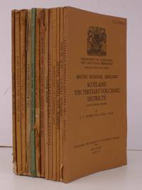
193628451HMSO 1936-56. 13 vols. 8vo. with numerous plates maps and diagrams a number folding small personal name-stamp on front wrappers of most volumes; original printed wrappers a very good clean run. The run comprises: Scotland. The Tertiary Volcanic Districts 1952; The South of Scotland 1948; Scotland. The Northern Highlands 1936; East Anglia and adjoining Areas 1948; The Hampshire Basin 1956; The Wealden District 1951; South-West England 1948; The Grampian Highlands 1948; The Midland Valley of Scotland 1953; North Wales 1948; East Yorkshire and Lincolnshire 1951; London and Thames Valley 1947; Northern England 1953. HMSO, unknown
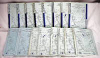
19852402140011Geological Society of America Boulder Colo. 1985. Paperback. Very Good. 16 blue envelopes with printed covers. Maps in envelopes; 23 x 31 cm. Contents:1. Northern Appalachians. D-1; 2. Transform margin south of Grand Banks : offshore eastern Canada D-2; 3. Rifted continental margin off Nova Scotia : offshore eastern Canada D-3; 4. Rifted continental margin off Labrador D-4; 6. Kodiak to Kuskokwim Alaska A-2; 7. Juan de Fuca plate to Alberta plains B-2; 8. Intermontane belt Skeen Mountains to insular belt Queen Charlotte Islands B-1; 10. Central California offshore to Colorado Plateau C-2; 11. Somerset Island to Canada Basin G; 13. Acapulco Trench to the Gulf of Mexico across southern Mexico H-3; 14. La Paz to Saltillo northwestern and northern Mexico H-1; 15. Gulf of Alaska to Arctic Ocean A-3. 2 parts.; 16. Central Kentucky to the Carolina Trough E-4; 18. Cumberland Plateau to Blake Plateau E-5; 19. Southwestern Pennsylvania to Baltimore Canyon Trough E-3. <br> This is an oversized or heavy book which requires additional postage for international delivery outside the US. Geological Society of America, Boulder, Colo., paperback
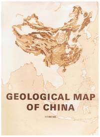
19852081502111902478China Map Publishing Company 1985. Soft Cover. Fine. Size: B4 hardcover book China Map Publishing Company paperback
196907479New York: University of Massachusetts 1969. First Edition. Paperback. Good/No dust jacket. 11.0 x 8.5 x 1.4 inches. The covers show light edge wear. The spine is creased. The binding is slightly rolled slanted forward at the top. The previous owner's name is printed on the front flyleaf. The interior pages are clean and unmarked. Electronic delivery tracking will be issued free of charge. University of Massachusetts paperback
1953099878Alger 1953. In 7 volumes.Parts 1 to 21 circa 6000 pages plates folding illustrations. Books measure 19x27cm. Bound in cloth flat bands leather title labels.Cloth dust/dirt marked society name on spines rubbed some abrasion wear. Generally all bindings in good firm condition. Internally occasional stamps mainly to plates some folding illustrations torn some sellotape repairs. Generally pages/plates very clean. A good clean run of 21 parts in solid bindings. Cloth. Near Very Good. Quarto. Hardcover
19872111902160101371Japan Society of Applied Geology 1987. Soft Cover. Fine. Number of pages: 164 Japan Society of Applied Geology paperback
19242091502135415516Internal and external publication 1924. Soft Cover. Fine. Number of books: 1 Internal and external publication paperback
19632080502106913540Not Available 1963. Soft Cover. Fine. The book is in fine condition. Not Available paperback
19561218Washington D. C.: United States Government Printing Office 1956. Very Good. 9-1/4" x 6-1/4". viii 1-164 vi 165-280 iv 281-354 vi 355-489 1 blank plates pp. In four parts 965A - 965D. 51 b/w plates total of which 13 are fold-out and stored in a large pocket at rear. Red cloth gilt lettering to spine. Light wear. Internally clean and tight plates fine. United States Government Printing Office hardcover
199187014Sacramento Calif: Division of Mines and Geology 1991. Paperback. Fine in slightly worn very good envelope. Four large loose multi-color folded multi-paneled maps 81 x 149 cm and a four-page introductory pamphlet in original printed envelope 31 x 25 cm. Uncommon. Contents: Sheet 1. Geologic map of the San Francisco-San Jose quadrangle California 1:250000 / compilation by D.L. Wagner E.J. Bortugno and R.D. McJunkin -- sheet 2. Geologic map explanation of the San Francisco-San Jose quadrangle California 1991 -- sheet 3. Index to geologic maps used in compilation of the San Francisco-San Jose quadrangle California 1:250000 -- sheet 4. Location map of rock samples dated radiometrically San Francisco-San Jose quadrangle California 1:250000 / compilation by T.A. Lindquist J.D. Morgenthaler and E.J. Bortugno. -- sheet 5. Map showing recency of faulting San Francisco-San Jose quadrangle California 1:250000 / compilation by E.J. Bortugno R.D. McJunkin and D.L. Wagner. Geology -- California -- San Francisco Region -- Maps. Geology -- California -- Maps. Geology Stratigraphic -- Maps. Géologie -- États-Unis -- Californie États-Unis -- Cartes. Geology. Geology Stratigraphic. Division of Mines and Geology paperback
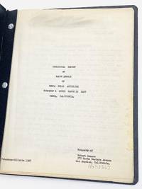
195179273Los Angeles 1951. The 24-page original typescript includes 16 tipped-in original black-and-white photographs two elevation charts and a map.<br /> <br /> Arnold was hired by Jack Leland to study reports and maps of the Mecca Hills Anticline and conduct a field inspection providing his opinion of the oil and gas possibilities of the rock formations. On page three of the report underlined in red is his comment: “This structure is ideal for oil and gas accumulation.†He further states: “from the evidence it is clear that oil exists in the general area of the north end of the Imperial Valley.â€<br /> <br /> The Mecca Hills Anticline is now in a protected reserve. Established in 1994 the U.S. Bureau of Land Management manages the 26356-acre Mecca Hills Wilderness. The area includes narrow steep-walled canyons that create a natural maze within the badlands. Uniquely faulted and folded geologic formations are the result of activity on the local sections of the San Andreas Fault making the Mecca Hills one of the more unusual geological sites of this kind. Located in Riverside County Mecca is a desert community on the north shore of the Salton Sea in the Eastern Coachella Valley and is surrounded by agricultural land with a population of approximately 8000 residents.<br /> <br /> Bound with brads in black leatherette wrappers. The contents are a little toned and the photographs once affixed with glue are now loose but all present. unknown
19904721Beijing: Geological Publishing House 1990. Book. Very Good. Soft cover. Two large folding coloured maps in envelope plus softcover book "Explanatory Notes" 82 pages. Map and book are contained in a plastic envelope. Geological Publishing House Paperback
198176728Socorro NM: New Mexico Institute of Mining and Technology 1981. A thesis presented by the author "in Partial Fulfillment of the Requirements for the Degree of Master of Science in Geology.†Quarto 8 3/4 x 11 inches. 10 i–xxiv 202 5 pp. plus two plates in rear pocket; four tables; illustrated with 40 figures including 24 tipped-in original color photographs. Rectos only. Original black cloth with gilt spine lettering. The original photographs are still bright and clear. An excellent copy.Plate 1 in the pocket measures 30 42 inches and is titled: Geological Map and Sections of the Western Gallinas Mountains Socorro County. It has been hand-colored and bears an explanatory legend.Plate 2 in the pocket measures 30 25.5 inches and is titled: Correlation of Major Ash-Flow Sheets Along the Northern Margin of the San Augustin Plains.In the Introduction Coffin lays out the Purpose of the Investigation: “The objectives of this thesis are to determine the stratigraphic relationships structural trends economic potential and the distribution of various rock units in the eastern half of the Dog Springs 7.5-minute quadrangle Socorro County New Mexico. This thesis was undertaken as part of the New Mexico Bureau of Mines and Mineral Resources extensive mapping project of the northeastern portion of the Datil-Mogollon volcanic province.†New Mexico Institute of Mining and Technology hardcover
19902110502150600177Kyoritsu shuppan 1990. Soft Cover. Fine. Number of pages: 332p310p Size: 26cm Number of books: 2 Kyoritsu shuppan paperback
19882111902156200182Kyoritsu shuppan 1988. Soft Cover. Fine. Number of pages: 332 pages Size: B5 size Kyoritsu shuppan paperback
19902111902154900078Kyoritsu Publishing Co. Ltd. 1990. Soft Cover. Fine. The book is in fine condition. Kyoritsu Publishing Co., Ltd. paperback
197326954Moscow Ussr: Nahda Publishing House 1973. First Russian Edition. Hardcover. Very Good- with no dust jacket. Unmarked except for stamps on inside front cover. ; Book Description; Spine has no signs of creasing. Pages are clean and not marred by notes or folds. Covers are square with minor wear. Ships Safe and Fast. Published without Dust Jacket. Several maps intact folded in pack of book. ; Volume XII Geology of the USSR; Textbook; B&W Illustrations; Large 8vo 9" - 10" tall; 630 pages DD2. Nahda Publishing House hardcover
196426955Moscow Ussr: Hepa Pubishing House 1964. First Russian Edition. Hardcover. Very Good with no dust jacket. Unmarked except for writing inside front cover and stamps on inside cover page. ; Book Description; Spine has no signs of creasing. Pages are clean and not marred by notes or folds. Covers are square with minor wear. Ships Safe and Fast. Published without Dust Jacket.; Volume XLIV Geology of the USSR; Textbook; B&W Photographs; Large 8vo 9" - 10" tall; 546 pages dd2. Hepa Pubishing House hardcover
1973207171Knoxville: Geological Society of America 1973. Hardcover. VG: Exlibrary book. Sticker at the base of the spine. Blue paper glued to the back cover. Plate on the front pasted end page. Slight damage to the textblocks. Majority clean body pages and solid binding. The maps have slight staining but are overall in great shape. An orange casebound book with black text on the spine and gilt text on the front cover. ix 184 pages; illustrated in black and white; contains a foldout display. Three color maps laid in. Geological Society of America hardcover
197328615Nashville Tennesee: Tennessee Division of Geology 1973. First Edition. Hardcover. Very Good- with no dust jacket. Unmarked except for company stamp on inside cover page. ; Book Description; Spine has no signs of creasing. Pages are clean and not marred by notes or folds. Covers are square with minor wear. Ships Safe and Fast. Published without Dust Jacket. Folded plates in rear pocket. ; Meeting At Knoxville April 11-14 1973 Bulletin 70; B&W Illustrations; 4to 11" - 13" tall; 184 pages DO4. Tennessee Division of Geology hardcover
1973140121031State of Tennessee Department of Conservation Division of Geology 1973-01-01. Hardcover. New. State of Tennessee, Department of Conservation, Division of Geology hardcover
1968MASTER372226IPortland OR.: State Of Oregon. G In Wraps. Large Fold-Out Maps In Rear Pocket. All Maps Present. Wraps Lightly Soiled & Stained. Rear Wrap Lightly Creased W/ Small Tear. Pages Clean Binding Tight. Pages: 337. 1968. Trade Paperback. State Of Oregon paperback