Bowen, Emanuel (After Ogilby, John)Biblio.com
11 résultats
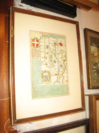
1720034014London: Thomas Bowles 1720. 1st Edition . No Binding. Fine. Maps #183 And 184 From "Britannia Depicta" Circa 1720. Nice Antique Coloring. Double Glass And Frame Maps Are On Two Sides Of Single Sheet Frame On One Side Only. Maps Fine Slight Wear To Frame. Shipping At Additional Cost Above Basic Charge. <br/> <br/> Thomas Bowles unknown
1720034015London: Thomas Bowles 1720. 1st Edition . No Binding. Fine. Maps From "Britannia Depicta" Circa 1720. Nice Antique Coloring. Double Glass And Frame Maps Are On Two Sides Of Single Sheet Frame On One Side Only. Maps Fine Slight Wear To Frame. Shipping At Additional Cost Above Basic Charge.D. <br/> <br/> Thomas Bowles unknown
1735016015Nuremburg / Nuernberg / Nurnberg circa 1735: G. C. Eimmarti / Officina Homanniana 1735. Reprint . Triple Mat Board. Fine. A Fine Colored Reprint Of An Exceptionally Decorative Astronomical Map Image 15 1/2" X 13 1/2" Not A Flat Copy Or Poster Heavy Raised Ink On Heavy Textured Paper With Faux Laid Lines No Center Fold Discernible. Beautifully Colored Probably Hand Colored. The Finest Possible Copy But Not An Eighteenth Century Original.Nicely Matted With Triple Mat Boards In Different Colors. <br/> <br/> G. C. Eimmarti / Officina Homanniana unknown
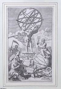
1701373389Timothy Childe London 1701. Unframed Print. Very Good Condition. Allegorical figures surround an armillary sphere and globe symbolising Enlightenment inquiry and maritime exploration. This classical composition introduces Herman Molls comprehensive geographical atlas blending celestial science with imperial ambition in the visual language of early 18th-century cartography. This frontispiece serves as a visual manifesto for early Enlightenment geography. Its significance lies in how it captures an intellectual shift in how the world was imagined studied and claimed. Engraving 14 x 24 cms sheet 22 x 35 cms. Category: PRINTS : Antiquarian Interest; PRINTS : Historic Interest; Printed before 1800; Special Features. This item may require more postage than the rates shown for delivery outside the UK. If extra postage is required we will contact you before processing your order and you will be given the details and option to decline the extra cost. Timothy Childe unknown
1709021539Leiden Leide: Chez Pierre Vander Aa 1709. Derniere Edition . Full Leather. Very Good. 6 3/8" x 4. Folding Plates and Maps Throughout. Complete with two front endpapers illustrated title page no printed title page pp 1-140 with all plates maps folding maps. Original spine decorated in gilt five raised bands also decorated in gilt polished calf boards which appear to be replacements in the 17th or early 18th century. Watered colored endpapers. Contents clean and unworn binding worn and frayed but professionally refreshed and quite solid. Pencil signature of George Ellery Hale the astronomer. <br/> <br/> Chez Pierre Vander Aa hardcover
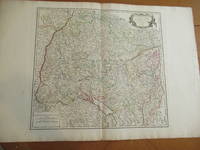
1751016323Paris: Robert Vaugondy 1751. Original Antique Map . Single Sheet. Near Fine. 22" x 32. Original very large antique map extracted from an atlas. Very detailed with hundreds of towns and villages probably all in existence at the time and showing jurisdictional boundaries as well. <br/> <br/> Robert Vaugondy unknown
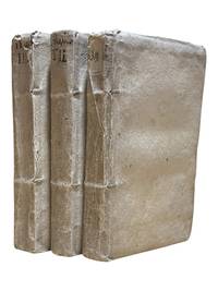
17399338Venice: Appresso Gio: Battista Recurti 1739. Third edition. 3 vols 8vos continuously paginated: 15 408; 409-816; 817-1365pp. plus 3pp publisher's ads. In Italian. Title in vol 1 in red and black. Index. Original thin parchment boards with hand lettered spines. A few leaves in Vol.1 browned and with tide mark to edges boards lightly soiled else a clean set. <br /> <br /> Originally published in 1722 this geographical treatise on the known world went through at least 4 editions through 1769 and was immensely popular. Chiusole 1679-1755 was a well-known historian mathematician and geographer who published several works which added to the Italian knowledge base of the time this geographical work being the most prominent. This text contains a short section on America in vol. III. An attractive set in original binding. <br /> <br /> European Americana 739/66. Appresso Gio: Battista Recurti unknown
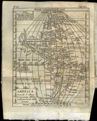
175169769Venezia 1751. 8vo. Samtidig helpergamentbind. 24 442 2 s. Med 19 foldede kobberstukne kart. Appresso Francesco Pitteri Italiensk. <br/><br/><em>På Amerika-kartet er California gjengitt som øy ! Noen eselører materien noe brunplettet bindet med slitasjer i ryggen. </em> unknown
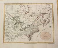
1776015982Circa 1776: Millar 1776. 1st Edition 1st Printing. Framed. Very Good/No Jacket. 15 1/2" x 14. Fine revolutionary era map of North America showing the British colonies with Nova Scotia part of the same British group of colonies as the Future United States with the southern colonies extending to the Ohio and Mississippi rivers. A clean complete copy with three folds as issued. <br/> <br/> Millar unknown
1742SZEPEBKS007524ILondon: John and Paul Knapton 1742. Hardcover. Good. Title continues: " . With a Sett of Maps Engraven from Cellarius. Designed for The Use of Schools and of Gentlemen who make the Antient Writers their Delight or Study. / Translated from the French of Mr. L'Abbe Du Fresnoy with great Additions and Improvements from Ptolemy Strabo Cellarius &cc. To which is added a Large Index." - Large wide 8vo. - vi615739 pp. plus 33 double-page plates with large margins. - Contemporary 3/4-leather with marbled paper boards corners somewhat worn edges of spine slightly cracked spine with 5 raised gilt bands title in gilt on green leather label. Front cover separated from binding - Some water stain especially in "Italia Antique" With an engraved heraldic bookplate with the motto: "COMME JE FCS" - In English. - "Additions and Corrections" on Page vi. - With 33 double-folded maps R. W. Seale sculp. Small tears at bottom of second fold without loss in 5 maps; a bigger tear but again without loss. in Map xxii: "Asia Minor". <br/> <br/> John and Paul Knapton hardcover
1792M1466Dublin: John Jones 1792. Very Good. Size : 330x410 mm 13x16.125 Inches Coloring: Original Outline Coloring Category: ; Maps North America Great Lakes; Maps Canada John Jones unknown