[GREAT BRITAIN - IRON]Biblio.com
98 résultats
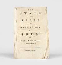
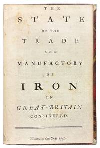
175042149London 1750. 8vo. 6 7/8 x 4 1/4 inches. 15 pp. An abridgement of the Interest of Great Britain in supplying herself with Iron circa 1747. Half red morocco and marble paper boards. Marginal notes trimmed<br/> <br/> A conflicted call for economic protectionism on the eve of industrial transformation and a snapshot of British iron trade policy in 1750 caught between timber tariffs and transatlantic competition.<br/> <br/> An important and revealing mid-eighteenth-century pamphlet addressing the British iron industry at a moment of significant economic and technological transition. This work is considered an abridged version of The Interest of Great Britain in Supplying Herself with Iron published circa 1747 and offers a pointed critique of foreign and colonial competition in iron production. The anonymous author provides a rare quantitative estimate of domestic iron output 18000 tons annually and laments the numerous challenges facing British ironmasters including the rising cost and increasing scarcity of timber then still the primary fuel used in smelting. In a notably conflicted argument the tract decries the influx of Swedish iron while expressing even greater alarm over the growth of ironworks in Britain's North American colonies viewing both as threats to the domestic market. Strikingly the pamphlet makes no mention of the use of pit coal i.e. mineral coal in iron manufacturing a technological development that would prove pivotal. This omission is particularly curious given that Lord Dudley had patented the process in 1619 and that Abraham Darby's pioneering use of coke at Coalbrookdale had been underway for over a decade by the time of this publication. The absence of such a reference suggests either a conservative industrial perspective or a lack of awareness of emergent metallurgical practices that would soon transform the industry and pave the way for Britain's dominance during the Industrial Revolution. Referenced by J.R. McCulloch in his A Select Collection of Scarce and Valuable Tracts on Commerce 1859 who found it "curious" for its data and omissions alike this tract provides not only valuable insight into 18th-century economic policy and protectionist sentiment but also a fascinating snapshot of the iron trade on the cusp of technological upheaval.<br/> <br/> ESTC T76989; Sabin 90635. McCulloch The Literature of Political Economy 1845. unknown
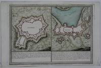
1705M5239Paris 1705. excellent. Notes: With a decorative water mark Size : 255x355 mm 10x14 Inches Coloring: Hand Colored Category: Maps City Maps; Maps Europe Portugal unknown
1715M5226Paris 1715. Excellent. Size : 255x365 mm 10x14.375 Inches Coloring: Hand Colored Category: Maps City Maps; Maps Europe Portugal unknown
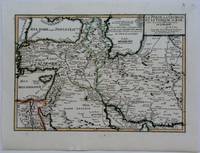
1703M5176Paris 1703. Excellent. Size : 230x335 mm 9x13.125 Inches Coloring: Original Outline Coloring Category: Maps Asia Near East Turkey; Maps Asia Middle East Iran Iraq; Maps Asia Middle East Caucasus.; unknown
171458931714. : 7 In four places along the edges of the map some discoloration from tape is visible. This does not affect the map itself. Dimensions of the map excluding the white borders: Height: 22 cm Width: 325 cm Height cm: 25 CM Width cm: 375 CM unknown
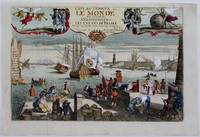
1725M4694Paris 1725. Excellent. Notes: A decorative and beautifully hand coloured title page of the important atlas L'Atlas Curieux ou Le Monde" by Nicholas de Fer. Size : 220x335 mm 8.625x13.125 Inches Coloring: Hand Colored Category: Maps Misc Curiosities Title Pages Games etc. unknown
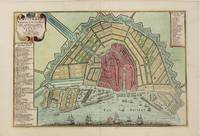
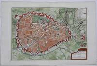
1705M4585Paris 1705. Very Good. Size : 230x340 mm 9x13.375 Inches Coloring: Hand Colored Category: Maps City Maps; Maps Europe Benelux unknown
1705M5243Paris 1705. Excellent. Size : 225x320 mm 8.875x12.625 Inches Coloring: Hand Colored Category: Maps City Maps; Maps Europe Benelux unknown
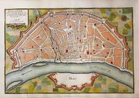
1705M5135Paris 1705. Very Good. Notes: Copper engraved plan of Cologne Köln in Germany. It is beautifully hand coloured. Size : 235x350 mm 9.25x13.75 Inches Coloring: Hand Colored Category: Maps City Maps; Maps Europe Germany unknown
1703M5179Paris 1703. Excellent. Size : 230x310 mm 9x12.25 Inches Coloring: Original Outline Coloring Category: ; Maps Asia Middle East Holy Land & Palestine unknown
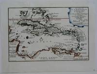
1702M5228Paris 1702. Very Good small tear in the upper left margin professionally repaired not affecting the image. Size : 225x335 mm 8.875x13.125 Inches Coloring: Hand Colored in Outline Category: ; Maps West Indies Whole unknown
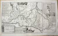
1705M10253Paris 1705. Very Good. Notes: Map showing the Canal de Briare and the Canal D'Orleans with indexes and descriptive notes on both canals. Size : 385x651 mm 15.16x25.63 Inches Coloring: Black & White Category: Maps Europe France; unknown
1705M5137Paris 1705. Excellent. Size : 235x350 mm 9.25x13.75 Inches Coloring: Black & White Category: Maps City Maps; Maps Europe Germany unknown
1750152922London: 1750. First edition thus an abridgement of the 1736 pamphlet The Interest of Great Britain in Supplying Herself with Iron. "This tract is curious from the information which it affords respecting the production of iron at the time which the author estimates at 18000 tons. He states the difficulties with which the manufacture had to contend from the scarcity and high price of timber; and yet not very consistently complains of the importation of Swedish iron and still more bitterly of the establishment of iron works in our North American colonies. It is curious that not a word is said in this tract about the employment of pit-coal in the manufacture of iron; though Lord Dudley had taken out a patent for its application in 1619; and the practice of making iron by its means had been carried on to some extent at the works in Colebrook Dale since about 1740 or for ten years previously to the publication of this tract" McCulloch p. 238. Octavo 16pp. Sewn as issued uncut. Neat ink notation at head of title page. Minor creases and soiling a very good copy. ESTC T76989; Sabin 90635. McCulloch The Literature of Political Economy 1845. unknown
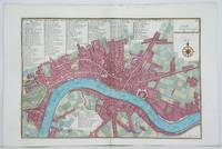
1705M4627Paris 1705. Very Good. Size : 230x340 mm 9x13.375 Inches Coloring: Hand Colored Category: Maps City Maps; Maps Europe United Kingdom England London unknown
1705M4703Paris 1705. Excellent. Size : 250x355 mm 9.875x14 Inches Coloring: Black & White Category: ; Maps Europe Germany unknown
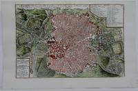
1742M4678Paris 1742. Very Good. Size : 575x430 mm 22.625x16.875 Inches Coloring: Original Outline Coloring Category: ; Maps Europe Spain; Maps Europe Portugal unknown
1705M5230Paris 1705. Excellent. Size : 225x335 mm 8.875x13.125 Inches Coloring: Hand Colored Category: Maps City Maps; Maps Europe Portugal unknown
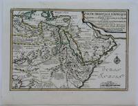
1703M5175Paris 1703. Excellent. Size : 225x325 mm 8.875x12.75 Inches Coloring: Original Outline Coloring Category: Maps Africa North Egypt; Maps Asia Middle East Arabia unknown
1705M6202Paris 1705. Excellent. Notes: An attractive map of the city of Narva besieged by a military encampment.<br><br>The Battle of Narva was an early battle in the Great Northern War fought in November of 1700. The Swedish army under Charles XII of Sweden defeated a Russian force four times its size commanded by Peter the Great. Narva marked the peak of Swedish power on the continent with Russia eventually gaining decisive victories that were able to end the conflict. Size : 230x325 mm 9x12.75 Inches Coloring: Hand Colored Category: ; Maps Europe Estonia Latvia; Maps City Maps; Maps Military unknown
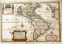
1717M11008Paris: Chez l'autheur dans l'Isle du Palais sur le Quay de l'Orloge a la Sphere Royale 1717. Very Good. Notes: Beautiful example of the map of the Americas by renowned 17th century French cartographer Nicolas De Fer.<br><br> Size : 225x337 mm 8.86x13.27 Inches Coloring: Hand Colored Category: Maps North America; Maps South America Countries; Chez l'autheur dans l'Isle du Palais sur le Quay de l'Orloge a la Sphere Royale unknown
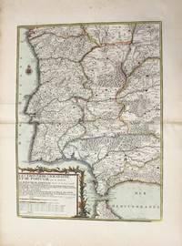
1790M10223Paris: Chez Desnos 1790. Very Good. Notes: Detailed map of Portugal and western Spain showing Gibraltar region. Size : 580x432 mm 22.83x17.01 Inches Coloring: Original Hand Coloring Category: Maps Europe Portugal; Maps Europe Spain; Chez Desnos unknown
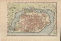
1715019811Paris. Very Good. 1715. Map. Lovely engraved map depicting Mexico City in the early 18th century. Map is on a 10 ¾" x 15 ¾" sheet that was taken from Nicolas de Fer's "L'Atlas Curieux" of 1715; no content on verso. Date of map was printed in upper margin along with the sheet number "125" and title; content in French. Hand-coloring is still bright. Map has very light toning to edges but is otherwise clean. This detailed map depicts Mexico City when it was surrounded by water and was linked to the mainland by the famous causeways originally designed by the Aztecs. Also pictured are aqueducts and farms and about 50 locations have been numbered on the map but the key is not present likely printed on another page in the Atlas. A beautiful map. . unknown
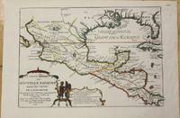
1705M772Paris 1705. Excellent. Notes: This map covers the Gulf of Mexico through Central America and includes parts of Cuba and Jamaica. It extends through Mexico to show the southern tip of Baja California. This is an early map to show the correct location of the Mississippi River delta gleaned from the expeditions of La Salle and Iberville. Two French forts are located: LaSalle's Fort St. Louis in Texas Fortbati en 1685 and another near present-day New Orleans. One of the prominent features in northern Mexico is Les Fameuses Mines de Ste. Barbe the legendary Santa Barbara mines of the Chihuahua-Durango region. Size : 230x335 mm 9x13.125 Inches Coloring: Original Outline Coloring Category: Maps Central America Mexico unknown
1705M5280Paris 1705. Excellent. Size : 225x340 mm 8.875x13.375 Inches Coloring: Hand Colored Category: ; Maps Europe Estonia Latvia unknown