[GREAT BRITAIN - IRON]Biblio.com
98 résultats
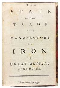
175042149London 1750. 8vo. 6 7/8 x 4 1/4 inches. 15 pp. An abridgement of the Interest of Great Britain in supplying herself with Iron circa 1747. Half red morocco and marble paper boards. Marginal notes trimmed<br/> <br/> A conflicted call for economic protectionism on the eve of industrial transformation and a snapshot of British iron trade policy in 1750 caught between timber tariffs and transatlantic competition.<br/> <br/> An important and revealing mid-eighteenth-century pamphlet addressing the British iron industry at a moment of significant economic and technological transition. This work is considered an abridged version of The Interest of Great Britain in Supplying Herself with Iron published circa 1747 and offers a pointed critique of foreign and colonial competition in iron production. The anonymous author provides a rare quantitative estimate of domestic iron output 18000 tons annually and laments the numerous challenges facing British ironmasters including the rising cost and increasing scarcity of timber then still the primary fuel used in smelting. In a notably conflicted argument the tract decries the influx of Swedish iron while expressing even greater alarm over the growth of ironworks in Britain's North American colonies viewing both as threats to the domestic market. Strikingly the pamphlet makes no mention of the use of pit coal i.e. mineral coal in iron manufacturing a technological development that would prove pivotal. This omission is particularly curious given that Lord Dudley had patented the process in 1619 and that Abraham Darby's pioneering use of coke at Coalbrookdale had been underway for over a decade by the time of this publication. The absence of such a reference suggests either a conservative industrial perspective or a lack of awareness of emergent metallurgical practices that would soon transform the industry and pave the way for Britain's dominance during the Industrial Revolution. Referenced by J.R. McCulloch in his A Select Collection of Scarce and Valuable Tracts on Commerce 1859 who found it "curious" for its data and omissions alike this tract provides not only valuable insight into 18th-century economic policy and protectionist sentiment but also a fascinating snapshot of the iron trade on the cusp of technological upheaval.<br/> <br/> ESTC T76989; Sabin 90635. McCulloch The Literature of Political Economy 1845. unknown
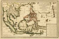
1702143641Paris: Nicolas de Fer 1702. Very Good. Paris Nicolas de Fer circa 1702. A hand-coloured engraved map printed surface 225 × 339 mm sheet size 250 × 361 mm. Engraved by Charles Inselin. Light tanning; a few unobtrusive spots and marks; crease to the border in the top right-hand corner with minimal loss to the marginal corner-tip; in very good condition. A map of the Philippines the Indonesian archipelago mainland Southeast Asia as far north as Taiwan and the Mariana Islands from de Fer's 'Atlas Curieux' 1700-1705. Nicolas de Fer unknown
1750S376681750. paperback. gebraucht gut Bon état. Ein Einriss 3 cm verso fachmännisch geschlossen Papier altersbedingt leicht fleckig und geknickt sonst GUTES EXEMPLAR. 235 x 345 cm. In französischer Sprache. 112. Par N. de Fer Geog. de Sa Majeste' Catolique et de Monseigneur le Dauphin. Für Ihre Zufriedenheit versenden wir mit DHL und ausschließlich mit Trackingcode für eine sichere Sendungsverfolgung! Weitere Angebote unter antiquariat-kastanienhof paperback
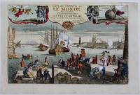
1725M4694Paris 1725. Excellent. Notes: A decorative and beautifully hand coloured title page of the important atlas L'Atlas Curieux ou Le Monde" by Nicholas de Fer. Size : 220x335 mm 8.625x13.125 Inches Coloring: Hand Colored Category: Maps Misc Curiosities Title Pages Games etc. unknown
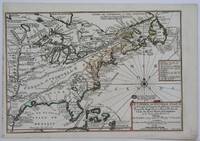
1705M4344Paris 1705. Excellent. Notes: This decorative map focuses on the French possessions in North America. The treatment of French Florida is intriguing. The map shows the United States of America and parts of Southern Canada East of the Mississippi river.<br>"Territorial expansion of New France had reached the Mississipi River with the establishment of the first European settlement at Fort Maurepas by Pierre Le Moyne d'Iberville in 1699 sixteen years after La Salle had reached the mouth of the river. This attractive map from 'L'Atlas Curieux ou le Monde' paris 1705 although containing geographical errors has many interesting historical notes" -The Macdonald Stewart Foundation Size : 232x342 mm 9.125x13.5 Inches Coloring: Hand Colored in Outline Reference: The Macdonald Stewart Foundation "La Decouverte du Monde Cartographes et Cosmographes" Map # 44; McCorkle 702.2 Category: ; Maps North America Great Lakes; Maps Canada; Maps Canada East; Maps United States East; Maps United States South unknown
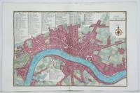
1705M4627Paris 1705. Very Good. Size : 230x340 mm 9x13.375 Inches Coloring: Hand Colored Category: Maps City Maps; Maps Europe United Kingdom England London unknown
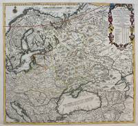
1711M4915Paris 1711. Very Good upper and lower margin have been extended. Laid on acid free paper for long term preservation. Notes: Stolen Size : 520x565 mm 20.5x22.25 Inches Coloring: Original Outline Coloring Category: ; Maps Europe Poland Lithuania; Maps Europe Ukraine unknown
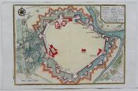
1705M4699Paris 1705. Excellent. Size : 245x340 mm 9.625x13.375 Inches Coloring: Hand Colored Category: Maps City Maps; Maps Europe Austria unknown
1705180573Paris: Published by the author 1705. First Edition . Hardcover. Very Good/No Jacket. Wide 8vo. An atlas comprising 19 maps 1. Des cercels de Longitude et de Latitude et des Diverses Positions de la Sphere; 2. Carte General du Globe Terrestre et Aquatiques ou Mappemonde en deux Plans-hemisphere 1705; 3. l'Europe Dresee sur diverse Relations; 4. L'Asie Dressee Sur Divers Relations 1705; 5. L'Aftique Dressez sur les dernieres Relations; 6. L'Amerique Meridionale; 7. L'Amerique Septentrionale et les Terres Polaires Arctique; 8. La France Avec Ses Acquisitions Insqu'a l'Annee 1705; 9. Les Environs de Paris 1705; 10. Les XVII Provinces des Pais Bas Divisees 1705; 11. Les Isles Britanniques ou Sont les Royaumes D'Angleterre D'Ecosse et D'Irleland avec les Costes Septentrionales de France et Celles de Pais Bas; 12. Suede Norvegue et Dannemarck 1705; 13. Les Estats de la Couronne de Pologne 1705; 14. L'Allemagne Divisee En Dix Cercles Dressee sur les Derniers memoires; 15. Estats du Grand Duc de Moscovie suivant les derniere relations; 16. Hongrie ou Partie Septent de la Turque en Europe; 17. L'Espagne Divisee en Galice Asturies Biscaye Navarre Leon Vielle et Nouvelle Castille Arragon Andalousie Mursie Valence et Catalogne avec Les Isles Majorque Minorque et Yvica au Roy d'Espagne; Le Portugal et L'Algarve avec Roy de Portugal; 18. L'Italie Divisee en ses Pricipaux Estats; 19. Partie Mediridionale de la Turquie D'Europe ou La Grece. Each map has a written descritpion in French. The first 2 pages are lacking the paper on the right-hand edge and have been repaired. The remainder of the maps and text are in very good original condition. A newer binding in 3/4 brown calf over brown boards with marbled endpapers with the bookplate of Antonio Barrette on the blank ffep. An excellent copy of a very scarce work. <br/> <br/> Published by the author hardcover
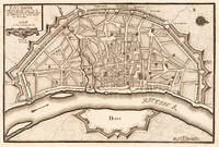
170219554Paris: N. de Fer 1702. Other. One old crease in the paper else in very good condition. 232 by 349mm 9 by 13 inches. 232 by 349mm 9 by 13 inches. Hand-Colored Original Copperplate Engraving by Nicolaus de Fer depicting Cologne. Published Paris N. de Fer 1702. Sheet: 232 by 349mm 9 by 13 inches. A fine and original hand-colored example of de Fer's celebrated cartographic work documenting this region of Germany with the precision and decorative artistry characteristic of the 17000s. Nicolaus de Fer was a cartographer active in the 1700s working in the tradition of European copper-engraved cartography. Their maps are valued by collectors for their historical accuracy and decorative quality.This original copperplate engraving with original hand coloring depicts the region of Cologne published in Paris N. de Fer 1702. The map records the political and geographic boundaries of the region as understood in 1702 offering a fascinating window into the history of German territorial organization. Sheet measures 232 by 349mm 9 by 13 inches. In excellent condition. Ready to frame. N. de Fer unknown
1705M1429A detailed map of Normandy also showing the islands of Guernsey Jersey and part of Brittany.<br /> From "L'Atlas Curieux ou le Monde Represente ans des Cartes Generales et Particulieres du Ciel et de la Terre..."
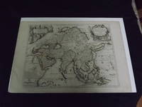
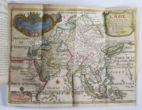
1722biblio10<p>Engraved double page map 28" x 20" wide margins hand colored in outline two uncolored pictorial cartouches. Expert and nearly invisible repairs along centerfold normal aging; about near fine. Impression is bright and clean. Nicholas De Fer 1646-1720 was a highly respected and prolific French cartographer whose maps were valued for their decorative appeal. Around 1690 he was made the geographer to the Dauphin and published his first atlas. He would become geographer to other high-ranking individuals in French and Spanish society. The present map is detailed and attractive map of Asia with a cartouche showing Chinese at the upper left and Indians in the upper right. The map covers a lot of territory showing Arabia and the Persian Empire in the West and Japan in the east but goes as far south as the Isle of Borneo and Java. Part of Eastern Europe is also visible. Library missouri website.</p>
1705356958Paris. 1705. Good old repair to right margin smoke stains to top margin no affecting the image short tears to lower margin. 26.5x29x0.1 cm. Image size: 21x32.2 to neatline. Uncolored engraved map of Duchy of Milan by the prolific French mapmaker. weight: 0.1 lb. unknown
170423542Paris: N. de Fer 1704. Other. In very good condition. 244 by 345mm 9½ by 13½ inches. Copper engraving uncolored as published. N. de Fer unknown
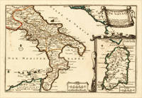
170515703Paris: N. de Fer 1705. Other. In excellent condition. 223 by 335mm 8 by 13 inches. 223 by 335mm 8 by 13 inches. Original antique hand-colored copper engraving published 1705. Depicting Kingdom of Naples this map is a fine example of 0s European cartography. Image: 223 by 335mm 8 by 13 inches. An attractive and historically significant 18th-century map for the discerning collector. Nicolas de Fer 16461720 was a prominent French cartographer engraver and publisher based in Paris. After inheriting his father's mapmaking business de Fer built it into one of the most productive cartographic firms in France eventually becoming Geographer to King Louis XIV of France and King Philip V of Spain. His output was prolificmore than 600 sheet maps town plans and atlasescovering Europe the Americas and beyond. De Fer's maps are known for their decorative cartouches attractive hand coloring and commercial appeal though they were sometimes criticized for prioritizing artistry over accuracy. His maps are particularly associated with the campaigns of the War of the Spanish Succession and are sought by collectors for their decorative quality.This decorative map show the Southern part of Italy with Sicily. Inside the map are many place names rivers mountains etc. engraved. In the upper right corner we see the title cartouche. In the lower right corner we see an inset map which shows the island Sardinia. At the bottom are two mileage scales.A fine example from Introduction à la Géographie Paris sought after by collectors of antique maps of Italy antique maps of Kingdom of Naples and antique hand-colored copper engravings for sale. In very good condition. Light age-toning to the sheet as expected for a 18th-century map. N. de Fer unknown
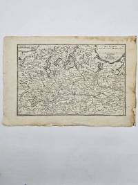
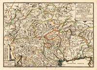
170515715Paris: N. de Fer 1705. Other. Full margins as published. 252 by 352mm 10 by 13 inches. 252 by 352mm 10 by 13 inches. Original antique hand-colored copper engraving published 1705. Depicting Tyrol & Trentino this map is a fine example of 0s European cartography. Image: 252 by 352mm 10 by 13 inches. An attractive and historically significant 18th-century map for the discerning collector. Nicolas de Fer 16461720 was a prominent French cartographer engraver and publisher based in Paris. After inheriting his father's mapmaking business de Fer built it into one of the most productive cartographic firms in France eventually becoming Geographer to King Louis XIV of France and King Philip V of Spain. His output was prolificmore than 600 sheet maps town plans and atlasescovering Europe the Americas and beyond. De Fer's maps are known for their decorative cartouches attractive hand coloring and commercial appeal though they were sometimes criticized for prioritizing artistry over accuracy. His maps are particularly associated with the campaigns of the War of the Spanish Succession and are sought by collectors for their decorative quality.Ornated in the lower left corner with a small milage scale.A fine example from Introduction à la Géographie Paris sought after by collectors of antique maps of Italy antique maps of Tyrol and antique hand-colored copper engravings for sale. In very good condition. Light age-toning to the sheet as expected for a 18th-century map. N. de Fer unknown
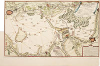
171752957Paris. 1717. Detailed map of a battle in the July of 1712 with troop placementsand positions on the map. An explanation of the battle at lower right. Accompanying text on reverse. Published in de Fer's Atlas Curieux ou Le Monde. Copper engraving. Very good condition. Upper left top and right hand margin have been trimmed close to edge of plate Later colouring. Size: 52.5 x 31 cm. unknown
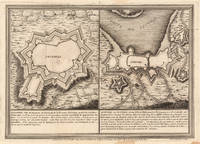
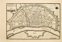
171753083Atlas Curieux ou le Monde. Paris 1717. Plan of Cologne with north to the right showing fortifications and old town. Title at top left. Includes accompanying text Copper engraving. Excellent condition good margins. Uncoloured. Size: 34.8 x 24 cm. 13½ x 9½ inches unknown
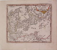
1725204942Paris: de Fer Nicolas 1725. unbound. very good. Map. Engraving with modern hand coloring. Image measures 5.25" x 6.25".<br/> <br/> Charming miniature map of Denmark with the Coat of Arms incorporated in the cartouche. Map includes both Schleswig and Holstein while today part of the former and all of the latter are northern Germany. Nicolas de Fer 1646-1720 was a French cartographer engraver and publisher. He became official geographer to the French Dauphin 1691 and to the Spanish King 1702.<br/> <br/> de Fer, Nicolas unknown
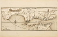
171053828Atlas Curieux ou le Monde. c.1710. The lower half of this attractive engraving shows the mouth of the Tagus from the sea to Lisbon showing the coastline settlement and fortification in detail. Title at top centre flanked by two views- To the left the 'Palais Royal de Lisbonne' and to the right 'Le Chateau de Belem'. Copper engraving. Fine condition. Uncoloured. Size: 405 x 175 mm. 16 x 7 inches. unknown
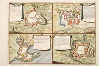
170565687Paris 1705. An unusual and interesting plan of the fortifications of four villages in Portugal. Published in the 'Atlas Curieux ou Le Monde'. Size: 275 x 410 mm. Copperplate engraving with later hand colour. Good condition. unknown
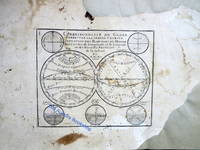
171750277Paris: Guillaume Danet Son-in law of the author 1717. Second edition. Hardcover. Good- to very good condition. Octavo. 197 9pp. 5 folding maps. Original calf with gilt lettering tooling and ruling on spine; raised bands. Decorative endpapers. Title page with copperplate engravings of two hand-colored printed globes and black double-framing California depicted as an island in this and two other maps. Second edition augmented with longitudes and latitudes of major cities. Illustrated headpiece decorative initials and endpieces. All pages with double frames; marginalia. <br /> <br /> Introduction to geography by the French cartographer and engraver Nicolas de Fer 1646–1720 containing five folding copperplate engraved maps four of them hand-colored. The first showing a general map of the globe with America in one Europe Africa and Australia in the second globe both with North and South Poles. The margins are adorned with hand-colored portraits of significant explorers; Columbus Vespuci Shouten etc. The second map is the only one in black and white. It depicts "La Sphere Artificielle." The third map shows Europe the fourth Asia the Middle-East and Oceania with parts of Europe and Africa and finally North and South America depicted on the fifth. Contains list of cities and catalog of Fer publications at rear.<br /> <br /> At the age of twelve Fer became an apprentice of the Parisian engraver Louis Spirinx. After the death of Fer's father in 1673 he also was a cartographer Nicolas took over the business specializing in the production atlases geography and cartography-oriented publications. Well connected to the Royal Court Fer advanced to become the official geographer of the Philip V of Spain and Louis XIV of France. His numerous publications are considered artistic rather than accurate.<br /> <br /> Text in French. Binding rubbed along edges and boards with front joint mostly cracked but holding together. Small plate of previous owner glued to upper inside front cover. Inked and penciled notes on verso of decorative front endpaper. Starting at title page. Some creasing and small closed tears of maps. B/w map with two inch tear reinforced with tape on verso. Map of Europe with four inch closed tear. Map of America also reinforced with three and a half inch paper strip on verso. Page ninety-three with remnants of black glossy paper glued to gutter and part of text some loss of text. Binding in overall good- interior in good to very good condition. Guillaume Danet (Son-in law of the author) hardcover
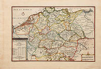
170578548Paris: 1705. Nicolas de Fer's excellent map of the German states. From the "Atlas Curieux ou Le Monde". Copper engraving. Hand colouring. Size: 274 x 405 mm Good condition. unknown
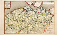
170566131Paris. c.1705. A charming map of Spanish and Dutch Flanders in the early eighteenth century. A number of the larger cities and towns are highlighted together with local physical features in the form of rivers canals woodlands and marshland. Published in de Fer's 'Atlas Curieux ou Le Monde'. Size: 275 x 400 mm. Copperplate engraving with later hand colour. Fine condition. unknown
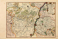
170578854Paris: 1705. Map of the Bishopric of Liege and the surrounding areas of Maastricht. Published in "Atlas Curieux ou le Monde". Copper engraving. Hand coloured. Size: 273 x 402 mm Very good condition. unknown