98 résultats
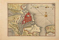
1706M6387Paris 1706. Very Good margins extended. Size : 130x175 mm 5.125x6.875 Inches Coloring: Hand Colored Category: ; Maps Europe Portugal unknown
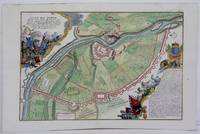
1705M4699Paris 1705. Excellent. Size : 245x340 mm 9.625x13.375 Inches Coloring: Hand Colored Category: Maps City Maps; Maps Europe Austria unknown
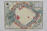
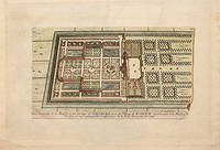
170578538Paris: 1705. Nicolas de Fer's excellent plan of the Nieuburg House where the treaty of Ryswick in the Netherlands was signed in 1697 and not 1705 as stated in the print. From the "Atlas Curieux ou Le Monde". Copper engraving. Hand colouring. Size: 275 x 400 mm Good condition. unknown
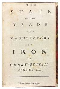
175042149London 1750. 8vo. 6 7/8 x 4 1/4 inches. 15 pp. An abridgement of the Interest of Great Britain in supplying herself with Iron circa 1747. Half red morocco and marble paper boards. Marginal notes trimmed<br/> <br/> A conflicted call for economic protectionism on the eve of industrial transformation and a snapshot of British iron trade policy in 1750 caught between timber tariffs and transatlantic competition.<br/> <br/> An important and revealing mid-eighteenth-century pamphlet addressing the British iron industry at a moment of significant economic and technological transition. This work is considered an abridged version of The Interest of Great Britain in Supplying Herself with Iron published circa 1747 and offers a pointed critique of foreign and colonial competition in iron production. The anonymous author provides a rare quantitative estimate of domestic iron output 18000 tons annually and laments the numerous challenges facing British ironmasters including the rising cost and increasing scarcity of timber then still the primary fuel used in smelting. In a notably conflicted argument the tract decries the influx of Swedish iron while expressing even greater alarm over the growth of ironworks in Britain's North American colonies viewing both as threats to the domestic market. Strikingly the pamphlet makes no mention of the use of pit coal i.e. mineral coal in iron manufacturing a technological development that would prove pivotal. This omission is particularly curious given that Lord Dudley had patented the process in 1619 and that Abraham Darby's pioneering use of coke at Coalbrookdale had been underway for over a decade by the time of this publication. The absence of such a reference suggests either a conservative industrial perspective or a lack of awareness of emergent metallurgical practices that would soon transform the industry and pave the way for Britain's dominance during the Industrial Revolution. Referenced by J.R. McCulloch in his A Select Collection of Scarce and Valuable Tracts on Commerce 1859 who found it "curious" for its data and omissions alike this tract provides not only valuable insight into 18th-century economic policy and protectionist sentiment but also a fascinating snapshot of the iron trade on the cusp of technological upheaval.<br/> <br/> ESTC T76989; Sabin 90635. McCulloch The Literature of Political Economy 1845. unknown
1750152922London: 1750. First edition thus an abridgement of the 1736 pamphlet The Interest of Great Britain in Supplying Herself with Iron. "This tract is curious from the information which it affords respecting the production of iron at the time which the author estimates at 18000 tons. He states the difficulties with which the manufacture had to contend from the scarcity and high price of timber; and yet not very consistently complains of the importation of Swedish iron and still more bitterly of the establishment of iron works in our North American colonies. It is curious that not a word is said in this tract about the employment of pit-coal in the manufacture of iron; though Lord Dudley had taken out a patent for its application in 1619; and the practice of making iron by its means had been carried on to some extent at the works in Colebrook Dale since about 1740 or for ten years previously to the publication of this tract" McCulloch p. 238. Octavo 16pp. Sewn as issued uncut. Neat ink notation at head of title page. Minor creases and soiling a very good copy. ESTC T76989; Sabin 90635. McCulloch The Literature of Political Economy 1845. unknown
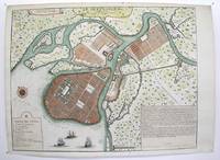
1717M3039Paris 1717. margins trimmed and laid down on 18th century paper otherwise very good. Notes: StolenRare map of the Imperial capital city during the reign of Alexander I with its traditional regular street layout and eleven districts. The map provides excellent detail of the public buildings docks and shipyards fortifications palaces churches hospitals universities etc Size : 365x473 mm 14.375x18.625 Inches Coloring: Hand Colored Category: ; Maps Russia; Maps City Maps unknown
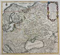
1711M4915Paris 1711. Very Good upper and lower margin have been extended. Laid on acid free paper for long term preservation. Notes: Stolen Size : 520x565 mm 20.5x22.25 Inches Coloring: Original Outline Coloring Category: ; Maps Europe Poland Lithuania; Maps Europe Ukraine unknown
1706M6389Paris 1706. Very Good margins extended. Size : 130x180 mm 5.125x7.125 Inches Coloring: Hand Colored Category: ; Maps Europe Portugal unknown
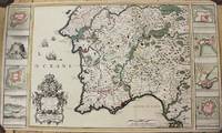
1704M10805Paris: St. Gaspar Baillieu 1704. Very Good backed on acid free tissue paper for long term preservation. Notes: Fine large scale map focused on Southern Portugal and Southern Spain. The map is surrounded by inset maps of Olivenca Castello Ferreire Aronches Badaioz Lisbonne Setubal Chateau St. Iulien Evora.<br> Size : 561x940 mm 22.09x37.01 Inches Coloring: Original Hand Coloring Category: Maps Europe Spain; Maps Europe Portugal; St. Gaspar Baillieu unknown
171458931714. : 7 In four places along the edges of the map some discoloration from tape is visible. This does not affect the map itself. Dimensions of the map excluding the white borders: Height: 22 cm Width: 325 cm Height cm: 25 CM Width cm: 375 CM unknown
1702M5130Paris 1702. Excellent. Size : 250x355 mm 9.875x14 Inches Coloring: Black & White Category: ; Maps Europe Spain unknown
1760M7182Paris: Desnos c. 1760. Very Good. Notes: These maps was originally designed by de la Hire 1640-1718 in 1705. Size : 461x461 mm 18.15x18.15 Inches Coloring: Hand Colored Reference: Tooley III:72 Category: Maps Celestial; Desnos unknown
1705M5145Paris 1705. Excellent. Size : 230x330 mm 9x13 Inches Coloring: Black & White Category: ; Maps Europe France unknown
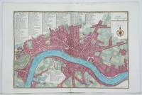
1705M4627Paris 1705. Very Good. Size : 230x340 mm 9x13.375 Inches Coloring: Hand Colored Category: Maps City Maps; Maps Europe United Kingdom England London unknown
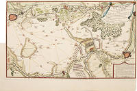
171752957Paris. 1717. Detailed map of a battle in the July of 1712 with troop placementsand positions on the map. An explanation of the battle at lower right. Accompanying text on reverse. Published in de Fer's Atlas Curieux ou Le Monde. Copper engraving. Very good condition. Upper left top and right hand margin have been trimmed close to edge of plate Later colouring. Size: 52.5 x 31 cm. unknown
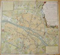
1735M7483Paris c.1735. Very Good;. Notes: Large scale decorative 18th century map of Paris. Top right title in a cartouche adorns a fountain spewing water referring to the establishment of the network of fountains in the capital. Size : 565x590 mm 22.24x23.23 Inches Coloring: Hand Colored Reference: Jean Boutier #212A Category: Maps Europe France Paris;Maps City Maps; unknown
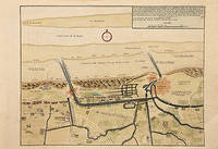
171778680Paris: c.1717. Map of the towns of Dunkirk and Mardick showing the new canal. Published in "Atlas Curieux ou le Monde". Copper engraving. Hand coloured. Size: 275 x 398 mm Very good condition. unknown
171678549Paris: 1716. A beautiful city plan of Stralsund in Germany just off the island of Rugen in the Baltic Sea. Copper engraving. Hand coloured. Sheet size: 275 x 404 mm Plate size: 230 x 332 mm Good condition. unknown
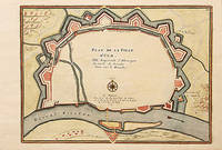
1716M5138Paris 1716. Excellent. Size : 235x325 mm 9.25x12.75 Inches Coloring: Black & White Category: ; Maps Europe Germany unknown
1705M6202Paris 1705. Excellent. Notes: An attractive map of the city of Narva besieged by a military encampment.<br><br>The Battle of Narva was an early battle in the Great Northern War fought in November of 1700. The Swedish army under Charles XII of Sweden defeated a Russian force four times its size commanded by Peter the Great. Narva marked the peak of Swedish power on the continent with Russia eventually gaining decisive victories that were able to end the conflict. Size : 230x325 mm 9x12.75 Inches Coloring: Hand Colored Category: ; Maps Europe Estonia Latvia; Maps City Maps; Maps Military unknown
1705M5280Paris 1705. Excellent. Size : 225x340 mm 8.875x13.375 Inches Coloring: Hand Colored Category: ; Maps Europe Estonia Latvia unknown
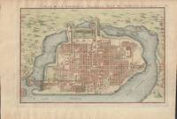
1715019811Paris. Very Good. 1715. Map. Lovely engraved map depicting Mexico City in the early 18th century. Map is on a 10 ¾" x 15 ¾" sheet that was taken from Nicolas de Fer's "L'Atlas Curieux" of 1715; no content on verso. Date of map was printed in upper margin along with the sheet number "125" and title; content in French. Hand-coloring is still bright. Map has very light toning to edges but is otherwise clean. This detailed map depicts Mexico City when it was surrounded by water and was linked to the mainland by the famous causeways originally designed by the Aztecs. Also pictured are aqueducts and farms and about 50 locations have been numbered on the map but the key is not present likely printed on another page in the Atlas. A beautiful map. . unknown
170578550Paris: 1705. A beautiful city plan of Ulm in the federal German state of Baden-Württemberg. Copper engraving. Hand coloured. Size: 277 x 403 mm Good condition. unknown
1705M5143Paris 1705. Excellent. Size : 240x340 mm 9.5x13.375 Inches Coloring: Black & White Category: Maps City Maps; Maps Europe France unknown
1720M9651Paris: Nicolas de Fer c. 1720. Very Good backed on 19th century paper. Notes: A large-scale and detailed map of the city of Paris and its surroundings during the early 18th century. The map has ornate cartouches in all corners and indexes in the left and right margins. <br>Nicolas de Fer 1646–1720 was a French cartographer and geographer. He also was an engraver and publisher. His work was most often praised for being beautiful and artistic. Size : 637x905 mm 25.08x35.63 Inches Coloring: Hand Colored Category: Maps City Maps; Maps Folding Maps; Maps Europe France Paris; Nicolas de Fer unknown