Antiquariat.de

10 résultats
1750308639AB(um 1750). 9 x 8 cm. (guter Zustand).
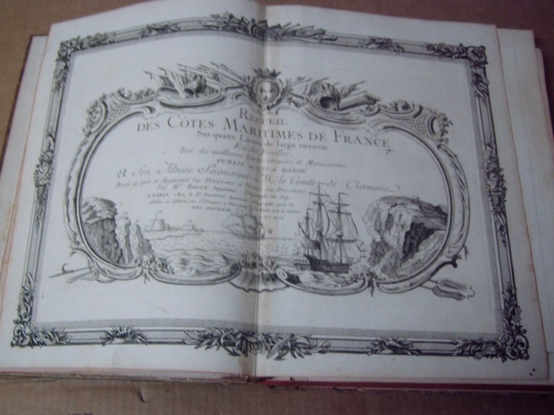
178018813genève pellet 1780 -in-4 une carte ancienne gravée sur cuivre (Copper etching) en noir par André, gravée par Arrivet. Format : 31 x 20,5 cm, pour illustrer l'uvre de l'Abbé Guillaume-Thomas Raynal intitulée "l'Histoire philosophique et Politique des Etablissemens et du Commerce des Européens dans les Deux Indes", tache brune en bas de la carte, pli central horizontal normal venant d'un atlas( horizontal centerfold), 1780 Genève Pellet Editeur,
1757245311757 1757 BRION DE LA TOUR L . DESNOS 1757/67, carte coloriée encadrée,pliure mediane jaunie image 275x 365 mm. Represente la région du GOLFE DE GASCOGNE BAYONNE-
176018711Nürnberg, Raspische Buchhandlung, um 1760. Ca. 23 cm x 35,5 cm (Druckplatte).
177278798Kopenhagen, André Philippe de Pretot, 1772. Blattmaß 28 x 40 cm; Bildmaß 18 x 28,5 cm.
178018804genève pellet 1780 -in-4 une carte ancienne gravée sur cuivre (Copper etching) en noir par André, gravée par Arrivet. Format : 31 x 20,5 cm, pour illustrer l'uvre de l'Abbé Guillaume-Thomas Raynal intitulée "l'Histoire philosophique et Politique des Etablissemens et du Commerce des Européens dans les Deux Indes", pli central horizontal normal venant d'un atlas( horizontal centerfold), 1780 Genève Pellet Editeur,
179446191794 London, Laurie & Whittle, 1794 Carte gravée sur cuivre (50,5 x 57 cm hors marges, 54 x 73 cm toutes marges comprises). Tirage de l'époque. Quelques traces d'une autre carte en surimpression. Map on copperplate (50,5 x 57 cm without the margins, 54 x 73 cm with the margins). Contemporary printing. Several light printed marks of another map.
175720773Paris, Ch. Ant. Jombert, 1757. 8vo. Mit 38 (statt 42) teils gef. Kupfertaf. XXXXI, 84 S. Pgt. d. Zeit m. hs. Rückentitel.
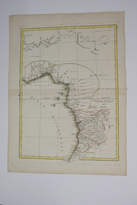
1770carte180b12Français : Un bel exemple de la carte décorative de l'Afrique de l'Ouest de Rigobert Bonne datant de 1770. Couvre de la Gold Coast (Ghana moderne), au sud autour du golfe du Bénin (Biafara) jusqu'au Gabon, au Congo et à l'Angola. Comprend les pays modernes du Ghana, du Togo, du Bénin, du Nigeria, du Cameroun, de la Guinée équatoriale, du Gabon, du Congo et de l'Angola. Comme la plupart des cartes de l’Afrique, cette carte montre d’excellents détails le long de la côte et uniquement des spéculations à l’intérieur. Donner la preuve d’importantes activités cartographiques belges à travers le Congo. Nomme de nombreux royaumes africains, dont Anzico, Mujaco, Bembe, Lubolo, Pemba, Dembi, Calbongo, Bake-Bake, Bénin et d'autres. Tentatives de cartographier le fleuve Niger quant à ses écoulements dans le désert de Seth ou Saghara, mais la plupart de cette cartographie est au mieux spéculative. Dessiné par R. Bonne en 1770 pour émission sous la planche no. B 30 dans le numéro de 1776 de Jean Lattre de l'Atlas Moderne English: A beautiful example of Rigobert Bonne's 1770 decorative map of West Africa. Covers from the Gold Coast (modern day Ghana), south around the Bight of Benin (Biafara) to Gabon, Congo and Angola. Includes the modern day countries of Ghana, Togo, Benin, Nigeria, Cameroon, Equatorial Guinea, Gabon, Congo and Angola. As with most maps of Africa, this map shows excellent detail along the coast and only speculation in the interior. Give evidence of significant Belgian mapping activities throughout the Congo. Names numerous African Kingdoms including Anzico, Mujaco, Bembe, Lubolo, Pemba, Dembi, Calbongo, Bake-Bake, Benin and others. Attempts to map the Niger River as to flows into the Desert de Seth or Saghara, but most of this cartography is speculative at best. Drawn by R. Bonne in 1770 for issue as plate no. B 30 in Jean Lattre's 1776 issue of the Atlas Moderne .
17893818<p>Appearing in the March 1789 issue of the American Museum magazine this engraving is the second American version of Franklin's famous chart of the Gulf Stream printed in America. Both American versions were preceded by English and French printings. The <strong>Chart of the Gulf Stream</strong> accompanies Franklin's "Remarks upon the navigation from Newfoundland to New York." p. 213 in the magazine. Franklin prepared the chart in 1768 while serving in London as a deputy postmaster general for mail service to and from the American colonies. It was Franklin's cousin Timothy Folger of Nantucket who provided him with a practical seafarer's knowledge of the Gulf Stream and its importance in trans-Atlantic crossings.</p><p>The previous American publication of the chart was in 1786 in <em>The Transactions of the American Philosophical Society</em>. This updated version provides a more accurate depiction of the North American coast. State boundary lines are partially indicated. One curious boundary delineation in the chart has a portion of the District of Maine extending over the northern boundaries of New Hampshire and part of Vermont.</p><p><strong>References:</strong> Wheat & Brun <em>Maps & Charts Published in America before 1800</em>: 723.</p><p><strong>Condition:</strong> Folded as issued with misfolding along one fold line. Light to occasionally moderate soiling. Edge roughness primarily at upper left edge.</p><p>ICN 7794.1</p> Mathew Carey