Gulf Research ProgramBiblio.com

505 résultats
0309368529.Gpaperback. Good. Access codes and supplements are not guaranteed with used items. May be an ex-library book. paperback
63672Berkshire:: Eaton Crane & Pike Co. no date. enclosed in publisher's two-part box illustrated in color with printed wraparound bands around envelopes and notepaper. Contents fine. Minor repairs to the joints of the illustrated box top which is a little sunned and dust-soiled. The unprinted box bottom has had several voids neatly supplied in facsimile. Box size 5-1/2 x 8-1/2 x 1 inch. Four color scenes of pairs of children playing golf in Victorian attire are illustrated on the box top; present here are three of those four illustrating 12 folded sheets of notepaper initialed by the artist W. C. O. with envelopes. Eaton, Crane & Pike Co., unknown
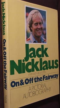
1978000167NY: Simon and Schuster. First Edition. Hard cover in dust jacket. Published NY: Simon and Schuster 1978 first printing. 4to. 256 pp. illus. Near fine in near fine price clipped dj. . Near Fine. Hard. 1st. 1978. Simon and Schuster unknown
1981491422.Gpaperback. Good. Access codes and supplements are not guaranteed with used items. May be an ex-library book. paperback
2022x-030926913XNational Academies Press 2022. Paperback. New. 86 pages. 9.02x5.98x0.79 inches. National Academies Press paperback
2023__3885795841Köllen Druck 2023. Hardcover. New. German language. 8.86x6.14x1.14 inches. Köllen Druck hardcover
188014137X.Gpaperback. Good. Access codes and supplements are not guaranteed with used items. May be an ex-library book. paperback
19971302134PN. New. 1997. Soft Cover. Date is original print. This is a reprint edition . PN paperback
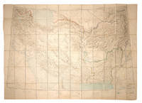
108381Calcutta Survey of India Office 1912-1923. . Heliozincographed colour map four sheets dissected and mounted on linen as one folding out to 108 x 152 cm in size scale 1:2000000 1.014 inches to 32 miles original paper covers with manuscript title label faint crayon lines confined to the area around Quetta a couple minor marginal tears repaired linen a little fragile in a few places but still a sturdy and attractive copy.<br /> Four sheets of the Survey of India Southern Asia Series 1912-1945 covering the Gulf Persia Afghanistan Boluchistan and western India stretching from Riyadh in the south-west to Bukhara in the north-east. The sheet covering the Arabian Gulf titled 'Southern Persia' is dated 1912 and shows the main travel routes along the Gulf and into the interior as far as Riyadh with none of the roads being depicted as suitable for wheeled vehicles and totally absent of railways or telegraph lines. Kuwait Bahrain Qatar Abu Dhabi and Dubai are all identified.<br /><br />Sir Sidney Gerald Burrard 1860-1943 initially served in the Survey offices at Dehra Dun before being made Surveyor General in 1908. In 1912 it was his decision to produce a new set of maps which would correct trigonometric errors in previous surveys and give a totally accurate mapping of Arabia and Central Asia centred on the oil reserves in Persia which Britain had a controlling interest in.<br /> Calcutta, Survey of India Office, 1912-1923. unknown
18943061aLondon: Simpkin Marshall Hamilton Kent & Co Ltd. G : in Good condition without dust jacket. Cover rubbed and soiled with edge-wear. Some foxing. 1894. Reprint. Illustrated card cover. 200mm x 250mm 8" x 10". 25pp ads. . Simpkin, Marshall, Hamilton, Kent & Co Ltd unknown
008750Japan: New St Andrews Golf Club Japan Very informative book on the New St Andrews Golf Club Japan Looks to be published around 1972 as an information pack for all aspects of the club. This is made up of 3 oblong format card cover booklets 14¼ x 10¼ Inches contained in an attractive cloth covered silver and gold embossed hard cover. Contains 44 pages in total plus three loose colour inserts all in overall bright clean condition a few small foxing spots to covers and a few pages. Many B/w photographs colour illustrations and plans of buildings and courses all present as called for plus very informative text NO dustwrapper outer boards are bright and clean just a small mark to bottom of spine. HEAVY BOOK 1.6 Kg with sound packing EXTRA POSTAGE REQUIRED FOR OVERSEAS.A pleasing example of an interesting and unusual golf book. SEE IMAGES. DETAILED IMAGES AVAILABLE ON REQUEST . DecorativeCloth Covered Boards. Good Plus/No Jacket. 14 ½ x 11Inches. Hardcover. New St Andrews Golf Club Japan Hardcover
1998Q-0966352408Natural Golf Corp 1998-03-01. paperback. New. In shrink wrap. Looks like an interesting title! Natural Golf Corp paperback
195220583Country Life 1952. 8vo. First Edition with title-vignette and very numerous photographs throughout; green cloth upper board and backstrip lettered in gilt red top a near fine copy in unclipped dustwrapper the latter very lightly browned on predominantly white rear panel. Scarce in this condition. Country Life, hardcover
1956153759London: Geographical Section General Staff 1956 & 1957. Scarce maps of Oman and south-east Arabia dating to the Jebel Akhdar War A pair of decidedly uncommon and impressively sized regional maps both second editions Muscat-Musira following the first of 1945 S. E. Arabia first published in 1956. The Muscat-Masira map drawn up by D Survey of the Ministry of Defence reaches as far north as Khaburah Oman on the coast south beyond Masirah Island and westward reaching beyond Lahus and Hadhi. It is based on several mappings including Bertram Thomas's map of Rub' al Khali the "Empty Quarter" 1931 the sand desert covering most of the southern third of the Arabian Peninsula Samuel Barrett Miles 1910 map of Oman and Captain F. F. Hunter's map of Arabia 1935 revision. The aeronautical chart goes into greater detail reaching beyond Sur in the North South to Masirah Island and Manadhif and West to Uruq ash Shaybah UAE; this was drawn up by No. 1 SPC.RE i.e. Survey Production Centre Royal Engineers and is based largely on the USAF Aeronautical Approach Charts 1956 and World Aeronautical Chart 563 1951. During the mid to late-1950s Britain was involved in a number of disputes in Oman perhaps the most serious involving the Imam Ghalib al-Hinai and his brother Talib bin Ali who led the Imamate's revolt against Sultan Said bin Taimur which resulted in the Jebel Akhdar or Oman War 1954-1959. In this the RAF played a leading role not least because aircraft could at the same time expedite oil exploration operations in the interior of Oman. Pembrokes light transport aircraft and heavier Avro Ansons from 1417 Communication Flight RAF carried out reconnaissance "and other tasks during this operation against the Imamate and were the first aircraft ever to land at Nizwa marked "Nazwa" on the chart on a roughly cleared strip which proved extremely hazardous for the pilots but which was later transformed into a passable airfield" Lee p. 22. The present chart has two pencilled lines radiating from Masira airfield one of which passes through Nizwa near which is marked the "approx. position" of an airstrip. The chart bear the proviso that they should "not be taken as an authority on names" and that "the alignment of all tracks is approximate". Users were also directed to update information and highlight errors which were to be directly sent to the Director of the Military Survey in the War Office. There are noticeable graphical variations between the chart and map as fitting their usage. Before the Second World War pilots flew using landmarks - such as train tracks or roads - as pointers which meant that they relied on perfect weather conditions. However technological advances in aviation alongside the use of radio for more accurate navigation meant that to a degree pilots could work in more challenging conditions. This meant that maps with their focus on terrain and details relevant from the perspective of ground troops would become irrelevant when observed from a plane's altitude. Therefore a number of countries started to produce charts highlighting key information by reducing the contour structure and focusing on key landmarks necessary for aviators. The Muscat-Masira map uses a five-colour tint scale to distinguish altitude includes a glossary and key the latter identifying towns given four categories of importance significant ruins geographical features such as mountains hills marshes saddles and passes rivers water holes and man-made features such as railways roads tracks telegraph lines pipelines and pumping stations mosques and temples; tribal and regional names are also given. However reflecting the simplification required by pilots the S. E. Arabia chart only uses fives tones to highlight land mountains paths and the sea. These maps intended for use in the field would have had a high rate of attrition; WorldCat locates just a handful of copies of the Muscat-Masira map whilst S.E. Arabia 4802 is well represented institutionally but decidedly uncommon on the market. Two colour printed maps the first 1: 1000000 scale 860 x 640 mm the second 1:500000 scale 1100 x 825 mm. Both with creases from old folds and some minor marginal splits and spots the second with pencil lines marking a flight route from Masira Island and a notation in the margin; both remain very good. Sir David Lee The RAF in the Mediterranean and Middle East 1945-71 1978. unknown
2354Durley Chine Tunbridge Wells 29 Oct. 1922. British Women's Golf Champion c.1922 one page 8vo partly laid down good condition saying "Many thanks for your letter and congratulations. I much regret the unavoidable delay in replying and have great pleasure in giving you herewith my signature." With a newspaper photograph clipping from newspaper of her admiring her trophy. Durley Chine, Tunbridge Wells, 29 Oct. 1922. unknown
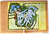
19781591219832Augusta National Golf Club 1978. Hardcover. Good. Missing dust jacket; Pages can have notes/highlighting. Spine may show signs of wear. ~ ThriftBooks: Read More Spend Less.Dust jacket missing. Shelf and handling wear to cover and binding with general signs of previous use. Boards betray fading and nicks and other signs of wear and imperfection commensurate with age. Binding is tight and structurally sound. Pages unmarked. Sealed in plastic for shipping. Secure packaging for safe delivery.Dust jacket quality is not guaranteed. Augusta National Golf Club hardcover
197876031aozThe Augusta National Golf Club 1978. imitation_leather. Good/Missing. 0x0x0. Signed by Other. Signed and isncribed by golf course designer Fred Sparks. Oversized green hardbound without dust jacket. Apart from the inscription no text markings noted. The Augusta National Golf Club hardcover
SB19B-02453Augusta National Golf Club. Used - Good. Good condition. Paperback edition. golf golfing golf tournament A copy that has been read but remains intact. May contain markings such as bookplates stamps limited notes and highlighting or a few light stains. Augusta National Golf Club paperback
5h3029Gulf Craft United Arab Emirates 2017. 143 S. mit zahlreichen Abbildungen Pappband quart. - gutes Exemplar / good condition / Text englisch - unknown
2000Q-0880119802Human Kinetics 2000-04-26. Paperback. New. New. In shrink wrap. Looks like an interesting title! Human Kinetics paperback
REDNRQTF7B0UIndependently published. paperback. Very Good. in x in x in. Independently published paperback
2018__1726703843Independently published 2018. Paperback. New. 438 pages. 8.43x5.85x0.73 inches. Independently published paperback
20182-1726708551Independently published 2018. Paperback. New. 341 pages. 10.90x8.40x0.90 inches. Independently published paperback
20182-1726703843Independently published 2018. Paperback. New. 438 pages. 8.43x5.85x0.73 inches. Independently published paperback
2018__1726708551Independently published 2018. Paperback. New. 341 pages. 10.90x8.40x0.90 inches. Independently published paperback