Manila Trading and Supply CoBiblio.com

63 résultats
1900z013094Cleveland OH: Manila Trading and Supply Co 1900. Very Good. 30 color tinted photo postcards of Japan ca. 1900s-10s most printed in Japan and distributed by Manila Trading and Supply Co. of Cleveland Ohio. Includes Geisha temples and castles scenes of everyday life cherry blossoms and nature views the giant Buddha at Daibutsu and others. Each card 6 by 4 inches all blank. Very good. Light edge wear soil and finger smudging to versos. Images bright and unmarked. Manila Trading and Supply Co unknown
4000Manila P.I.:: Central Station and Offices . Not illustrated; single sheet printed on both sides 10 33 inches accordion folded to 10 4 inches. The Manila Railroad was founded by the Spanish in the 1880s. After the Spanish American War the Americans took over control and before WWII there was quite a network on Luzon amounting to some 700 miles of track when the Japanese were approaching Luzon the Americans and the Philippine army destroyed much of the infrastructure. When the Allies finally took back the Islands there was only 452 usable miles of track.This timetable was for the Northern line and was published just a year before the Southern Line opened which ran from Manila to Legazpi on the Bicol Peninsula at the southern tip of Luzon. Attempts to build back the Philippine rail system have been many and sporadic and have been hampered by hurricane and volcano damage by illegal settlement on the rights of way and by general inertia Manila, P.I.:: Central Station and Offices, ,. unknown
2003__1843762641Edward Elgar Pub 2003. Hardcover. New. illustrated edition. 400 pages. 9.25x6.50x1.00 inches. Edward Elgar Pub hardcover
1976DNIieMAN42Manila: 1976. 1976. folio. pp. unpaginated. biblio. 96 full-page colour illus. 1 double-page colour map & colour portrait of Imelda. cloth. dw. edges little chipped. cloth slipcase little worn. First Edition. F. Hardcover. Manila: 1976. Hardcover
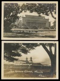
1945List3159Manila The Philippines 1945. Twenty-one photos: twelve measuring 2 ½ x 2 ½ inches most with stamped captions verso; nine measuring 2 x 3 ¾ inches most with captions on negative. Some wear; excellent. Imperial Japan occupied the Philippines from 1942 until its surrender in 1945. From early February to early March of 1945 American and Filipino forces fought to drive the Japanese out of the Philippines’ capital city of Manila. Though successful this campaign was incredibly destructive to both the infrastructure of Manila and to its people—including mass murder and rape of Filipino civilians by Japanese forces. Offered here are twenty-one photographs of buildings taken before and after the destruction of the city with most the twelve smaller photos showing the aftermath. Locations include several churches and university buildings the treasury building legislative building Manila Central Post Office and others. The photos taken after the battle are arresting showing Manila’s ruined architecture burnt out trees and downed power lines. unknown
2021DBS-9781774076712Society Publishing 2021. 1st. Hardcover. New. Society Publishing hardcover
2021DBS-9781774076712Society Publishing 2021. 1st. Hardcover. New. Society Publishing hardcover
2021DBS-9781774076699Society Publishing 2021. 1st. Hardcover. New. Society Publishing hardcover
2021DBS-9781774076699Society Publishing 2021. 1st. Hardcover. New. Society Publishing hardcover
2021DBS-9781774076200Delve 2021. 1st. Hardcover. New. Delve hardcover
2021DBS-9781774076200Delve 2021. 1st. Hardcover. New. Delve hardcover
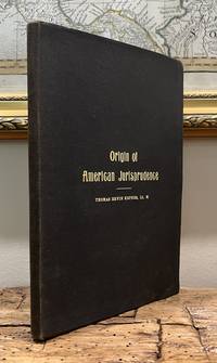
190578759n9<p>Manila: Limited Edition for Private Distribution 1905. Book. Near Fine. Hardcover. Inscribed by Authors. 1st Edition. 8vo - over 7¾ - 9¾" tall. Original grey flexible cloth covers with gilt titles to front. Moderate surface and shelf-wear to covers; edges and endpapers toned. A presentation inscription by author on front endpaper as follows: Lieut. James J. McLain / Compliments of the Author." Otherwise clean tight and unmarked. Very neat -- a sound and handsome copy. xvi186pp.</p> Limited Edition for Private Distribution hardcover
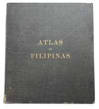
190085192Washington: GPO 1900. 1st ed. Hardcover. Good. Second Spanish-language title-page dated 1899 24p. plus 30 full page maps. Original black cloth. 38 x 33 cm. Backstrip reglued bur still chipped at ends and worn along sides. Forner owner's name on front pastedown. Internally sound and clean. No jacket as published. At head of title: Treasury Department U. S. Coast and Geodetic Survey. Special Publication No. 3. The maps in this atlas were compiled at the Jesuit Observatory in the Philippines and generally credited to Father Jose Algue its Director who supervised preparation of the maps. The maps were completed with U. S funding and published through the agency of the United States Coast and Geogetic Survey. Exact geographic information did not yet exist for some areas such as the interior of Mindanao but as the Introduction states the maps were believed ". to fairly represent the present state of geographic knowledge of the Philippine Archipelago . have utilized a large amount of new information. GPO hardcover