PHILIPPE DE PRETOT, Etienne AndreBiblio.com
137 résultats
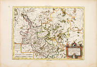
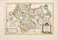
178753092Paris. 1787. An attractive map of Lower Saxony with a pleasant title cartouche at lower right scales at lower left. From the Atlas Universal. Copper engraving. Fine condition Later colour. Size: 41 x 26 cm. unknown
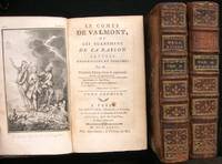
1776NS0200<p>A Paris Chez Moutard M.DCC. LXXVI 1776. First published 1774. Epistolary novel of a young rake-- said to reflect the author before entering priesthood-- saved by turning to the Church. Surely Laclos knew this popular novel and named his own rakish hero for the one here portrayed. Cioranescu 30923. Hard Cover. Three volumes: xx 4 577; 8 506; 8 590 2 pages 10 plates incl. 2 frontispieces; 17.5 cm. Bound in contemporary full calf. Good waterstains on lower portion of paper bindings worn. stock#NS0200.</p> Chez Moutard, M.DCC. LXXVI hardcover
1736AQ21594Paris: Chez Prault Pere 1736. 4 137pp 3. Bound with: DESTOUCHES Nericault Philippe. Le tambour nocturne ou le mari devin comedie angloise. Paris. Chez Prault Pere 1736. 10 116pp 4. And: DESTOUCHES Nericault Philippe. Le dissipateur ou l'honneste-friponne comedie. Paris. Chez Prault Pere 1736. 2 xii 127pp 3. 8vo. Contemporary speckled calf morocco lettering-piece spine richly gilt. Extremities worn joints split. Typed booksellers description pasted to FEP. Armorial bookplate of Elden Hall home of the Viscounts Keppel to FEP blind-stamp of John Fowles to FFEP. A sammelband of three comedies by dramatist Philippe Nericault Destouches 1680- 1754 noted for bringing to the tradition of French classical comedy influences derived from the English Restoration theatre. John Fowles 1926-2005 English novelist whose notable works include The Magus 1965 and The French Lieutenant's Woman 1969. . Chez Prault Pere unknown
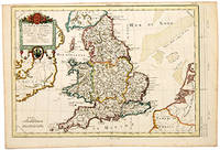
178757382Cosmographie Universale. 1787. Detailed map of England with ornamental title cartouche and coats of arms. Copper engraving. Fine condition. Light foxing to the margins not affecting the image. Later colour. Size: 41 x 28 cm. 16 x 11 inches unknown
179380590Sans lieu 1793. 205x125mm. XVI - bandeaux. Reliure plein-veau marbr de lÕpoque. Titre tomaison et fleurons dors au dos nerfs. Tranches rouge. Belle reliure dÕpoque. Bel exemplaire. 400 unknown
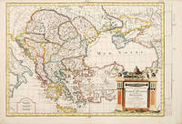
178765677Paris. c.1787. An interesting map of those countries that comprised the Turkish Empire in Europe. Each separate country is coloured in outline. A handsome and very decorative title cartouche is viewed in lower left corner. Size: 290 x 430 mm. Copperplate engraving with later additional hand colour. Good condition. Some minor foxing. unknown
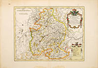
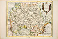
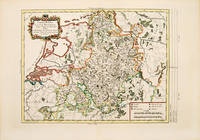
178778564Paris. 1787. An interesting map of Baviera with a very decorative cartouche. Size: 292 x 440 mm. Copperplate engraving with later hand colour. In fine condition. unknown
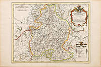
178752367Paris. 1787. Attractive Map of Bavaria with decorated cartouche at top right and 'Explication of Signes' at lower right. Published in the Atlas Universal. Copper engraving. Fine condition good margins. Later colouring. Size: 35 x 27 cm. unknown
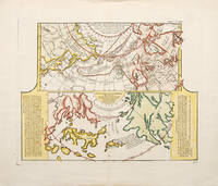
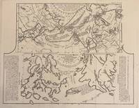
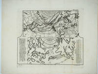
1752523481752. A fascinating map showing two early maps of the American north-west. the upper map shows the new discoveries in the northern Pacific. The coastline of Asia is more or less correctly drawn but America is wildly inaccurate. The lower part is an extract from a Japanese map brought back to Europe by Kaempfer for the collection of Hans Sloane. This shows the same area even more fancifully. The lower map is flanked by texts - an 'Avertissement'. and an extract from Kaempfer's travels. Worm hole in bottom margin not affecting the image Copper engraving. Fine condition good margins. Later colouring. Size: 40 x 32 cm. 15½ x 12½ inches. unknown
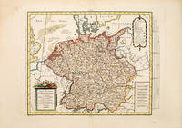
178753093Paris. 1787. Map of the whole of Germany which at the time included the Netherlands cartouche at lower right scales at lower left. Published in the Atlas Universal. Copper engraving. Fine condition Later colour. Size: 37 x 28.5 cm. unknown
179053072Paris. c.1790. An attractive and detailed map of a part of the Rhine in central Germany. Interesting and decorative title cartouche. Copper engraving. Very good condition good margins waterstains along lower margin not affecting map Later colour. Size: 35 x 26 cm. unknown
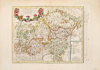
178754682Atlas Universal. 1787. Map of south east Germany. Decorated cartouche at top right. 'Explication des Signes' and scales at lower left. Copper engraving. Fine condition. Later colour. Size: 34 x 26.5 cm. 13½ x 10½ inches. unknown
17761204110039Paris Chez Moutard 1776. Hardcover. Very Good. 3 Volumes. xv 421 p ; 364 p ; 414 p. fronts. plates. 16 cm. 8vo. Bound in contemporary leather. Good bindings and covers to each volume. Ornate gilt design on spine. Gilt lettering on red spine label. Minimal wear to extremities. Chipping and loss to head and spine to Volume I and III; only to head of Volume II. Splitting starting on Volume I and III at head of spine. French. Clean unmarked pages with minimal toning. Please feel free to view our photographs. <br><br> Paris, Chez Moutard hardcover
172570717Paris: Chez les Associez Choisis par Ordre de Sa Majeste pour l'impression de ses Novelles Ordonnances 1725. Nouvelle Edition. Full Leather. Very Good. A mixed two volume set both being Nouvelle Edition but different dates and bindings. Tome premier 1725 edition 25 x 18.5 cm. 558pp ccviii unpaginated index. With a seperate title page for "Arrets du Conseil Detat Du Roy" done in 1719 Tome Second 1744 edition 26 x 20 cm. 1000pp. Both bound in full leather 5 raised bands to spines leather spine labels and gilt design. Tome premier being slightly smaller and in a darker binding than second. Small gouge to front cover of volume one and tail of spine chipped. Second has a more modern bookplate. Premier has some writing 18th century doggerel on endpapers. Bindings remain tight. French language text. Chez les Associez Choisis par Ordre de Sa Majeste pour l'impression de ses Novelles Ordonnances unknown
1772331985Paris: Academie des Sciences 1772. Map. Engraving. Image measures 12.25" x 15.5".<br/> <br/> This fascinating sheet contains two maps-- a French map of Western discoveries in Russia and the Northwest Passage area and a Japanese map of the same area taken from Japan by German explorer Englebert Kaempfer. Both maps contain notes on discoveries and speculations islands land masses and bodies of water. This map offers an interesting comparison between Eastern and Western perspectives and achievement in cartography and on the first mapping of Russia and the Northwest Passage. This was published as a supplement to Diderot's Encyclopedie. In very good condition wiith some scattered light foxing. <br> <br> Robert de Vaugondy 1688-1766 was an important French mapmaker during the 18th century. His "Atlas Universel" was one of the most significant atlases of the period integrating older sources with more modern surveyed maps in order to convey correct geographical and political information. <br> <br> Philippe Buache 1700--1773 was a French geographer who trained under the geographer Guillaume Delisle. This map of Lake Geneva is a fine example of his work.<br/> <br/> Academie des Sciences unknown
1752NS0289Paris Michel Lambert 1752. Cioranescu 18th Cent. 49804. Translated from <i>Compendium historiae universalis</i> of Jean Le Clerc by Etienne-André Philippe de Prétot. Pages 8-24 1st count is "Livres les Plus Necessaires". Not found in American or British libraries. Hard Cover. Octavo; 24 298 4 pages; 17 cm. Bound in contemporary full leather flaking hinges starting; good. stock#NS0289. Michel Lambert. hardcover
177925866Livourne 1779. Maps. A map of Asia Canada Japan and the Arctic regions with two maps on one sheet. The upper map shows the European view of the northern Pacific showing western North America from New Orleans west with a clearly depicted Mer de l'Ouest to Kamchatka and northern Japan. The lower map shows the Japanese perception of the same region with very sketchy and inaccurate features in North America and a larger showing of the Japanese islands. The Japanese map has no depiction of Alaska.<br /> <br /> Copper engraving with two maps on one sheet. Includes text. Upper margin: "Suppl. 6e carte." Lower margin: "189 190"; "R. Spadaccini Sculp." This conforms with the edition at the Univ. of British Columbia mccormick_174. According to UBC "This atlas map removed from source: Robert de Vaugondy Didier. Recueil de 10 cartes.traitant particulierement de l'Amerique du Nord et des regions arctiques d'apres les relations les plus authentiques depuis le commencement du 17 siecle reproduites. 1 p.l. 10 fold. maps. 8. Livourne 1779."<br /> <br /> The title translates - Map of new discoveries prepared by Phil. Buache the King's Geographer presented to the Academy of Science August 9 1752 and approved in its meeting on the 6th of September following. and Excerpt from a Japanese map of the universe brought to Europe by Kaempfer and deposited in the cabinet of the late Mr. Han-Sloane president of the Royal Society of London. <br /> <br /> The map also appeared in a supplement to Diderot and d'Alembert's "Encyclopédie" without the lower margin text.<br /> <br /> Printed area measures 12 1/2 x 14" on paper 15 3/4 x 20 1/4". Very good overall with some unevenness in paper production causing the lower margin to look somewhat mottled. unknown
178753094Paris. 1787. Atractive map of present day Netherlands and North West part of Germany with decorative cartouche at top left scales at lower right. Published in the Atlas Universal. Copper engraving. Fine condition Later colour. Size: 38 x 28 cm. unknown
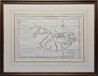
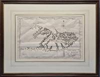
1787026741Paris: Privately Printed. 1st thus n.d. 1787; originally published in 1771. 360 x 240mm 540 x 420mm framed. Copperplate engraving; mounted with gilt border and framed in gilt decorated wood with glass. This map shows no west coast on the western island and other than Is. Sebaldes gives only two place-names. Point A indicates "Lieu ou étoit l'établissement François occupe aujourd'hui par les Espagnols." and Point B "Ou l'on soupçone que les Anglois sont établis." Appears in Bougainville's "Voyage autour du Monde" 1771 and 1772 in "Receuil des Cartes pour l'Histoire Moderne" par l'Abbé de Marsy et M. Richer extrait de "l'Atlas Universel" par Philippe de Pretot 1787 &c. Fordham 18. Framed by The Parker Gallery London BADA. VG condition with very slight fold as issued . Very Good. No Binding. 1787. Privately Printed unknown
1775026742Venice: Vincenzo Formaleoni. 1st thus n.d. 1775; originally published in 1771. 360 x 240mm 540 x 420mm framed. Copperplate engraving; mounted with gilt border and framed in gilt decorated wood with glass. Printed by Vincenzo Formaleoni. Unrecorded in Fordham's "Falkland Islands: A bibliography of 50 examples of printed maps bearing specific reference to the Falkland Islands." Framed by The Parker Gallery London BADA. VG condition with very slight folds as issued . Very Good. No Binding. 1775. Vincenzo Formaleoni unknown
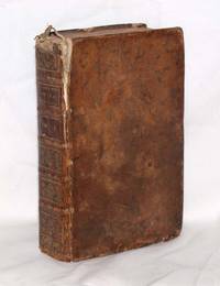
174057023Antverpiae Antwerp Anvers Antwerp: Ex offinina plantiniana Balthasaris Moretti 1740. Fine. Ex offinina plantiniana Balthasaris Moretti Antverpiae Antwerp Anvers Antwerp 1740 7.50 x 13 cm relié New edition. One engraved title-frontispiece. Contemporary worn full brown sheep binding. Headcaps worn. Joints cracked and split at head and foot. Corners cut. Some foxing and dampstains to margins. Canons and decrees of the Council of Trent in the edition and interpretation of Philippe Chifflet theologian of Besançon. Ex offinina plantiniana Balthasaris Moretti unknown
178877673BB1788 . Paris: Didot Fils 1788. 8°. XVI 341 3 S. Titelblattvignette. 28 gestochene Schlachtenpläne auf 18 Ausfalttaf. Marmorierter Pappband mit rotem Rückenschild mit goldgeprägter Schrift und Filletten und umlaufendem gemustertem Schnitt leicht gebräunt; wenige Stockflecken; Ecken bestossen: Kanten berieben; Einband minim beschabt; altersmässig gut erhalten Philippe Henri Comte de Grimoard 1753-1815. Französischer Generaladjutant und Militärschriftsteller. unknown
178752368Atlas Universal 1787. Attractive map of Austria which at the time included most of Southern Germany part of northeast Italy the Czech Republic and Slovenia. Title cartouche at top right with five coats of arms. Key at lower right. Copper engraving. Fine condition. Later colouring. Size: 36 x 27 cm. 14 x 10½ inches. unknown
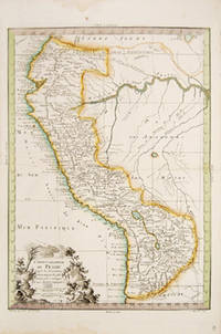
177354586Cosmographie Universal. 1773. Attractive map of Peru. Decorated title cartouche and scales at lower right. Copper engraving. Fine condition. Original outline colour. Size: 27 x 37.5 cm. 10½ x 15 inches. unknown
1708M13627Paris:: Jacques Etienne 1708. 1708. Two works in one volume. 147 x 86 mm. 12mo. xviii 94; xiv 145 7 pp. Decorated initials headpieces; lightly water-stained. Contemporary full calf raised bands gilt spine brown leather spine label marbled end-leaves; rubbed head of spine lightly chipped. Early ms. inscription on half-title. Franco Crainz rubber stamp on title. Very good. FIRST EDITION. Title translates as: 'ON THE INDECENCY OF MALE PHYSICIANS ATTENDING TO WOMEN IN CHILD-BIRTH. ' In this work the pious French physician and theologian Philippe Hecquet argued that it is immodest and indecent to have male accoucheurs deliver their children and that a woman had a 'natural right' to have a female midwife deliver their baby. In the second part of this two-part work Hecquet argues that it is a woman's duty to nurse her infant. He documents the problems of producing milk for nursing and concerns about the health of the mother. Philippe Hecquet was 'M.D. of Reins 1684 and physician to Port-Royal 1688-93. . . Hecquet . . . had to enter the Paris Faculty as a student in 1694 obtaining the license two years later and the 'bonnet de docteur' in 1697. He was made dean in 1712 and physician to the Charite in 1710.' Bibliotheca Osleriana p. 262. See: Blake NLM p. 202; Hirsch III p. 105; Osler 2922 1744; Waller 4176 Paris 1744; Wellcome III p. 232. Jacques Etienne, 1708. hardcover