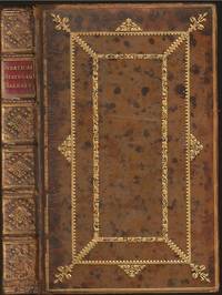
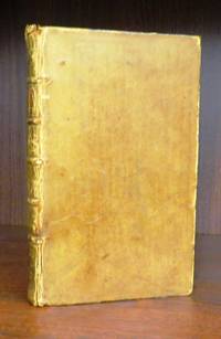
137 résultats
17879001Paris 1787. Copper engraving 29 x 41 cm engraved by Moithy after Herault black and white blank verso. Map of Asia as understood in the Greco-Roman world in classical antiquity; subsequent European discoveries are shown in outline. Map unknown
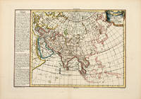
178757628Paris. 1787. Attractive map of Asia with text in French on the left on the geography divisions and borders of the continent. Decorated title cartouche at right. Copper engraving. Excellent condition. Hand coloured. Size: 42 x 28 cm. unknown
17801394642Argentorati Strasbourg: Bauer et Treuttel 1780. Quarto xiv 243 pages. In Good minus condition. Bound in full leather with gilt tooling to banded spine spine label worn away. Boards show moderate plus wear to edges moderate plus bumping and wear to corners significant wear to head and tail of spine and significant cracking along joint of front board front board loose but attached. Text block has moderate plus age toning to speckled edges and some light smudging to front free end paper. Ex libris of former owner on front paste down. Marbled end papers. 1394642. Special Collections - Downstairs. Bauer et Treuttel unknown
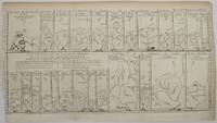
175217483Very Good. 1752. Map. Rare. Title: Essai Dun Parallele Des Fleuves De L'Europe qui ont leurs Embouchures Immediatement dans 1 ' Ocean ou dont les Eaux s'y jettent par les Mers Baltique et Meditrranee pour servir d'exemple du Parallele des Fleuves disposes en hauteur sur une meme ligne et selon la distance la plus courte des Sources aux Embouchures qui en sont comme les Bases avec le Developem. Du Cours de chaque Fleuve. Essay on a Parallel of the Rivers of Europe which have their Mouths Immediately in the Ocean or whose Waters flow there through the Baltic and Mediterranean Seas to serve as an example of the Parallel of the Rivers arranged in height on the same line and according to the shortest distance from the Sources to the Mouths which are like the Bases with the Developem. Of the Course of each River. Date printed: 1752.Condition: This original 18th century copper plate engraved map is toned with close trimming on lower left side and folds as issued but overall in very good condition. Dimensions: 19.5 x 11. Details: RIVERS OF RUSSIA POLAND GERMANY FRANCE SPAIN TURKEY and ITALY. . . unknown
17501230617.23<p>Petrum Mortier Amsterdam 1750. Hardcover. Fair. 8vo hardcover. No dj. Fair condition. Missing front cover rear board much worn barely attached. pages 233 - 788 books 3 through 8 plus Index and errata. Lacking any title page: text begins with Book 3. Text free of writing or marking binding intact cover issues nothwithstanding.</p> Petrum Mortier, Amsterdam hardcover
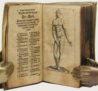
170434368Leipzig: Thomas Fritsch 1704. First German Edition. Illustrated with an engraved frontispiece of the author and 31 additional full-page engravings depicting various anatomical views. 8vo bound in the original contemporary vellum the spine with calligraphic titling by hand. viii 742 26 Register pp. A very good copy the binding still strong and well preserved the text with the usual mellowing and aging still crisp and very usable. FIRST GERMAN EDITION of this important work on anatomy partnered with the work of Philippi Verheyen Anmerckungen In Die Anatomiam Blancardi. Brieff An den weitberühmten Hrn. Friedrich Ruyschium.<br> 'Verheyen was a prolific writer including several books and manuscripts. His main work published originally in Latin the “Corporis Humani Anatomiae†was translated into multiple languages as here. This book became one of the most used anatomy books of the time.<br> The following excerpt of his book "Corporis Humani Anatomiae Liber Primus" reads : " . QuintusAuricularis quia cum minimum sit auribus expurgandis est aptissimus" translates as".the fifth finger called Auricularis because how small it is is most suitable to clean the ears". Incredibly anatomists at that time called the fifth digit "digitus auricularis".<br> Verheyen is credited with the creation of the eponym the “Achilles tendon†which denominates the common tendon for the gastrocnemius and soleus muscle although at the time he called it the “Chorda Achillisâ€. He also described the kidneys in detail especially the arterial “stars†found on the surface of the kidney which are today known as the “Stars of Verheyen†'. E. A. Miranda 2014 M.T.D. Thomas Fritsch hardcover
1752NS0289Paris Michel Lambert 1752. Cioranescu 18th Cent. 49804. Translated from <i>Compendium historiae universalis</i> of Jean Le Clerc by Etienne-André Philippe de Prétot. Pages 8-24 1st count is "Livres les Plus Necessaires". Not found in American or British libraries. Hard Cover. Octavo; 24 298 4 pages; 17 cm. Bound in contemporary full leather flaking hinges starting; good. stock#NS0289. Michel Lambert. hardcover
1749mon0004042909Paris: Desaint & Saillant 1749. Hardcover. Good. . Volume 5 only. Bound in full leather with 5 raised bands on the spine and gilt decoration cover shows moderate wear tear edgewear rubbing cracks on the spine joints starting. Marbled endpapers torn and fused. Pages show minor holing throughout. Paris: Desaint & Saillant hardcover
175022474London: R. Griffiths 1750. First Edition Thus . Hardcover. Good. A just about good copy in a worn leather binding which lacks the title-piece. Five raised bands on spine. Old ownership inscription. Two old newspaper cuttings tipped-in to front end-papers. Pp.xiv368. Folding plan of Algiers and map of Barbary the latter with a 2.5 inch repaired tear. Originally published in 1725 with a different title this edition has two additional sections on the history of Tunis and Tripoli by the translator. Quite a clean copy which would benefit from rebinding. Photograph available on request. <br/> <br/> R. Griffiths hardcover
1750ABE-EBAY-197700219745London: R. Griffiths 1750. Hardcover. Good. A Compleat History of the Piratical States of Barbary viz. Algiers Tunis Tripoli and Morocco. Containing the Origin Revolutions and Present State of these Kingdoms their Forces Revenues Policy and Commerce. Illustrated with a Plan of Algiers and a Map of Barbary. By a Gentleman who resided there many Years in a public Character Jacques Philippe Laugier de Tassy trans. Joseph Morgan. London: R. Griffiths 1750. xiv 1 368pp. The front board is detached along with the first few leaves; the rear board is weakly attached; the spine is cracked vertically the textblock nearly split in half. Externally very worn and chipped spine appears to have been treated with a glossy preservative at some point. The pages are lightly yellowed with occasional foxing minor blemishes a handful of pencil check marks. The plan of Algiers has some extra-creasing small tears and a little reinforcement verso. On the whole decent contents in a rough binding. R. Griffiths hardcover
1750E0558axiv368 pages with one folding map and folding plan. Octavo 8" x 5" bound in full leather with five raised spine bands and red label in gilt lettering to spine and gilt decorative cover with gilt spine ends. translated by Joseph Morgan. Querard IV 614 - Playfair n° 220 - Chadenat n° 896 later edition first published in English in 1725.<br /><br />This work is an influential description of Algeria first published in 1725 in French and expanded here with a detailed list of 73 Dutch ships captured by Algerian pirates. Algeria was at this time nominally ruled by the Ottoman Empire but retained a great deal of independence in practice. The work begins with a description of the various inhabitants including separate chapters on the Arabic and Turkish populations followed by chapters on its architecture military navy politics slavery trade etc. It was written by the Jacques Philippe Laugier de Tassy a former diplomat in Algeria and at this date commissioner of the French navy and consul in the Netherlands. It was translated into English as A complete history of the piratical states of Barratry a title that emphasized the notorious Algerian pirates. "Barbary" was not always a unified political entity. From the 16th century on wards it was divided into the political entities of the Regency of Algiers Tunis and Tripolitania Tripoli. Major rulers during the times of the Barbary states' plundering parties included the Pasha or Dey of Algiers the Bey of Tunis and the Bey of Tripoli. Before then the territory was usually divided between Ifriqiya Morocco and a west-central Algerian state centered on Tlemcen or Tiaret. Powerful Berber dynasties such as the Almohads 12th century and briefly thereafter the Hafsids occasionally unified it for short periods. From a European perspective its "capital" or chief city was often considered to be Tripoli in modern-day Libya although Marrakesh in Morocco was the largest and most important Berber city at the time. In addition Algiers in Algeria and Tangiers in Morocco were also sometimes seen as the "capital".<br /><br /><b>Condition:</b><br /><br />folding plate with neat repairs contemporary calf gilt upper joint repaired but splitting again lower joint tender spine a little rubbed with slight loss to extremities else about a very nice copy. Printed for R Griffiths hardcover
1750111394London: J. & J. Rivington 1751; 1750. Leather_bound. Very good . 191; 148 p. 18 cm. Full leather binding is softened at spine head and rear corners slightly bumped. Bookplate of former owner and some pencil notations on front endpapers. <br/><br/>The first work in this book is a guide to Latin language pronunciation the main author being Philippe Labbe 1607-1667 a French Jesuit writer on historical geographical and philological issues. The second part of the book is on the Greek language compiled by Ludolf Kuster 1670-1716 German philologist. J. & J. Rivington hardcover