16 résultats
1740017354London: John and Paul Knapton 1740. FIRST EDITION first printing. Period full calf with riased bands. Front & back boards are detached. First signature attached to front board. 16 1 - 359 16 pp. Previous owner's name on the front free endpaper. Not exlibrary. Overall a READING COPY only. First Edition. Full Calf Leather. Poor. 8vo - over 7¾" - 9¾" tall. Hardcover. John and Paul Knapton Hardcover
170639290J.F. & C. Rivington et al. London 1706 1707 1717 1733. Dutch reissue. Good/No Jacket. Quarter leather binding Some worm damage to boards but overall in good condition. J.F. & C. Rivington et al., London hardcover
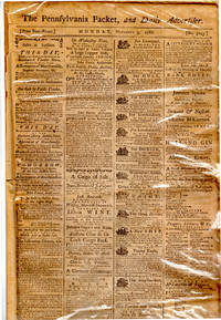
1788001479Philadelphia: John Dunlap and David C. Claypoole 1788. Soft cover. Very Good. Elephant Folio - over 15 - 23" tall. Philadelphia: John Dunlap and David C. Claypoole 1788. The November 3 1788 issue of The Pennsylvania Packet and Daily Advertiser. Elephant Folio newsprint wraps 4 pp. Very Good; small chips at fold ends modest age-toning. See scans. In protective plastic. "Epistle to Charles Wilson Peale Esq. of Philadephia on his Inimitable Painting."; the current installment of the ongoing running of "The Memoirs of Baron de Tott on the Turks and Tartars Translated from the French by an English gentleman at Paris under the immediate inspection of the Baron"; an "English Anecdote"; Foreign Intelligence; news items from Portsmouth New Haven Middletown New York Frederick Town Petersburg Charleston Savannah and Nassau. Also all of the standard fare for the Pennsylvania Packet at the time - auctions ships for charter estate sales selections from other gazettes Delaware Gazette Connecticut Gazette and period ads of all types. l-Lng1 <br/> <br/> John Dunlap and David C. Claypoole paperback
1797006228Edinburgh: Bell Andrew & Macfarquhar Colin publishers 1797 Edinburgh: Bell Andrew & Macfarquhar Colin 1797. 4to. Pages from the third edition in eighteen volumes greatly improved specifically the final part: text to vol. XVIII Part II 4 full-page engraved illustrations to this volume title-pages to all volumes preface to volume one errata to all eighteen vols. 2 ll. cancellanda for volumes XIV and VIII and frontispiece to vol. I. Large 4to pp. xvi title-page and preface to vol. I xxxiv title-pages to vols. II-XVIII and pp. 801-945 to vol. XVIII errata on verso rest as described above. One gathering 5U separated from block causing complete tear across a leaf but everything still present this gathering dustry an untampered-with survivor uncut and unopened in remains of original blue publisher's wrappers ex libris of Sir James Sutton. The final part as issued by the publisher of the third edition of the 'Encyclopaedia Brittanica' it gives the text in full from WARRANT to ZYMOSIMETER. There are five plates in the packet each measuring 9" x 11" four with multiple engravings: 1 entitled "Le Clere invenit. A. Bell Prin. Wal. Sculptor Auxit et exornavit." which is the frontispiece to Volume I and shows a variety of curiosities and inventions. 2 - 5 the plates to volume XVIII the packet also contains the complete text to this volume - "Water Works" with 9 geometical and mechanical figures "Weighing" with 2 figures one showing the back of a weighing machine the other the front with concentric circles and the weights of different countries; on the same plate ""Water" with 2 figures showing what appears to be the distillation of water. "WINTERA Aromatica" a full-page engraving showing the plant with 12 additional figures on the bottom showing the stages of growth of the plant from seed to flower. In-depth articles on Watches Water illustrated Weather Weight illustrated John Wesley Whist Wind Wine Wintera illustrated Witchcraft Wool Work-House Water-Works illustrated with tables Zoology Zurich Bell, Andrew & Macfarquhar, Colin, publishers paperback
17836524London: R. Sayer & J. Bennett 1783. Mezzotint collection mark on verso tipped onto early mount. Expert small repairs to upper corners. A charming anonymous image from the collection of Frederic R. Halsey 1847-1918 'un des principaux collectionneurs de son èpoque à New York' Lugt 1308<br/> <br/> The image of a fashionably-dressed young lady reclining by a brook being approached by a young gentleman is explained by the engraved verse by 'Mr. Nicholl' in the title area beneath the image: Alone by the side of a murmuring rill / That lav'd the gay foot of a primrosy hill / Pastora beneath a broad poplar was laid / When Damon in extasy enter'd the Shade / He sigh'd & he swore by the pow'rs overhead / If she'd bless him to day to morrow he'd wed. R. Sayer & J. Bennett unknown
177318688Paris 1773. Engraved plan cut into sections but now mounted on a single sheet of card. Image size: 20 1/4 x 31 1/2 inches. Lovely pre-Revolution map of Paris.<br/> <br/> Fascinating 1773 map of Paris that locates all major buildings and parks with an extensive index. unknown
177318688Paris 1773. Engraved plan cut into sections but now mounted on a single sheet of card. Image size: 20 1/4 x 31 1/2 inches. Lovely pre-Revolution map of Paris.<br/> <br/>Fascinating 1773 map of Paris that locates all major buildings and parks with an extensive index. unknown books
17836524London: R. Sayer & J. Bennett 1783. Mezzotint collection mark on verso tipped onto early mount. Expert small repairs to upper corners. A charming anonymous image from the collection of Frederic R. Halsey 1847-1918 'un des principaux collectionneurs de son èpoque à New York' Lugt 1308<br/> <br/>The image of a fashionably-dressed young lady reclining by a brook being approached by a young gentleman is explained by the engraved verse by 'Mr. Nicholl' in the title area beneath the image: Alone by the side of a murmuring rill / That lav'd the gay foot of a primrosy hill / Pastora beneath a broad poplar was laid / When Damon in extasy enter'd the Shade / He sigh'd & he swore by the pow'rs overhead / If she'd bless him to day to morrow he'd wed. R. Sayer & J. Bennett unknown books
17458536Roma, Fratelli Pagliarini, 1745. 3 volumes 406-[2]; VII-[1]-419; [4]-407 pages, plein veau caramel, dos à nerfs joliment ornés de filets et fleurons dorés, pièces de titre et tomaison bordeaux et beige, roulette dorée sur les coupes, tranches rouges, accroc à la coiffe du t. I, quelques petits trous de vers aux dos seulement.
17926504London: Robert Sayer & Co 1792. Mezzotints. A fine highly decorative pair of anonymous mezzotints.<br/> <br/> By the middle of the seventeenth century the bow was no longer considered a viable weapon of war in Europe although as late as 1808 Napoleon's army in Poland faced a force including 1500 archers on horseback. However Archery as a sport survived and prospered and a number of quite exclusive toxophilic societies were formed. Through the eighteenth and much of the nineteenth century archery enjoyed an enviable reputation as a genteel pursuit that both men and women could take part in with decorum. The present pair of plates depicts two archery matches: the first a men's match shows the four male contestants dressed in the uniform of their society. The central figure is just about to release an arrow at an unseen but clearly distant target. His companions stand around another stretched canvas target just behind the central bowman. The second image of a ladies' match shows four contestants all dressed in similar costume. The central figure standing behind one target draws her bow and looks to the distance where a man standing by the second target signals where her last arrow hit. Robert Sayer & Co unknown
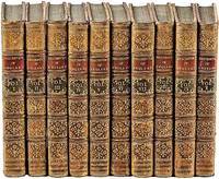
1770041343London: Printed for Newbery and Carnan 1770. First Edition. Hardcover. Very Good. Set of 10 volumes octavo; complete with 240 copper plates and vignettes in the text. Bound in contemporary calf green and red spine labels gilt rules decorations and lettering. Edges of several boards lightly rubbed. 7" x 4" This is quite an elaborate county-by-county treatment of the 18th-century English and Welsh countryside with its small towns castles monuments Roman ruins cathedrals &c. with handsome copper-engraved plates of views and buildings. Printed for Newbery and Carnan hardcover
17946467London: Laurie & Whittle 1794. Engraving with mezzotint and roulette-work a set of four titled 'Spring' 'Summer' 'Autumn' and 'Winter'. A beautiful series depicting a pair of lovers progressing through the seasons in a country landscape<br/> <br/> Spring and the gentleman presents his love with garlands of flowers a flower-seller kneels in front of them and holds up a swag of flowers she has just picked up from her overflowing basket. Summer and the harvest is in full swing the gentleman holds his love's hand and points to the young children gathering sheaths of corn in the mid-ground. The lady is seated on harvested corn in front of a stand of trees. In the trees an elder lady keeps an eye on the pair of lovers. Autumn and the pair are seated at the edge of some trees the lady offers her love a pineapple whilst her apron overflows with the fruits of the autumn. In the mid-ground two gentlemen and their dogs are out shooting. Winter and the happy pair well-wrapped against the cold take a stroll and watch the skaters in the mid-ground. Each title panel includes an appropriate 6 to 8 line quote from James Thomson's The Seasons. Laurie & Whittle unknown
179425786London: publish'd by Laurie & Whittle 1794. Engraved map on four joined sheets hand coloured in outline. Bowen and Gibson's large scale wall map of North America: a Laurie and Whittle issue published following the Treaty of Paris that ended the American Revolution.<br/> <br/>Bowen and Gibson's map was first issued in about 1755 under the title An Accurate Map of North America. It served as a generally accurate template for showing the enormous political changes that took place in the next forty years. Sometimes known as the Pownall Map of North America because of the significant contribution the former governor of Massachusetts Thomas Pownall made to the geographical knowledge of the northeast this large wall map has great presence and teems with information including numerous Native American placenames in the western areasnative tribal regions notes and routes of early roads and the forts along the Mississippi and to the west of the Appalachians. The two inset maps are of Baffin and Hudson's Bays and the mouth of the Colorado River the latter map based on the explorations of Eusebio Kino. The present map is the fourth version of the title and is an issue which incorporates the changes brought about by the 1783 Treaty of Paris. A notation on the map reads: "The Divisions in this map are coloured according to the preliminaries signed at Versailles sic. January 20th. 1783. The Red indicates the British posessions; the Green those of the United States; the Blue what belongs to the French and the Yellow what belongs to the Spaniards." Also included is Article III from the Treaty that guaranteed fishing rights to the United States in the Grand Banks and other places around New Brunswick and Newfoundland. Previous issues dating to the Revolution had included some of the articles of the 1763 Treaty these have been entirely removed and the cartouche has been reworked among other changes. The present issue has no imprint in the bottom right corner is printed on laid paper and includes the western coast of Newfoundland coloured in red.<br/> <br/>Degrees of Latitude 36; Stevens & Tree "Comparative Cartography" 49k in Tooley The Mapping of America. publish'd by Laurie & Whittle unknown books
17946467London: Laurie & Whittle 1794. Engraving with mezzotint and roulette-work a set of four titled 'Spring' 'Summer' 'Autumn' and 'Winter'. A beautiful series depicting a pair of lovers progressing through the seasons in a country landscape<br/> <br/>Spring and the gentleman presents his love with garlands of flowers a flower-seller kneels in front of them and holds up a swag of flowers she has just picked up from her overflowing basket. Summer and the harvest is in full swing the gentleman holds his love's hand and points to the young children gathering sheaths of corn in the mid-ground. The lady is seated on harvested corn in front of a stand of trees. In the trees an elder lady keeps an eye on the pair of lovers. Autumn and the pair are seated at the edge of some trees the lady offers her love a pineapple whilst her apron overflows with the fruits of the autumn. In the mid-ground two gentlemen and their dogs are out shooting. Winter and the happy pair well-wrapped against the cold take a stroll and watch the skaters in the mid-ground. Each title panel includes an appropriate 6 to 8 line quote from James Thomson's The Seasons. Laurie & Whittle unknown books
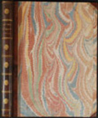
177623542London: Printed for R. Sayer and J. Bennet 1776. Octavo. 10 5/8 x 8 1/4 inches. Letterpress text: title verso blank 2pp. dedication to 'Gov. Pownall' 2pp. 'Advertisement' 1p. 'List of maps' verso blank. 6 folding engraved maps all hand-coloured in outline all cut into sections hinged with linen and folded. Large triangle from upper outer corner of dedication leaf torn away without affecting the text. Expertly bound to style in 18th-century half russia over contemporary marbled paper-covered boards spine ruled in gilt in compartments lettered direct in the second compartment the others with a repeat decoration in gilt<br/> <br/>The Holster Atlas: one of the most important atlases of the American Revolution designed for use in the field. The Holster Atlas was issued at the suggestion of Governor George Pownall and included the "maps that the British high command regarded as providing essential topographical information in the most convenient form" Schwartz & Ehrenberg.<br/> <br/>This collection of maps was published by Sayer and Bennet at the beginning of the Revolution for the use of British officers. "Surveys and Topographical Charts being fit only for a Library such maps as an Officer may take with him into the Field have been much wanted. The following Collection forms a Portable Atlas of North America calculated in its Bulk and Price to suit the Pockets of Officers of all Ranks" Advertisement. Although the publishers claimed the atlas would fit into an officer's pocket it was more usually carried in a holster and thus gained its nick-name. The six maps are as follows: 1. DUNN Samuel. 'North America as divided amongst the European Powers. By Samuel Dunn Mathematician London: printed for Robt. Sayer 10 Jany. 1774.' Engraved map hand-coloured in outline in six unequal sections sheet size: 13 3/4 x 19 inches. Engraved for Dunn's 'A New Atlas' London: 1774. 2. DUNN Samuel. 'A compleat map of the West Indies containing the coasts of Florida Louisiana New Spain and Terra Firma: with all the islands.' London: Robt. Sayer 10 January 1774. Engraved map hand-coloured in outline in six unequal sections sheet size: 13 1/8 x 19 inches. Engraved for Dunn's 'A New Atlas' London: 1774. The 'Advertisement' describes these first two maps as 'a general map of the part of the globe called North America and a second general map of those islands shores gulfs and bays which form what is commonly called the West Indies; these we consider as introductory and as giving a general idea and we trust a just one.' 3. 'A general map of the Northern British Colonies in America. which comprehends the Province of Quebec the Government of Newfoundland Nova-Scotia New-England and New-York. from the maps published by the Admiralty and Board of Trade Regulated by the astronomic and trigonometric observations of Major Holland and corrected from Governor Pownall's late Map 1776. London: Robt. Sayer & Jno. Bennet 14 August 1776.' Engraved map hand-coloured in outline in eight unequal sections sheet size: 20 1/2 x 27 1/2 inches. First state also issued as a separate map. This map was re-issued in 1788 with the title changed to reflect the new political realities. McCorkle New England 776.11; Sellers & Van Ee 143; Stevens & Tree 65 4. EVANS Lewis. 'A general map of the Middle British Colonies in America. containing Virginia Maryland the Delaware Counties Pennsylvania and New Jersey. With the addition of New York and the greatest part of New England as also of the bordering parts of the Province of Quebec improved from several surveys made after the late war and corrected from Governor Pownall's late Map 1776. London: R. Sayer & J. Bennet 15 October 1776.' Engraved map hand-coloured in outline in eight unequal sections sheet size: 20 1/4 x 27 3/4 inches. Based on Lewis Evans' map of 1755 with additions and corrections. Cf. Stephenson & McKee Virginia p.82 an image of the Evans map 5. ROMANS Bernard. 'A general map of the Southern British Colonies in America. comprehending North and South Carolina Georgia East and West Florida with the neighbouring Indian countries. From the modern surveys of Engineer de Brahm Capt. Collet Mouzon & others; and from the large hydrographical survey of the coasts of East and West Florida. By B. Romans. London: R.Sayer & J. Bennett sic. 15 Octr. 1776.' Engraved map hand-coloured in outline eight unequal sections sheet size: 20 3/4 x 27 inches. Based on charts and maps by Roman and others. 6. BRASSIER William Furness 1745-1772. 'A Survey of Lake Champlain including Lake George Crown Point and St. John Surveyed by order of . Sr. Jeffery Amherst . by William Brassier draughtsman. 1762. London: Robt. Sayer & Jno. Bennet 5 Aug. 1776.' Engraved map hand-coloured in outline on eight unequal panels 27 3/4 x 20 3/8 inches. Also issued as the first separately published map of Lake Champlain this excellent detailed chart was based on a survey made during the French and Indian War but not published until the Revolution. Included is an inset illustrating America's first naval battle in which General Benedict Arnold though forced back down the lake was able to delay the British attempt to descend to the Hudson for that year. No mention of course is made of Ethan Allen's taking of Fort Ticonderoga in 1775.<br/> <br/>Fite & Freeman A Book of Old Maps pp.212-216; Howes A208; Nebenzahl Atlas of the American Revolution pp.61-63; Phillips Atlases 1206; Rumsey p.311; Sabin 1147; Schwartz & Ehrenberg p.190; Streeter Sale 73. Printed for R. Sayer and J. Bennet unknown books
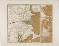
1775WRCAM54968London: Printed for R. Sayer & J. Bennett 1775. Copper-engraved map with original color. Two insets along the right side titled "Plan of Boston Harbour from an Actual Survey" and "Plan of the Town of Boston with the Attack on Bunker's Hill in the Peninsula of Charlestown." Plate mark: 18 1/4 x 21 1/2 inches. Sheet size: 21 1/4 x 27 1/4 inches. Expertly conserved with a few instances of renewed color. In very good condition with large margins. A rare and dramatic Revolutionary war map of New England showing George Washington's troops marching on British-occupied Boston with a large inset plan of the Battle of Bunker Hill showing Charlestown in flames: among the earliest pictorial representations of the Battle of Bunker Hill. This copy is printed on a large full sheet with ample margins. <br> <br> Published by Sayer & Bennett shortly after news of the Battle of Bunker Hill reached London the map celebrates the British victory in the battle but gives a portent of the impending siege of Boston and the eventual Battle of Dorchester Heights. The general map of New England provides a backdrop for illustrations of American troops most notably including the "march of General Washington" in western Massachusetts but also showing militia marching from New Hampshire Connecticut and Rhode Island all converging on Boston. Two smaller insets along the right side of the map each printed from a separate plate depict a general plan of Boston Harbor and a plan of Boston and Charlestown showing the Battle of Bunker Hill. <br> <br> This latter inset is quite dramatic and of great significance. Charlestown is shown under attack by British forces with the town in flames as British warships bombard it from the water and a British battery fires across the Charles River from Cornhill in Boston; the locations of the British and American forces on Breed's Hill are shown as the two armies face each other in battle. In Boston a large encampment of British regulars is shown on Boston Commons surrounding the Liberty tree. The inset would later be re- engraved and used in Newcastle and Boston editions of Murray's IMPARTIAL HISTORY OF THE WAR. <br> <br> It is believed that the inset is a graphic representation of information on the battle derived from a June 25 1775 letter written by General Burgoyne to Lord Stanley: <br> <br> ".Howe's corps ascending the hill in the face of entrenchments and in a very disadvantageous ground was much engaged; and to the left the enemy pouring in fresh troops by the thousands over the land; and in the arm of the sea our ships and floating batteries cannonading them: straight before us a large and noble town in one great blaze; the church steeples being of timber were great pyramids of fire above the rest.the whole a picture and a complication of horror and importance beyond any thing that ever came to my lot to be witness to." <br> <br> Sayer and Bennett published this letter as a broadside on November 27 1775 nearly two months after this inset illustrating it with a different plan of the battle. <br> <br> The earliest cartographic representation of the Battle of Bunker Hill is an August 1 1775 plan published by Jefferys and Faden titled "A Sketch of the Action between British Forces and the American Provincials on the Heights of the Peninsula of Charlestown." That map however purely shows military movements. The inset to the present map is the second printed plan of the battle and considered to be the first pictorial representation. This map was produced on September 2 1775 a scant two- and-a-half months after the crucially important actions it depicts. It is remarkable that such detailed news was transmitted from New England to London and published in such a magnificent cartographic representation in so brief a period of time. Not in Nebenzahl's ATLAS OF THE AMERICAN REVOLUTION which reproduces a later version of the inset on page 55 or Phillips. <br> <br> An exciting important rare and early map of the American Revolution. NEBENZAHL BATTLE PLANS OF THE AMERICAN REVOLUTION 6 6A. McCORKLE NEW ENGLAND IN EARLY PRINTED MAPS 775.1. KRIEGER & COBB MAPPING BOSTON p.103. SCHWARTZ & EHRENBERG plate 117. GUTHORN BRITISH MAPS OF THE AMERICAN REVOLUTION p.66. STOKES B105. RISTOW CARTOGRAPHY OF THE BATTLE OF BUNKER HILL. SELLERS & VAN EE 813. Printed for R. Sayer & J. Bennett unknown books