221 résultats
187024841london Stannard & Co 1870 Une Chromolithographie Originale en couleurs, ornant la première page d'une partition intitulée : "Nantes (fantasia on subjects from Mozarts Twelfth Mass) - Cathedral Gems Series No. 1 by LOUIS DUPUIS", Format total de la gravure : Hauteur : 33 centimètres Largeur : 23 centimètres, format de la gravure seule : 26 cm de haut par 19,5 cm de large, gravure sur papier épais blanc, avec imprimé en bas à droite de la litho couleur : PACKER & GRIFFIN LITH. + imprimé en bas à droite : Stannard & Co. 7 Poland Street London + imprimé en bas au centre CATHEDRAL OF NANTES, et aussi imprimé en haut de la litho couleur : NANTES, sans date (1870) LONDRES Stannard & Co Editeurs de Musique,
1847437334London : The Proprietors 1847. 1st edition. Hardcover. 7 volumes in different bindings: 6 good copies in the original gilt-blocked cloth. Spine worn and cracked; panel edges somewhat dust-toned and rubbed as with age-- 1 volume has the front board detaching. 1 poor copy in marbled boards backed in aniline-calf spine taped and detaching. Foxing and worming to the pages across de 7 volumes. Physical description; 7 volumes 24 x 35 cm. Subjects; Horticulture England ; Periodicals. Agriculture England ; Periodicals. Gardening ; Periodicals. Gardening Great Britain ; Periodicals. Ornamental horticulture ; Periodicals. Ornamental horticulture Great Britain ; Periodicals. Plants Ornamental Great Britain ; Periodicals. Gardening Great Britain ; Periodicals. London : The Proprietors hardcover
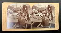
189849371Meadville Pa / St. Louis Mo: Keystone View Company 1898. Pink mount slightly bowed with publisher imprint to either side caption under right image. Rounded corners. Blank verso. Now housed in a mylar sleeve. Light wear & soiling. Photo clear & sharp. A VG example. Domed b/w images of 7 men on a dock with a dozen or so sea turtles being gathered. Oblong format: 3-7/16" x 7" <br/><br/> Keystone View Company unknown books
1870268911870 un dépliant en accordéon de 12 gravures d'aprés la photographie format : 11,6 x 7,5 cm, dos muet, 1er plat titré en rouge sur fond bleu-ciel : NICE, dans un encadrement "aux deux angelots" en rouge, même décor en rouge sur fond bleu-ciel sur la 4ème de couverture non-titrée, sans date (1870 environ), Paris WELTER ET Cie EDITEURS ,
18823554New York: Currier & Ives 1882. Lithograph printed in colours. An excellent Currier & Ives image of a racing yacht at full stretch.<br/> <br/>A valuable pictorial record of this New York Yacht Club vessel owned jointly by H.W. Johnson and William Krebs from a painting by the prolific and highly talented Charles R. Parsons.<br/> <br/>Conningham 1281; Gale 1404. Currier & Ives unknown books
1869015071Dublin: Hodge's Smith and Foster 1869. Book measures 22.5x15.cm. lxix16552pp. Bound in full calf raised bands gilt lines and lettering. Calf rubbed wear loss on edges top hinge joint split loose but still attached. Internally occasional institution library stamp. Pages in good clean condition. A good clean copy in a worn binding. . Calf. Near Very Good. 8vo. Hodge's Smith, and Foster Paperback
1900102634<p>No place no date but French c. 1900. Each mark pasted on a single sheet of thin paper 17 x 22 cm. Most with an identification in ink at the bottom of the sheet. paper browned uniformly and eight sheets with rodent damage not affecting the image.</p><p>A curious collection. The marks and vignettes are mostly French Paris even but there are marks from all over France and also a few European: Milan Genève Bruxelles Madrid most identify 19th century printers and publishers but there are a few earlier ones. Some printers and publishers are represented with more than one mark some identical but mostly with slight differences.</p>
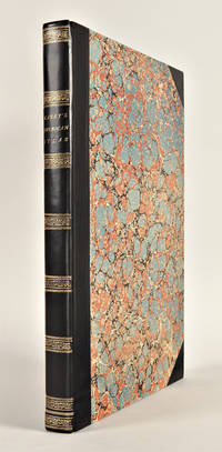
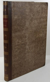
1823WRCAM43415APhiladelphia: H.C. Carey & I. Lea 1823. Letterpress title copyright notice on verso 1p. advertisement verso blank 1p. table of contents verso blank. Forty-six double-page handcolored engraved maps of the United States all but one with borders of letterpress descriptive text; uncolored double-page engraved view showing the comparative heights of mountains throughout the world; handcolored double-page engraved table showing the comparative lengths of the principal rivers worldwide; five letterpress tables four double-page three of these handcolored; 18pp. of letterpress text. Mounted on guards throughout. Modern half calf and marbled boards spine gilt leather label. Dampstaining along lower edge causing chipping to initial leaves. Closed tear in bottom margin of first map repaired with tissue. Very light offsetting from maps. Some dust soiling light tanning and foxing. Good plus. A handsome atlas of the Americas with individual color maps of each state in the Union including a seminal map of the West by Stephen H. Long. At the time of publication this was the best and most detailed atlas to be produced in the United States with substantial historical background text accompanying each map. Fielding Lucas the major Baltimore printer was the principal engraver. <br> <br> Among the most noted maps in the atlas is Major Stephen H. Long's "Map of Arkansa and other Territories of the United States." That map which depicts the Missouri basin between Nashville in the east the Mandan villages in the north and the Rocky Mountains in the west was based on the surveys conducted by Long on his expeditions of 1819 and 1820. The map published in Carey & Lea's atlas preceded the official account of that expedition by expedition botanist Edwin James which includes a smaller map with similar detail titled "Country drained by the Mississippi Western Section." Carey & Lea's 1823 publication of James' ACCOUNT perhaps explains the prior inclusion of this map with Long expedition information in their atlas. <br> <br> On this famous map is the printed legend which would perpetuate a myth for many years to come identifying the high plains as the "Great American Desert." Carey & Lea's atlas was first issued in 1822; this is the second issue with revised states of three maps Maine North Carolina and Louisiana with the same printing of the remaining maps and a cancel title. HOWES C133 "aa." PHILLIPS ATLASES 1373a. SABIN 15055. WHEAT TRANSMISSISSIPPI 348 352. H.C. Carey & I. Lea hardcover books
182729764Philadelphia: H.C. Carey & I. Lea 1827. Folio. Mounted on guards throughout. Letterpress title copyright notice on verso 1p. "Advertisement" to Third Edition dated "January 1827" verso blank 1p. "Contents" and "Index" verso blank plus forty-six double-page handcolored copper engraved maps most with descriptive letterpress in margins and many with supplementary text pages following; one double-page engraved plate of mountains uncolored; and one double-page colored plate of river lengths. Titlepage remargined minor foxing some faint staining along bottom edge. Later 19th-century three-quarter calf and original plain paper boards later gilt morocco label. Boards slightly rubbed.<br/> <br/>One of the most important early atlases printed in the United States: a handsome atlas of the Americas with individual colour maps of each state in the Union including a seminal map of the West by Stephen H. Long.<br/> <br/>At the time of publication this was the best and most detailed atlas to be produced in the United States. Fielding Lucas the major Baltimore printer was the principal engraver and substantial historical background text accompanies each map. Among the most noted maps in the atlas is Major Stephen H. Long's "Map of Arkansa and other Territories of the United States." That map which depicts the Missouri basin between Nashville in the east the Mandan villages in the north and the Rocky Mountains in the west was based on the surveys conducted by Long on his expeditions of 1819 and 1820. On this famous map is the printed legend which would perpetuate a myth for many years to come identifying the high plains as the "Great American Desert." The 1827 edition "Third edition Corrected and Improved" of Carey & Lea's historic atlas first published in 1822 includes much new material with all the maps and text updated except for the Washington D.C. and Michigan maps. This was the first American atlas that was modeled on Le Sage's plan of having explanatory text surrounding the maps. The maps for the most part by Fielding Lucas are beautifully drawn and colored.<br/> <br/>Howes C133 "aa"; Phillips 1373a; Sabin 15055; Wheat Transmississippi West 348 and 352. H.C. Carey & I. Lea unknown books
182325085Philadelphia: H.C. Carey & I. Lea 1823. Folio. 17 1/2 x 11 7/8 inches. Mounted on guards throughout letterpress title copyright notice on verso 1p. Advertisement verso blank 1p. Contents verso blank 46 double-page hand-coloured engraved maps of the United States all but one with borders of letterpress descriptive text 1 uncoloured double-page engraved view showing the comparative heights of mountains throughout the world 1 hand-coloured double-page engraved table showing the comparative lengths of the principal rivers worldwide 5 letterpress tables 4 double-page 3 of these hand-coloured 18pp. of letterpress text. Expertly bound to style in half calf over contemporary marbled paper covered boards flat spine in six compartments divided by gilt roll tools red morocco label in the second compartment the others with a repeat decoration in gilt.<br/> <br/>One of the most important early atlases printed in the United States: a handsome atlas of the Americas with individual colour maps of each state in the Union including a seminal map of the West by Stephen H. Long.<br/> <br/>At the time of publication this was the best and most detailed atlas to be produced in the United States. Fielding Lucas the major Baltimore printer was the principal engraver and substantial historical background text accompanies each map. Among the most noted maps in the atlas is Major Stephen H. Long's "Map of Arkansa and other Territories of the United States." That map which depicts the Missouri basin between Nashville in the east the Mandan villages in the north and the Rocky Mountains in the west was based on the surveys conducted by Long on his expeditions of 1819 and 1820. The map published in Carey & Lea's atlas preceded the official account of that expedition by expedition botanist Edwin James which included a smaller map with similar detail titled "Country drained by the Mississippi Western Section". Carey and Lea's 1823 publication of James Account perhaps explains the prior inclusion of this map with Long expedition information in their atlas. On this famous map is the printed legend which would perpetuate a myth for many years to come identifying the high plains as the "Great American Desert." Carey and Lea's atlas was first issued in 1822; this is the 1823 second issue substantially the same as the first but with a new title and revised states of several maps and text leaves generally minor revisions including additional shading to maps and improved resetting of several text leaves though this copy with first state settings of the Maryland and Virginia text leaves.<br/> <br/>Howes C133 "aa"; Phillips 1373a; Sabin 15055; Wheat Transmississippi West 348 and 352. H.C. Carey & I. Lea unknown books
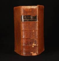
1868FGN10-H-2New York: Harper & Brothers Publishers 1868. Leather. Good. 10" by 6.5". None. A bright scarce early New York edition of Andrew's Latin-English Lexicon. Scarce. Ethan Allen Andrews 1787 1858 was an American educator. He was born in Connecticut and graduated at Yale in 1810. He practiced law for several years then was professor in the University of North Carolina of ancient languages after which he taught at New Haven and Boston. He published a number of Latin grammar textbooks and in 1850 a Latin-English lexicon based on Freund which went through many revisions and came to be known as Harper's Latin Dictionary in 1907. in a calf binding. Externally sound with wear to the extremities and rubbing. Loss to the leather. Hinges are strained. Internally firmly bound. Pages bright with occasional spotting and an ink signature to the front free-endpaper. Good Harper & Brothers Publishers hardcover
1825434577Edinburgh : Daniel Lizars 1825. 1st edition. Hardcover. Good copy in marbled boards backed in gilt-blocked spine with raised bands. Covers and spine dust-toned bumped and rubbed as with age. Some foxing to the first and last pages. Previous owner's bookplate inside. Physical description; 302 p. ; 19 cm. Subjects; Macculloch John 1773-1835. Highlands and Western Isles of Scotland. Macculloch John. Highlands Scotland Description and travel. Western Isles Scotland Description and travel. Highland Region Scotland Description and travel. Edinburgh : Daniel Lizars hardcover
180119020London: Printed and Published by Robert Laurie and James Whittle 1801. Folio. 21 1/8 x 15 1/4 inches. Mounted on guards throughout letterpress title verso blank and 1p. index verso blank otherwise engraved throughout. 59 engraved maps on seventy-five mapsheets all hand-coloured in outline 1 map on 3 folding sheets; 14 on 2 folding sheets; 9 on single folding sheets; 34 on single double-page sheets; 1 on a one-page sheet. Contemporary tree calf covers with roll-tool border in gilt the flat spine divided into seven compartments by gilt fillets and roll-tools blue morocco lettering-piece in the second the other compartments with repeat neo-classical decoration of a single centrally-placed tool marbled endpapers<br/> <br/>A very fine copy of the fifth edition of this important atlas of the world including a newly revised chart of world and nine other maps that were not available in the early editions of this spectacular work.<br/> <br/>Eight editions of this work were issued on an almost annual basis from 1796 until 1807. The publishers constantly changed and improved the atlas in an effort to outdo not only their competitors but also to improve on the previous edition. Maps were added the first edition included only 66 map sheets maps were replaced the present work includes two maps dated 1800 including 'A New Chart of the World' dated 25 November 1800 and maps were updated eight maps are dated 1799. The scale of some of the maps is truly spectacular: this atlas contains 15 maps that if joined would form large scale wall maps: 'Asia and its Islands' on three folding sheets ranging from the Arctic regions in the north down through Russia Indonesia and Australia would measure approximately 56 x 46 inches if assembled. The remaining maps on two folding sheets would all be approximately 40 x 46 inches if joined: these include three maps of American interest: 'A new map of the whole continent of America'; 'A new map of North America with the West India Islands'; and 'A map of South America'. The remaining areas that are covered by large scale maps are 'A general map of the World'; England & Wales; Scotland; Ireland; the Netherlands; Germany; Hindoostan; Bengal Bahar etc; Delhi Agrah Oude and Allahabad. This atlas was originally created by Thomas Kitchin. Sayer and Bennett had published the work in 1773 and Laurie and Whittle took over the Sayer business in 1794. They subsequently enlarged the work adding maps and changing the name from the General Atlas to A New Universal Atlas. The maps are based on the work of a variety of mapmakers and surveyors: Thomas Kitchin Thomas Jefferys John Rocque Robert Campbell John Armstrong John Roberts L. S. d'Arcy Delarochette James Rennell Andrew Dury Thomas Pownall and Jean Baptiste Bourguignon d'Anville. Also included is the information gathered as a result of the important Pacific voyages of Captain James Cook George Vancouver and Jean Francois Galaup de La Perouse.<br/> <br/>Phillips Atlases 3534. Printed and Published by Robert Laurie and James Whittle unknown books
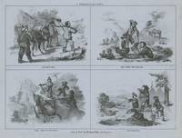
1850List1315Britton and Rey 1850. Single sheet measuring 8 ¼ x 10 ¾ inches on blue wove paper. Small chip to corner not affecting image some older tape repairs verso at margins else fine very good plus overall and quite attractive. Very Good. A series of four illustrations telling the story of a mining party that heads out with a pack mule only to fail to find gold and lose their mule before returning to a new prospect with their clothes in shambles. This is entry 209 in Baird’s California’s Pictorial Letter Sheets in which he sets the publication date as being prior to 1855. The series possibly illustrates scenes from a song. A particularly fine example on the classic blue wove paper of the period. unknown
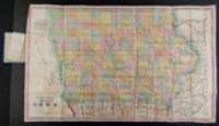
185524811Fairfield Iowa and Philadelphia: Henn Williams & Co. and R. Barnes 1855. Folding pocket map lithographed by Friend & Aub of Philadelphia full original period hand colouring. Folds into original blue cloth covers blocked in blind the upper cover with publisher and title in gilt. A fine copy of this attractive map of Iowa from the early years of its settlement this second edition shows the rapid development within the state and is the first edition to include Sioux City and many proposed railroad routes.<br/> <br/> This large and colourful map of Iowa shows the state divided into numerous counties all within nine land districts with the sites of the land offices identified in each. Issued to promote settlement in the state the map includes an advertisement in the upper left corner for Henn Williams and Co.: "dealers in land land warrants & exchange . special attention given to Location of Land the sale and loan of Warrants and to the collecting & remitting of sight and time bills. Investments made in any part of Iowa." Besides locating numerous towns and river systems the state's burgeoning railroad system is shown with many proposed routes depicted across the state by means of dotted lines. This is the second edition of the map after the first of 1854 but apparently printed from a new plate to incorporate the rapid growth. A third edition followed in 1856.<br/> <br/> Phillips A List of Maps of America p. 337; Rumsey 1739; Graff 1857; Streeter sale 3898. Henn, Williams & Co. and R. Barnes unknown
185524811Fairfield Iowa and Philadelphia: Henn Williams & Co. and R. Barnes 1855. Folding pocket map lithographed by Friend & Aub of Philadelphia full original period hand colouring. Folds into original blue cloth covers blocked in blind the upper cover with publisher and title in gilt. A fine copy of this attractive map of Iowa from the early years of its settlement this second edition shows the rapid development within the state and is the first edition to include Sioux City and many proposed railroad routes.<br/> <br/>This large and colourful map of Iowa shows the state divided into numerous counties all within nine land districts with the sites of the land offices identified in each. Issued to promote settlement in the state the map includes an advertisement in the upper left corner for Henn Williams and Co.: "dealers in land land warrants & exchange . special attention given to Location of Land the sale and loan of Warrants and to the collecting & remitting of sight and time bills. Investments made in any part of Iowa." Besides locating numerous towns and river systems the state's burgeoning railroad system is shown with many proposed routes depicted across the state by means of dotted lines. This is the second edition of the map after the first of 1854 but apparently printed from a new plate to incorporate the rapid growth. A third edition followed in 1856.<br/> <br/>Phillips A List of Maps of America p. 337; Rumsey 1739; Graff 1857; Streeter sale 3898. Henn, Williams & Co. and R. Barnes unknown books
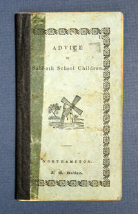
183840630Northampton: J. H. Butler / John Metcalf 1838. 1st printing presumed. Light blue printed paper wrappers with later navy blue cloth spine reinforcement. Significant wear to wrappers glue remains to sides of spine reinforcement light soiling and rubbing. A Good copy. 24 2 pp. Woodcut illustrations within. 5-3/16" x 2-7/8" <br/><br/> J. H. Butler / John Metcalf hardcover books
1891400257Leipzig, Bibliograph. Inst. 1891. M. 12 Ktn., 16 (teils farb.) Taf. u. 154 Textabb. VIII, 468 S. OHldr m. reicher Rückenvergold. Ecken beschabt, Seitenschnitt tintenfl.
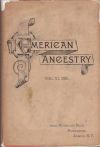
189132609Albany: Joel Munsell's Sons 1891. First Edition. Soft cover. Good/fair. Quarto. 8 211 pages 8. Red flexible boards with black illustrated title on the front cover and black title on the spine. Includes tan illustrated dust jacket. Edges shaded red are partially faded. Light edge wear to the red covers and spine. Dust jacket has light toning soil edge chips and splits at the flap folds. Small "nick" to the text foredge. Joel Munsell's Sons unknown
1876elala1328Chicago: c1876. 1876. 24mo. accordion foldout of 12 views. original gilt-stamped cloth corners bit frayed. Hardcover. Chicago: [c1876]. Hardcover
18576284New York: Currier & Ives 1857. Lithograph coloured by hand by Charles Parsons. A dramatic scene after Arthur Tait full of movement: a pair of retrievers quest for their master's quarry one successful holds aloft a bird the second has spotted the second injured bird. In the background their master urges them on.<br/> <br/> Tait spent the first three decades of his life in England and arrived in New York in 1850. A follower of Edwin Landseer and the style of the Pre-Raphaelites he established himself as a realistic painter of animals and sporting scenes. He kept a summer studio at a camp in the Adirondack Mountains where he painted sporting scenes. He and Nathaniel Currier sometimes hunted together. 'These wilderness scenes often composed around an anecdote appealed to a wide popular audience and from 1852 Currier & Ives as well as Louis Prang published a number of lithographs and chromolithographs of his work.' Grove / Artnet<br/> <br/> Conningham 151; Gale 164. Currier & Ives unknown
190030800Paris: Liraires De L'academie De Medecine 1900. These are bindery copies. Front and back covers are gone. Insides are good. Histoire des Machines de Guerre. Lots of line drawings. A total of 5 volumes. 1899: September-December and January-April 1900: All 3 volumes covering entire year. $50 per volume. Hard Cover. Good Inside. Disbound Ex-Library. Liraires De L'academie De Medecine Hardcover
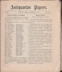
188535995Ipswich Massachusetts: Augustine Caldwell and Arthur Dow 1885. First Edition. Periodical. Fair. Periodicals. 4 pages each. Illustrations. 41 misc. issues dated 1879-1885. Condition is fair with a few of the 4 page issues split in half. Some edge tears and small chips to the fragile paper. 7 issues have either a previous owner name or a short note written top of the issues. 1 issue has an old blind embossed institutional seal. Names written top of a few of the issues are from Mary and Charles Goodhue. Issues are as follows:. Augustine Caldwell and Arthur Dow unknown
18711712070024F. W. Beers and Co 1871-01-01. First Edition. Hardcover. Acceptable. Folio. 34 x 41 cm. Original leather backed brown boards. Fading and staining to boards. Wear/tear to spine leather with loss. Front board detached. Only 32 of 36 maps lacks the Greenfield Mass maps nos. 26-29. Hand colored maps folding map of Shelburne Falls. Title page has a crease. Foxing and hand soiling to maps. Sold with all faults. This is an oversized or heavy book which requires additional postage for international delivery outside the US. F. W. Beers and Co hardcover
18711801050004NY 1871-01-01. Hardcover. Acceptable. Folio. 34 x 41 cm. Original leather backed brown boards. Fading and staining to boards. Wear/tear to spine leather with loss. Boards detached. 36 maps Hand colored maps folding map of Shelburne Falls. Title page has a crease. Foxing and soiling to maps. A few maps have tears pencil marks to verso of maps. Sold with all faults. This is an oversized or heavy book which requires additional postage for international delivery outside the US. NY hardcover