195 résultats
177318688Paris 1773. Engraved plan cut into sections but now mounted on a single sheet of card. Image size: 20 1/4 x 31 1/2 inches. Lovely pre-Revolution map of Paris.<br/> <br/>Fascinating 1773 map of Paris that locates all major buildings and parks with an extensive index. unknown books
197526531New York N.Y.: Grosset & Dunlap 1975. 16 pages; illustrated in color black and white including a 4-panel centerfold. Issued by the publisher as a promotional preview for the then forthcoming WWII James Jones book giving the table of contents and samples of the writing to be found within. Approx. 9" x 12" size; glossy illustrated heavy paper covers; light wear; in very good condition; interesting high-quality promotional ephemera for this WWII book. First Edition. Soft Cover. Very Good. Grosset & Dunlap paperback books
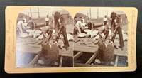
189849371Meadville Pa / St. Louis Mo: Keystone View Company 1898. Pink mount slightly bowed with publisher imprint to either side caption under right image. Rounded corners. Blank verso. Now housed in a mylar sleeve. Light wear & soiling. Photo clear & sharp. A VG example. Domed b/w images of 7 men on a dock with a dozen or so sea turtles being gathered. Oblong format: 3-7/16" x 7" <br/><br/> Keystone View Company unknown books
18823554New York: Currier & Ives 1882. Lithograph printed in colours. An excellent Currier & Ives image of a racing yacht at full stretch.<br/> <br/>A valuable pictorial record of this New York Yacht Club vessel owned jointly by H.W. Johnson and William Krebs from a painting by the prolific and highly talented Charles R. Parsons.<br/> <br/>Conningham 1281; Gale 1404. Currier & Ives unknown books
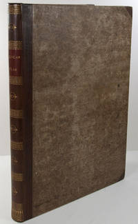
1823WRCAM43415APhiladelphia: H.C. Carey & I. Lea 1823. Letterpress title copyright notice on verso 1p. advertisement verso blank 1p. table of contents verso blank. Forty-six double-page handcolored engraved maps of the United States all but one with borders of letterpress descriptive text; uncolored double-page engraved view showing the comparative heights of mountains throughout the world; handcolored double-page engraved table showing the comparative lengths of the principal rivers worldwide; five letterpress tables four double-page three of these handcolored; 18pp. of letterpress text. Mounted on guards throughout. Modern half calf and marbled boards spine gilt leather label. Dampstaining along lower edge causing chipping to initial leaves. Closed tear in bottom margin of first map repaired with tissue. Very light offsetting from maps. Some dust soiling light tanning and foxing. Good plus. A handsome atlas of the Americas with individual color maps of each state in the Union including a seminal map of the West by Stephen H. Long. At the time of publication this was the best and most detailed atlas to be produced in the United States with substantial historical background text accompanying each map. Fielding Lucas the major Baltimore printer was the principal engraver. <br> <br> Among the most noted maps in the atlas is Major Stephen H. Long's "Map of Arkansa and other Territories of the United States." That map which depicts the Missouri basin between Nashville in the east the Mandan villages in the north and the Rocky Mountains in the west was based on the surveys conducted by Long on his expeditions of 1819 and 1820. The map published in Carey & Lea's atlas preceded the official account of that expedition by expedition botanist Edwin James which includes a smaller map with similar detail titled "Country drained by the Mississippi Western Section." Carey & Lea's 1823 publication of James' ACCOUNT perhaps explains the prior inclusion of this map with Long expedition information in their atlas. <br> <br> On this famous map is the printed legend which would perpetuate a myth for many years to come identifying the high plains as the "Great American Desert." Carey & Lea's atlas was first issued in 1822; this is the second issue with revised states of three maps Maine North Carolina and Louisiana with the same printing of the remaining maps and a cancel title. HOWES C133 "aa." PHILLIPS ATLASES 1373a. SABIN 15055. WHEAT TRANSMISSISSIPPI 348 352. H.C. Carey & I. Lea hardcover books
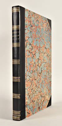
182729764Philadelphia: H.C. Carey & I. Lea 1827. Folio. Mounted on guards throughout. Letterpress title copyright notice on verso 1p. "Advertisement" to Third Edition dated "January 1827" verso blank 1p. "Contents" and "Index" verso blank plus forty-six double-page handcolored copper engraved maps most with descriptive letterpress in margins and many with supplementary text pages following; one double-page engraved plate of mountains uncolored; and one double-page colored plate of river lengths. Titlepage remargined minor foxing some faint staining along bottom edge. Later 19th-century three-quarter calf and original plain paper boards later gilt morocco label. Boards slightly rubbed.<br/> <br/>One of the most important early atlases printed in the United States: a handsome atlas of the Americas with individual colour maps of each state in the Union including a seminal map of the West by Stephen H. Long.<br/> <br/>At the time of publication this was the best and most detailed atlas to be produced in the United States. Fielding Lucas the major Baltimore printer was the principal engraver and substantial historical background text accompanies each map. Among the most noted maps in the atlas is Major Stephen H. Long's "Map of Arkansa and other Territories of the United States." That map which depicts the Missouri basin between Nashville in the east the Mandan villages in the north and the Rocky Mountains in the west was based on the surveys conducted by Long on his expeditions of 1819 and 1820. On this famous map is the printed legend which would perpetuate a myth for many years to come identifying the high plains as the "Great American Desert." The 1827 edition "Third edition Corrected and Improved" of Carey & Lea's historic atlas first published in 1822 includes much new material with all the maps and text updated except for the Washington D.C. and Michigan maps. This was the first American atlas that was modeled on Le Sage's plan of having explanatory text surrounding the maps. The maps for the most part by Fielding Lucas are beautifully drawn and colored.<br/> <br/>Howes C133 "aa"; Phillips 1373a; Sabin 15055; Wheat Transmississippi West 348 and 352. H.C. Carey & I. Lea unknown books
182325085Philadelphia: H.C. Carey & I. Lea 1823. Folio. 17 1/2 x 11 7/8 inches. Mounted on guards throughout letterpress title copyright notice on verso 1p. Advertisement verso blank 1p. Contents verso blank 46 double-page hand-coloured engraved maps of the United States all but one with borders of letterpress descriptive text 1 uncoloured double-page engraved view showing the comparative heights of mountains throughout the world 1 hand-coloured double-page engraved table showing the comparative lengths of the principal rivers worldwide 5 letterpress tables 4 double-page 3 of these hand-coloured 18pp. of letterpress text. Expertly bound to style in half calf over contemporary marbled paper covered boards flat spine in six compartments divided by gilt roll tools red morocco label in the second compartment the others with a repeat decoration in gilt.<br/> <br/>One of the most important early atlases printed in the United States: a handsome atlas of the Americas with individual colour maps of each state in the Union including a seminal map of the West by Stephen H. Long.<br/> <br/>At the time of publication this was the best and most detailed atlas to be produced in the United States. Fielding Lucas the major Baltimore printer was the principal engraver and substantial historical background text accompanies each map. Among the most noted maps in the atlas is Major Stephen H. Long's "Map of Arkansa and other Territories of the United States." That map which depicts the Missouri basin between Nashville in the east the Mandan villages in the north and the Rocky Mountains in the west was based on the surveys conducted by Long on his expeditions of 1819 and 1820. The map published in Carey & Lea's atlas preceded the official account of that expedition by expedition botanist Edwin James which included a smaller map with similar detail titled "Country drained by the Mississippi Western Section". Carey and Lea's 1823 publication of James Account perhaps explains the prior inclusion of this map with Long expedition information in their atlas. On this famous map is the printed legend which would perpetuate a myth for many years to come identifying the high plains as the "Great American Desert." Carey and Lea's atlas was first issued in 1822; this is the 1823 second issue substantially the same as the first but with a new title and revised states of several maps and text leaves generally minor revisions including additional shading to maps and improved resetting of several text leaves though this copy with first state settings of the Maryland and Virginia text leaves.<br/> <br/>Howes C133 "aa"; Phillips 1373a; Sabin 15055; Wheat Transmississippi West 348 and 352. H.C. Carey & I. Lea unknown books
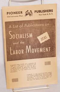
196193537New York: Pioneer Publishers 1961. 12p. wraps slightly browned. Publishers catalog. Pioneer Publishers unknown books
179425786London: publish'd by Laurie & Whittle 1794. Engraved map on four joined sheets hand coloured in outline. Bowen and Gibson's large scale wall map of North America: a Laurie and Whittle issue published following the Treaty of Paris that ended the American Revolution.<br/> <br/>Bowen and Gibson's map was first issued in about 1755 under the title An Accurate Map of North America. It served as a generally accurate template for showing the enormous political changes that took place in the next forty years. Sometimes known as the Pownall Map of North America because of the significant contribution the former governor of Massachusetts Thomas Pownall made to the geographical knowledge of the northeast this large wall map has great presence and teems with information including numerous Native American placenames in the western areasnative tribal regions notes and routes of early roads and the forts along the Mississippi and to the west of the Appalachians. The two inset maps are of Baffin and Hudson's Bays and the mouth of the Colorado River the latter map based on the explorations of Eusebio Kino. The present map is the fourth version of the title and is an issue which incorporates the changes brought about by the 1783 Treaty of Paris. A notation on the map reads: "The Divisions in this map are coloured according to the preliminaries signed at Versailles sic. January 20th. 1783. The Red indicates the British posessions; the Green those of the United States; the Blue what belongs to the French and the Yellow what belongs to the Spaniards." Also included is Article III from the Treaty that guaranteed fishing rights to the United States in the Grand Banks and other places around New Brunswick and Newfoundland. Previous issues dating to the Revolution had included some of the articles of the 1763 Treaty these have been entirely removed and the cartouche has been reworked among other changes. The present issue has no imprint in the bottom right corner is printed on laid paper and includes the western coast of Newfoundland coloured in red.<br/> <br/>Degrees of Latitude 36; Stevens & Tree "Comparative Cartography" 49k in Tooley The Mapping of America. publish'd by Laurie & Whittle unknown books
180119020London: Printed and Published by Robert Laurie and James Whittle 1801. Folio. 21 1/8 x 15 1/4 inches. Mounted on guards throughout letterpress title verso blank and 1p. index verso blank otherwise engraved throughout. 59 engraved maps on seventy-five mapsheets all hand-coloured in outline 1 map on 3 folding sheets; 14 on 2 folding sheets; 9 on single folding sheets; 34 on single double-page sheets; 1 on a one-page sheet. Contemporary tree calf covers with roll-tool border in gilt the flat spine divided into seven compartments by gilt fillets and roll-tools blue morocco lettering-piece in the second the other compartments with repeat neo-classical decoration of a single centrally-placed tool marbled endpapers<br/> <br/>A very fine copy of the fifth edition of this important atlas of the world including a newly revised chart of world and nine other maps that were not available in the early editions of this spectacular work.<br/> <br/>Eight editions of this work were issued on an almost annual basis from 1796 until 1807. The publishers constantly changed and improved the atlas in an effort to outdo not only their competitors but also to improve on the previous edition. Maps were added the first edition included only 66 map sheets maps were replaced the present work includes two maps dated 1800 including 'A New Chart of the World' dated 25 November 1800 and maps were updated eight maps are dated 1799. The scale of some of the maps is truly spectacular: this atlas contains 15 maps that if joined would form large scale wall maps: 'Asia and its Islands' on three folding sheets ranging from the Arctic regions in the north down through Russia Indonesia and Australia would measure approximately 56 x 46 inches if assembled. The remaining maps on two folding sheets would all be approximately 40 x 46 inches if joined: these include three maps of American interest: 'A new map of the whole continent of America'; 'A new map of North America with the West India Islands'; and 'A map of South America'. The remaining areas that are covered by large scale maps are 'A general map of the World'; England & Wales; Scotland; Ireland; the Netherlands; Germany; Hindoostan; Bengal Bahar etc; Delhi Agrah Oude and Allahabad. This atlas was originally created by Thomas Kitchin. Sayer and Bennett had published the work in 1773 and Laurie and Whittle took over the Sayer business in 1794. They subsequently enlarged the work adding maps and changing the name from the General Atlas to A New Universal Atlas. The maps are based on the work of a variety of mapmakers and surveyors: Thomas Kitchin Thomas Jefferys John Rocque Robert Campbell John Armstrong John Roberts L. S. d'Arcy Delarochette James Rennell Andrew Dury Thomas Pownall and Jean Baptiste Bourguignon d'Anville. Also included is the information gathered as a result of the important Pacific voyages of Captain James Cook George Vancouver and Jean Francois Galaup de La Perouse.<br/> <br/>Phillips Atlases 3534. Printed and Published by Robert Laurie and James Whittle unknown books
193979729Moscow and Leningrad: State Art Publishers 1939. 1st ed. Hardcover. Very Good. frontis sepia-toned photos unpaginated. Original blue cloth with beveled edges. 26cm. Light cover soil and wear including a small scratch on back cover. Bookplate. No Jacket. Consists almost entirely of captioned photos of Soviet athletics physical culture and mass parades. <br/><br/> State Art Publishers hardcover books
19101281798London: Ward Lock & Co 1910. Thirty-Fifth Edition. 12mo; G/no-DJ softcover; Covers show moderate wear/small open tears on spine with vertical crease on front cover Textblock age-toned foxing and stains on several pages and head/fore edge; Binding strong; 27988pp. 1281798. FP New Rockville Stock. Ward, Lock & Co unknown books
185524811Fairfield Iowa and Philadelphia: Henn Williams & Co. and R. Barnes 1855. Folding pocket map lithographed by Friend & Aub of Philadelphia full original period hand colouring. Folds into original blue cloth covers blocked in blind the upper cover with publisher and title in gilt. A fine copy of this attractive map of Iowa from the early years of its settlement this second edition shows the rapid development within the state and is the first edition to include Sioux City and many proposed railroad routes.<br/> <br/>This large and colourful map of Iowa shows the state divided into numerous counties all within nine land districts with the sites of the land offices identified in each. Issued to promote settlement in the state the map includes an advertisement in the upper left corner for Henn Williams and Co.: "dealers in land land warrants & exchange . special attention given to Location of Land the sale and loan of Warrants and to the collecting & remitting of sight and time bills. Investments made in any part of Iowa." Besides locating numerous towns and river systems the state's burgeoning railroad system is shown with many proposed routes depicted across the state by means of dotted lines. This is the second edition of the map after the first of 1854 but apparently printed from a new plate to incorporate the rapid growth. A third edition followed in 1856.<br/> <br/>Phillips A List of Maps of America p. 337; Rumsey 1739; Graff 1857; Streeter sale 3898. Henn, Williams & Co. and R. Barnes unknown books
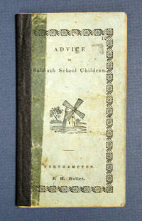
183840630Northampton: J. H. Butler / John Metcalf 1838. 1st printing presumed. Light blue printed paper wrappers with later navy blue cloth spine reinforcement. Significant wear to wrappers glue remains to sides of spine reinforcement light soiling and rubbing. A Good copy. 24 2 pp. Woodcut illustrations within. 5-3/16" x 2-7/8" <br/><br/> J. H. Butler / John Metcalf hardcover books
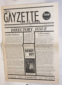
1971231921San Francisco: ADZ 1971. Newspaper. 8p. folded tabloid newspaper fewer personal ads and more local ads for gay services and sex toys toning newsprint. Special issue with centerfold maps to SF gay bars baths shops etc. ADZ unknown books
1995250291Paris: INRA / Economica 1995. Paperback. 433p. illustrated with a few tables softbound in 9.5x6 inch decorated wraps. Ex library with spine label blank but disfiguring nonetheless rubberstamp impression and a handwritten code; quite sound and clean a good good-only copy. INRA / Economica paperback books
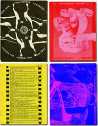
1971143125New York: Filmmakers Newsletter / Filmmakers' Cinematheque 1971. Archive of 41 issues of "Filmmakers Newsletter" dating from the first four years of the magazine including Vol. I issue 1. Early issues of the magazine are scarce and putting together a collection of this size piecemeal would be prohibitively difficult. <br/><br/>Founded in 1967 by experimental filmmaker Carl Linder as "New York Filmmakers' Newsletter" it was originally published out of the Filmmakers Cinematheque and served a similar purpose as Canyon Cinema's "Canyon Cinemanews" disseminating information on screenings festivals and republishing articles and essays about experimental film. Suni Mallow took over as editor in early 1968 and she quickly brought a wider focus to the magazine dropping "New York" from the title and publishing the magazine under its own imprint although it still retained ties to the Cinematheque. This broader approach to the world of avant garde film was successful and when Mallow sold the magazine in 1979 after becoming publisher in 1969 it had one of the highest ad rates per reader in business speaking to "Filmmakers Newsletter's" reach and influence among experimental filmmakers distributors hobbiest critics and fans. <br/><br/>Contributors to the issues in the archive include Jonas Mekas Stan Brakhage Bruce Conner George Maciunas Hollis Frampton Standish Lawder and Alan Lomax while future Academy Award and Cannes animator Bill Plympton was a staff member in 1970. <br/><br/>For more details please inquire. <br/><br/>Issues 8.5 x 11 inches with black and white images and illustrations throughout. Generally Near Fine. Filmmakers Newsletter / Filmmakers' Cinematheque unknown books
1972225903Princeton: Auerbach Publishers 1972. First. hardcover. near fine/very good. Illustrated. 172pp. tall 8vo cloth d.w. Princeton: Auerbach Publishers 1972. First Printing. A near fine copy in a very good dust wrapper.<br/><br/> Auerbach Publishers unknown books
1972225906Princeton: Auerbach Publishers 1972. First. hardcover. near fine/very good. Illustrated. 133pp. tall 8vo cloth d.w. Princeton: Auerbach Publishers 1972. First printing. A near fine copy in a very good dust wrapper.<br/><br/> Auerbach Publishers unknown books
5220AUTHORS AND PUBLISHERS. New York: G.P. Putman 1883. Large 8vo. Publisher's cloth. vi 96 2 pag First edition. A standard survey on how a book is published from the initial contracts throu production to distribution and copyright proceedings. Fine. unknown books
30430<p>Quarto two pages plus stamp-less address leaf some light toning to paper else in good legible condition.<br /></p><p>1850 Book-shop patronized by Abraham Lincoln</p><p>Sends a bill of lading for $ 568.20 in books purchased including the "Barn Book" Clater "Farmer's barn-book: containing the causes symptoms and treatment of all the diseases incident to oxen sheep swine… horses" 1850 sent for Leary & Co. in Philadelphia. Also sends a bill for 33 Chambers Information probably William and Robert Chambers Information for the People Philadephia 1847 "a book which you ought to sell cords of." The other titles in the shipment are: Remarkable Events in the History of America Lovechild's Nursery Stories Hart's Spenser's Faerie Queen White's History of the World Songs for the People Gems from Moore's Melodies Gems of Art and Beauty Ballad of Lord Bateman Pollok's Course of Time Baron Trenck Robinson Crusoe Don Juan and Childe Harold.</p><p>Caleb Brichall opened his first Springfield store in 1837. In the following years he was partners with various printers and bookbinders and published Goudy's Illinois Farmer's Almanac and from 1848 to 1855 with druggist Thomas Jefferson Vance Owen a veteran of the Mexican War in which he served as assistant surgeon. Their thriving business on the Capitol Square in Springfield sold books stationery patent medicine medical and dental supplies shipped from Philadelphia Boston and Chicago. Brichall was an ardent Whig and a supporter of the group that sent free Blacks to "colonize" Liberia. Abraham Lincoln had a long history of connection to the book-store both as customer and politician. He purchased his law office ledgers there but not his cough medicine which he bought from another druggist and once delivered to the store 23 copies of a steamy novel written by the daughter of a fellow lawyer and state legislator which was read appreciatively by Mary Lincoln.</p> books
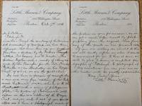
30940<p>Octavo two pages written on the publishing firm's letter head in very good clean and legible condition.</p><p>"Dear Sir</p><p> Through the courtesy of the American Art Association of New York we have been informed that some time ago you purchased from them a picture by Mr Frederic Remington entitled "Fort Laramie and its Inmates". This picture together with a number of others was made by Mr. Remington for the late Francis Parkman as an illustration in his "Oregon Trail" of which we are the publishers.</p><p> We now have in process of manufacture a new and very fine edition of Mr. Parkman's historical works which is to be illustrated with a series of photogravure plates. The picture of "Fort Laramie" will appear in this new edition of the "Oregon Trail" and we write to ask if you would allow us to have a photograph made of the picture in your possession as we can get a much better result by photographing from the original than from any of the prints in our present edition.</p><p> If you are willing we should do this and will kindly inform us when it would be convenient for you to have it done we will be glad to secure a competent photographer of Pittsburgh to photograph it. Any assistance you can give us in this matter will be greatly appreciated."</p><p>Remington's Laramie illustration was included in Little Brown's 1898 "Oregon Trail" but there is no indication that it was taken from the original painting owned by Mr. Shea who owned Pittsburgh's leading department store.</p> books
1975244554San Francisco: Benro Enterprises 1975. Magazine. 32p 8x10.75 inches photos ads articles listings reviews services personals mild wear otherwise a very good magazine-style newspaper in stapled glossy wraps and newsprint. San Francisco-Bay Area's long-running respected homophile/LGBT newspaper a free entertainment and services biweekly community paper. Two articles from Harvey Milk. The 10th Annual Coronation Ball report. In the early days pre-AIDS pre-White Night Riots the political reports were mainly on the campaigns for Empress. Yet with an increase in police & political abuse of gay rights note the attempt by Republican George Dye to pass a bill requiring all homosexuals be castrated and the advent of gay activists like Reverend Ray Broshears the paper began to publish an increasing number of political and gay-rights reports. The emphasis continued to be Drag shows Tavern Guild and S.I.R. reports. Book film and stage reviews relating to the gay experience. For the most part this was an exciting and fun period in the Castro and the early issues reflect that. An important record of the early days of Gay Liberation in SF. Benro Enterprises unknown books
1975244564San Francisco: Benro Enterprises 1975. Magazine. 32p. 8.25x10.75 inches photos ads articles listings reviews services personals mild wear otherwise a very good magazine-style newspaper in stapled glossy wraps and newsprint. San Francisco-Bay Area's long-running respected homophile/LGBT newspaper a free entertainment and services biweekly community paper. Gay Freedom Day report and photos. Harvey Milk castigates the Board of Supervisors and City Hall for not supporting the Parade. Entertainment Sweetlips Polk Street Sally Mr. Marcus et al. Benro Enterprises unknown books
1975244566San Francisco: Benro Enterprises 1975. Magazine. 32p. 8.25x10.75 inches photos ads articles listings reviews services personals mild wear otherwise a very good magazine-style newspaper in stapled glossy wraps and newsprint. San Francisco-Bay Area's long-running respected homophile/LGBT newspaper a free entertainment and services biweekly community paper. Interviews with Jeff Druce Jack Wrangler and Paul Thomas under his actual name Philip Toubus who got his start in "Jesus Christ Superstar" and shifted to straight and gay pornography in the late 1970s. Entertainment Sweetlips Polk Street Sally Mr. Marcus et al. Benro Enterprises unknown books