John MitchellBiblio.com
13 résultats
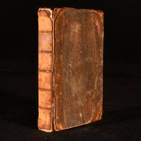
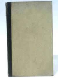
17831710849704BILPrinted for the Author 1783. Hardcover. Good. 1783. Second Edition . 76 pages. Quarter bound leather with brown paper covered boards. From the library of Cornelius Watford with plates to pastedowns. Book has been rebound. Pages are lightly tanned with noticeable foxing throughout. Binding remains firm. Dust marks to edges of some pages. Small pen and pencil inscriptions to title page with faint markings to edges. Boards have noticeable edge wear with corner bumping. Noticeable split to front joint causing spine strip to be slightly loose to top. Leather slightly peeling to spine edges. Faint black marks overall. Printed for the Author hardcover
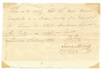
1796128309Quebec City March 7 1796. Very good. One 12 x 18 cm page handwritten by Mitchell. Text reads: "This is to certify that the bearer Duncan Campbell is a person worthy of a renewal of his licence to retail spirituous liquors in this city . Quebec 7th March 1796 . James Mitchell." <br/><br/> unknown
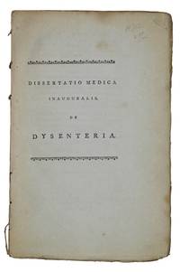
1789AQ28532Edinburgi i.e. Edinburgh: Apud Balfour et Smellie 1789. 6 35pp 1. With a half-title. Uncut. Disbound. Stab-stitch holes to gutter. A doctoral thesis on the diagnosis and treatment of dysentery by Andrew Mitchell d. 1800; submitted to William Robertson 1721-1793 sometime principal at the University of Edinburgh. ESTC N8238. Second edition. 8vo. Apud Balfour et Smellie unknown
1797859B4London : J. Butterworth 1797 . First edition. Leather. Fair. 8" by 5.5". None. A first edition copy of The Posthumous Works of Charles Fearne. A first edition copy of The Posthumous Works of Charles Fearne which consists of a reading on the statute of enrolments arguments in the singular case of General Stanwix and a collection of case and opinions. Charles Fearne was a Barrister at Law and this collection of works were selected from his manuscripts by Thomas Mitchell Shadwell. Without a half title page. Birmingham Law Students Society bookplate to the front pastedown and stamp to the title page. In half calf. Externally poor. Both boards are detached with rubbing to the spine and boards. Birmingham Law Students Society bookplate to the front pastedown and stamp to the title page. Title page and front free endpaper are loose ad without a half title page. The title page is also a little torn to the middle. Pages are generally firmly bound with some scattered spots to the first and last few pages. Fair J. Butterworth hardcover
179761316London: J Butterworth. 1797. Hardcover. Very Good. ix 15pp 468pp 12pp bound in full calf a little rubbed; Octavo . J Butterworth hardcover
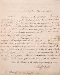
1800323878Washington D.C. 1800. 1p. Folded quarto sheet. Usual folds. 1p. Folded quarto sheet. Dr. Mitchell informs Duvall the Comptroller of the Treasury of the plight of William Dunlap: "This gentleman has suffered extremely by misfortunes in life which have stripped him of his property . unknown
1792036366London And Edinburgh; : W. Stranahan And T. Cadell And W. Creech 1792; William Creech And T. Cadell 1797; Falconer & Willison For The Author 1799 1792. 1st Edition . Hardcover. Good. Three Volumes Bound In One: V 1 With Errata On Verso 232 Pp; Ii 121 Including Half-Title Errata On Verso Of Last Page; X I With Directions On Verso 13-96. Full Calf Red Morocco Spine Label. Titles And Authors' Names Written On First Free Endpaper; Beattie's Name Written On Title Of That Section. Wear Fraying At Corners Binding Sound. The Third Title Is Quite Scarce. Bookplate Of Sir Henry Jardine. Henry Jardine Of Harwood 1766-1851 Was A Solicitor Antiquarian And A Founder Member Of The Bannatyne Club In 1823 Alongside His Friend Sir Walter Scott. He Became A Writer To The Signet In 1790 And In 1793 Took The Important Government Role Of Solicitor Of Taxes Through The Patronage Of Henry Dundas 1St Viscount Melville. From 1820 Until 1831 He Was King's Remembrancer In The Exchequer Throughout The Reign Of King George Iv. In 1814 He Was Elected A Fellow Of The Royal Society Of Edinburgh. His Proposers Were George Steuart Mackenzie His Son-In-Law Henry Mackenzie And Thomas Charles Hope.In 1818 He Was Of Those Present With Sir Walter Scott At The Rediscovery Of The Honours Of Scotland. His Home At 123 Princes Street In Edinburgh Faced Directly On To Edinburgh Castle. <br/> <br/> W. Stranahan And T. Cadell And W. Creech (1792); William Creech And T. Cadell (1797); Falconer & Willison For The Author (1799) hardcover
1796240344Philadelphia: Bioren & Maden 1796. First. exhibiting a variety of transactions which usually occur in business.To which is added a table of the duties payable on goods wares and merchandise imported into the United States of America. The whole in dollars and cents. pages 6-454. 8vo contemporary calf leather label spine and edges of covers worn covers lightly worn front hinge cracked but holding scattered light foxing light dampstain to pages 415-454. Philadelphia: Bioren & Maden 1796. First Edition<br/><br/> This copy lacks pages 1-5 of the introduction. The top right corner of the title page is torn with the loss of letter "M" in the word "System." Pages 231 and 255 are repeated in the pagination as in all published copies. This book is divided into three parts. The third part is the bookkeeping systems in use in 1796 which can be used as a comparison to the new method shown in the first and second parts of this work. Evans 30802.<br/><br/> Bioren & Maden unknown books
1796240344Philadelphia: Bioren & Maden 1796. First. exhibiting a variety of transactions which usually occur in business.To which is added a table of the duties payable on goods wares and merchandise imported into the United States of America. The whole in dollars and cents. pages 6-454. 8vo contemporary calf leather label spine and edges of covers worn covers lightly worn front hinge cracked but holding scattered light foxing light dampstain to pages 415-454. Philadelphia: Bioren & Maden 1796. First Edition<br/> <br/> This copy lacks pages 1-5 of the introduction. The top right corner of the title page is torn with the loss of letter "M" in the word "System." Pages 231 and 255 are repeated in the pagination as in all published copies. This book is divided into three parts. The third part is the bookkeeping systems in use in 1796 which can be used as a comparison to the new method shown in the first and second parts of this work. Evans 30802.<br/> <br/> Bioren & Maden unknown
1767799501767. Mitchell John. The Present State of Great Britain and North America with Regard to Agriculture Population Trade and Manufactures Impartially Considered. London. 1767. xvi363pp. plus errata. Half title. Contemporary calf gilt ruled edges sprinkled red rebacked to style. Original boards bumped and somewhat scuffed. Light foxing to outer leaves light tanning throughout. Very good in a half morocco box. The first and only edition. The first part is a consideration of the agriculture of Great Britain the insufficient supply of food and goods in England and the decrease in population there and in Scotland and Ireland. The second part treats the agriculture and population of the North American colonies specifically examining Canada Nova Scotia Georgia East and West Florida and the Ohio and Mississippi territories. The third part concerns the relations between the colonies and Britain the tax situation etc. An important and informative pre-Revolutionary work. HOWES M679 "aa." SABIN 49696. KRESS 6478. unknown
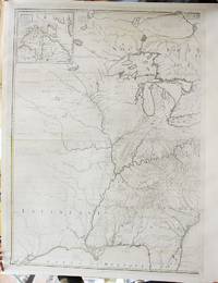
1770M10905Paris c.1770. Very Good backed on linen for long term preservation. Notes: French edition of Mitchell's map of the Central and Southern part of North America. It lacks the Eastern part.<br>The map was used for every treaty and boundary dispute from the French & Indian War until the end of the 19th Century. This example was published by the French cartographer Georges Le Rouge. Size : 1300x950 mm 51.18x37.40 Inches Coloring: Original Outline Coloring Category: Maps United States; unknown
177726040Paris: Le Rouge 1777. Engraved map hand-coloured in outline on 8 sheets individual sheets: 27 1/4 x 21 inches if joined would form a single large sheet 59 x 79 inches with large allegorical cartouche and inset map of Hudson's Bay and Labrador. Good condition small repaired tear. Housed in a red morocco backed box. A fine example of a French edition of Mitchell's monumental mapping of Colonial America a scarce issue published during the American Revolution.<br/> <br/> "John Mitchell was not a mapmaker by profession rather he was a medical doctor natural philosopher and botanist of considerable merit. Yet his sole cartographic endeavor.was perhaps the greatest produced in the history of America" Degrees of Latitude. Mitchell's Map of the British and French Dominions in North America is widely regarded as the most important map in American History. Prepared on the eve of the French & Indian War it was the second large format map of North America printed by the British and included the best up to date information on the region. Over the next century it would play a significant role in the resolution of every significant boundary dispute involving the northern border of the then British Colonies and later the United States. It was also the map-of-record at the birth of the United States and continued in this role through several decades in the early life of the country. John Mitchell a respected British physician botanist chemist biologist and surveyor lived for a time in Virginia but returned to England in 1746 where he remained. Mitchell initially conceived of his map of North America as the best method of presenting to the British public in a single large format image of all the colonies the extent of the French threat to the British claims in North America. Mitchell completed his first draft of the map in 1750. However because he was limited to publicly available sources of information this initial effort was rather crude even in Mitchell's own opinion. But word of Mitchell's work spread and the Board of Trade and Plantations retained Mitchell to make a new map using the official manuscript and printed maps and reports in the Board's possession including maps by Fry and Jefferson Christopher Gist George Washington John Barnwell and others. The Board also instructed all the colonial governors to send detailed maps and boundary information for Mitchell's use. Mitchell's map was first published by Andrew Millar in 1755 the year before war broke out with the French. The map is decidedly pro-English in its interpretation of the various boundaries and geographical information depicted on the map as would be expected for what amounted to thinly veiled pre-war propaganda. In addition to the geographical detail shown on the map Mitchell included many annotations describing the extent of British and French settlements. He also submitted a report to the Board in 1752 listing the French encroachments and his ideas of ways to encourage British settlement west of the Appalachian Mountains as a means of combating French influence in the region. Mitchell's map shows the British Colonial claims of Virginia both Carolinas and Georgia extending beyond the Mississippi to the Pacific Ocean. In the West Mitchell's treatment of the lower Missouri is a vast improvement over earlier maps. Regarding the source of the Missouri Mitchell noted that the Missouri river was reckoned to run westward to the Mountains of New Mexico as far as the Ohio does eastward reflecting his belief in symmetrical geography. Mitchell correctly shows the northern branch of the Missouri to be the main branch of the river although his estimate of the latitude of the river's source is inaccurate. Nonetheless the information Mitchell's map provided led Meriwether Lewis to explore the Marias River to determine the northern reaches of the Missouri River basin. The present French edition appeared in 1777 within Le Rouge's Atlas Ameriquain Septentrional. Le Rouge had first published an edition of the Mitchell map in 1756. The speed with which Le Rouge produced a full-size copy of Mitchell's original is an indication of how important the 1755 map was considered at the time. War in the region meant that consistent reliable cartographic intelligence was vital. Both the English and French versions went through a number of subsequent editions well into the 1770s. Mitchell's map went on to become the primary political treaty map in American history. Regarded by many authorities as the most important map in the history of American cartography twenty-one variant states and editions of the map appeared between 1755 and 1781.<br/> <br/> McCorkle 777.15; Ristow A La Carte p. 112; Tooley p 124; Moreland & Bannister p. 171-2.; Cf. E. and D.S. Berkeley Dr. John Mitchell the Man who made the Map Chapel Hill 1974 chapters 12 and 13; Richard W. Stephenson "Table for identifying variant editions and impressions of John Mitchell's map" p.110 in A la Carte Selected Papers on Maps and Atlases Washington 1972. Le Rouge unknown
177726040Paris: Le Rouge 1777. Engraved map hand-coloured in outline on 8 sheets individual sheets: 27 1/4 x 21 inches if joined would form a single large sheet 59 x 79 inches with large allegorical cartouche and inset map of Hudson's Bay and Labrador. Good condition small repaired tear. Housed in a red morocco backed box. A fine example of a French edition of Mitchell's monumental mapping of Colonial America a scarce issue published during the American Revolution.<br/> <br/>"John Mitchell was not a mapmaker by profession rather he was a medical doctor natural philosopher and botanist of considerable merit. Yet his sole cartographic endeavor.was perhaps the greatest produced in the history of America" Degrees of Latitude. Mitchell's Map of the British and French Dominions in North America is widely regarded as the most important map in American History. Prepared on the eve of the French & Indian War it was the second large format map of North America printed by the British and included the best up to date information on the region. Over the next century it would play a significant role in the resolution of every significant boundary dispute involving the northern border of the then British Colonies and later the United States. It was also the map-of-record at the birth of the United States and continued in this role through several decades in the early life of the country. John Mitchell a respected British physician botanist chemist biologist and surveyor lived for a time in Virginia but returned to England in 1746 where he remained. Mitchell initially conceived of his map of North America as the best method of presenting to the British public in a single large format image of all the colonies the extent of the French threat to the British claims in North America. Mitchell completed his first draft of the map in 1750. However because he was limited to publicly available sources of information this initial effort was rather crude even in Mitchell's own opinion. But word of Mitchell's work spread and the Board of Trade and Plantations retained Mitchell to make a new map using the official manuscript and printed maps and reports in the Board's possession including maps by Fry and Jefferson Christopher Gist George Washington John Barnwell and others. The Board also instructed all the colonial governors to send detailed maps and boundary information for Mitchell's use. Mitchell's map was first published by Andrew Millar in 1755 the year before war broke out with the French. The map is decidedly pro-English in its interpretation of the various boundaries and geographical information depicted on the map as would be expected for what amounted to thinly veiled pre-war propaganda. In addition to the geographical detail shown on the map Mitchell included many annotations describing the extent of British and French settlements. He also submitted a report to the Board in 1752 listing the French encroachments and his ideas of ways to encourage British settlement west of the Appalachian Mountains as a means of combating French influence in the region. Mitchell's map shows the British Colonial claims of Virginia both Carolinas and Georgia extending beyond the Mississippi to the Pacific Ocean. In the West Mitchell's treatment of the lower Missouri is a vast improvement over earlier maps. Regarding the source of the Missouri Mitchell noted that the Missouri river was reckoned to run westward to the Mountains of New Mexico as far as the Ohio does eastward reflecting his belief in symmetrical geography. Mitchell correctly shows the northern branch of the Missouri to be the main branch of the river although his estimate of the latitude of the river's source is inaccurate. Nonetheless the information Mitchell's map provided led Meriwether Lewis to explore the Marias River to determine the northern reaches of the Missouri River basin. The present French edition appeared in 1777 within Le Rouge's Atlas Ameriquain Septentrional. Le Rouge had first published an edition of the Mitchell map in 1756. The speed with which Le Rouge produced a full-size copy of Mitchell's original is an indication of how important the 1755 map was considered at the time. War in the region meant that consistent reliable cartographic intelligence was vital. Both the English and French versions went through a number of subsequent editions well into the 1770s. Mitchell's map went on to become the primary political treaty map in American history. Regarded by many authorities as the most important map in the history of American cartography twenty-one variant states and editions of the map appeared between 1755 and 1781.<br/> <br/>McCorkle 777.15; Ristow A La Carte p. 112; Tooley p 124; Moreland & Bannister p. 171-2.; Cf. E. and D.S. Berkeley Dr. John Mitchell the Man who made the Map Chapel Hill 1974 chapters 12 and 13; Richard W. Stephenson "Table for identifying variant editions and impressions of John Mitchell's map" p.110 in A la Carte Selected Papers on Maps and Atlases Washington 1972. Le Rouge unknown books