1 490 résultats
193613197JNew York: Macmillan 1936. First Edition First Issue. Signed by Margaret Mitchell on the flyleaf. Laid into the book is what is considered the finest Clark Gable letter extant an amazing reflection all about Gone With the Wind. Dated January 25 1960 it is a Typed Letter Signed in blue ink by Clark Gable on his printed stationery with the original stamped envelope which is written to the News Editor of the Atlanta Constitution newspaper Mr. Actor Cordell Jr. who had asked for Gable’s remarks on Gone With the Wind twenty years after the release of the film classic and to which Clark Gable wrote this amazing response: "Dear Mr. Cordell: I have received your letter of December 29 and will answer your questions in the order which you ask them. - Yes it does seem like 20 years. - I feel about GONE WITH THE WIND as being one of the greatest pictures ever made not because I played a leading role in it but because of the great story the way the story was brought to the screen the production it received and because of its very fine cast. When I look at the picture now after 20 years I still feel it is one of the finest motion pictures ever made. - Yes I think Rhett Butler is my favorite role and I am associated more with GONE WITH THE WIND than with any of my other pictures. - As to suggestions for the casting of Rhett in the forthcoming stage musical this is a little out of my line. I am sure the producer and the director will be completely capable of finding a very fine Rhett Butler. - Of the late Margaret Mitchell I would like to say that in addition to writing a wonderful novel she was of great help to me before I started working in the picture advising me of the manner in which she thought I should attempt to portray Butler. I listened to her and followed her advice and fortunately for me everything she told me was right. Naturally she was the one to whom I went for advice because she was the one who had created the character. I am forever grateful to Margaret Mitchell. - Most sincerely Signed Clark Gable.†This letter was written shortly before Gable left to film his final motion picture the late masterwork The Misfits co-starring Marilyn Monroe and Montgomery Clift directed by John Huston using an original screenplay by Monroe’s husband Arthur Miller. Gable died in November a few days after shooting his last scene. This articulate and fascinating letter therefore remains his final observations about Gone With the Wind. The book itself is a near fine first edition in original cloth in a very good first issue dust jacket with some minor expert restoration by a paper conservationist. A truly historic piece enclosed in a very handsome custom morocco and cloth custom box. Macmillan hardcover books
193613198JNew York: Macmillan 1936. First Edition First Issue. Signed by Margaret Mitchell on the flyleaf. Laid into the book is what is considered the finest Clark Gable letter extant an amazing reflection all about Gone With the Wind. Dated January 25 1960 it is a Typed Letter Signed in blue ink by Clark Gable on his printed stationery with the original stamped envelope which is written to the News Editor of the Atlanta Constitution newspaper Mr. Actor Cordell Jr. who had asked for Gable’s remarks on Gone With the Wind twenty years after the release of the film classic and to which Clark Gable wrote this amazing response: "Dear Mr. Cordell: I have received your letter of December 29 and will answer your questions in the order which you ask them. - Yes it does seem like 20 years. - I feel about GONE WITH THE WIND as being one of the greatest pictures ever made not because I played a leading role in it but because of the great story the way the story was brought to the screen the production it received and because of its very fine cast. When I look at the picture now after 20 years I still feel it is one of the finest motion pictures ever made. - Yes I think Rhett Butler is my favorite role and I am associated more with GONE WITH THE WIND than with any of my other pictures. - As to suggestions for the casting of Rhett in the forthcoming stage musical this is a little out of my line. I am sure the producer and the director will be completely capable of finding a very fine Rhett Butler. - Of the late Margaret Mitchell I would like to say that in addition to writing a wonderful novel she was of great help to me before I started working in the picture advising me of the manner in which she thought I should attempt to portray Butler. I listened to her and followed her advice and fortunately for me everything she told me was right. Naturally she was the one to whom I went for advice because she was the one who had created the character. I am forever grateful to Margaret Mitchell. - Most sincerely Signed Clark Gable.†This letter was written shortly before Gable left to film his final motion picture the late masterwork The Misfits co-starring Marilyn Monroe and Montgomery Clift directed by John Huston using an original screenplay by Monroe’s husband Arthur Miller. Gable died in November a few days after shooting his last scene. This articulate and fascinating letter therefore remains his final observations about Gone With the Wind. The book itself is a near fine first edition in original cloth in a very good first issue dust jacket with some minor expert restoration by a paper conservationist. A truly historic piece enclosed in a very handsome custom morocco and cloth custom box. Macmillan hardcover books
1932124744London: Jarrolds Publishers 1932-1934. First editions of each volume of Gibbon's classic trilogy describing the life of Chris Guthrie a woman from the north-east of Scotland during the early 20th century each volume inscribed by him to George Malcolm Thomson. Octavo original cloth 3 volumes. Sunset Song is inscribed on the title page "For G. Malcolm Thomson L. Grassic Gibbon." Cloud Howe is the dedication copy inscribed on the title page "For the 'dedicatee' with kind regards. L. Grassic Gibbon." Grey Granite is inscribed on the title page "For George Malcolm Thomson with good wishes L. Grassic Gibbon." Each are in very good condition. Rare and desirable signed and inscribed. A Scots Quair is revolutionary - innovative in its form deft and humorous in its use of language courageous in its characterization and politics. Central to the trilogy is Chris Guthrie one of the most remarkable female characters in modern literature. In Sunset Song Gibbon's finest achievement the reader follows Chris through her girlhood in a tight-knit Scottish farming community: the seasons the weddings the funerals the grind of work the gossip. As the Great War takes its toll machines replace the old way of life. Cloud Howe and Grey Granite take Chris from her rural homeland to life in an industrial Scotland and the desperate years of the Depression. Gibbon attracted attention from his earliest attempts at fiction notably from H. G. Wells but it was his trilogy entitled A Scots Quair and in particular its first book Sunset Song with which he made his mark. A Scots Quair with its combination of stream-of-consciousness lyrical use of dialect and social realism is considered to be among the defining works of the 20th century Scottish Renaissance. All three parts of the trilogy have been turned into serials by BBC Scotland written by Bill Craig with Vivien Heilbron as Chris. Additionally Sunset Song has been adapted into a film released in 2015. Jarrolds Publishers hardcover books
177726040Paris: Le Rouge 1777. Engraved map hand-coloured in outline on 8 sheets individual sheets: 27 1/4 x 21 inches if joined would form a single large sheet 59 x 79 inches with large allegorical cartouche and inset map of Hudson's Bay and Labrador. Good condition small repaired tear. Housed in a red morocco backed box. A fine example of a French edition of Mitchell's monumental mapping of Colonial America a scarce issue published during the American Revolution.<br/> <br/>"John Mitchell was not a mapmaker by profession rather he was a medical doctor natural philosopher and botanist of considerable merit. Yet his sole cartographic endeavor.was perhaps the greatest produced in the history of America" Degrees of Latitude. Mitchell's Map of the British and French Dominions in North America is widely regarded as the most important map in American History. Prepared on the eve of the French & Indian War it was the second large format map of North America printed by the British and included the best up to date information on the region. Over the next century it would play a significant role in the resolution of every significant boundary dispute involving the northern border of the then British Colonies and later the United States. It was also the map-of-record at the birth of the United States and continued in this role through several decades in the early life of the country. John Mitchell a respected British physician botanist chemist biologist and surveyor lived for a time in Virginia but returned to England in 1746 where he remained. Mitchell initially conceived of his map of North America as the best method of presenting to the British public in a single large format image of all the colonies the extent of the French threat to the British claims in North America. Mitchell completed his first draft of the map in 1750. However because he was limited to publicly available sources of information this initial effort was rather crude even in Mitchell's own opinion. But word of Mitchell's work spread and the Board of Trade and Plantations retained Mitchell to make a new map using the official manuscript and printed maps and reports in the Board's possession including maps by Fry and Jefferson Christopher Gist George Washington John Barnwell and others. The Board also instructed all the colonial governors to send detailed maps and boundary information for Mitchell's use. Mitchell's map was first published by Andrew Millar in 1755 the year before war broke out with the French. The map is decidedly pro-English in its interpretation of the various boundaries and geographical information depicted on the map as would be expected for what amounted to thinly veiled pre-war propaganda. In addition to the geographical detail shown on the map Mitchell included many annotations describing the extent of British and French settlements. He also submitted a report to the Board in 1752 listing the French encroachments and his ideas of ways to encourage British settlement west of the Appalachian Mountains as a means of combating French influence in the region. Mitchell's map shows the British Colonial claims of Virginia both Carolinas and Georgia extending beyond the Mississippi to the Pacific Ocean. In the West Mitchell's treatment of the lower Missouri is a vast improvement over earlier maps. Regarding the source of the Missouri Mitchell noted that the Missouri river was reckoned to run westward to the Mountains of New Mexico as far as the Ohio does eastward reflecting his belief in symmetrical geography. Mitchell correctly shows the northern branch of the Missouri to be the main branch of the river although his estimate of the latitude of the river's source is inaccurate. Nonetheless the information Mitchell's map provided led Meriwether Lewis to explore the Marias River to determine the northern reaches of the Missouri River basin. The present French edition appeared in 1777 within Le Rouge's Atlas Ameriquain Septentrional. Le Rouge had first published an edition of the Mitchell map in 1756. The speed with which Le Rouge produced a full-size copy of Mitchell's original is an indication of how important the 1755 map was considered at the time. War in the region meant that consistent reliable cartographic intelligence was vital. Both the English and French versions went through a number of subsequent editions well into the 1770s. Mitchell's map went on to become the primary political treaty map in American history. Regarded by many authorities as the most important map in the history of American cartography twenty-one variant states and editions of the map appeared between 1755 and 1781.<br/> <br/>McCorkle 777.15; Ristow A La Carte p. 112; Tooley p 124; Moreland & Bannister p. 171-2.; Cf. E. and D.S. Berkeley Dr. John Mitchell the Man who made the Map Chapel Hill 1974 chapters 12 and 13; Richard W. Stephenson "Table for identifying variant editions and impressions of John Mitchell's map" p.110 in A la Carte Selected Papers on Maps and Atlases Washington 1972. Le Rouge unknown books
19362011509MacMillan 1936. First edition. hardcover. Very good/Very good. First edition first issue book May 1936 on copyright page in a first issue dust jacket lower position of listing for this title inscribed and dated by Margaret Mitchell in Atlanta 1936. Very good in a very good price-clipped first issue dust jacket with Housed in a custom-made slipcase. MacMillan unknown books
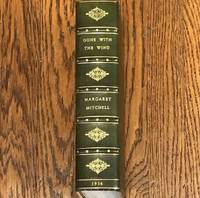
12826First Edition First Printing May 1936. A beautiful copy tastefully bound in green full oasis Morocco with raised bands gilt dentelles marbled endpapers and the original brown cloth bound in at the rear.<br />Inscribed on the front endpaper:<br />"For Rose Harbaugh / Margaret Mitchell"<br />This is undoubtedly Rose Oller Harbaugh the longtime book department manager of Marshall Fields in Chicago who regularly sponsored book signings and other literary events.<br />Laid into this stunning copy is a card signed by both CLARK GABLE and VIVIEN LEIGH.<br />A truly handsome copy of this 20th Century monolith even more so inscribed and signed by the author -- as well as the inclusion of signatures of the two superstars of the iconic film. hardcover books
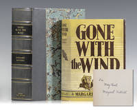
1936117051New York: The Macmillan Company 1936. First edition of Mitchell's masterpiece. Octavo original gray cloth. First printing with "Published May 1936" on the copyright page and no mention of other printings. Presentation copy inscribed by the author on the front free endpaper "For Mary Buck Margaret Mitchell." Near fine in the rare original dust jacket which is in near fine condition. Housed in a custom half morocco clamshell box. A superior example. In 1923 Margaret Mitchell became a feature writer for the Atlanta Journal and in 1925 married John Marsh a public relations officer for Georgia Power. She found most of her assignments unfulfilling and she soon left to try writing fiction more to her own taste. Her own harshest critic she would not try to get her work published. She began to write Gone with the Wind in 1926 while recovering from an automobile accident. Over the next eight years she painstakingly researched for historical accuracy. She accumulated thousands of pages of manuscript. Here is how she later described her life's labor: "When I look back on these last years of struggling to find time to write between deaths in the family illness in the family and among friends which lasted months and even years childbirths not my own divorces and neuroses among friends my own ill health and four fine auto accidents . it all seems like a nightmare. I wouldn't tackle it again for anything. Just as soon as I sat down to write somebody I loved would decide to have their gall-bladder removed. . " In 1934 an editor from Macmillan's Publishers came to Atlanta seeking new authors. He was referred to John and Margaret Marsh as people who knew Atlanta's literary scene. She steered him to several prospects but didn't mention her own work. A friend told him that she was writing a novel but she denied it. On the night before he was to leave Atlanta she appeared at his hotel-room door with her still imperfect mountainous manuscript and left it with him for better or for worse. "This is beyond doubt one of the most remarkable first novels produced by an American writer. It is also one of the best" New York Times. Gone With the Wind is said to be the fastest selling novel in the history of American publishing 50000 copies in a single day and went on to win the Pulitzer Prize. The Macmillan Company hardcover books
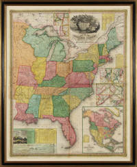
183122138Philadelphia 1831. No binding. Fine. Map of the United States. Entered according to Act of Congress in the Clerks Office of the Eastern District of Pennsylvania October 10th 1831. Philadelphia 1831. Folding map on four sheets joined. Folding into original covers 8vo binding size: 9 5/8 x 6 1/2 in. red half morocco over marbled paper boards upper cover with gilt-lettered title label corner and edges worn. The map and covers now apart and separately mounted for display. Historical BackgroundFirst edition and the first wall map issued by Mitchell. This edition does not have the counties delineated and numbered. Ristow mistakenly says all editions have the townships he means counties numbered but this one the first does not thereby eliminating the index of counties and thus showing more of the western territory. This map predates the Traveler's Guide by 1 year and thus is Mitchell's first ""original"" production as opposed to the Finley material he reissued as the American Atlas and Pocket Maps. Copyright date is October 10 1831. There is no other date on the map. Ristow thinks the map was issued in early 1832 but it is not in Phillips until 1834 edition which probably has the counties indicated by number and the 1831 copyright so Ristow may not have seen this edition but rather the 1834.ReferenceKarrow 1-1473; Ristow p309.ConditionOriginal full color the palette rich and bright. One 5-inch repaired tear at left into Arkansas some cracking and more minor tears at folds. Some overall browning of the sheet. In good condition. books
1960140940127New York: Tiber Press 1960. First Edition. Fine. Complete in four folio volumes each measuring 17½" x14¼". Each volume with three full-page color silkscreen prints and additional prints at title page and upper cover original cloth-backed illustrated boards. First Edition. No. 47 of 200 copies. Each volume signed by the poet and artist on the limitation page. A Fine set bright and sharp in publisher's thick acetate jackets housed in cloth slipcase with light shelf wear.<br /> <br /> <p>A visionary collaboration between the leading lights of the New York School of poetry and four second generation abstract expressionist artists produced at the height of their creative collective powers. A heady encapsulation of the New York literary and visual avant garde at the dawning of the '60s. Tiber Press unknown books
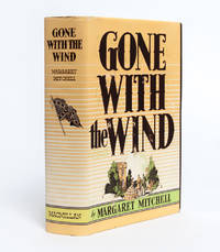
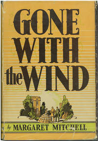
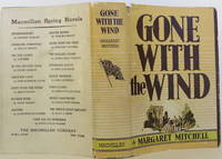
19363055New York: Macmillan 1936. First edition. Fine/Near Fine. First printing May 1936 in first issue jacket. A Fine copy of the book in a lovely Near Fine dust jacket. Jacket with slight rubbing to the front panel a small chip at the lower front corner and one small tear with a tape repair on the verso. Overall a very clean and attractive example.<br/><br/>Set in Georgia during the Civil War and Reconstruction the novel follows the fall of the South and its gentility as experienced by Scarlett O'Hara one of literature's most ruthlessly optimistic characters. More than a war story Gone With the Wind is a reflection on humanity. "Mitchell carefully analyzes the nature of human resilience and hold up hopefulness as the critical tool for getting through the worst of times" The Guardian. Popular from its release and an almost-immediate best-seller Gone With the Wind won the Pulitzer Prize the following year and would be transformed into one of the most iconic Hollywood golden-era films starring Vivien Leigh and Clark Gable. No other work of literature more fully captures the old Southern gentility than Gone With the Wind. "This is beyond a doubt one of the most remarkable first novels produced by an American writer. It is also one of the best" contemporary New York Times Book Review. Fine in Near Fine dust jacket. Macmillan unknown books
19881653591988. MITCHELL Joan. Smoke. Poems by Charles Hine. Illustrated with 16 sugarlift and spitbite aquatints by Joan Mitchell. Folio loose as issued laid-in to a cloth folding box. San Francisco: Limestone Press 1988. Comprised of 16 diptych etchings by Mitchell and accompanied by poems of Charles Hine this book is the result of a wonderful collaboration between the artist poet and publisher. Mitchell a celebrated American abstract expressionist created the etchings using sugarlift and spitbite aquatint technique. Signed on the colophon by Mitchell and Hine. One of 80 copies. hardcover books
1936WRCLIT51586New York: Macmillan 1936. Thick octavo. Gray cloth lettered in blue. Modest rubbing at corners with a few small smudges to cloth usual light tanning to endsheets but a very good tight copy in shelfworn dust jacket with a creased edge tear two large chips to the spine panel and a clean split part way up the lower joint. Half morocco folding slipcase. First edition first printing. Signed by Mitchell on the front free endsheet. The dust jacket is price-clipped but is in the preferred state with the "Spring Novels" advert on the lower panel showing this work as the second title in the right hand column. "The book that lives on and on decried by the devotees of higher criticism scorned by the intellectuals and loved by the public. It was awarded a Pulitzer Prize in 1937" - Harwell. WILLINGHAM & HARWELL 120. Harwell IN TALL COTTON 125. Macmillan hardcover books
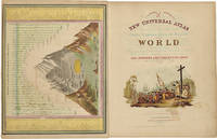
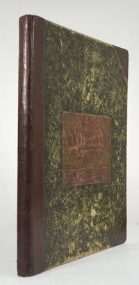
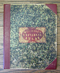
1852236680Philadelphia: Thomas Cowperthwait & Co 1852. Chromolithograph title hand-colored frontispiece 73 hand-colored lithographic maps. 1 vols. Folio. Half red morocco in period style original marbled boards with printed label on upper cover very clean. Chromolithograph title hand-colored frontispiece 73 hand-colored lithographic maps. 1 vols. Folio. Mitchell & Sons first published their NEW UNIVERSAL ATLAS in 1846 having acquired Tanner's NEW UNIVERSAL ATLAS in 1845 and printed it several times subsequently until 1850 when the firm sold the rights to Cowperthwait & Co. of Philadelphia who published it until 1856 continually adding to and editing the hand-colored maps. Despite the attribute "Universal" in the title the Atlas clearly concentrates on America with 43 maps of the continent and features a large double-page transcontinental map of the U.S; and this 1852 Cowperthwait edition is the first to show counties in California and New Mexico. Phillips 809; Ristow pp.311-13; Rumsey p.240 Thomas, Cowperthwait & Co unknown books
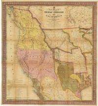
1846WRCAM32518CPhiladelphia: S. Augustus Mitchell 1846. 46pp. text plus colored folding map 22 1/2 x 20 3/4 inches. 18mo. Original gilt morocco cover neatly rebacked in matching morocco. Map neatly repaired with tissue on folds. Text is clean. A major western map with accompanying text. The detailed "New Map of Texas Oregon and California with the Regions Adjoining." shows the western portion of the U.S. to the Pacific with Indian Territory Missouri Territory Iowa and portions of the states of Missouri Arkansas Louisiana and Wisconsin as well as northern Mexico and part of British Columbia illustrating in detail the trans-Mississippi region on the verge of the Mexican-American War. Texas is elaborately depicted with the Rio Grande as its southern border; Oregon is shown to extend to 54° 40"; and the Santa Fe Trail and the Oregon Trail are both detailed the latter with a table of distances published in the lower corner of the map. "This map represents a great step forward in that it is among the first by a commercial cartographer to utilize the recent explorations that had bounded and determined the nature of the Great Basin.because of its popularity this map of the West exerted great influence not only with the public but on other commercial cartographers" - Wheat. The text describes each territory or state in turn with notes on Lewis and Clark and other early explorers and more historical material. Howes also mentions an issue with thirty-four pages of text but Sabin lists only the present collation. HOWES M685 "aa." SABIN 49714. MARTIN & MARTIN 36. WAGNER-CAMP 122b. COWAN p.433. WHEAT TRANSMISSISSIPPI 520. STREETER SALE 2511. PHILLIPS MAPS p.844. WHEAT GOLD REGIONS 29. REESE BEST OF THE WEST 91. S. Augustus Mitchell unknown books
185949436Philadelphia: S. Augustus Mitchell 1859. Large hand-colored wall map on rods approx. 64" square with 4 engraved vignettes 3 inset maps 2 of the world and 1 of the Sandwich Islands all within an elaborate floral border; some infill along the margins slight loss in the population tables at the bottom and several cracks in the paper the whole neatly and professionally backed with linen; overall appearance is certainly very good or better with the usual small defects. America as it was on the eve of the Civil War. OCLC records examples from 1856 1857 1858 1860 and 1861 but not this. Unusual features of this map include the Shoshone Territory what is now mostly Idaho Colona now part of Colorado the unusually large Nebraska the horizontal Utah and New Mexico and the unusually small Dakotas. <br/><br/> S. Augustus Mitchell unknown books
18525810Philadelphia: Thomas Cowperthwait & Co 1852. Folio. 17 x 13 3/4 inches. Chromolithographic title with large vignette hand-coloured frontispiece of the heights of the principal mountains and lengths of the principal rivers contents list printed in red black and gold 73 hand-coloured lithographed maps charts and city plans 1 double-page. Publisher's green marbled paper-covered boards with morocco title label elaborately tooled and lettered in gilt on upper cover red morocco spine and corners expertly renewed to style. Modern red cloth box morocco lettering piece<br/> <br/>A fine copy of this famous atlas with hand-coloured maps of all the individual States and Territories. The map of California shows counties in California and New Mexico for the first time.<br/> <br/>Despite its title the Atlas concentrates to a marked degree on the American continent with 43 maps of the area including a fine double-page east-to-west-coast map of the United States. S. Augustus Mitchell and his sons were the leading publishers of maps in the United States during most of the nineteenth century. Mitchell had come to Philadelphia around 1830 with the intention of improving the standard of geography textbooks Philadelphia then being the leading city in America for cartographical publications. A New American Atlas published in 1831 was his first work. In 1845 he acquired the rights to Tanner's New Universal Atlas first published in 1836 and in 1846 he published his first edition of the present work. Mitchell continued to publish the atlas until 1850 when he sold the copyright to Cowperthwait & Co. of Philadelphia. Thomas Cowperthwait & Company published it until the mid-1850s when it was purchased by Charles De Silver. The Cowperthwait company continued to add edit alter and hand-colour the maps.<br/> <br/>Phillips Atlases 807; cf. Ristow pp. 311-313; Rumsey p.239. Thomas, Cowperthwait & Co unknown books
18556365Philadelphia: Charles DeSilver 1855. Folio. 17 x 14 inches. Chromolithographic title with large vignette hand-coloured frontispiece of the heights of the principal mountains and lengths of the principal rivers contents list printed in red black and gold 71 hand-coloured lithographed maps and charts 3 double-page and 1 city plan. Publisher's red half morocco with green marbled paper-covered boards morocco title label elaborately tooled and lettered in gilt on upper cover. Modern red cloth box dark red morocco lettering piece<br/> <br/>A fine copy of this famous atlas with hand-coloured maps of all the individual States and Territories. The first edition to have DeSilver as publisher and here including 'A New Map of Nebraska Kansas New Mexico & the Indian Territories' for the first time: present here as an additional map un-numbered and not called for in the contents list<br/> <br/>Despite its title the Atlas concentrates to a marked degree on the American continent with a city plan of Washington D.C. and 42 maps of the area including a fine double-page coast-to-coast map of the United States and 30 maps of the States and Territories. The un-numbered map of Nebraska Kansas etc. is here bound between sheets numbered 37 and 38. S. Augustus Mitchell and his sons were the leading publishers of maps in the United States during most of the nineteenth century. Mitchell had come to Philadelphia around 1830 with the intention of improving the standard of geography textbooks Philadelphia then being the leading city in America for cartographical publications. A New American Atlas published in 1831 was his first work. In 1845 he acquired the rights to Tanner's New Universal Atlas first published in 1836 and in 1846 he published his first edition of the present work. Mitchell continued to publish the atlas until 1850 when he sold the copyright to Cowperthwait & Co. of Philadelphia. Thomas Cowperthwait & Company published it until the mid-1850s when it was purchased by Charles De Silver. The Cowperthwait company continued to add edit alter and hand-colour the maps.<br/> <br/>Phillips Atlases 6118; cf. Ristow pp. 311-313; Rumsey pp.240-241. Charles DeSilver unknown books
1936140938421New York: The Macmillan Company 1936. First Edition. Near Fine/Poor. First edition first printing with "Published May 1936" on the copyright page. Signed by Margaret Mitchell on the front free endpaper. Very Good with a short tear to the cloth at the top of the spine light general rubbing and light wear and toning to the pages. With remnants of the tattered first issue dust jacket present though in rather poor condition. A lovely copy of the first printing signed by the author. The Macmillan Company unknown books
600114"Margaret" in black fountain pen ink on personal letterhead Atlanta May 3 1939. 4to 3 separate pages. To Mable and Edwin Granberry: " We have been in one of our hurricanes. It all started when Selznick at last announced Miss Vivien Leigh and things are just now quieting down." She then goes on to ponder an invitation to Long Beach New York. On page two she comments on that years Pulitzer Prize-winner: "Of course you know about Marjorie Rawlings getting the Pulitzer award. There never was much doubt that she would get it if there was any justice anywhere.I do not know whether the award will keep her too busy to make this trip. The members of the Atlanta Womens Press Club have asked me to give a party for her should she come as they are all anxious to meet her." Mitchell closes with mention of the book which made her famous: "I was interested in your remarks about finding a GWTW mention in an article written by a Chinese. I did not see the article and if you have to or know who wrote it Id be interested. As far as I know the book has not been done into Chinese.I am just learning now that it was published in Japan a year and half ago and that it has sold 150000 copies there. I will not get a cent from this because Japan has a treaty with the United States which gives them the right to translate and publish American books without paying royalties to the authors." Mitchell met Edwin Granberry when he wrote an early laudatory review of GWTW; he later interviewed her for his March 13 1937 article "The Private Life Of Margaret Mitchell." They became friends and frequent correspondents see Darden Pyron's "Southern Daughter" for numerous comments. Not in "GWTW Letters." Mitchell 1900-49 American writer; author of the 1936 Pulitzer Prize winning "Gone With the Wind" filmed by MGM in 1939 under directors George Cukor and Victor Fleming starring Clark Gable and Vivien Leigh. Signed by Authors. F. Soft cover. paperback books
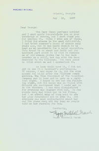
1937252027Atlanta Georgia 1937. One page on personal letterhead. 4to. light creasing and toning esle fine. One page on personal letterhead. 4to. To Cukor on "old mimosa groves" - "bees demented in the blossoms" -- and Tallulah. Mitchell thanks Cukor for the gift of Mary Chess perfumes and especially the "mimosa":<br/><br/>"I had tried someone's brand of mimosa many years ago but it was heavy enough to be used as an anesthetic for a major operation. This brand is so sweet and faint and the lovliest part about it is that it reminds me of old mimosa groves far in the back country on a still hot day with the bees demented in the blossoms."<br/><br/>She then goes on to discuss Tallulah Bankhead's recent performance in Atlanta which she unfortunately missed:<br/><br/>'Of course I was eager to go but the show opened the night after the Pulitzer Award arrived. The Vice President of The Macmillan Company was in town and he gave me a party that night. I hoped to see her the following night but the house was so filled with friends and excitement that I could not go to the theatre. I was very disappointed for everyone was charmed with her. So few people here had liked her in her films and I am afraid many of them went to see her play determined not to like it. But everyone was most enthusiastic about her and the phone rang all day long as people told me how charming she was. "<br/><br/>Mitchell won the Pulitzer Prize in 1937 for her novel GONE WITH THE WIND; and George Cukor was David Selznick's first choice as director of the film. unknown books
1936Embry 177556The Macmillan Company 1936. First edition first printing. Rebound fine thus in custom slipcase with matching leather title label. Rebound in full confederate gray morocco by master binder Glenn Fukunaga spine panels with double gilt surrounds and crossed confederate swords central device. Briefly inscribed "Foir Gunvor Svendsen Margaret Mitchell." The Macmillan Company, 1936. First edition, first printing. hardcover books
1852WRCAM31820APhiladelphia: Thomas Cowperthwait & Co. 1852. Chromolithographic title with large vignette; handcolored frontispiece of heights of principal mountains and lengths of principal rivers; contents list printed in red black and gold; seventy-three handcolored lithographic maps charts and city plans one double-page. Folio. Publisher's three-quarter red morocco and marbled boards spine ruled in gilt morocco label lettered in gilt on front board. Binding worn and rubbed front hinge tender. Contemporary bookplate on front pastedown. Some toning but generally clean internally. Very good overall. A famous atlas with handcolored maps of all the individual states and territories with the map of California showing counties in California and New Mexico for the first time and with the locations of Native American tribes shown in several western states and territories. Despite its title the atlas concentrates to a marked degree on the American continent with forty-three maps of the area including a fine double-page coast- to-coast map of the United States. <br> <br> S. Augustus Mitchell and his sons were the leading publishers of maps in the United States during most of the 19th century. Mitchell had come to Philadelphia round 1830 with the intention of improving the standard of geography textbooks Philadelphia then being the leading city in America for cartographical publications. A NEW AMERICAN ATLAS published in 1831 was his first work. In 1845 he acquired the right to Tanner's NEW UNIVERSAL ATLAS first published in 1836 and in 1846 he published his first edition of the present work. Mitchell continued to publish the atlas until 1850 when he sold the copyright to Cowperthwait & Co. of Philadelphia. Thomas Cowperthwait & Company published it until 1856 when it was purchased by Charles DeSilver. The Cowperthwait company continued to add edit alter and hand-color the maps. PHILLIPS ATLASES 807. RISTOW pp.311-13 ref. RUMSEY 553. Thomas, Cowperthwait & Co. hardcover books
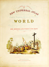
185265704With the First Map to Show Counties in California and New Mexico MITCHELL S. Augustus. A New Universal Atlas of the World. Containing Maps of the various Empires Kingdoms States and Republics Of The World. With a special map of each of the United States Plans of Cities &c. Comprehended in seventy sheets and forming a series of One Hundred And Seventeen Maps Plans And Sections Philadelphia: Cowperthwait & Co. 1852. Complete with seventy-three full colored maps one of which is double-paged color frontispiece vignette title-page and table of contents heightened in gilt. Folio 17 x 14 inches; 430 x 355 mm. Half red morocco over marbled boards. Front board with red morocco label lettered in gilt. Binding scuffed and bumped. Hinges professionally repaired. Some toning throughout mainly to blank versos of maps and margin edges only occasionally affecting the maps. Closed tear to front free endpaper. A few instances of foxing on maps mainly to map 51 "Holland and Belgium." A small dark spot in Buenos Ayres on map 44. A small piece scraped off of map 73 "Oceana" but not making a hole all the way through. Also a marginal closed tear to this map professionally repaired. Overall a very good copy. This atlas was first published in 1846 by Mitchell & Sons after acquiring the rights to Tanner's New Universal Atlas in 1845. Mitchell & Sons reprinted it several times until 1850 when they sold the rights to Cowperthwait & Co. of Philadelphia who published it until 1856. During this time the atlas was further expanded and edited. Over half of this atlas deals with the Americas and features the double-page "A New Map of the United States of America." Within this map of the USA is a detailed inset of "The Gold Regions of California." The present edition is the first to show counties in California and New Mexico. Howes. Streeter. HBS 65704. $7500 Cowperthwait & Co. hardcover books
18496558Philadelphia: S. Augustus Mitchell 1849 Folio. 17 3/8 x 14 inches. Lithographed title with large vignette letterpress "Table of Contents" and 73 hand-colored lithographed maps charts and city plans. Three-quarter red morocco over marbled boards large red morocco title label on front cover elaborately tooled and lettered in gilt. Spine and corners renewed in red leather. Boards rubbed and scuffed at edges. Maps in fine condition. Overall a fine copy. A very nice copy of this very scarce atlas with hand-colored maps of all the individual States and Territories and including the rare and famous map of "Oregon Upper California & New Mexico" showing the large yellow-colored area in California labeled "Gold Region." The Atlas concentrates on the American continent with 43 maps of the area including a fine double-page coast-to-coast map of the United States. Samuel Augustus Mitchell and his sons were the leading publishers of maps in the United States during most of the nineteenth century. A New American Atlas published in 1831 was Mitchell's first work. In 1846 he published his first edition of the present work. He continued to publish the Atlas until 1850 when he sold the copyright to Cowperthwait & Co. It was with this 1849 edition that "New Mexico" was added to the title of the map as well as the words "Gold Region" added in a large yellow area in "Upper or New California." As Wheat states "We find S. Augustus Mitchell in Philadelphia publishing in 1849 a revised version of his Texas Oregon and California map taking advantage of Frémont's later work and displaying a large colored Gold Region." Also many routes are shown by red hand-colored lines including Frémont's routes. Wheat: Mapping the Transmississippi West: 630 p.284; text p.82; not noted in Wheat's Maps of the Gold Region. S. Augustus Mitchell hardcover books
19361511033MacMillan 1936. 1st Edition. Hardcover. Fine/Very Good. A fine first edition in a very good dust jacket. May 1936 on copyright page. First issue dust jacket with book title in second column and original price of $3 on front flap. Housed in a custom-made collector's slipcase. MacMillan hardcover books