46 résultats
191009110Paris: Aristide Quillet 1910. First Edition. Hard Cover. Quarto. In two volumes. 221pp. text volume profusely illustrated in black and white atlas volume containing 13 leaves of COLOR diagrams with MOVEABLE OVERLAYS mounted on stiff boards. Both volumes bound in original brown pictorial cloth lettered and decorated in blue orange gold black and white; decorative endpapers; minor wear to spine ends. A very handsome set of this guide to contemporary sources of energy for transportation and industry. Each plate with an explanatory leaf describing each device opposite the plate which includes; a compound steam locomotive a Daimler automobile a motorcycle and of course the famed Wright brother's aircraft among others; with an historical survey of aviation with photogravure plates of Lilienthal's first flight and Delagrange's biplane. Internally clean and fresh with no foxing; a fine copy. Moveable plates complete showing no wear or tears. <br/><br/> Aristide Quillet hardcover books
19100027751910. Full Leather with the original decorated cloth bindings bound in. Very Good. 4to. 12 by 8.5 inches 30 by 21 cm. x 2 9-221. Atlas: 2 13 color plates on heavy card stock with movable parts captions on facing versos. The atlas anatomizes with great precision generators and motors and various vehicles including automobiles motorcycles zeppelins airplanes. The pulls allow one to see the inner workings of all the machinery as well as relate it to the other layers and it is also a fun learning too. An ink mark affecting half the leaves in the fore-edge. Scattered soiling and moderate wear. <br/><br/> hardcover books
1922007670Paris: Librairie Plon 1922. First Edition 1922. Rebound in a signed Henri Creuzevault 1905-1971 Art Deco binding half dark brown morocco spine in one compartment with lettering stamped in gilt the compartment bordered by a geometric design the other half a green morocco resembling snakeskin. top edge gilt ribbon marker two-tone brown end pages in crossing lines. Near Fine two small rubs to morocco at spine. . First Edition. Half Morocco . Near Fine/No Jacket As Issued. 8vo - over 7¾" - 9¾" tall. Librairie Plon Hardcover books
1918WRCLIT46419Paris: Georges Crès et Cie / Les Maitres du Livre 1918. Printed wrappers. Woodcut frontis by Paul Colin. One of 1550 numbered copies on Arches from a total edition of 1612. About fine unopened. TALVART & PLACE BARRÈS 44c. Georges Crès et Cie / Les Maitres du Livre unknown books
1913WRCLIT46418Paris: Georges Crès et Cie / Les Maitres du Livre 1913. Printed wrappers. Colored woodcut frontis by P.-E. Vibert. One of 1050 numbered copies on Rives from a total edition of 1100. Old mend at top of one joint wrappers a bit darkened; good. TALVART & PLACE BARRÈS14e. Georges Crès et Cie / Les Maitres du Livre unknown books
1912WRCLIT46349Paris: George Crès et Cie / Les Maitres du Livre 1912. Printed wrappers. Woodcut portrait and decorations by P.-E. Vibert. One of forty- eight numbered copies on Japon Impérial from a total edition of 999 copies. About fine. TALVART & PLACE BARRÈS 7e. George Crès et Cie / Les Maitres du Livre unknown books
1930041109Paris: Librairie Plon 1930. 7e Ãdition. iv 471p. folded map original stiff printed wrappers lightly chipped on the edges. Librairie Plon unknown books
1916263102Paris: Emile-Freres 1916. pamphlet. very good. 55 pages small 4to original cream printed wrappers. Paris: Emile-Paul Freres 1916. First Edition.<br/><br/> Author's inked presentation on the cover.<br/><br/> Emile-Freres unknown books
006256Strasbourg: 1920. Half-Buckram. A Very Good Copy 1st. 32mo - over 4" - 5" tall. 55 pp. Signed by Barres. Text of a speech given in London in 1916 to the Royal Academy of Britain on motives and qualities of the French under arms. Strasbourg: , 1920 unknown books
1913WRCLIT46417Paris: Georges Crès et Cie / Les Maitres du Livre 1913. Printed wrappers. Engraved portrait by Robert Vallier after Alexis Axilette. One of 975 numbered copies on Rives from a total edition of 1039. Old mend at toe of one joint wrappers a bit darkened; good. TALVART & PLACE BARRÈS 5e. Georges Crès et Cie / Les Maitres du Livre unknown books
1915119903London: T. Fisher Unwin 1915. Softcover. VG clean and tight but for ex-lib. stamp on front cover and a bit of age discoloration. Ivory paper wraps stapled with red lettering and border; 41 pp. Contents include The Savage Onslaught of the Inferior Race The Soul of the Ruins The Mass on the Graves of Victory Burnt Villages Spring Awakening among the Ruins and The Village in the Forest. T. Fisher Unwin paperback books
1912WRCLIT46420Paris: Georges Crès et Cie / Les Maitres du Livre 1912. Printed wrappers. Woodcut portrait by P.-E. Vibert. One of 975 numbered sets on Rives from a total edition of 1034 Very good. TALVART & PLACE BARRÈS 6e. Georges Crès et Cie / Les Maitres du Livre unknown books
15181Paris France: H. Floury no date. Hardcover. VG wear at the edges. Blue cloth. 192 pp. 26 bw plates. In-depth biography of El Greco involving the progression and development of his art throughout his life. Many nice plates. Text in French. One of 750 copies. H. Floury hardcover books
194622517Paris: Editions Littéraires De France. 1946. Softcover. Unbound signatures in wraps No. 80 of 490 copiess illustrated by Bernard Cochet. Fine in fine wraps in fine chemise and box a few scratches to the latter. ; 4to 11" - 13" tall . Editions Littéraires De France paperback books
192722247Paris: Javal & Bourdeaux. 1927. Softcover. 1 of 490 this one marked "hors commerce". Unbound signatures with 17 watercolor plates and numerous illustrations. Wraps have very minor crease to front wrap otherwise fine in a near fine chemise with sunned spine. Box is sunned on edges with a bumped corner. ; 4to 11" - 13" tall . Javal & Bourdeaux paperback books
1922LD5785Paris: Pous les Cent Bibliophiles 1922. Limited Edition. Paperback. Very Good. Original pictorial wraps printed in color and gilt embossed to cover and spine edges uncut in glassine dust jacket. Illustrated with 41 color drypoint etchings all by Malo Renault; decorative margins. Number 125 from a limited edition of 130 copies. Attractive sound copy if only slightest browning and wear at edges. <br/><br/> Pous les Cent Bibliophiles paperback books
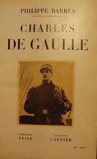
194414301944. BARRES Philippe. CHARLES DE GAULLE. Paris: Libraire Plon- Editions Cartier 1945. Small 8vo. blue quarter-morocco leather & gray boards; 242 pages. First Edition later printing. Signed presentation from Barres on the half-title page in French to Jane Rittenhouse. Very Good contents clean & tight; some rubbing & scuffing leather. $125.00. <br/><br/> hardcover books
178134403London: J.F.W. Des Barres 1781. Hand-colored line engraving and aquatint. Two plates printed on two sheets joined with 8 views arranged in 5 rows. Sheet size: 32 x 43 3/4 inches. 8 navigational profile views from the greatest of all 18th century sea atlases.<br/> <br/>These eight views of sites in and around Nova Scotia were designed to give navigators additional information to the soundings on the charts of these same places. Several of the placenames have changed but Beaver Island Port Bickerton Chedabucto Bay and Canso remain. This is the 5th of 5 states with many ships and aquatinted features to the landscapes added to the original plates. Des Barres of Swiss-Huguenot extraction studied under the great mathematician Daniel Bernoulli at the University of Basel before continuing on to the Royal Military College at Woolwich. Upon the outbreak of hostilities with France in 1756 he joined the British Royal American Regiment as a military engineer. He came to the attention of General James Wolfe who appointed him to join his personal detail. During this period he also worked with the future legendary explorer James Cook on a monumental chart of the St. Lawrence River. From 1762 Des Barres was enlisted to survey the coastlines of Nova Scotia Newfoundland and the Gulf of St. Lawrence while his colleague Samuel Holland charted the New England coast. He also managed to gain access to some surveys of the American South Cuba and Jamaica. In 1774 Des Barres returned to England where he began work on The Neptune. His dedication to the project was so strong that often at his own expense he continually updated and added new charts and views up until 1784. That year he returned to Canada where he remained for a further forty years becoming a senior political figure and a wealthy land owner and living to the advanced age of 103.<br/> <br/>The American Revolution in drawings and prints; a checklist of 1765-1790 graphics in the Library of Congress / Compiled by Donald H. Cresswell with a foreword by Sinclair H. Hitchings. Washington : 1975 no. 397-404; #61e Henry Stevens Collection. J.F.W. Des Barres unknown books
177517671London: Published by J.F.W. Des Barres in 'The Atlantic Neptune' 1775. Copper-engraved and etched map with aquatint on two joined sheets. Printed on laid paper with `J Bates' watermark and `JB' countermark in excellent condition. Sheet size: 30 1/4 x 42 5/8 inches. With: The explanatory text leaf titled as above. 1p. folio 25 1/2 x 19 inches. The finest and most celebrated sea chart of Boston Harbor ever produced and a highly important Revolutionary War map depicting details relating to the Siege of Boston: with the very rare explanatory text leaf.<br/> <br/>This is one the most important maps contained in Des Barres' The Atlantic Neptune and one of the most significant large-scale maps of the Revolutionary War. It provides an invaluable record of Boston at the beginning of the war covering the area from the environs of the city out into the open waters of Massachusetts Bay. A particularly striking feature is the use of boldly etched and subtly aquatinted details to capture the diverse topography of the region including the numerous hills islands and river estuaries. It is important to remember that this was issued as a working sea-chart and as such the cartographer has naturally concentrated on features such as depth soundings indicated by detailed lines and based on surveys by Samuel Holland and George Callendar and the navigable channels between the harbor's numerous shoals which are delicately outlined in stipple-engraving. Holland's original manuscript map is today preserved in the British Hydrographic Library at Taunton Somerset. The present map shows the city of Boston with its streets carefully outlined occupying a pear-shaped peninsula a position that would soon prove precarious to its British defenders in the escalating conflict. This is the second state of five of Des Barres' chart and is identical to the Henry Stevens Collection variant 96D in the National Maritime Museum Greenwich. This state shows a number of notable changes when compared with the original and was evidently altered to take particular account of the Siege of Boston April 19 1775 to March 17 1776. Henry Stevens noted that this state depicted the addition of "Numerous Forts Batteries Redoubts &c. which have been inserted in many places notably on the Charles Town peninsula and on the mainland between 'Willis Creek' and 'Mystic River' also on the east and north side of 'Charles River' below 'Cambridge'.also to the south of 'Boston Neck' and 'Dorchester Neck'.This state is almost as rare as the first state. It is found in some copies of the earliest edition of the Neptune." The accuracy scope and artistic virtue of Des Barres's Chart of the Harbour of Boston was apparent to his contemporaries and it became the main source map of the area for decades to come. Joseph Frederick Wallet Des Barres was born in Switzerland where his Huguenot ancestors had fled following the repeal of the Edict of Nantes. He studied under the great mathematician Daniel Bernoulli at the University of Basel before immigrating to Britain where he trained at the Royal Military College Woolwich. Upon the outbreak of hostilities with France in 1756 he joined the British Royal American Regiment as a military engineer. He came to the attention of General James Wolfe who appointed him to join his personal detail. During this period he also worked with the legendary future explorer James Cook on a monumental chart of the St. Lawrence River. Upon the conclusion of the Seven Years War Britain's empire in North America was greatly expanded and this required the creation of a master atlas featuring new and accurate sea charts for use by the Royal Navy. Des Barres was enlisted to survey the coastlines of Nova Scotia Newfoundland and the Gulf of St. Lawrence. With these extremely accurate surveys in hand Des Barres returned to London in 1774 where the Royal Navy charged him with the Herculean task of producing the atlas. He was gradually forwarded the manuscripts of numerous advanced surveys conducted by British cartographers in the American Colonies Jamaica and Cuba of which the present map is based on the work of Samuel Holland conducted in the 1760s. The result was The Atlantic Neptune which became the most celebrated sea atlas of its era containing the first systematic survey of the east coast of North America. Des Barres's synergy of great empirical accuracy with the peerless artistic virtue of his aquatint views created a work that "has been described as the most splendid collection of charts plates and views ever published" National Maritime Museum Catalogue. The Neptune eventually consisted of four volumes and Des Barres's dedication to the project was so strong that often at his own expense he continually updated and added new charts and views to various editions up until 1784 producing over 250 charts and views many appearing in several variations. All of these charts were immensely detailed featuring both hydrographical and topographical information such that in many cases they remained the most authoritative maps of the regions covered for several decades. Following the completion of The Neptune Des Barres returned to Canada where he remained for a further forty years becoming a senior political figure and a wealthy land owner living to the advanced age of 103.<br/> <br/>Cf. GuthornBritish Maps of the American Revolution referring to Holland's original manuscript 59/3; Krieger & Cobb p.107 1781 issue; Lingel Atlantic Neptune N91.2; National Maritime Museum Henry Stevens Collection K0713 HNS 96D; National Maritime Museum Catalogue 78-83; Nebenzahl Bibliography 3; Stevens Bibliography of the Atlantic Neptune unpublished pp.211-216; Sellers & Van Ee 945. Published by J.F.W. Des Barres in 'The Atlantic Neptune' unknown books
177933200London 1779. Engraved and aquatint map period hand colouring. 14 lettered references large inset with title as above. Rare revolutionary chart of the Hudson River showing the American defenses on the eve of the Battle of Fort Montgomery.<br/> <br/>On October 6 1777 a British force led by Lieutenant General Sir Henry Clinton attacked Forts Montgomery and Clinton from the landward side where the American defenses were only partially completed. Support from cannon fire from British ships on the Hudson River that had passed through the chevaux de frise on the lower river. By the end of the day both forts had fallen to the British who burned the forts and tore down the stonework buildings. However the battle was a pyrrhic victory for the British. The campaign against the forts caused delays in reinforcing General John Burgoyne at Saratoga where Americans forced the British surrender ten days later at the Battle of Saratoga before Clinton's forces could arrive. The present map which depicts the Forts and the River defenses prior to the battle is from The Atlantic Neptune the finest large scale sea atlas of the United States and Canadian Atlantic coastline ever produced. The maps in the atlas were produced over a seven-year period 1775-82 and are well known for their accurate portrayal of various sounds bays bars harbors as well as navigational hazards. This atlas was used extensively by the Royal Navy during the American Revolution. Des Barres studied under the great mathematician Daniel Bernoulli at the University of Basel before continuing on to the Royal Military College at Woolwich. On the outbreak of the Seven Years war in 1756 he joined the British Royal American Regiment as a military engineer. He came to the attention of General James Wolfe who appointed him to be his aide-de-camp. From 1762 Des Barres was enlisted to survey the coastlines of Nova Scotia Newfoundland and the Gulf of St.Lawrence while his colleague Samuel Holland charted the New England coast and further south. In 1774 Des Barres returned to England where he began work on the Neptune. His dedication to the project was so strong that often at his own expense he continually updated and added new charts and views up until 1784. That year he returned to Canada where he remained for a further forty years becoming a senior political figure and a wealthy land owner and living to the advanced age of 103. The Atlantic Neptune was the first British sea atlas of her North American colonies and one of the most important achievements of eighteenth century cartography. With an official commission from the Royal Navy Des Barres published the first volume in London in 1775 which was soon followed by further volumes. Des Barres' monumental endeavor eventually featured over two-hundred charts and aquatint views many being found in several states. All of the charts were immensely detailed featuring both hydrographical and topographical information. The Neptune met with the highest acclaim from the beginning and is today widely regarded as superior to all other atlases produced during its time. Henry Stevens identified only a single state of this chart issued coloured or uncoloured which appeared in some examples volume four part two of the Atlantic Nepture; the map however is not listed in the engraved list of maps for that section and given the rarity was likely not issued in all copies.<br/> <br/>National Maritime Museum: Henry Stevens Collection: HNS156; Cf. Phillips Atlases 1198; Hornsby Surveyors of Empire: Samuel Holland J.F.W. Des Barres and the Making of the Atlantic Neptune 2011. unknown books
177634921London: J. F. W. Des Barres 1776. Engraved view printed on laid paper engraved by James Newton after Pierie. Sheet size: 22 1/2 x 31 1/2 inches. First state. Repaired tears in lower margin. Rare view of Boston from Dorchester Heights published shortly after George Washington's first victory of the American Revolution.<br/> <br/>Following the Battles of Lexington and Concord American troops laid siege to Boston. Strategically Dorchester Heights offered commanding views of both Boston town and harbour. On March 4 1776 under the cover of darkness and with batteries firing from Roxbury and Cambridge to provide a diversion George Washington moved canon captured at Ticonderoga onto the Heights and fortified the position. Faced with little choice given the overwhelming strategic advantage General Howe retreated from Boston on March 17 giving George Washington and the Americans a decisive early victory in the war. The present view accomplished by British artillery officer William Pierie in 1773 depicts Boston Boston Harbor and Roxbury as it would have been seen by Washington and the American army. The Shirley-Eustis house the home of Governor William Shirley and later Governor William Eustis in Roxbury is visible in the middle ground and in the far distance the beacon is visible atop Beacon Hill. A rare view published in 1776 in the New England section of Des Barres monumental Atlantic Neptune. Joseph Frederick Wallet Des Barres was born in Switzerland where his Huguenot ancestors had fled following the repeal of the Edict of Nantes. He studied under the great mathematician Daniel Bernoulli at the University of Basel before immigrating to Britain where he trained at the Royal Military College Woolwich. Upon the outbreak of hostilities with France in 1756 he joined the British Royal American Regiment as a military engineer. He came to the attention of General James Wolfe who appointed him to join his personal detail. Des Barres returned to London in 1774 where the Royal Navy charged him with the Herculean task of producing an atlas of sea charts of the American coast. The result was The Atlantic Neptune which became the most celebrated sea atlas of its era containing the first systematic survey of the east coast of North America. Des Barres's synergy of great empirical accuracy with the peerless artistic virtue of his aquatint views created a work that "has been described as the most splendid collection of charts plates and views ever published" National Maritime Museum Catalogue. The Neptune eventually consisted of four volumes and Des Barres's dedication to the project was so strong that often at his own expense he continually updated and added new charts and views to various editions up until 1784 producing over 250 charts and views many appearing in several variations. Following the completion of The Neptune Des Barres returned to Canada where he remained for a further forty years becoming a senior political figure and a wealthy land owner living to the advanced age of 103.<br/> <br/>Henry Stevens Collection HNS97; Deak 132. J. F. W. Des Barres unknown books
177634405London: J. F. W. Des Barres 1776. Engraved with color wash and outline color. Sheet: 31 x 42 1/4 inches. Expert restoration primarily at the upper margin. Two sheets joined both watermarked "J.Bates" and countermarked "JB". Fourth state of five. Among the earliest charts published by Des Barres were those relevant to the crisis in New England as the War of Independence broke out.<br/> <br/>This chart depicts the coast of Massachusetts from Salem to Scituate Harbor and includes the complicated hydrography of Boston Harbor and the confluent rivers. A considerable amount of coastal topography is included obviously relevant to warships. Fundamentally a chart for navigators it includes soundings and shoals with particularly strong detail along the Charles and Mystic Rivers as well as in Salem and Marblehead. Samuel Holland was the lead surveyor. In 1764 he was named Surveyor General of both the Province of Quebec and the Northern District of North America. He had a considerable staff and the British Navy assisted in providing soundings. From 1770 to 1774 his squad worked exclusively on northeastern colonies that soon became part of the United States. The surveys that derived from the industry of their work were the most accurate ever made to that time. They were sent to London where Des Barres supervised the engraving and publication. The charts were very soon put to use. Des Barres of Swiss-Huguenot extraction studied under the great mathematician Daniel Bernoulli at the University of Basel before continuing on to the Royal Military College at Woolwich. Upon the outbreak of hostilities with France in 1756 he joined the British Royal American Regiment as a military engineer. He came to the attention of General James Wolfe who appointed him to join his personal detail. During this period he also worked with the future legendary explorer James Cook on a monumental chart of the St. Lawrence River. From 1762 Des Barres was enlisted to survey the coastlines of Nova Scotia Newfoundland and the Gulf of St. Lawrence while his colleague Samuel Holland charted the New England coast. He also managed to gain access to some surveys of the American South Cuba and Jamaica. In 1774 Des Barres returned to England where he began work on The Neptune. His dedication to the project was so strong that often at his own expense he continually updated and added new charts and views up until 1784. That year he returned to Canada where he remained for a further forty years becoming a senior political figure and a wealthy land owner and living to the advanced age of 103.<br/> <br/>Stevens Collection 94d ; cf. Hornsby Surveyors of Empire: Samuel Holland J.F.W. Des Barres and the Making of the Atlantic Neptune. 2011. J. F. W. Des Barres unknown books
178019770London: J.F.W. Des Barres in the 'Atlantic Neptune' 1780. Engraved with aquatint period oxidized color. Good condition apart from expert restoration to center fold upper and lower margins. A very rare and highly important sea chart of Pensacola Harbor from the 'Atlantic Neptune' the finest marine atlas of North America's east coast produced during the Revolutionary War.<br/> <br/>This superbly drafted map features the magnificent natural harbor of Pensacola on the Florida panhandle. The town with its fort and carefully laid out streets is featured in the left-centre of the map. Another settlement "Campbell Town" is located further up the harbour toward where the entrance of the "Scambia" Escambia River. The borders of various land grants are demarcated and the countryside is elegantly detailed with aquatint features and coloured in a light brown-green wash. The chart precisely captures the features of the coast showing how the harbor is protected by two sandy bars of land the outer being Santa Rosa Island. The chart features a great deal of quantitative hydrographic information and instructions to mariners are written in the lower right of the map ensuring that it was by far the most accurate and comprehensive pilot for the harbor produced in the eighteenth-century. The present example is the first of two variants of this chart. It is important to note that the year this map was printed the region was caught up in the dramatic action of the Revolutionary War. The Spaniards who had just joined the war on the American side seized the British garrison at Fort Barrancas and West Florida remained in their possession for the duration of the war. Joseph Frederick Wallet Des Barres was born in Switzerland where his Huguenot ancestors had fled following the repeal of the Edict of Nantes. He studied under the great mathematician Daniel Bernoulli at the University of Basel before immigrating to Britain where he trained at the Royal Military College Woolwich. Upon the outbreak of hostilities with France in 1756 he joined the British Royal American Regiment as a military engineer. He came to the attention of General James Wolfe who appointed him to join his personal detail. During this period he also worked with the legendary future explorer James Cook on a monumental chart of the St. Lawrence River. Upon the conclusion of the Seven Years War Britain's empire in North America was greatly expanded and this required the creation of a master atlas featuring new and accurate sea charts for use by the Royal Navy. Des Barres was enlisted to survey the coastlines of Nova Scotia Newfoundland and the Gulf of St. Lawrence. With these extremely accurate surveys in hand Des Barres returned to London in 1774 where the Royal Navy charged him with the Herculean task of producing the atlas. Gradually he was forwarded the manuscripts of numerous advanced surveys conducted by British cartographers in the American Colonies Jamaica and Cuba. The result was The Atlantic Neptune which became the most celebrated sea atlas of its era containing the first systematic survey of the east coast of North America. Des Barres's synergy of great empirical accuracy with the peerless artistic virtue of his aquatint views created a work that "has been described as the most splendid collection of charts plates and views ever published" National Maritime Museum Catalogue. The Neptune eventually consisted of four volumes and Des Barres's dedication to the project was so strong that often at his own expense he continually updated and added new charts and views to various editions up until 1784 producing over 250 charts and views many appearing in several variations. All of these charts were immensely detailed featuring both hydrographical and topographical information such that in many cases they remained the most authoritative maps of the regions covered for several decades. Following the completion of the Neptune Des Barres returned to Canada where he remained for forty years becoming a senior political figure and a wealthy land owner living to the advanced age of 103.<br/> <br/>National Maritime Museum Henry Newton Stevens Collection HNS 173A & Catalogue III 144 p.384; Sellers & Van Ee Maps and Charts of North America and the West Indies 1663. J.F.W. Des Barres in the 'Atlantic Neptune' unknown books
178119326London 1781. Engraved chart the town and border hand-coloured as issued. Minor repaired edge tears. Sheet Size: 22 5/8 x 32 1/2 inches. An important 18th century chart of Louisbourg harbour.<br/> <br/>Des Barres of Swiss-Huguenot extraction studied under the great mathematician Daniel Bernoulli at the University of Basel before continuing on to the Royal Military College at Woolwich. Upon the outbreak of hostilities with France in 1756 he joined the British Royal American Regiment as a military engineer. He came to the attention of General James Wolfe who appointed him to join his personal detail. During this period he also worked with the future legendary explorer James Cook on a monumental chart of the St. Lawrence River. From 1762 Des Barres was enlisted to survey the coastlines of Nova Scotia Newfoundland and the Gulf of St. Lawrence while his colleague Samuel Holland charted the New England coast. He also managed to gain access to some surveys of the American South Cuba and Jamaica. In 1774 Des Barres returned to England where he began work on The Neptune. His dedication to the project was so strong that often at his own expense he continually updated and added new charts and views up until 1784. That year he returned to Canada where he remained for a further forty years becoming a senior political figure and a wealthy land owner and living to the advanced age of 103. The Atlantic Neptune the most celebrated sea atlas contained the first systematic survey of the east coast of North America. Des Barres's synergy of great empirical accuracy with the peerless artistic virtue of his aquatint views created a work that "has been described as the most splendid collection of charts plates and views ever published" National Maritime Museum Catalogue. Upon the conclusion of the Seven Years War Britain's empire in North America was greatly expanded and this required the creation of a master atlas featuring new and accurate sea charts for use by the Royal Navy. Des Barres was charged with this Herculean task publishing the first volume in London in 1775 which was soon followed by three further volumes. Des Barres's monumental endeavor eventually featured over two-hundred charts and views many being found in several states. Des Barres's charts were immensely detailed featuring both hydrographical and topographical information and in many cases remained the most authoritative maps of the regions covered for several decades.<br/> <br/>Stevens 140. unknown books
178133877London: Published by J.F.W. Des Barres in 'The Atlantic Neptune' 1781. Etching with aquatint. Printed on laid paper with `J. Bates' watermark and `JB' countermark. Skillful marginal restoration in several places. One of the most desirable large-scale views from the 'The Atlantic Neptune' the first British sea atlas of her North American colonies.<br/> <br/>In this fine scene Des Barres depicts his own men camping beneath the hills that form the spine of Sable Island the 20 mile-long shifting sandbar that lies 111 miles off the coast of Halifax. From 1766 to 1768 Des Barres and his party spent two seasons surveying the waters around Sable Island. The island is known for both for its wild horses depicted here and more ominously. as the "Graveyard of the Atlantic." The island is the last offshore remnant from the time when the sea levels were much lower. It is theorized that the vast mound of sand that forms the island was deposited there by glaciers at the end of the last ice age. The shifting nature of the shoals off the island allied with treacherous sea currents have meant that until the invention of modern navigational techniques it was extremely hazardous to ships. Over 350 wrecks have been recorded since 1583 the most recent in July 1999. The horses on the island now numbering about 200 are probably descended from stock belonging to the Acadians of Nova Scotia. In 1760 the Boston merchant Thomas Hancock shipped 60 Acadian horses to Sable island where they have bred and flourished ever since. The isolated nature of the herd means that they provide insights into the type of animal that was favoured by the eighteenth-century settlers. This view is the fourth and final state produced and is identical to the Henry Stevens Collection variant 77D in the National Maritime Museum Greenwich. Des Barres studied under the great mathematician Daniel Bernoulli at the University of Basel before continuing on to the Royal Military College at Woolwich. On the outbreak of the Seven Years war in 1756 he joined the British Royal American Regiment as a military engineer. He came the attention of General James Wolfe who appointed him to be his aide-de-camp. From 1762 Des Barres was enlisted to survey the coastlines of Nova Scotia Newfoundland and the Gulf of St.Lawrence while his colleague Samuel Holland charted the New England coast. In 1774 Des Barres returned to England where he began work on the Neptune. His dedication to the project was so strong that often at his own expense he continually updated and added new charts and views up until 1784. That year he returned to Canada where he remained for a further forty years becoming a senior political figure and a wealthy land owner and living to the advanced age of 103. The Atlantic Neptune was the first British sea atlas of her North American colonies and one of the most important achievements of eighteenth century cartography. With an official commission from the Royal Navy Des Barres published the first volume in London in 1775 which was soon followed by further volumes. Des Barres' monumental endeavor eventually featured over two-hundred charts and aquatint views many being found in several states. All of the charts were immensely detailed featuring both hydrographical and topographical information. Des Barres' plates were used to print further editions up into the first decade of the nineteenth-century. The Neptune met with the highest acclaim from the beginning and is today widely regarded as superior to all other atlases produced during its time.<br/> <br/>Spendlove The Face of Early Canada Chapter 4: "J.F.W. Des Barres and The Atlantic Neptune"; pp. 18-22; Debard "The Family Origins of Joseph Fredericks Wallet DesBarres: A Riddle Finally Solved" Nova Scotia Historical Review Vol 14 No. 2 1994 p.15; National Maritime Museum: Henry Stevens Collection: K0252 HNS 77D &Catalogue no.62-66 p.383; Phillips p.634. Published by J.F.W. Des Barres in 'The Atlantic Neptune' unknown books