Des Barres, PamelaBiblio.com

507 résultats
0515097128New. Brand new and still unused unknown
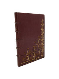
1890001538Paris: Didier Perrin 1890. 7 viii-ix 4 14-58pp 2. Slightly later full morocco by Charles Meunier. Raised bands spine in six panels author and title lettered directly to second panel upper cover with inlaid flowers in tan brown and green morocco and tooled in gilt gilt roll to edges and inner edges blue silk moire doublures and fly leaves and gold veined marbled fly leaves a.e.g. original wrappers bound in signed to foot of upper turn in 'Ch. Meunier 97'. Slightly rubbed to extremities especially to upper joint but generally quite bright and clean. Signed and inscribed by the author to the Comtesse de Lagnes to the half title. For Charles Meunier 1866-1948 bookbinder see Flety pages 128-129. Signed by Author. Second Edition. Hardback. Good. 16mo. Didier Perrin Hardcover
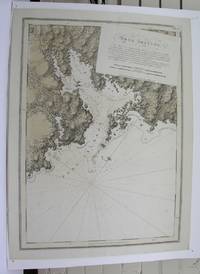
1779M8840London: Des Barres Joseph F.W. 1779. Very Good lower margin extended. Laid down on acid free paper for long term preservation. . Notes: This map of the Keppell Knowles Tangier Saunder's and Deane harbours found on Cape Breton Island in Nova Scotia appears in The Atlantic Neptune an important cartographic work published by De Barres. <br><br>Colonel Joseph Frederick Wallet DesBarres 1721 – 1824 was a hydrographer cartographer military engineer and landscape artist who served in the Seven Years War in part as the aide-de-camp to General James Wolfe. He also created the monumental four volume Atlantic Neptune which was the most important collection of maps charts and views of North America published in the eighteenth century. Finally he was the Governor of Cape Breton Island and Prince Edward Island. Size : 620x930 mm 24.41x36.61 Inches Coloring: Original faint Hand Coloring Category: Maps Canada East Nova Scotia; Des Barres, Joseph F.W. unknown
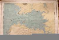
178134986London: J. F. W. Des Barres 1781. Engraved with aquatint on single double-page sheet watermarked "J. Bates." Excellent condition with minor repairs along centerfold. Detailed depiction of the mouth of the Miramachi River in New Brunswick and Miramachi Bay in the Gulf of St. Larwence.<br/> <br/> Des Barres of Swiss-Huguenot extraction studied under the great mathematician Daniel Bernoulli at the University of Basel before continuing on to the Royal Military College at Woolwich. Upon the outbreak of hostilities with France in 1756 he joined the British Royal American Regiment as a military engineer. He came to the attention of General James Wolfe who appointed him to join his personal detail. During this period he also worked with the future legendary explorer James Cook on a monumental chart of the St. Lawrence River. From 1762 Des Barres was enlisted to survey the coastlines of Nova Scotia Newfoundland and the Gulf of St. Lawrence while his colleague Samuel Holland charted the New England coast. He also managed to gain access to some surveys of the American South Cuba and Jamaica. In 1774 Des Barres returned to England where he began work on The Neptune. His dedication to the project was so strong that often at his own expense he continually updated and added new charts and views up until 1784. That year he returned to Canada where he remained for a further forty years becoming a senior political figure and a wealthy land owner and living to the advanced age of 103. The Atlantic Neptune the most celebrated sea atlas contained the first systematic survey of the east coast of North America. Des Barres's synergy of great empirical accuracy with the peerless artistic virtue of his aquatint views created a work that "has been described as the most splendid collection of charts plates and views ever published" National Maritime Museum Catalogue. Upon the conclusion of the Seven Years War Britain's empire in North America was greatly expanded and this required the creation of a master atlas featuring new and accurate sea charts for use by the Royal Navy. Des Barres was charged with this Herculean task publishing the first volume in London in 1775 which was soon followed by three further volumes. Des Barres's monumental endeavor eventually featured over two-hundred charts and views many being found in several states. Des Barres's charts were immensely detailed featuring both hydrographical and topographical information and in many cases remained the most authoritative maps of the regions covered for several decades. The survey of the St. Lawrence River and Gulf was conducted by Samuel Holland who provided many charts to the immense hydrographic enterprise realized in the Atlantic Neptune. This is the fourth state of the map with the imprint date changed to 1781.<br/> <br/> HNS 131D; Spendlove The Face of Early Canada Chapter 4: "J.F.W. Des Barres and The Atlantic Neptune"; pp. 18-22; Debard "The Family Origins of Joseph Fredericks Wallet Des Barres: A Riddle Finally Solved" Nova Scotia Historical Review Vol 14 No. 2 1994 p.15. J. F. W. Des Barres unknown
1779M10469London 1779. Very Good wide margins. Notes: With oval shaped Inset View showing Cape Spry N. NE… Beaver Isles… Westermost Ledge of Pegasus Wing East.<br><br>The Atlantic Neptune published for the Royal Navy of Great Britain in London 1774-1781. It included a comprehensive survey of the coasts of Nova Scotia the coasts and harbors of the Gulf and River of St. Lawrence and the Atlantic coast of North America including New York to Mexico and New England. Size : 723x1035 mm 28.46x40.75 Inches Coloring: Original Outline Coloring Category: Maps Canada East Nova Scotia; unknown
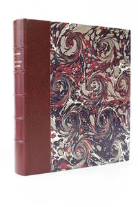
190353153Paris: Félix Juven 1903. Fine. Félix Juven Paris 1903 16 x 19 cm relié First edition one of 20 numbered copies on Japan paper the tirage de tête. Half maroon morocco over marbled paper boards by P. Goy & C. Vilaine spine in six compartments maroon paper pastedowns and endpapers covers preserved top edge gilt. A fine well-margined copy in a lovely binding. Félix Juven hardcover
28450Paris pour les Cent Bibliophiles 10 août 1922. 1 vol. 200 x 265 mm de 171 p. 1 et 2 f. Maroquin à mastic dos lisse muet large pièce mosaïqué en box crème titre doré souligné par un jeu de vagues du même box estampé à froid et rehaussé de filets de pointillés à la guache lila contreplats et gardes de velours beige couverture illustrée et dos conservés reliure signée de N. Kiyomiya 2004. . Édition ornée de 42 pointes-sèches en couleurs tirées sur Rives dont un frontispice et un hors-texte. Tirage à 130 exemplaires n° 107. Les 13 pages de la préface sont également illustrées d'une ornementation végétale encadrant le texte œuvre de Malo Renault. . Né à Saint-Malo le 5 octobre 1870 il se spécialise d'abord dans l'eau-forte puis le vernis mou avant d'aborder à la pointe-sèche à l'occasion de cette édition commandée par les Cent bibliophiles pour lesquels il grave sur bois l'estampe du menu en utilisant quatre planches pour les quatre couleurs. Le Jardin de Bérénice troisième volet de la trilogie romanesque que Barrès intitula Le Culte du moi est publié en 1896. Cette fable allégorique magnifie la contemplation et l'imagination qui fait comprendre les choses du coeur : il raconte l'histoire d'un jeune intellectuel Philippe qui vient d'adhérer au programme du général Boulanger - on est en 1889 - et qui part plein d'enthousiasme pour la Provence organiser une campagne électorale - il brigue la députation à Arles. Mais c'est à Aigues-Mortes qu'il retrouve Bérénice une ancienne connaissance qu'il ne cesse de contempler « si belle dans son jardin » : il découvre pour la première fois l'harmonie de la vie et pense trouver dans le cadre de ce jardin et grâce à l'amour de cette femme la signification secrète de l'univers. Cette romance - qui prendra une tournure tragique - est particulièrement mise en valeur grâce aux pointes-sèches en couleur de Malo-Renault pseudonyme d'Émile Auguste Renault. 1922 marque un tournant dans son oeuvre qui se tourne dès lors vers la représentation de la grâce féminine la mutinerie et la naïveté des enfants. Influencé par l'oeuvre d'Henri de Toulouse-Lautrec et l'art japonais la richesse de ses tons et ses compositions hautement décoratives sont celles d'un coloriste de premier ordre. Paris, pour les Cent Bibliophiles, (10 août) 1922. 1 vol. (200 x 265 mm) de 171 p., [1] et 2 f. Maroquin à mastic, dos lisse m unknown
178120210London: J. F. W. Des Barres for 'The Atlantic Neptune' 1781. Etched with aquatint and stippling. Some outline color. Platemark: 29 1/4 x 21 3/8 inches; sheet: 32 3/4 x 24 3/4 inches. Laid paper watermarked "J. Bates" with counter mark "J.B." A meticulous survey of a portion of the eastern coast of New Brunswick on the Northumberland Straits with soundings and topographical detailing.<br/> <br/> This chart which appeared in Volume II of The Atlantic Neptune was part of the surveying work conducted by Des Barres himself in the late 1760s and early 1770s. The first state was issued in 1776; this enhanced second state appeared in 1779. Des Barres of Swiss-Huguenot extraction studied under the great mathematician Daniel Bernoulli at the University of Basel before continuing on to the Royal Military College at Woolwich. Upon the outbreak of hostilities with France in 1756 he joined the British Royal American Regiment as a military engineer. He came to the attention of General James Wolfe who appointed him to join his personal detail. During this period he also worked with the future legendary explorer James Cook on a monumental chart of the St. Lawrence River. From 1762 Des Barres was enlisted to survey the coastlines of Nova Scotia Newfoundland and the Gulf of St. Lawrence while his colleague Samuel Holland charted the New England coast. He also managed to gain access to some surveys of the American South Cuba and Jamaica. In 1774 Des Barres returned to England where he began work on The Neptune. His dedication to the project was so strong that often at his own expense he continually updated and added new charts and views up until 1784. That year he returned to Canada where he remained for a further forty years becoming a senior political figure and a wealthy land owner and living to the advanced age of 103. The Atlantic Neptune the most celebrated sea atlas contained the first systematic survey of the east coast of North America. Des Barres's synergy of great empirical accuracy with the peerless artistic virtue of his aquatint views created a work that "has been described as the most splendid collection of charts plates and views ever published" National Maritime Museum Catalogue. Upon the conclusion of the Seven Years War Britain's empire in North America was greatly expanded and this required the creation of a master atlas featuring new and accurate sea charts for use by the Royal Navy. Des Barres was charged with this Herculean task publishing the first volume in London in 1775 which was soon followed by three further volumes. Des Barres's monumental endeavor eventually featured over two-hundred charts and views many being found in several states. Des Barres's charts were immensely detailed featuring both hydrographical and topographical information and in many cases remained the most authoritative maps of the regions covered for several decades.<br/> <br/> Stevens 72h. J. F. W. Des Barres for 'The Atlantic Neptune' unknown
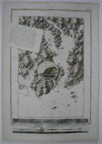
1775M5011London: The Atlantic Neptune 1775. Very Good laid on acid free canvas for long term preservation. A crease from the left extending in to the circle vignette in the map. Notes: Splendid chart of Egmont Harbor Nova Scotia - 30 miles east of Halifax. The beautifully engraved chart shows topography soundings anchorages and navigational notes. A circular vignette is superimposed on the chart with a view of what appears to be the only settlement there. At bottom is another engraved view of the coastline as seen from the sea. The title which includes detailed sailing instructions appears as a scrap of paper laid across the chart.<br>Aquatint and line engraving. This fine chart is from "The Atlantic Neptune" by Capt. Joseph Fredrick Wallet Des Barres 1721-1824. "The Atlantic Neptune" is one of the most important sea atlases of the USA and Canadian Atlantic coast that was ever been produced. The atlas was first published in England in 1774 and was updated regularly till 1784. The maps are known for the accurate portrayal of various sounds bays bars and harbours in addition to navigational challenges. The maps are very detailed and contain both hydrographical and topographical information. Des Barres a Swiss cartographer and landscape artist who immigrated to England and trained at the royal military academy became a colonial administrator in Halifax Nova Scotia where he died. He was a lieutenant in the royal American regiment c 1756; engineer under general wolf at Quebec c.1759; and governor of Prince Edward Island. He mapped the shore line of Nova Scotia Newfoundland and St. Lawrence River regions c.1764/1774 . This atlas was used by the Royal Navy during the American Revolution. <br>Reference Debard J. M. the family origins of J.f.W.Des Barres; Evens uncommon Obdurate: the several public careers of J.F.W. Des Barres Toronto 1989; De Vorsey map collector 1982 p.31 Size : 795x550 mm 31.25x21.625 Inches Coloring: Hand Colored Category: Maps Canada East Nova Scotia The Atlantic Neptune unknown
17795597London: Published by J.F.W. Des Barres in 'The Atlantic Neptune' 1779. Sea chart etched with roulette-work with original colour with aquatint view. Printed on laid paper with 'J Bates' watermark and 'JB' countermark. A very fine sea chart and view of Egmont now called Jeddore Harbour from 'The Atlantic Neptune' the first British sea atlas of her North American colonies<br/> <br/> This is a finely presented and highly detailed chart of what is now known as Jeddore Harbour near Halifax. The bay seven miles long and three miles wide is captured in a cartographic composition of great topographical and hydrographical detail and is further embellished by a roundel containing a mariner's view of the area. This chart is the fifth and final state produced and is identical to the Henry Stevens Collection variant 49G in the National Maritime Museum Greenwich. Des Barres studied under the great mathematician Daniel Bernoulli at the University of Basel before continuing on to the Royal Military College at Woolwich. On the outbreak of the Seven Years war in 1756 he joined the British Royal American Regiment as a military engineer. He came to the attention of General James Wolfe who appointed him to be his aide-de-camp. From 1762 Des Barres was enlisted to survey the coastlines of Nova Scotia Newfoundland and the Gulf of St.Lawrence while his colleague Samuel Holland charted the New England coast. In 1774 Des Barres returned to England where he began work on the Neptune. His dedication to the project was so strong that often at his own expense he continually updated and added new charts and views up until 1784. That year he returned to Canada where he remained for a further forty years becoming a senior political figure and a wealthy land owner and living to the advanced age of 103. The Atlantic Neptune was the first British sea atlas of her North American colonies and one of the most important achievements of eighteenth century cartography. With an official commission from the Royal Navy Des Barres published the first volume in London in 1775 which was soon followed by further volumes. Des Barres' monumental endeavor eventually featured over two-hundred charts and aquatint views many being found in several states. All of the charts were immensely detailed featuring both hydrographical and topographical information. Des Barres' plates were used to print further editions up into the first decade of the nineteenth-century. The Neptune met with the highest acclaim from the beginning and is today widely regarded as superior to all other atlases produced during its time.<br/> <br/> National Maritime Museum: Henry Stevens Collection: K0124 HNS 49G & Catalogue no.38 p.382; Cf. Spendlove The Face of Early Canada Chapter 4: "J.F.W. Des Barres and The Atlantic Neptune"; pp. 18-22; Debard "The Family Origins of Joseph Frederick Wallet Des Barres: A Riddle Finally Solved" Nova Scotia Historical Review Vol 14 No. 2 1994 p.15. Published by J.F.W. Des Barres in 'The Atlantic Neptune' unknown
177928787London: British Admiralty for 'The Atlantic Neptune' 1779. Etching with roulette work original outline color on laid paper watermarked "JBates" and countermarked "JB" This excellent example of Des Barres' craftsmanship details a portion of the strait between New Brunswick and what is now Prince Edward Island then St. John's Island. It includes on the New Brunswick side: Shediac Cocagne and Boutouche. The chart includes soundings throughout the Straits and Baie Verte. This is one of the many regions Des Barres himself surveyed during the 1760s. Des Barres of Swiss-Huguenot extraction studied under the great mathematician Daniel Bernoulli at the University of Basel before continuing on to the Royal Military College at Woolwich. Upon the outbreak of hostilities with France in 1756 he joined the British Royal American Regiment as a military engineer. He came to the attention of General James Wolfe who appointed him to join his personal detail. During this period he also worked with the future legendary explorer James Cook on a monumental chart of the St. Lawrence River. From 1762 Des Barres was enlisted to survey the coastlines of Nova Scotia Newfoundland and the Gulf of St. Lawrence while his colleague Samuel Holland charted the New England coast. He also managed to gain access to some surveys of the American South Cuba and Jamaica. In 1774 Des Barres returned to England where he began work on The Neptune. His dedication to the project was so strong that often at his own expense he continually updated and added new charts and views up until 1784. That year he returned to Canada where he remained for a further forty years becoming a senior political figure and a wealthy land owner and living to the advanced age of 103. The Atlantic Neptune the most celebrated sea atlas contained the first systematic survey of the east coast of North America. Des Barres's synergy of great empirical accuracy with the peerless artistic virtue of his aquatint views created a work that "has been described as the most splendid collection of charts plates and views ever published" National Maritime Museum Catalogue. Upon the conclusion of the Seven Years War Britain's empire in North America was greatly expanded and this required the creation of a master atlas featuring new and accurate sea charts for use by the Royal Navy. Des Barres was charged with this Herculean task publishing the first volume in London in 1775 which was soon followed by three further volumes. Des Barres's monumental endeavor eventually featured over two-hundred charts and views many being found in several states. Des Barres's charts were immensely detailed featuring both hydrographical and topographical information and in many cases remained the most authoritative maps of the regions covered for several decades.<br/> <br/> Streeter copy: Vol. II # 58; Stevens 68e. British Admiralty for 'The Atlantic Neptune'] unknown
M3913London 1775. Very good. Notes: Aquatint and line engraving. This fine chart is from "The Atlantic Neptune" by Capt. Joseph Fredrick Wallet Des Barres 1721-1824. "The Atlantic Neptune" is one of the most important sea atlases of the USA and Canadian Atlantic coast that was ever been produced. The atlas was first published in England in 1774 and was updated regularly till 1784. The maps are known for the accurate portrayal of various sounds bays bars and harbours in addition to navigational challenges. The maps are very detailed and contain both hydrographical and topographical information. Des Barres a Swiss cartographer and landscape artist who immigrated to England and trained at the royal military academy became a colonial administrator in Halifax Nova Scotia where he died. He was a lieutenant in rhw royal American regiment c 1756; engineer under general wolf at Quebec c.1759; and governor of Prince Edward Island. He mapped the shore line of Nova Scotia Newfoundland and St. Lawrence River regions c.1764/1774 . This atlas was used by the Royal Navy during the American Revolution. <br>Reference Debard J. M. the family origins of J.f.W.Des Barres; Evens uncommon Obdurate: the several public careers of J.F.W. Des Barres Toronto 1989; De Vorsey map collector 1982 p.31 Size : 540x748 mm 21.25x29.375 Inches Coloring: Original Hand Coloring Category: Maps Canada East Nova Scotia unknown
1776M4657London 1776. Very Good. Notes: A scarce and sought after map of Charlotte Bay in Greater Halifax. This area in present day contains numerous luxary cottages. Size : 680x975 mm 26.75x38.375 Inches Coloring: Hand Colored Category: Maps Canada East Nova Scotia; unknown
1775P739London 1775. Excellent. Notes: Aquatint and line engraving. This fine view is from "The Atlantic Neptune" by Capt. Joseph Fredrick Wallet Des Barres 1721-1824. "The Atlantic Neptune" is one of the most important sea atlases of USA and Canadian Atlantic coast that was ever produced. The atlas was first published in England in 1774 and was updated regularly till 1784. The maps are known for the accurate portrayal of various sounds bays bars and harbours in addition to navigational challenges. The maps are very detailed and contain both hydrographical and topographical information. Des Barres a Swiss cartographer and landscape artist who immigrated to England and trained at the royal military academy became a colonial administrator in Halifax Nova Scotia where he died. He was lieutenant royal American regiment c 1756; engineer under general wolf at Quebec c.1759; and governor of Prince Edward Island. He mapped the shore line of Nova Scotia New Found land and St. Lawrence River regions c.1764/1774 . This atlas was used by the Royal Navy during the American Revolution. <br>Reference Debard J. M. the family origins of J.f.W.Des Barres; Evens uncommon Obdurate: the several public careers of J.F.W. Des Barres Toronto 1989; De Vorsey map collector 1982 p.31 Image Size : 184x793 mm 7.25x31.25 Inches Platemark Size : Paper Size : 278x823 mm 11x32.375 Inches Coloring: Hand Colored Medium: Aquatint and line engraving Categories: Views Canada Nova Scotia unknown
17815598London: Published by J.F.W. Des Barres in 'The Atlantic Neptune' 1781. Etching with added hand-colour. On laid paper with 'J Bates' watermark and 'JB' countermark. A fine print from "The Atlantic Neptune" which charts the Annapolis Royal with a coastal view of Gulliver's Hole and a descriptive text.<br/> <br/> 'The Atlantic Neptune' was the first great marine atlas and one of the greatest achievements of eighteenth century cartography. Published in England in 1774 it contained over 250 charts and views of the North American and Canadian coasts. The charts were intensely detailed and contained both hydrographical and topographical details. The Neptune was compiled and published for the Royal Navy by Joseph F. W. Des Barres a Swiss cartographer who joined the Royal American Regiment as a surveyor. Des Barres fought in the French and Indian wars and was enlisted to survey the Canadian coastline. While his fellow surveyor Samuel Holland charted the New England coast Des Barres mapped the shoreline of Nova Scotia Newfoundland and the St. Lawrence River regions. In 1774 Des Barres returned to England where he compiled and published his monumental atlas; his dedication to the project was so strong that he published an updated version of the work every year until 1784. Des Barres' work was so superior to any other contemporary atlas that the maps were used as the standard charts of the East coast for over 50 years. The Neptune remains one of the most important atlases ever printed its views and maps chart the history of North America and allow us to glimpse a forgotten land long changed by the passage of time. This chart is an excellent eighteenth century record of the first settlement in Canada. In 1605 two years before the first permanent English settlement at Jamestown three years before the founding of Quebec and fifteen years before the Pilgrims landed at Plymouth a small party of French explorers led by Sieur de Monts established Port Royal as the first settlement in Canada. The settlement was later renamed Annapolis Royal which is the name asigned to it in Des Barres chart.<br/> <br/> Spendlove The Face of Early Canada Chapter 4: "J.F.W. Des Barres and The Atlantic Neptune"; pp. 18-22; Debard "The Family Origins of Joseph Fredericks Wallet DesBarres: A Riddle Finally Solved" Nova Scotia Historical Review Vol 14 No. 2 1994 p.15. Published by J.F.W. Des Barres in 'The Atlantic Neptune' unknown
3547London ca. 1780. Engraving on two joined sheets 30.25†x 43.25†sheet size hand-colored border. CONDITION: Good trimmed close at top and bottom with loss of a portion of neat line at top and all of neat line at bottom lower portions of longitudinal figures at bottom nicked original fold marks. <p>A fine chart depicting a portion of the Penobscot Bay region of Maine from the most celebrated maritime atlas of the eighteenth century.</p> <p>Published in London around 1780 in The Atlantic Neptune J. F. W. Des Barres’s landmark four-volume maritime atlas of North America this chart depicts the islands of Vinalhaven called Southern Fox Island until 1789 part of North Haven Isle au Haut Matinicus Isle spelled Metimicus and the area around Owl’s Head. It demonstrates a precise knowledge of the location of numerous smaller islands ledges and rocks the hazardous nature of the latter two being of particular significance to those navigating the waters of the region. Two rhumb line networks cover Penobscot Bay with a north arrow and a smaller one indicating magnetic north shown on the western side. Depth soundings appear around the most important islands and harbors. From a semantic viewpoint the highlight of this chart has to be “Ragged Arse Island.â€</p> <p>The lack of good charts during the Seven Years War generated complaints among British military engineers and naval officers leading to several large-scale surveying projects of the North American coast including newly-gained territory in Canada. Des Barres’ surveys represented just a portion of the massive charting initiative though he is given credit for assembling these various charts into atlas form. </p> <p>The Atlantic Neptune is considered the most comprehensive and important maritime atlas of the 18th century. It was published several times after 1774 and includes engraved plates from many distinct British surveying efforts most dating to the late 1770s and early 1780s. Des Barres was paid by the Admiralty for his work but allowed to keep the rights to plates. Due to the ongoing nature of the surveying effort Des Barres was constantly reconfiguring his atlas as new surveys emerged. Consequently there is considerable variation among the various copies of The Atlantic Neptune in terms of binding organization and contents.</p> <p>J. F. W. Des Barres 1721-1824 was a Swiss-born military engineer and cartographer. Trained in mathematics under Daniel and Jean Bernoulli he moved to England to study at the Royal Military College at Woolwich. In 1756 he received a lieutenant’s commission in the Royal American Regiment and recruited soldiers in the American colonies to join the fight against the French in the Seven Years War. He joined General James Wolfe’s Quebec campaign and worked on various engineering and surveying projects in Canada. In 1763 Des Barres accepted a commission to survey the coasts and harbors of North America. He first worked alongside the Surveyor General of North America Samuel Holland later undertaking his own surveys while Holland continued in parallel. Though there was substantial overlap Des Barres’ work in contrast to Holland’s land surveys focused on producing charts for maritime use. These regional charts were considered to be the most accurate for decades. Des Barres’s atlas owed much to Holland’s maps—which he obtained from the Board of Trade and Plantations—and the work of other contemporaries.</p> <p>REFERENCES: Brown Lloyd A. “The Atlantic Neptune.†The Pennsylvania Magazine of History and Biography Vol. 67 No. 4 1943 pp. 377–81.</p> [London, ca. 1780] unknown
1776227653London 1776. First. unbound. very good. Sea chart. Engraving. Image measures 27.25" x 40.25".<br/> <br/> Beautiful rare nautical chart of Port Campbell SE Nova Scotia. This is the first state and shows settlements and shoals in outline only. Includes the yet named Shelburne Harbour and Roseneath Island now McNutt Island. Includes description of the shoreline and tides. Map is dated 1776 just before the Loyalists came and settled the area. Published in "The Atlantic Neptune" the first British sea atlas of the eastern coast of North America hailed for both its accuracy and its aesthetics. Small chips and tears to margin not affecting the image slight wear to original folds overall toning. J.F.W. Des Barres c. 1729-1827 was born in Basle Switzerland but went to military school in England. He became a colonial administrator in Nova Scotia and also served as governor of Quebec. Des Barres was commissioned for the surveying project in 1762 and dedicated ten years to the gathering of the charts and publication of the atlas.<br/> <br/> unknown
178119326London 1781. Engraved chart the town and border hand-coloured as issued. Minor repaired edge tears. Sheet Size: 22 5/8 x 32 1/2 inches. An important 18th century chart of Louisbourg harbour.<br/> <br/> Des Barres of Swiss-Huguenot extraction studied under the great mathematician Daniel Bernoulli at the University of Basel before continuing on to the Royal Military College at Woolwich. Upon the outbreak of hostilities with France in 1756 he joined the British Royal American Regiment as a military engineer. He came to the attention of General James Wolfe who appointed him to join his personal detail. During this period he also worked with the future legendary explorer James Cook on a monumental chart of the St. Lawrence River. From 1762 Des Barres was enlisted to survey the coastlines of Nova Scotia Newfoundland and the Gulf of St. Lawrence while his colleague Samuel Holland charted the New England coast. He also managed to gain access to some surveys of the American South Cuba and Jamaica. In 1774 Des Barres returned to England where he began work on The Neptune. His dedication to the project was so strong that often at his own expense he continually updated and added new charts and views up until 1784. That year he returned to Canada where he remained for a further forty years becoming a senior political figure and a wealthy land owner and living to the advanced age of 103. The Atlantic Neptune the most celebrated sea atlas contained the first systematic survey of the east coast of North America. Des Barres's synergy of great empirical accuracy with the peerless artistic virtue of his aquatint views created a work that "has been described as the most splendid collection of charts plates and views ever published" National Maritime Museum Catalogue. Upon the conclusion of the Seven Years War Britain's empire in North America was greatly expanded and this required the creation of a master atlas featuring new and accurate sea charts for use by the Royal Navy. Des Barres was charged with this Herculean task publishing the first volume in London in 1775 which was soon followed by three further volumes. Des Barres's monumental endeavor eventually featured over two-hundred charts and views many being found in several states. Des Barres's charts were immensely detailed featuring both hydrographical and topographical information and in many cases remained the most authoritative maps of the regions covered for several decades.<br/> <br/> Stevens 140. unknown
177734270London: Published by J.F.W. Des Barres in 'The Atlantic Neptune' 1777. Hand-colored etching on Bates paper. No imprint. Sheet size: 32 1/4 x 23 3/4 inches with center fold as with all early issues. Expert restoration to center fold and marginal tears. A set of six navigational views of Halifax Harbour and nearby coastal area from one of the most important North American marine atlases.<br/> <br/> This group includes four profile views intended as aids to navigation. The profiles were intended for use by captains of vessels to identify exactly where they were in relation to distant shorelines; added to these is a charming roundel giving a picturesque view of a waterfall on the Hinchinbroke River and finally a tranquil view in Halifax harbour which is enlivened by the small scene in the lower right of the image where amid clouds of steam men work frantically to re-tar the hull of a man-of-war. This finely coloured example of the print corresponds to Stevens 51 first state without stamped plate number. 'The Atlantic Neptune' was the first great marine atlas and one of the greatest achievements of eighteenth century cartography. Published in England in 1774 it contained over 250 charts and views of the North American and Canadian coasts. The charts were intensely detailed and contained both hydrographical and topographical details. The Neptune was compiled and published for the Royal Navy by Joseph F. W. Des Barres a Swiss cartographer who joined the Royal American Regiment as a surveyor. Des Barres fought in the French and Indian wars and was enlisted to survey the Canadian coastline. While his fellow surveyor Samuel Holland charted the New England coast Des Barres mapped the shoreline of Nova Scotia Newfoundland and the St. Lawrence River regions. In 1774 Des Barres returned to England where he compiled and published his monumental atlas; his dedication to the project was so strong that he published an updated version of the work every year until 1784. Des Barres' work was so superior to any other contemporary atlas that the maps were used as the standard charts of the East coast for over 50 years. The Neptune remains one of the most important atlases ever printed its views and maps chart the history of North America and allow us to glimpse forgotten shores long changed with the passage of time.<br/> <br/> Spendlove The Face of Early Canada Chapter 4: "J.F.W. Des Barres and The Atlantic Neptune"; pp. 18-22; Debard "The Family Origins of Joseph Fredericks Wallet DesBarres: A Riddle Finally Solved" Nova Scotia Historical Review Vol 14 No. 2 1994 p.15; Stevens 51A. Published by J.F.W. Des Barres in 'The Atlantic Neptune' unknown
177913202London: Published by J.F.W. Des Barres in 'The Atlantic Neptune' 1779. Etching with aquatint printed in sepia coloured by hand. Printed on laid paper with `J Bates' watermark and `JB' countermark. Small tears to fold repaired tear to plate mark. A large-scale view of the entrance to the harbour at Louisbourg from one of the most important North American marine atlases.<br/> <br/> This very fine view is taken from the sea with the harbour mouth in the foreground and in the background the spires and roofs of the town and fort of Louisbourg the port of entry to Cape Breton county Nova Scotia. As usual Des Barres has added rowing boats and ships to give the viewer the correct sense of scale. Des Barres of Swiss-Huguenot extraction studied under the great mathematician Daniel Bernoulli at the University of Basel before continuing on to the Royal Military College at Woolwich. Upon the outbreak of hostilities with France in 1756 he joined the British Royal American Regiment as a military engineer. He came to the attention of General James Wolfe who appointed him to join his personal detail. During this period he also worked with the future legendary explorer James Cook on a monumental chart of the St. Lawrence River. From 1762 Des Barres was enlisted to survey the coastlines of Nova Scotia Newfoundland and the Gulf of St. Lawrence while his colleague Samuel Holland charted the New England coast. He also managed to gain access to some surveys of the American South Cuba and Jamaica. In 1774 Des Barres returned to England where he began work on The Neptune. His dedication to the project was so strong that often at his own expense he continually updated and added new charts and views up until 1784. That year he returned to Canada where he remained for a further forty years becoming a senior political figure and a wealthy land owner and living to the advanced age of 103. The Atlantic Neptune the most celebrated sea atlas contained the first systematic survey of the east coast of North America. Des Barres's synergy of great empirical accuracy with the peerless artistic virtue of his aquatint views created a work that "has been described as the most splendid collection of charts plates and views ever published" National Maritime Museum Catalogue. Upon the conclusion of the Seven Years War Britain's empire in North America was greatly expanded and this required the creation of a master atlas featuring new and accurate sea charts for use by the Royal Navy. Des Barres was charged with this Herculean task publishing the first volume in London in 1775 which was soon followed by three further volumes. Des Barres's monumental endeavor eventually featured over two-hundred charts and views many being found in several states. Des Barres's charts were immensely detailed featuring both hydrographical and topographical information and in many cases remained the most authoritative maps of the regions covered for several decades.<br/> <br/> Spendlove The Face of Early Canada Chapter 4: "J.F.W. Des Barres and The Atlantic Neptune"; pp. 18-22; National Maritime Museum Greenwich Henry Newton Stevens Collection: 65C; Debard "The Family Origins of Joseph Fredericks Wallet DesBarres: A Riddle Finally Solved" Nova Scotia Historical Review Vol 14 No. 2 1994 p.15. Published by J.F.W. Des Barres in 'The Atlantic Neptune' unknown
17793603London: Published by J.F.W. Des Barres in 'The Atlantic Neptune' 1779. Etching with aquatint printed in sepia. Printed on laid paper with `J Bates' watermark and `JB' countermark. A large-scale view of the entrance to the harbour at Louisbourg from 'The Atlantic Neptune' the first British sea atlas of her North American colonies<br/> <br/> A fine view of the harbour of Louisbourg the former "impregnable" fortress that was the gateway to French America and the scene of two great battles between France and Britain in 1748 and 1758. The scene depicted here features ships sailing into the excellent natural harbour surrounded by a ruggedly beautiful landscape. This is the third state of this view and is identical to the Henry Stevens Collection variant 65C in the National Maritime Museum Greenwich. Des Barres studied under the great mathematician Daniel Bernoulli at the University of Basel before continuing on to the Royal Military College at Woolwich. On the outbreak of the Seven Years war in 1756 he joined the British Royal American Regiment as a military engineer. He came the attention of General James Wolfe who appointed him to be his aide-de-camp. From 1762 Des Barres was enlisted to survey the coastlines of Nova Scotia Newfoundland and the Gulf of St.Lawrence while his colleague Samuel Holland charted the New England coast. In 1774 Des Barres returned to England where he began work on the Neptune. His dedication to the project was so strong that often at his own expense he continually updated and added new charts and views up until 1784. That year he returned to Canada where he remained for a further forty years becoming a senior political figure and a wealthy land owner and living to the advanced age of 103. The Atlantic Neptune was the first British sea atlas of her North American colonies and one of the most important achievements of eighteenth century cartography. With an official commission from the Royal Navy Des Barres published the first volume in London in 1775 which was soon followed by further volumes. Des Barres' monumental endeavor eventually featured over two-hundred charts and aquatint views many being found in several states. All of the charts were immensely detailed featuring both hydrographical and topographical information. Des Barres' plates were used to print further editions up into the first decade of the nineteenth-century. The Neptune met with the highest acclaim from the beginning and is today widely regarded as superior to all other atlases produced during its time.<br/> <br/> Spendlove The Face of Early Canada Chapter 4: "J.F.W. Des Barres and The Atlantic Neptune"; pp. 18-22; Debard "The Family Origins of Joseph Fredericks Wallet Des Barres: A Riddle Finally Solved" Nova Scotia Historical Review Vol 14 No. 2 1994 p.15; National Maritime Museum: Henry Stevens Collection: K0206 HNS 65C. Published by J.F.W. Des Barres in 'The Atlantic Neptune' unknown
178134403London: J.F.W. Des Barres 1781. Hand-colored line engraving and aquatint. Two plates printed on two sheets joined with 8 views arranged in 5 rows. Sheet size: 32 x 43 3/4 inches. 8 navigational profile views from the greatest of all 18th century sea atlases.<br/> <br/> These eight views of sites in and around Nova Scotia were designed to give navigators additional information to the soundings on the charts of these same places. Several of the placenames have changed but Beaver Island Port Bickerton Chedabucto Bay and Canso remain. This is the 5th of 5 states with many ships and aquatinted features to the landscapes added to the original plates. Des Barres of Swiss-Huguenot extraction studied under the great mathematician Daniel Bernoulli at the University of Basel before continuing on to the Royal Military College at Woolwich. Upon the outbreak of hostilities with France in 1756 he joined the British Royal American Regiment as a military engineer. He came to the attention of General James Wolfe who appointed him to join his personal detail. During this period he also worked with the future legendary explorer James Cook on a monumental chart of the St. Lawrence River. From 1762 Des Barres was enlisted to survey the coastlines of Nova Scotia Newfoundland and the Gulf of St. Lawrence while his colleague Samuel Holland charted the New England coast. He also managed to gain access to some surveys of the American South Cuba and Jamaica. In 1774 Des Barres returned to England where he began work on The Neptune. His dedication to the project was so strong that often at his own expense he continually updated and added new charts and views up until 1784. That year he returned to Canada where he remained for a further forty years becoming a senior political figure and a wealthy land owner and living to the advanced age of 103.<br/> <br/> The American Revolution in drawings and prints; a checklist of 1765-1790 graphics in the Library of Congress / Compiled by Donald H. Cresswell with a foreword by Sinclair H. Hitchings. Washington : 1975 no. 397-404; #61e Henry Stevens Collection. J.F.W. Des Barres unknown
177634405London: J. F. W. Des Barres 1776. Engraved with color wash and outline color. Sheet: 31 x 42 1/4 inches. Expert restoration primarily at the upper margin. Two sheets joined both watermarked "J.Bates" and countermarked "JB". Fourth state of five. Among the earliest charts published by Des Barres were those relevant to the crisis in New England as the War of Independence broke out.<br/> <br/> This chart depicts the coast of Massachusetts from Salem to Scituate Harbor and includes the complicated hydrography of Boston Harbor and the confluent rivers. A considerable amount of coastal topography is included obviously relevant to warships. Fundamentally a chart for navigators it includes soundings and shoals with particularly strong detail along the Charles and Mystic Rivers as well as in Salem and Marblehead. Samuel Holland was the lead surveyor. In 1764 he was named Surveyor General of both the Province of Quebec and the Northern District of North America. He had a considerable staff and the British Navy assisted in providing soundings. From 1770 to 1774 his squad worked exclusively on northeastern colonies that soon became part of the United States. The surveys that derived from the industry of their work were the most accurate ever made to that time. They were sent to London where Des Barres supervised the engraving and publication. The charts were very soon put to use. Des Barres of Swiss-Huguenot extraction studied under the great mathematician Daniel Bernoulli at the University of Basel before continuing on to the Royal Military College at Woolwich. Upon the outbreak of hostilities with France in 1756 he joined the British Royal American Regiment as a military engineer. He came to the attention of General James Wolfe who appointed him to join his personal detail. During this period he also worked with the future legendary explorer James Cook on a monumental chart of the St. Lawrence River. From 1762 Des Barres was enlisted to survey the coastlines of Nova Scotia Newfoundland and the Gulf of St. Lawrence while his colleague Samuel Holland charted the New England coast. He also managed to gain access to some surveys of the American South Cuba and Jamaica. In 1774 Des Barres returned to England where he began work on The Neptune. His dedication to the project was so strong that often at his own expense he continually updated and added new charts and views up until 1784. That year he returned to Canada where he remained for a further forty years becoming a senior political figure and a wealthy land owner and living to the advanced age of 103.<br/> <br/> Stevens Collection 94d ; cf. Hornsby Surveyors of Empire: Samuel Holland J.F.W. Des Barres and the Making of the Atlantic Neptune. 2011. J. F. W. Des Barres unknown
17763748<b>Striking Casco Bay Chart from the Atlantic Neptune 1776</b><br /><br />This is an exceptional chart of the coast of Maine between Cape Elizabeth and Popham from the early Revolutionary War period. It is from Des Barres' monumental <i>Atlantic Neptune</i> a sea atlas published by the British Admiralty during the last quarter of the 18th century. The <i>Atlantic Neptune</i> has been called "the most splendid collection of charts plans and views ever published." <br /><br />The present chart includes all of Casco Bay naming the larger islands and extends east to include Seguin "Segevin Island" and Georgetown Islands. Among the numerous geographic features named are Great Jebieg Chebeague Merrymeeting Bay Segadahock River Arrowsick Island and Halfway Road i.e. Rock. Roads are shown on the chart as are individual buildings. <br /><br />The chart is dated July___ 1776 i.e. with a prominent space after the month as if a date were going to be inserted. There is no type-stamped "15" at the upper right as called for in some copies of state "b" of the Stevens Catalogue. <br /><br />The chart was folded into four vertical panels about 30 1/4 x 12" to accommodate being "bound up in tall narrow form" Stevens' Catalogue p. vii. The chart paper has the LVG watermark consistent with the earlier issues of the chart. <br />A scarce early state of a desirable chart. <br /><br /><b>References:</b> Stevens <i>Catalogue of the Atlantic Neptune</i>: 105 State: b. Sellers & Van Ee <i>Maps and Charts of North America and the West Indies</i> 1750-1789: 855. <br /><br /><b>Condition: </b>A wonderfully clean example of a striking chart of Casco Bay.<br /><br />ICN 3763. From The Atlantic Neptune.
177634921London: J. F. W. Des Barres 1776. Engraved view printed on laid paper engraved by James Newton after Pierie. Sheet size: 22 1/2 x 31 1/2 inches. First state. Rare view of Boston from the road to Dorchester published shortly after George Washington's first victory of the American Revolution.<br/> <br/> Following the Battles of Lexington and Concord American troops laid siege to Boston. Strategically Dorchester Heights offered commanding views of both Boston town and harbour. On March 4 1776 under the cover of darkness and with batteries firing from Roxbury and Cambridge to provide a diversion George Washington moved canon captured at Ticonderoga onto the Heights and fortified the position. Faced with little choice given the overwhelming strategic advantage General Howe retreated from Boston on March 17 giving George Washington and the Americans a decisive early victory in the war. The present view accomplished by British artillery officer William Pierie in 1773 depicts Boston Boston Harbor and Roxbury as it would have been seen by Washington and the American army. The Shirley-Eustis house the home of Governor William Shirley and later Governor William Eustis in Roxbury is visible in the middle ground and in the far distance the beacon is visible atop Beacon Hill. A rare view published in 1776 in the New England section of Des Barres monumental Atlantic Neptune. Joseph Frederick Wallet Des Barres was born in Switzerland where his Huguenot ancestors had fled following the repeal of the Edict of Nantes. He studied under the great mathematician Daniel Bernoulli at the University of Basel before immigrating to Britain where he trained at the Royal Military College Woolwich. Upon the outbreak of hostilities with France in 1756 he joined the British Royal American Regiment as a military engineer. He came to the attention of General James Wolfe who appointed him to join his personal detail. Des Barres returned to London in 1774 where the Royal Navy charged him with the Herculean task of producing an atlas of sea charts of the American coast. The result was The Atlantic Neptune which became the most celebrated sea atlas of its era containing the first systematic survey of the east coast of North America. Des Barres's synergy of great empirical accuracy with the peerless artistic virtue of his aquatint views created a work that "has been described as the most splendid collection of charts plates and views ever published" National Maritime Museum Catalogue. The Neptune eventually consisted of four volumes and Des Barres's dedication to the project was so strong that often at his own expense he continually updated and added new charts and views to various editions up until 1784 producing over 250 charts and views many appearing in several variations. Following the completion of The Neptune Des Barres returned to Canada where he remained for a further forty years becoming a senior political figure and a wealthy land owner living to the advanced age of 103.<br/> <br/> Henry Stevens Collection HNS97; Deak 132. J. F. W. Des Barres unknown