507 résultats
19292309290020Librairie Plon Paris 1929-1957 1929. Paperback. Very Good. 13 volumes. Softcover. Good binding and cover. Clean unmarked pages. Contents:v. 1. 1896-1898; v. 2. 1898-1902; v. 3. 1902-1904; v. 4. 1904-1906; v. 5. 1906-1907; v. 6. 1907-1908; v. 7. 1908-1909; v. 8. 1909-1911; v. 9. 1911-1912; v. 10. 1913-1914; v. 11. 1914-1918; v. 12. 1919-1920; v. 13. 1920-1922 Librairie Plon, Paris, [1929-1957] paperback
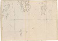
178134986London: J. F. W. Des Barres 1781. Engraved with aquatint on single double-page sheet watermarked "J. Bates." Excellent condition with minor repairs along centerfold. Detailed depiction of the mouth of the Miramachi River in New Brunswick and Miramachi Bay in the Gulf of St. Larwence.<br/> <br/> Des Barres of Swiss-Huguenot extraction studied under the great mathematician Daniel Bernoulli at the University of Basel before continuing on to the Royal Military College at Woolwich. Upon the outbreak of hostilities with France in 1756 he joined the British Royal American Regiment as a military engineer. He came to the attention of General James Wolfe who appointed him to join his personal detail. During this period he also worked with the future legendary explorer James Cook on a monumental chart of the St. Lawrence River. From 1762 Des Barres was enlisted to survey the coastlines of Nova Scotia Newfoundland and the Gulf of St. Lawrence while his colleague Samuel Holland charted the New England coast. He also managed to gain access to some surveys of the American South Cuba and Jamaica. In 1774 Des Barres returned to England where he began work on The Neptune. His dedication to the project was so strong that often at his own expense he continually updated and added new charts and views up until 1784. That year he returned to Canada where he remained for a further forty years becoming a senior political figure and a wealthy land owner and living to the advanced age of 103. The Atlantic Neptune the most celebrated sea atlas contained the first systematic survey of the east coast of North America. Des Barres's synergy of great empirical accuracy with the peerless artistic virtue of his aquatint views created a work that "has been described as the most splendid collection of charts plates and views ever published" National Maritime Museum Catalogue. Upon the conclusion of the Seven Years War Britain's empire in North America was greatly expanded and this required the creation of a master atlas featuring new and accurate sea charts for use by the Royal Navy. Des Barres was charged with this Herculean task publishing the first volume in London in 1775 which was soon followed by three further volumes. Des Barres's monumental endeavor eventually featured over two-hundred charts and views many being found in several states. Des Barres's charts were immensely detailed featuring both hydrographical and topographical information and in many cases remained the most authoritative maps of the regions covered for several decades. The survey of the St. Lawrence River and Gulf was conducted by Samuel Holland who provided many charts to the immense hydrographic enterprise realized in the Atlantic Neptune. This is the fourth state of the map with the imprint date changed to 1781.<br/> <br/> HNS 131D; Spendlove The Face of Early Canada Chapter 4: "J.F.W. Des Barres and The Atlantic Neptune"; pp. 18-22; Debard "The Family Origins of Joseph Fredericks Wallet Des Barres: A Riddle Finally Solved" Nova Scotia Historical Review Vol 14 No. 2 1994 p.15. J. F. W. Des Barres unknown
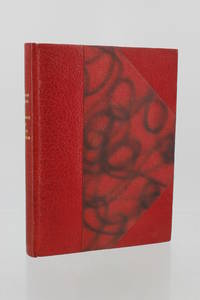
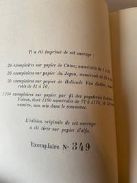
195883979Paris: Plon 1958. Fine. Plon Paris 1958 15 x 20.50 cm relié First edition one of 48 numbered copies on Japan paper deluxe issue. Handsome copy with full margins. Half red morocco with corners smooth spine with a slight tear of no consequence at head marbled paper boards marbled endpapers and pastedowns covers and spine preserved top edge gilt retaining deckled edges signed binding by Lucie Weill. Plon hardcover
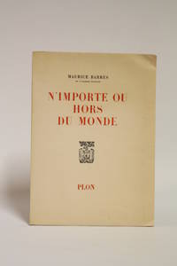
195869512Paris: Plon 1958. Fine. Plon Paris 1958 15 x 21 cm broché First edition one of 48 numbered copies on Japan paper deluxe issue. Spine and boards very lightly and marginally faded without gravity otherwise handsome full-margined copy. Plon hardcover
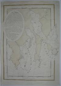
177928787London: British Admiralty for 'The Atlantic Neptune' 1779. Etching with roulette work original outline color on laid paper watermarked "JBates" and countermarked "JB" This excellent example of Des Barres' craftsmanship details a portion of the strait between New Brunswick and what is now Prince Edward Island then St. John's Island. It includes on the New Brunswick side: Shediac Cocagne and Boutouche. The chart includes soundings throughout the Straits and Baie Verte. This is one of the many regions Des Barres himself surveyed during the 1760s. Des Barres of Swiss-Huguenot extraction studied under the great mathematician Daniel Bernoulli at the University of Basel before continuing on to the Royal Military College at Woolwich. Upon the outbreak of hostilities with France in 1756 he joined the British Royal American Regiment as a military engineer. He came to the attention of General James Wolfe who appointed him to join his personal detail. During this period he also worked with the future legendary explorer James Cook on a monumental chart of the St. Lawrence River. From 1762 Des Barres was enlisted to survey the coastlines of Nova Scotia Newfoundland and the Gulf of St. Lawrence while his colleague Samuel Holland charted the New England coast. He also managed to gain access to some surveys of the American South Cuba and Jamaica. In 1774 Des Barres returned to England where he began work on The Neptune. His dedication to the project was so strong that often at his own expense he continually updated and added new charts and views up until 1784. That year he returned to Canada where he remained for a further forty years becoming a senior political figure and a wealthy land owner and living to the advanced age of 103. The Atlantic Neptune the most celebrated sea atlas contained the first systematic survey of the east coast of North America. Des Barres's synergy of great empirical accuracy with the peerless artistic virtue of his aquatint views created a work that "has been described as the most splendid collection of charts plates and views ever published" National Maritime Museum Catalogue. Upon the conclusion of the Seven Years War Britain's empire in North America was greatly expanded and this required the creation of a master atlas featuring new and accurate sea charts for use by the Royal Navy. Des Barres was charged with this Herculean task publishing the first volume in London in 1775 which was soon followed by three further volumes. Des Barres's monumental endeavor eventually featured over two-hundred charts and views many being found in several states. Des Barres's charts were immensely detailed featuring both hydrographical and topographical information and in many cases remained the most authoritative maps of the regions covered for several decades.<br/> <br/> Streeter copy: Vol. II # 58; Stevens 68e. British Admiralty for 'The Atlantic Neptune'] unknown
61832Impr. de Perriquet et Bouille - Auxerre 1857 In-8 24 cm 20pp. quelques marques d'usage sur la couverture hommage autographe de l'auteur Nb-0367 unknown
0265700272.Ghardcover. Good. Access codes and supplements are not guaranteed with used items. May be an ex-library book. hardcover
2000Q-1888992190Catholic Answers 2000-11-01. Paperback. New. In shrink wrap. Looks like an interesting title! Catholic Answers paperback
0270751734.Ghardcover. Good. Access codes and supplements are not guaranteed with used items. May be an ex-library book. hardcover
1164877763.Gpaperback. Good. Access codes and supplements are not guaranteed with used items. May be an ex-library book. paperback
0265321670.Ghardcover. Good. Access codes and supplements are not guaranteed with used items. May be an ex-library book. hardcover
1332671349.Gpaperback. Good. Access codes and supplements are not guaranteed with used items. May be an ex-library book. paperback
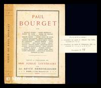
1923237340Paris : Revue hebdomadaire 1923. First Edition. Softcover. Near fine copy in the original stiff-card wrappers; edges very slightly dust-dulled and toned. Remains particularly and surprisingly well-preserved; tight bright clean and especially sharp-cornered. Provenance; from the personal library of Professor Lloyd Austin University of Manchester. Physical description; 209 p. ; In-16. Notes; Limited printing of 350 copies this is no. 77. Subject; Bourget Paul -- 1852-1935. Paris : Revue hebdomadaire paperback
3547London ca. 1780. Engraving on two joined sheets 30.25†x 43.25†sheet size hand-colored border. CONDITION: Good trimmed close at top and bottom with loss of a portion of neat line at top and all of neat line at bottom lower portions of longitudinal figures at bottom nicked original fold marks. <p>A fine chart depicting a portion of the Penobscot Bay region of Maine from the most celebrated maritime atlas of the eighteenth century.</p> <p>Published in London around 1780 in The Atlantic Neptune J. F. W. Des Barres’s landmark four-volume maritime atlas of North America this chart depicts the islands of Vinalhaven called Southern Fox Island until 1789 part of North Haven Isle au Haut Matinicus Isle spelled Metimicus and the area around Owl’s Head. It demonstrates a precise knowledge of the location of numerous smaller islands ledges and rocks the hazardous nature of the latter two being of particular significance to those navigating the waters of the region. Two rhumb line networks cover Penobscot Bay with a north arrow and a smaller one indicating magnetic north shown on the western side. Depth soundings appear around the most important islands and harbors. From a semantic viewpoint the highlight of this chart has to be “Ragged Arse Island.â€</p> <p>The lack of good charts during the Seven Years War generated complaints among British military engineers and naval officers leading to several large-scale surveying projects of the North American coast including newly-gained territory in Canada. Des Barres’ surveys represented just a portion of the massive charting initiative though he is given credit for assembling these various charts into atlas form. </p> <p>The Atlantic Neptune is considered the most comprehensive and important maritime atlas of the 18th century. It was published several times after 1774 and includes engraved plates from many distinct British surveying efforts most dating to the late 1770s and early 1780s. Des Barres was paid by the Admiralty for his work but allowed to keep the rights to plates. Due to the ongoing nature of the surveying effort Des Barres was constantly reconfiguring his atlas as new surveys emerged. Consequently there is considerable variation among the various copies of The Atlantic Neptune in terms of binding organization and contents.</p> <p>J. F. W. Des Barres 1721-1824 was a Swiss-born military engineer and cartographer. Trained in mathematics under Daniel and Jean Bernoulli he moved to England to study at the Royal Military College at Woolwich. In 1756 he received a lieutenant’s commission in the Royal American Regiment and recruited soldiers in the American colonies to join the fight against the French in the Seven Years War. He joined General James Wolfe’s Quebec campaign and worked on various engineering and surveying projects in Canada. In 1763 Des Barres accepted a commission to survey the coasts and harbors of North America. He first worked alongside the Surveyor General of North America Samuel Holland later undertaking his own surveys while Holland continued in parallel. Though there was substantial overlap Des Barres’ work in contrast to Holland’s land surveys focused on producing charts for maritime use. These regional charts were considered to be the most accurate for decades. Des Barres’s atlas owed much to Holland’s maps—which he obtained from the Board of Trade and Plantations—and the work of other contemporaries.</p> <p>REFERENCES: Brown Lloyd A. “The Atlantic Neptune.†The Pennsylvania Magazine of History and Biography Vol. 67 No. 4 1943 pp. 377–81.</p> [London, ca. 1780] unknown
155380Paris. Etat satisfaisant. in-8. Edition originale Non coupé unknown
1775M6223London 1775. Very Good. Notes: Aquatint and line engraving. This fine chart is from "The Atlantic Neptune" by Capt. Joseph Fredrick Wallet Des Barres 1721-1824. "The Atlantic Neptune" is one of the most important sea atlases of the USA and Canadian Atlantic coast that was ever been produced. The atlas was first published in England in 1774 and was updated regularly till 1784. The maps are known for the accurate portrayal of various sounds bays bars and harbours in addition to navigational challenges. The maps are very detailed and contain both hydrographical and topographical information. Des Barres a Swiss cartographer and landscape artist who immigrated to England and trained at the royal military academy became a colonial administrator in Halifax Nova Scotia where he died. He was a lieutenant in rhw royal American regiment c 1756; engineer under general wolf at Quebec c.1759; and governor of Prince Edward Island. He mapped the shore line of Nova Scotia Newfoundland and St. Lawrence River regions c.1764/1774 . This atlas was used by the Royal Navy during the American Revolution. <br>Reference Debard J. M. the family origins of J.f.W.Des Barres; Evens uncommon Obdurate: the several public careers of J.F.W. Des Barres Toronto 1989; De Vorsey map collector 1982 p.31 Size : 700x485 mm 27.5x19.125 Inches Coloring: Original Hand Coloring Category: ; Maps Canada East Nova Scotia unknown
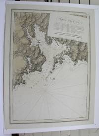
1776227653London 1776. First. unbound. very good. Sea chart. Engraving. Image measures 27.25" x 40.25".<br/> <br/> Beautiful rare nautical chart of Port Campbell SE Nova Scotia. This is the first state and shows settlements and shoals in outline only. Includes the yet named Shelburne Harbour and Roseneath Island now McNutt Island. Includes description of the shoreline and tides. Map is dated 1776 just before the Loyalists came and settled the area. Published in "The Atlantic Neptune" the first British sea atlas of the eastern coast of North America hailed for both its accuracy and its aesthetics. Small chips and tears to margin not affecting the image slight wear to original folds overall toning. J.F.W. Des Barres c. 1729-1827 was born in Basle Switzerland but went to military school in England. He became a colonial administrator in Nova Scotia and also served as governor of Quebec. Des Barres was commissioned for the surveying project in 1762 and dedicated ten years to the gathering of the charts and publication of the atlas.<br/> <br/> unknown
M3913London 1775. Very good. Notes: Aquatint and line engraving. This fine chart is from "The Atlantic Neptune" by Capt. Joseph Fredrick Wallet Des Barres 1721-1824. "The Atlantic Neptune" is one of the most important sea atlases of the USA and Canadian Atlantic coast that was ever been produced. The atlas was first published in England in 1774 and was updated regularly till 1784. The maps are known for the accurate portrayal of various sounds bays bars and harbours in addition to navigational challenges. The maps are very detailed and contain both hydrographical and topographical information. Des Barres a Swiss cartographer and landscape artist who immigrated to England and trained at the royal military academy became a colonial administrator in Halifax Nova Scotia where he died. He was a lieutenant in rhw royal American regiment c 1756; engineer under general wolf at Quebec c.1759; and governor of Prince Edward Island. He mapped the shore line of Nova Scotia Newfoundland and St. Lawrence River regions c.1764/1774 . This atlas was used by the Royal Navy during the American Revolution. <br>Reference Debard J. M. the family origins of J.f.W.Des Barres; Evens uncommon Obdurate: the several public careers of J.F.W. Des Barres Toronto 1989; De Vorsey map collector 1982 p.31 Size : 540x748 mm 21.25x29.375 Inches Coloring: Original Hand Coloring Category: Maps Canada East Nova Scotia unknown
86828Couverture rigide. Bon/1925. in-8. Paris 1925 in-8 282pp Reliure demi-chagrin a coins Très bel exemplaire de l'édition originale numérotée sur Pur Fil Lafuma Voiron. Dos et couvertures conservés! unknown
0656510110.Ghardcover. Good. Access codes and supplements are not guaranteed with used items. May be an ex-library book. hardcover
2000mon0003594074Cold Spring Harbor Laboratory Pr 11/30/2013 12:00:01. hardcover. Very Good. 0.7087 11.0236 8.5827. Cold Spring Harbor Laboratory Pr hardcover
2013__1936113996Cold Spring Harbor Laboratory Pr 2013. Paperback. New. lab manual edition. 250 pages. 11.00x8.75x0.50 inches. Cold Spring Harbor Laboratory Pr paperback
A9781936113996Paperback. New. paperback
0243887302.Gpaperback. Good. Access codes and supplements are not guaranteed with used items. May be an ex-library book. paperback
0265504694.Ghardcover. Good. Access codes and supplements are not guaranteed with used items. May be an ex-library book. hardcover