Maurice BarresBiblio.com

507 résultats
0656571926.Ghardcover. Good. Access codes and supplements are not guaranteed with used items. May be an ex-library book. hardcover
0243228317.Gpaperback. Good. Access codes and supplements are not guaranteed with used items. May be an ex-library book. paperback
0266144527.Gpaperback. Good. Access codes and supplements are not guaranteed with used items. May be an ex-library book. paperback
0266310494.Ghardcover. Good. Access codes and supplements are not guaranteed with used items. May be an ex-library book. hardcover
1258214237.Gpaperback. Good. Access codes and supplements are not guaranteed with used items. May be an ex-library book. paperback
1258110040.Ghardcover. Good. Access codes and supplements are not guaranteed with used items. May be an ex-library book. hardcover
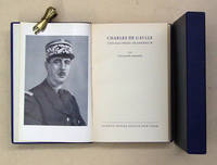
67025Zürich Europa 1945. 8° 299 S. OLdr. in OHLdr.-Schmuckschuber Etw. berieben. E 118. Was Churchill für England war de Gaulle für Frankreich. Die Personifikation des integren Widerstandes gegen Hitlerdeutschland. 010 Zürich, Europa, 1945 unknown
A9781258110048Hardback. New. hardcover
B9781258110048Hardback. New. hardcover
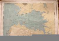
1776M4657London 1776. Very Good. Notes: A scarce and sought after map of Charlotte Bay in Greater Halifax. This area in present day contains numerous luxary cottages. Size : 680x975 mm 26.75x38.375 Inches Coloring: Hand Colored Category: Maps Canada East Nova Scotia; unknown
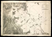
178120210London: J. F. W. Des Barres for 'The Atlantic Neptune' 1781. Etched with aquatint and stippling. Some outline color. Platemark: 29 1/4 x 21 3/8 inches; sheet: 32 3/4 x 24 3/4 inches. Laid paper watermarked "J. Bates" with counter mark "J.B." A meticulous survey of a portion of the eastern coast of New Brunswick on the Northumberland Straits with soundings and topographical detailing.<br/> <br/> This chart which appeared in Volume II of The Atlantic Neptune was part of the surveying work conducted by Des Barres himself in the late 1760s and early 1770s. The first state was issued in 1776; this enhanced second state appeared in 1779. Des Barres of Swiss-Huguenot extraction studied under the great mathematician Daniel Bernoulli at the University of Basel before continuing on to the Royal Military College at Woolwich. Upon the outbreak of hostilities with France in 1756 he joined the British Royal American Regiment as a military engineer. He came to the attention of General James Wolfe who appointed him to join his personal detail. During this period he also worked with the future legendary explorer James Cook on a monumental chart of the St. Lawrence River. From 1762 Des Barres was enlisted to survey the coastlines of Nova Scotia Newfoundland and the Gulf of St. Lawrence while his colleague Samuel Holland charted the New England coast. He also managed to gain access to some surveys of the American South Cuba and Jamaica. In 1774 Des Barres returned to England where he began work on The Neptune. His dedication to the project was so strong that often at his own expense he continually updated and added new charts and views up until 1784. That year he returned to Canada where he remained for a further forty years becoming a senior political figure and a wealthy land owner and living to the advanced age of 103. The Atlantic Neptune the most celebrated sea atlas contained the first systematic survey of the east coast of North America. Des Barres's synergy of great empirical accuracy with the peerless artistic virtue of his aquatint views created a work that "has been described as the most splendid collection of charts plates and views ever published" National Maritime Museum Catalogue. Upon the conclusion of the Seven Years War Britain's empire in North America was greatly expanded and this required the creation of a master atlas featuring new and accurate sea charts for use by the Royal Navy. Des Barres was charged with this Herculean task publishing the first volume in London in 1775 which was soon followed by three further volumes. Des Barres's monumental endeavor eventually featured over two-hundred charts and views many being found in several states. Des Barres's charts were immensely detailed featuring both hydrographical and topographical information and in many cases remained the most authoritative maps of the regions covered for several decades.<br/> <br/> Stevens 72h. J. F. W. Des Barres for 'The Atlantic Neptune' unknown
177510833London 5th August 1775. 705 by 1040mm 27.75 by 41 inches. Large aquatint and etched engraving on two sheets joined unfolded and uncut with the LVG watermark together with pamphlet quarto 280 by 230mm original blue wrappers typographic title pp. 5-12 there are no pages 3-4 which agrees with the John Carter Brown example. The first state of one of the most important Revolutionary War illustrations of Boston and its approaches accompanied by the very rare 12 page pamphlet by George Callender entitled 'Nautical remarks and observations for the chart of the harbour of Boston'. Callendar was the Master of HMS Romney. Commissioned in 1762 she served extensively in North America arriving in Boston in May 1768 to support the British during the enforcement of the Townshend Acts. Short of men it was the pressing of local men into service which increased tension in the town to a level which culminated in the Boston Massacre of 1770. This chart is part of a very large body of work known as the 'Atlantic Neptune' undertaken by Des Barres one of the greatest hydrographic achievements of the eighteenth century. The French and Indian War highlighted the lack of accurate mapping of the vast territories now under British control in North America. Samuel Holland was entrusted with the task of accurately mapping the northern portion of these territories. He proposed using the latest accurate methods which included astronomical readings and triangulation. In 1769 he was still working in Canadian waters but had instructed Callendar to undertake the survey of Boston. In England Des Barres was in charge of undertaking the detailed engraving. He set about providing the British government with more accurate mapping of the entire coastline of America and Canada. They proved to be of just as much use to the American rebel forces. This particular chart is notable for recording Boston as it was at the outbreak of hostilities. It illustrates the British defences before the siege. The second state in particular out of the four later ones would record the progress of the siege works constructed by the Americans around the city. As the title informs us it was surveyed in the year 1769 a troubled time in Boston. Extensive soundings are provided in the harbour. The road structure is accurately recorded as are the local towns. It even shows recorded field boundaries. An alphabetical key upper right identifies fourteen locations in the immediate area of Boston including batteries docks forts wharves and the all-important Charles-town Ferry. The accompanying pamphlet of sailing directions is rare. It was replaced soon after by a single sheet version entitled 'A Chart of the Harbour of Boston' which is sometimes found pasted to later states of the map. It is rarely found with the chart as here. Boston Engineering Department List of Maps of Boston pp. 70-71; Cumming British Maps of Colonial America pp.51-56; ESTC N12343 pamphlet; Guthorn 'British Maps of the American Revolution' 59/3 Holland's original manuscript; Krieger and Cobb Mapping Boston p. 106 plate 19; Nebenzahl Bibliography of printed battle plans 3; Sabin 10061 pamphlet; Sellers & Van Ee 945; Stevens Bibliography of the Atlantic Neptune unpublished pp. 211-216; Streeter II:706. unknown
178026675London 1780. Aquatint and line engraving period hand colouring. Very rare first state of Des Barres's chart of the coast of Georgia.<br/> <br/> This fine chart is from "The Atlantic Neptune" one of the finest large scale sea atlases of the United States and Canadian Atlantic coastline ever produced. The maps in the atlas were produce over a seven-year period 1775-82 and are well known for their accurate portrayal of various sounds bays bars harbors as well as navigational hazards. This atlas was used extensively by the Royal Navy during the American Revolution. This is a detailed chart of the Georgia and upper Florida coastlines covering an area between the mouth of the River May to John's Island. The towns of Savannah Beaufort Hardwick and Sunbury are shown and the coastal Parishes in Georgia are names. To the west is noted "Indian Boundary Line." This very rare first state is larger than the subsequent two states without any detail added to the South Carolina coast and without the inset in the lower right corner added in or after 1780.<br/> <br/> Stevens 168a. unknown
2006Q-1846771307LEONAUR 2006-11-21. Paperback. New. In shrink wrap. Looks like an interesting title! LEONAUR paperback
1846771293.Ghardcover. Good. Access codes and supplements are not guaranteed with used items. May be an ex-library book. hardcover
2406149897.Gpaperback. Good. Access codes and supplements are not guaranteed with used items. May be an ex-library book. paperback
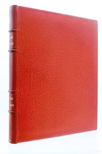
192875704Paris: Librairie Delagrave 1928. Fine. Librairie Delagrave Paris 1928 22.50 x 28.50 cm relié sous étui Edition illustrated with original woodcuts within and outside the text by André Deslignières one of 100 numbered copies on tinted laid Rives paper the deluxe edition after 50 Annam copies. Full orange morocco binding spine very lightly darkened with four raised bands set with black fillets gilt roulettes on the headcaps endpapers and pastedowns of moiré-effect paper frame of gilt fillets finished at the corners with floral motifs in yellow and green mosaic morocco pieces as well as a brown mosaic morocco fillet covers and spine preserved top edge gilt gilt fillets on the edges slipcase bordered with orange morocco boards of moiré-effect paper binding signed J. Van West. Our copy is exceptionally expanded with 6 original watercolors signed by André Deslignières which were used for the illustration of the work. Handsome copy superbly bound in full morocco signed by J. Van West and expanded with 6 original signed watercolors by André Deslignières. Librairie Delagrave hardcover
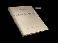
1913247551913. Paris Librairie Delagrave 1928. Un vol. au format in-4 286 x 233 mm de 196 pp. brochÂŽ sous couverture ˆ rabats rempliÂŽs. Edition originale collective. Tirage de tÂte : un des 50 premiers exemplaires du tirage numÂŽrotÂŽ sur Annam. Il s'agrÂŽmente - ici en premier tirage - de compositions in et hors-texte d'AndrÂŽ DeslignÂres. ''ElÂve de l'Ecole Germain Pilon ˆ Paris ce graveur renommÂŽ et artiste sensible et savant a illustrÂŽ un grand nombre d'ouvrages''. in BÂŽnÂŽzit. ''DeslignÂres est un graveur d'une grande habiletÂŽ. Son mÂŽtier n'a plus pour lui de secrets et il creuse le bois avec une vÂŽritable ma”trise''. Jean Dorsenne citÂŽ in Osterwalder. Ce roman fait suite Au service de lÕAllemagne publiÂŽ en 1905 lequel inaugurait la sÂŽrie des Bastions de lÕEst. BarrÂs y dÂŽfend la langue franÂaise et sa culture et face ˆ ce quÕil appelle le Ç barbare prussien È son nationalisme est souvent intransigeant et empreint de mauvaise foi. Maurice BarrÂs ÂŽcrivit Colette Baudoche pendant un sÂŽjour ˆ Metz en Lorraine. Au mois dÕaožt 1911 sur lÕinvitation des chefs de la rÂŽsistance lorraine il se rendit de nouveau ˆ Metz afin dÕy prononcer un discours affirmant ainsi sa foi en lÕavenir : Ç En avant ! Ayons confiance dans la puissance de la vie dans la vie qui sÕexhale du tertre des hÂŽros. CÕest une vie plus forte quÕaucune politique". MahÂŽ RÂŽpertoire des ÂŽditions de luxe p. 67 - BÂŽnÂŽzit III Dictionnaire des peintres p. 524 - Osterwalder II Dictionnaire des illustrateurs p. 304. Piqžres affectant les plats et dans le texte davantage marquÂŽes sur quelques feuillets. Du reste belle condiiton. b42961 unknown
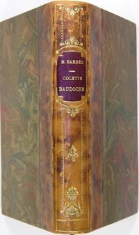
8527Librairie Félix Juven Paris 1909. In/8 reliure demi-basane fauve marbrée dos lisse à décor doré pièce de titre bordeaux doré sur tête couvertures conservées 258 pages. Joint une lettre de deux pages manuscrite de M. Barrès datée du 16 mars 1917 sur du papier de la chambre des députés. Petites usures sur les mors. Ex-libris. Trace dun document contrecollé au verso de la page de faux-titre. unknown
45409908like new. unknown
1017918309.Ghardcover. Good. Access codes and supplements are not guaranteed with used items. May be an ex-library book. hardcover
190938895Paris: Librairie Félix Juven 1909. A OUTSTANDING LARGE-PAPER COPY ON IMPERIAL JAPANESE PAPER OF COLETTE BAUDOCHE Barrès' most popular and arguably most important work. ONE OF ONLY 25 NUMBERED COPIES I offer copy no. 5 PRINTED ON EXTREMELY FINE IMPERIAL JAPANESE PAPER. Huge margins. Large 12mo. Beautifully bound in recent quarter vellum and marbled boards. Top edge gilt other edges uncut. Original wraps and backstrip preserved. Small faint old stain to top edge of original front wrapper else FINE AND BRIGHT. <br/><br/> Librairie Félix Juven paperback
1928158434to. Fine longgrained hmorocco 4 raised bands ornamental gilt compartments uncut top-edge gilt broad back and large corners. Orig. wrappers withbound. Flammarion. No 118 of 175 "sur velin de Rives" a total of 240 copies. With 48 fine engravings both as plates and in the text by Bouroux. hardcover
0259503991.Gpaperback. Good. Access codes and supplements are not guaranteed with used items. May be an ex-library book. paperback