Sanson GuillaumeLivre Rare Book
269 résultats
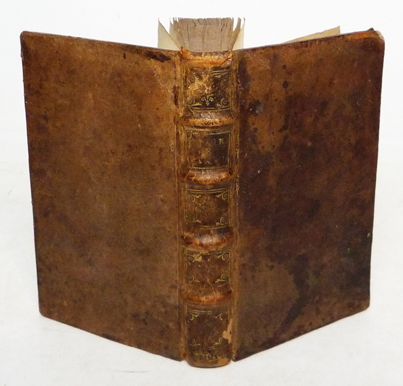
1682za2213A Paris, chez l'Auteur, aux Galleries du Louvre, vis à vis l'Eglise de St Nicolas Relié 1682 "In-12 (9,8 x 16 cm), reliure plein veau, dos à 4 nerfs orné de caissons dorés, liseré doré sur les coupes, tranches mouchetées, titre comple : ""Introduction à la géographie, première partie. Où sont 1. Indiquées les Sciences dont la Géographie emprunte plusieurs Principes. 2. La Description des differentes Manieres dont cette Science est Représentée. 3. L'Explication des Termes de toutes les Parties de la Geographie. 4. Une Instruction de toutes les Parties de la Geographie. 4. Une Instruction de l'Usage des Cartes."", pagination comme suit : page de titre, préface (6 pp. non numérotées), avis au lecteur (2 pp. non numérotées), table des chapitres (9 pp. non numérotées, fautes à corriger, extrait du Privilege du Roy, 292 pp., table alphabetique (13 pp. non numérotées), avertissement (5 pp. non numérotées). Le plan de cet ouvrage de 320 pages est composé de trois parties. Dans la première, l'auteur place la géographie dans la cosmoraphie, puis il distingue entre globes et cartes, avant de décrire, comme l'avait fait Lubin, le vocabulaire de la géographie. Guillaume Sanson conclut cette partie par un chapitre sur l'usage des cartes. La deuxième partie s'intéresse aux relations entre l'astronomie et la géographie, décrivant le globe soit par par zones, soit par la grille des latitudes et longitudes. Enfin, la troisième partie, dite de géographie naturelle, rassemble pêle-mêle la liste des découpages du globe, selon les grilles évoquées dans la deuxième partie, puis en fonction des continents et des mers, voire selon d'autres critères comme les géographies historique, politique et sacrée, ou linguistique. La description de l'ensemble des Etats du monde y occupe 20 pages (et semble avoir été inspirée par l'Atlas du monde publié par Nicolas Sanson en 1665). Il s'agit donc d'abord d'une géographie assez théorique qui viserait à faire connaître le vocabulaire ainsi que les catégories de la géographie. Pourquoi cette introduction n'offre-t-elle pas plus de description de la géographie du monde ? Parce que la géographie --comme Guillaume Sanson l'écrit dans la préface-- ""est présentement à la Portée de tout le Monde, puisqu'avec cette méthode il ne faut que des yeux et des cartes"" (Sanson 1682). Deux hypothèses en découlent. La première fait de ce livre avant tout un prospectus pour les cartes des Sanson. La seconde y voit une tentative, par la famille Sanson, de captation de la géographie par la cartographie. De plus, on trouve dans l'édition de 1682 un avertissement passionnant de la main de Sanson, situé après la table alphabétique des matières. Il y critique la ""Méthode pour apprendre facilement la géographie"" de Jacques Robbe (1678), ainsi que la ""Description de Univers contenant les différents systèmes du monde"" à paraître (1683) de Manesson-Mallet, le traitant sans retenue de plagiaire. Plus loin, ayant mis en garde des acheteurs de cartes que les copistes étaient foison, Sanson note qu'il fait encore partie des vivants : ""Quelques uns nous effacent hardiment du nombre des Vivans, d'autres ont voulu persuader que nous estions retournez en Province, & qu'il y en avoit qui avoient eu assez d'effronterie pour prendre notre Nom ; de sorte que nous avons fait mettre à la Teste de cette Introduction Que nous demeurons aux Galleries du Louvre, pour desabuser le Public, & faciliter par là de Dessein de ceux qui voudront nous faire l'honneur de venir chez nous pour s'éclaircir de quelques difficultez, ou pour prendre avis touchant nos Ouvrages qu'ils voudront avoir."" ; quelques épidermures au dos, coiffe supérieure et coins du premier plat un peu usés, par ailleurs intérieur frais, bon état général. Livraison a domicile (La Poste) ou en Mondial Relay sur simple demande."
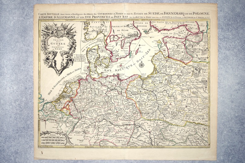
16962308A AMSTERDAM. CHEZ P. MORTIER. SANS DATE (VERS 1696). GRANDE CARTE GEOGRAPHIQUE, GRAVEE PAR JOAN VAN LUGTENBURG, LIMITES COLORIEES A LA MAIN D'EPOQUE (46,5 X 58 CENTIMETRES ENVIRON, 53 X 61,5 CENTIMETRES ENVIRON AVEC LES MARGES), AVEC UN CARTOUCHE DECORATIF AUX ATTRIBUTS MILITAIRES DONNANT LE TITRE. BON ETAT.
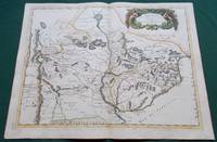
1668014632Paris: Cartes Generales de Toutes les Parties du Monde. 1668. Hand coloured. Map measures 55x40.cm plus margin. Some light surface wear or dust marking. Map in good condition. Boldly engraved map of the region of present day Paraguay Uruguay northern Argentina and parts of Chile and Brazil. The Rio de la Plata is the main feature of the map which extends north to the mythical Lago de los Xarayes. The mountains and volcanoes of the Cordillera de los Andes are also prominently shown. There is good detail of topography missions and villages. The decorative title cartouche is adorned with two female figures fruit and flowers. Very Good. Cartes Generales de Toutes les Parties du Monde.. unknown
1651R320074492A COMPTE D'AUTEUR. 1651. In-Folio. Broché. Etat d'usage, Couv. défraîchie, Dos satisfaisant, Intérieur frais. 43 pages - Quelques taches jaunatres en fin de volume (en tranches - gouttiere) sans conséquence sur la lecture - + 1 planche depliante. Bandeau et lettrine en tete de chapitre. Renfort en 1er plat et dos. Bandaux; lettrines et culs de lampe. 4 PHOTOS DISPONIBLES -. . . . Classification Dewey : 94.2-Livres anciens XVII ème
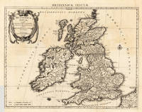
1662280971662 une carte ancienne gravée sur cuivre (Copper etching) en noir . Format : 46,5 x 58 cm, par Nicolas SANSON carthographe, 1662 [s.n.] Editeur,
1651284611651 une carte ancienne gravée sur cuivre (Copper etching) en noir . Format : 44 x 58 cm, par Nicolas SANSON carthographe, 1651 [s.n.] Editeur,
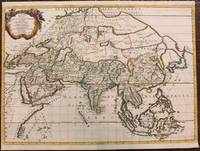
1680024707London: William Berry 1680. .Kingdoms and States which are found there at present/Described by Sanson/Corrected and amended By William Berry =Kopftitel; Text der figürlich reich verzierten Kartusche oben rechts: Asia Divided into its Principall Regions in which may be seen the extent of the Empires Monarchies Kingdoms and States which at present divide Asia/To the Most serene and Most Sacred Majesty of Charles II./By the Grace of God King of Great Britain France and Ireland/This Map of Asia is humbly Dedicated and Presented By Your Majesties Loyal Subject and Servand William Berry; Text der reich verzierten Kartusche links oben: Scale es folgen Maßstäbe verschiedener Länder/London/Sold by William Berry at the Sign of the Globe between Charing-Cross and White-Hall/1680; SW-Kupferstich-Landkarte nach Nicolas Sanson d'Abbeville gestochen von William Berry; ca. 51 x 39 cm; Falzspuren einige Tintenflecken hauptsächlich ausserhalb des Druckbildes mässige Lichtverfärbung; professionell hinter Glas gerahmt in schwarzem Holzrahmen; äußerst selten; for description in other languages of this extremely rare map please don't hesitate to contact me. . Gut. Landkarte. William Berry unknown
1678M3431Paris: Mariette Pierre 1678. Excellent. Size : 357x595 mm 14x23.375 Inches Coloring: Original Outline with later cartouche coloring Category: ; Maps Asia Near East Turkey Mariette, Pierre unknown
166725060Paris: P. Mariette 1667. Other. The centre fold minor spotting else in excellent condition. 395 by 565mm 15 by 22 inches. Rare and decorative large-format historical map of Europe showing the locations of Church Councils and Synods in original outline color. By Guillaume Sanson 16331703 Géographe du Roy published by Pierre Mariette Paris 1667. Image: 395 x 565 mm 15.5 x 22 inches. Decorated with a superb allegorical title cartouche depicting a Catholic council in session a unique historical and cartographic document. Guillaume Sanson 16331703 was a leading French cartographer who inherited the celebrated family firm from his father Nicolas Sanson 16001667 known as the 'Father of French Cartography' and official Géographe du Roy to Louis XIV. Like his father Guillaume held the title of Géographe Ordinaire du Roy. Much of his work after 1671 was published in collaboration with Alexis-Hubert Jaillot and together the Sanson dynasty dominated French cartography throughout the 17th century. Their maps are held in the Bibliothèque nationale de France the British Library and major research collections worldwide.This large and striking map plots the locations of ecumenical councils national synods provincial councils and diocesan synods across Europe a unique cartographic subject of combined religious and historical significance. The coverage extends from the British Isles and Iberian Peninsula across to the eastern Mediterranean including Cyprus and Syria with North Africa also shown. Political borders are rendered in hand-applied outline color. The splendid allegorical title cartouche depicts a Catholic council in session and was engraved to the highest standard of the Parisian workshop. The Geographia Synodica is among the most unusual and collectible maps ever published of Europe: a historic document of scholarship faith and cartographic craft. In excellent condition. Original outline color fresh and vivid. The centrefold shows minor spotting as expected for a 17th-century map of this size; all else excellent. No tears or significant foxing. 395 x 565 mm. P. Mariette unknown
1678M3434Paris: Mariette Pierre 1678. Excellent. Size : 390x522 mm 15.375x20.5 Inches Coloring: Original Outline with later cartouche coloring Category: ; Maps Asia Near East Turkey Mariette, Pierre unknown
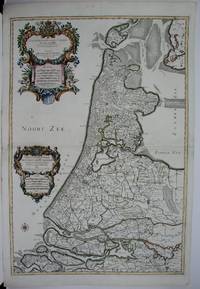
1674M1744Paris: Jaillot Hubert 1674. Very Good to Excellent. Size : 572x840 mm 22.5x33 Inches Coloring: Original Outline Coloring Category: ; Maps Europe Benelux Jaillot, Hubert unknown
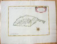
166710027Paris 1667. No Binding. Near Fine. 12 ½ x 17 inches. Original outline color; excellent. Earliest map of Martinique listed in Phillips featuring attractive original color and an elegant cartouche. This map depicts the situation on the island before 1660 when it was still largely inhabited by natives and only about half of it had been claimed by colonists for sugar cane farming. The map goes so far as to mark with a printed line the partition dividing the "demeure des François" and the "demeure des savages." However by 1660 the entirety of the native population was either dead expelled or in slavery and Martinique was a full-fledged sugar cane-farming European colony. Phillips Maps P. 389. unknown
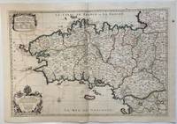
1693324404Paris: Alexis-Hubert Jaillot 1693. Map. Engraving with hand colored outline. Image measures 21" x 31"<br/> <br/> This large 17th century double-page map features the Brittany region of France. Cities towns abbeys government buildings rivers ports and harbors are labeled. Mountains forests and wetlands are depicted pictorially. The attention to detail in topography and population centers hints at the abundance of the region known for its production of Muscadet wine cheese boar seafood and other agricultural products. Executed by Nicolas Sanson in dedication to his son this map was published by Alexis-Hubert Jaillot in Paris and later reproduced in Amsterdam by Jaillot and Pierre Mortier. This early edition is scarce and hard to find. In very good condition with some offsetting to left side and a spot in the right margin. <br> <br> Nicolas Sanson 1600-1667 is considered the founder of the French school of cartography. In reaction to the prevailing trend of Dutch lavishness Sanson favored minimal details focusing rather on accurate cartography than ornament.<br/> <br/> Alexis-Hubert Jaillot unknown
170054035Amsterdam: 1700. Map of Germany divided into regions which at the time extended over much of the Low Countries. Maps by Sanson in original colour are rare. Nicolas Sanson was founder of the French school of mapmakers at a time when the leadership in European cartography passed from the Low Countries to France. This map was published in Brion's treatise on globes. Nicolas Brion was a famous French mathematical and scientific instrument maker. L'Usage des Globes. Copper engraving. Fine condition. Original colour. Size: 23.5 x 18.5 cm. unknown
1691M1345Paris 1691. Very Good. Size : 590x885 mm 23.25x34.875 Inches Coloring: Hand Colored in Outline Category: ; Maps South America Continent unknown
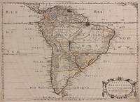
1650309461Paris: Pierre Mariette 1650. unbound. Abraham Peyrounin. Map. Engraving with original outline color. Image measures 15 3/4" x 21 3/4"<br/> <br/> This exceptionally fine map of South America covers the continent in fine detail. Coastlines are extensively labeled and mountains beautifully rendered in profile. The Orinoco and Amazon Rivers as well as Rio de la Plata are prominently rendered. Sanson refrains from drawing a southern coastline to Tierra del Fuego and the relatively unknown Amazon region is depicted in minimal detail. Sanson does however include the mythical lake "Lac de Parime" and the city of gold "Manoa del Dora" between the Orinoco and Amazon rivers. Nice dark impression. In very good condition. Minor dampstain to lower margin not affecting the image and some faint stains near the center of the map - otherwise clean and bright. Hard to find. <Br> <br> Nicolas Sanson 1600-1667 is considered the founder of the French school of cartography. In reaction to the prevailing trend of Dutch lavishness Sanson favored minimal details focusing rather on accurate cartography than ornament.<br/> <br/> Pierre Mariette unknown
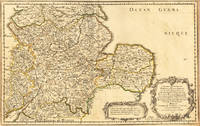
165417463Paris: N. Sanson 1654. Other. In very good condition. 365 by 580mm 14¼ by 22¾ inches. 365 by 580mm 14¼ by 22¾ inches. Copper-engraving handcolored in outline when published. Fine and strong impression of this early decorative mid-seventeenth century map of this English regional map covering the area Chester Darbing Nottingham. by the famous French cartographer Nicolaus Sanson. Very detailled and naming many cities and villages as well many places along the coastline. Showing prominently the eastern part of central England. In the lower right corner with a large floral title cartouche and milage scale. N. Sanson unknown
16546571Paris 1654. Copper engraving 37 x 48 cms modern hand-colour blank verso. Nicolas Sanson 1600-1667 founder of the Sanson dynasty of map-makers is considered by many to be the father of the French school of cartography. He was a prolific and original map-maker admired for the clarity and scientific accuracy of his maps. Map unknown
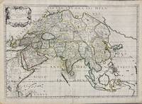
1650005908Paris: Pierre Mariette 1650. First state. Loose Sheet. Very good. Hand colored map on laid paper. Sheet Measurements: 600mm x 440 mm; Plate Measurements: 563mm x 392mm. Antique map titled "Asia Vetus" Ancient Asia by Nicolas Sanson first published circa 1650. Considered a significant piece of cartographic history marking the shift of mapmaking excellence from Amsterdam to Paris in the 17th century. Map Condition: center fold with light reinforcement ancient remains of dried adhesive to corners lower left corner shows small area of paper thinning and some disruption to text very light toning in spots. Discrete prior owner notations in pencil to verso. Please examine photographs for condition in general. Pierre Mariette unknown
1667M8921Paris: Pierre Mariette 1667. Very Good. Notes: An important map of Asia by Nicolas Sanson showing the boundaries of the major historic civilizations of this continent. Examples include Assyria Syria Asia Minor Armenia Arabia Felix Libya Sarmatia Thracia Graecia Persia India China Ethiopia Scythia and Gangem. <br><br>Sanson 1600–1667 was a French cartographer termed by some as the "father of French cartography." His works are known for their incorporation of the most up to date information of the time and their clean modern style. Size : 402x470 mm 15.83x18.50 Inches Coloring: Original Hand Coloring Category: Maps Asia Continent; Pierre Mariette unknown
169623767Amsterdam: Covens 1696 -1700. Other. In very good to excellent condition. A small tear at the left side. 392 by 517mm 15½ by 20¼ inches. 392 by 517mm 15½ by 20¼ inches. Copper engraving uncolored as published. Covens unknown
1658M7057Paris 1658. Very Good;. Notes: An early map of the Island of St. Christopher that includes a decorative compass rose in sea area and an ornamental title cartouche in top right decorated with scrolls ribbons and fruit. This is the first printed map of St. Kitts published in "Cartes Generales De Toutes Les Parties Du Monde."<br>With wide margins. Size : 314x429 mm 12.36x16.89 Inches Coloring: Original Outline Coloring cartouche and compass hand coloured Category: Maps West Indies Other Islands; unknown
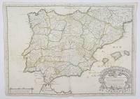
1658356952Paris.: Tavernier. 1658. Dampstain cover mot of the image also some coffee spots otherwise good. 42.5x57.2x.01 cm. Image size 41x55.5 to neatline. An uncommon map of Spain and Portugal with outline color. weight: 0.1 lb. Engraved by Melchior Tavernier. Tavernier. unknown
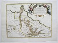
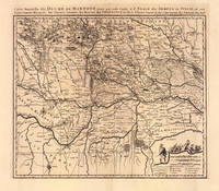
169319103Amsterdam: Pierre Mortier 1693-1700. Other. A strong impression in excellent condition. 490 by 580mm 19 by 22 inches. 490 by 580mm 19 by 22 inches. Original antique copper engraving uncolored from the 'Atlas Nouveau' published in Paris 1693. Depicting Mantua this map is a fine example of 1690s European cartography. Image: 490 by 580mm 19 by 22 inches. An attractive and historically significant 17th-century map for the discerning collector. Nicolas Sanson d'Abbeville 16001667 was the founder of the French school of cartography and arguably the most important French cartographer of the 17th century. Appointed Géographe Ordinaire du Roi to Louis XIII in 1630 he produced hundreds of maps that set a new standard for geographic accuracy and systematic coverage. His work was continued and expanded by Alexis-Hubert Jaillot and later by Pierre Mortier in Amsterdam ensuring that Sanson's surveys remained in use well into the 18th century. Maps bearing the Sanson name are prized for their scholarly precision large format and the elaborate cartouches that reflect the grandeur of the Sun King's court.Large detailed and interesting map by the famous French cartographer Nicolaus Sanson published in the famous sea atlas Le Neptune francois. in Amsterdam at Pierre Mortier. This interesting and large map was originally first published in the Atlas Noveau. by Alexis Hubert Jaillot & N. Sanson in Paris 1683-89. Alexis Hubert Jaillot & Nicolaus Jaillot worked as a royal cartographers for the French royal house for king Louis XIV. His maps published for the Atlas Nouveau. can be regarded as masterpieces of cartography in France in the ending 18th century. Also the maps impress by their accuracy and are providing an enormous amount of place names monasteries rivers trails fortifications etc. Shown is the duchy of Mantua Mantova in Northern Italy. Mantua is shown prominently in the center of the map. The map provides many place names detailed information on the river system also in the lower right corner a cartouche with a mileage scale and a table of explanations.A fine example from Atlas Nouveau Paris / Amsterdam sought after by collectors of antique maps of Italy antique maps of Mantua and antique copper engraving uncoloreds for sale. In good condition consistent with age. Shown is the duchy of Mantua Mantova in Northern Italy. Mantua is shown prominently in the center of the map. The map provides many place names detailed information on the river system also in the lower right corner a cartouche with a mileage scale and a table of explanations. Pierre Mortier unknown
1650011592Paris 1650. No Binding. Very Good/No Jacket. R Cordier. 1650 Normanie. Engraved by R Cordier. A fine and detailed province map with the english coast included. All important place names are shown. Original outline colour. very slight discoloration. otherwise good condition. 385 x 515 mm framed and glazed <br/> <br/> unknown