Nicolas Sanson d'Abbeville / I SomerBiblio.com
269 résultats
165461177<p>40.1 x 56 cm original outline hand-colour copper engraving. EXTREMELY RARE map probably from ''Cartes generales de toutes les parties du monde' . Condition: with folds as issued with water stains and professionally repaired tear on lower left margin not affecting plate. Reference: Quirino p. 83; BMC Printed Maps XII col.867; Cat.Nat.mar.Mus.271 map 15; Nordenskiöld 275 vol.1 map 17; pastoureau Sanson V map 12.</p> Pierre Mariette, Paris.
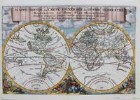
1692M9110Trajecti ad Rhenum : Francisci Halma c. 1692. Very Good. Notes: A finely engraved map of the world by Nicolas Sanson "the father of French cartography" during the late 17th century. Engraved by A. de Winter. There are a lot of fascinating cartographic errors that were made such as California being shown as an island and the western half of North America not being depicted as it had yet to be discovered. But the treatment of far and southeast Asia is much improved when we compare it to Sanson's map of 1652. Korea reverts to an attenuated peninsula instead of the short squat round island in the earlier Sanson version. Likewise the partial outline of Australia changes it shape to a much more realistic outline of Australia. Size : 200x305 mm 7.87x12.01 Inches Coloring: Hand Colored Category: Maps World; Francisci Halma unknown
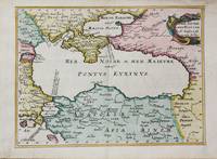
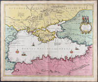
1656M10647Paris c.1656. Very Good. Size : 182x246 mm 7.17x9.69 Inches Coloring: Hand Colored Category: Maps Russia; Maps Asia Near East Turkey; Maps Europe Ukraine; unknown
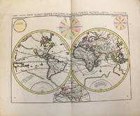
1696M10191Amsterdam: Covens & Mortier c.1696. Very Good. Size : 393x540 mm 15.47x21.26 Inches Coloring: Original Hand Coloring Category: Maps World; Covens & Mortier unknown
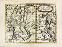
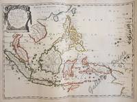
1652M8177Paris. 1652. Very Good. Notes: Fine 17th century map of Thailand Burma and Malaysia.<br><br> Size : 191x249 mm 7.50x9.80 Inches Coloring: Original Hand Coloring Category: Maps Asia South East Thailand Laos Vietnam Cambodia & Burma / Myanmar; Maps Asia South East Malaysia & Singapore; unknown
16969749<p>Scarce original hand-colored engraving by Sanson published in Pierre Mortier's <em>Atlas Nouveau</em> or <em>Atlas Novum ad usum serenissimi</em>.</p><p>Image size is approximately 23 x 18.75 in 58.5 x 47.5 cm; page size is 24.75 x 21 in 63 x 53.5 cm.</p><p>Some minor staining and toning to edges not affecting the image.</p>
16511111150111Paris 1651. Map. Very Good. Paris: Sanson Marriette 1651. 55.3 x 39.2 cm. Black-and-white copper plate engraved chart of primarily Eastern Europe with Turkey in the lower right panel. Modern hand-coloring applied to political boundaries. Title cartouche in upper right corner. Numbered 299 in upper right corner. Otherwise clean unmarked sheet with slight toning to edges. Vertical crease down center from atlas extraction. Minor chipping to edges. Colors are bright and vivid. Lines remain crisp and clear.<br><br>Nicolas Sanson was a Jesuit-trained French cartographer who attracted attention with a detailed accurate map of Gaul which he constructed when only 18. Active from 1627 Sanson issued his first map of importance the Postes de France which was published by Melchior Tavernier in 1632. After publishing several general atlases himself he became the associate of Pierre Mariette a publisher of prints.<br><br>The following map is one of the many prints Sanson collaborated with Mariette on. Unlike Jaillots future reproductions the original plates maintain a more modest decorative style with understated cartouches and less flourish or embellishment. Please feel free to view our photographs of this piece. Paris unknown
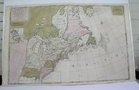
1698M3704Paris 1698. Excellent. Notes: Rather rare original coloured version of this map an important 17th century map of the Great Lakes and East coast with an inset map of Boston.<br><br>Cumming qtd in Arkway: "in spite of its scope and size it has a good deal of information for the Carolina Coast".<br><br>This map by Sanson first appeared in Mortier's sea atlas "Le Neptune Francois"; interestingly it is not generally found in Sanson or Jaillot atlases. Size : 650x924 mm 25.625x36.375 Inches Coloring: Original Hand Coloring Reference: Arkway 58:23 Category: Maps Canada East; Maps United States New England unknown
1678200041AG1678. Paris Sanson d'Abbeville 1678. Original hand-coloured engraving. Plate Size: 53.6 cm x 41.7 cm. Sheet Size: 61.8 cm x 46.5 cm. Original map. In very good condition. Faint signs of browning to map. Minor paper imperfections to the outer margins. Small stain to map near centre-fold. A richly detailed map showing the northern part of Portugal. Relief on map depicted pictorially and border inlaid with longitudinal and latitudinal details The map is dominated by three rivers: the Tajo Tagus in the south the Douro and the Minho further north. The Spanish kingdom and regions such as Leon are included and the great city of Salamanca can be seen. The lower part of the map runs out before the Tagus estuary empties into the Atlantic at Lisbon. The ornamental title cartouche is in the lower right corner of the map. Off the coast is a large warship flying the coat-of-arms Kingdom of Portugal and the Algarves. The sails of the boat carry Latin text commemorates the commercial and maritime exploits of King John IV in Africa Arabia Ethiopia Persia India and Brazil. Nicolas Sanson 20 December 1600 7 July 1667 was a French cartographer termed by some the creator of French geography in which he's been called the "father of French cartography." The French school of Geography was unprecedented in its attention to precision and scientific detail and discarded much of the decorative embellishments of previous maps as irrelevant. From Sanson's time in the second half of the seventeenth century until the latter part of the eighteenth century French geographical conceptions were more influential than those put forward by any other nation. He was tutor to Louis XIII and Louis XIV. Sanson published over 300 maps. In 1692 Hubert Jaillot collected Sanson's maps in an Atlas nouveau. Wikipedia unknown
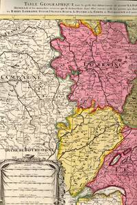
1700BB614331700. unknown. gebraucht gut gefaltete Landkarte mit Mittelfalz Papier altersbedingt etwas fleckig und gebräunt sonst GUTES EXEMPLAR. 442 x 575 cm. Blatt: 535 x 605 cm. l'Archevesche et l'Elctorat de Mayence et le Palatinat du Rhein Lorraine Suisse l'Alsace Sueve la Duche et la Comte de Bourgogne et d'autres Provinces voisines de France et Italie. Altkolorierter Kupferstich um 1700 Für Ihre Zufriedenheit versenden wir mit DHL und ausschließlich mit Trackingcode für eine sichere Sendungsverfolgung! Weitere Angebote unter antiquariat-kastanienhof unknown
1700M7994Paris c. 1700. Very Good. Notes: Engraved by Cordier.<br>A map of Central Germany. Frankfurt appears at the south-center of the map. Size : 457x648 mm 17.99x25.51 Inches Coloring: Original Hand Coloring Category: Maps Europe Germany; unknown
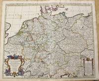
1700M7991Paris: S. Jallot c. 1700. Very Good. Notes: Map of Northern Germany Size : 650x460 mm 25.59x18.11 Inches Coloring: Original Hand Coloring Category: Maps Europe Germany; S. Jallot unknown
1657031360Paris: Anthoine Pas-de-Loup. 2 vols bound as one 188 284pp flower basket devices to title pages some browning minor marginal notes in contemporary full calf gilt with raised bands top of spine rubbed with some loss some loss at joint decorated panels ex-monastery library with A.W.N. Pugin designed bookplate to front paste-down rubbed . Good. Hardcover. 1st Edition. 1657. Anthoine Pas-de-Loup hardcover
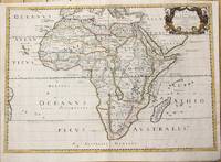
1650M6678Paris: Pierre Mariette c. 1650. Very Good;. Notes: Title cartouche bordered by two outward-facing birds of prey.<br><br>Norwich writes: "This is an early Sanson map. An odd feature is the name Barditus Mons given to a long chain of mountains running continuously from somewhere in Angolato Algoa Bay. No place names appear even on the coast of the southern part of the continent which is labelled 'Agi Symba' a name usually referring to the northern African region and inhabitants are 'Anthropophagi Aethiopes' or cannibals." Size : 396x553 mm 15.59x21.77 Inches Coloring: Hand Colored Reference: Norwich's Map 35. Category: Maps Africa Continent; Pierre Mariette unknown
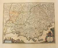
1656M6320Paris 1656. Very Good. Notes: This map shows the southern coast of France. Size : 425x535 mm 16.75x21 Inches Coloring: Original Hand Coloring Category: Maps Europe France unknown
167638217Paris: Sanson 1676. AN ATTRACTIVE MAP OF SPAIN AND PORTUGAL. 18 x 25 cm plate 23.5 x 32 cm sheet. FULLY COLORED by a later hand. Printed on fine laid paper. Reverse blank. A fine impression. A PRISTINE EXAMPLE with the paper FINE AND BRIGHT. Very scarce in such fine condition. <br/><br/> Sanson unknown
169255111692 Utrecht, François Halma, 1692 (suivant la copie à Paris, chez l'Auteur), 222pp. + tables. 10x16cm. Reliure en plein veau. Dos à 5 nerfs, richement orné et portant le titre en lettres dorées. Illustré d'un beau frontispice gravé. Marques de cire (cachet rouge ?) sur les gardes sinon bon exemplaire, envoi de photographies sur demande.
1696M10211Amsterdam: Covens & Mortier c.1696. Very Good. Size : 510x605 mm 20.08x23.82 Inches Coloring: Original Outline Coloring Category: Maps Europe Germany; Covens & Mortier unknown
165214178Paris: Sanson 1652. Double hemisphere world map showing the rivers and water bodies of the world. Original outline color. 20 3/4 x 15 3/4". Depicts Australia prior to Tasman's discoveries and labels North Australia "Beach" according to Marco Polo and California as an island. References: Shirley R.W. World 394. Sanson unknown
1654M5952Paris 1654. Very Good some mild discoloration along the margins. Size : 350x555 mm 13.75x21.875 Inches Coloring: Original Outline Coloring Reference: Gole 16; Nebenzahl 3.9B Category: Maps Asia South East Thailand Laos Vietnam Cambodia & Burma / Myanmar; Maps Asia Central India & Sri Lanka / Ceylon; unknown
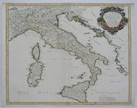
1665M5118Paris 1665. Very Good central fold reinfrced. Notes: There is a water mark on the right hand portion of the map. Size : 435x540 mm 17.125x21.25 Inches Coloring: Original Outline Coloring Category: ; Maps Europe Italy unknown
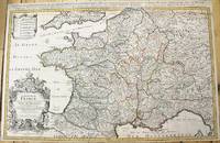
1690M10380Paris: H. Jaillot c.1690. Very Good backed on acid free tissue paper for long term preservation. Notes: Large and detailed map of France with a large decorative cartouche in the lower left two sheets joined. Size : 565x896 mm 22.24x35.28 Inches Coloring: Original Outline Coloring Category: Maps Europe France; H. Jaillot unknown
1655M5583Paris 1655. Very Good. Size : 385x535 mm 15.125x21 Inches Coloring: Hand Colored Category: Maps Africa North unknown
1666M1204Paris: Mariette Pierre 1666. Very Good. Size : 410x555 mm 16.125x21.875 Inches Coloring: Hand Colored Reference: Mojski Piotr Maria "Cartographia Rappersviliana Polonorum" page 388 number 32; Category: ; Maps Europe Poland Lithuania Mariette, Pierre unknown
1665M589Paris: Mariette Pierre 1665. Excellent. Size : 410x560 mm 16.125x22 Inches Coloring: Hand Colored Reference: Mojski Piotr Maria "Cartographia Rappersviliana Polonorum" page 387 number 31; Category: ; Maps Europe Poland Lithuania Mariette, Pierre unknown