(Robert DESNOS) - Maurice FOMBEUREBiblio.com

111 résultats
194325325Paris: Gallimard 1943. Fine. Gallimard Paris 1943 12 x 19 cm broché First edition one advance service de presse copy. Handsome autograph inscription signed by the author to Robert Desnos. Light and rare foxings on the upper cover a good copy. Gallimard unknown
1975319861975. Paris Editions Jean-Michel Place 1980. Un fort vol. au format in-4 297 x 208 mm non paginÂŽ. Reliure d'ÂŽdition de pleine percaline satinÂŽe cerise sous jaquette illustrÂŽe. Reprint de cette cÂŽlÂbre revue ; agrÂŽmentÂŽe de nombreuses illustrations. ''La RÂŽvolution surrÂŽaliste sera pendant cinq annÂŽe le creuset dans lequel vont se fondre les grands thÂmes de ce mouvement trÂs connu et toujours trÂs mystÂŽrieux le surrÂŽalisme. C'est l'incitation ˆ la vie dangereuse la sagesse de l'Orient l'engagement poÂŽtique la libÂŽration sexuelle l'amour la femme''. Dos et marge gauche du premier plat insolÂŽs. Infime altÂŽration affectant la coiffe supÂŽrieure de la jaquette. Du reste trÂs belle condition. b42961 unknown
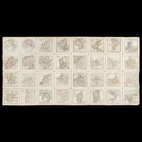
42554Paris : Desnos circa 1771. Thirty-two copperplate engraved maps each measuring 95 x 95 mm image and 115 x 115 mm sheet numbering in the upper right corner of each map; laid on linen overall measurements 470 x 940 mm; inscribed verso Presented by the Marquis St. Simon to A. Gordon with the initials M. G. another Gordon family member below and with another inscription crossed out; housed in a red morocco presentation case with gilt-tooled decoration and title ATLAS 125 x 125 mm lined with blue paper and silk. A rare configuration - possibly unique - of Desnos' Almanach géographique ou petit atlas élémentaire dissected and laid on linen in a fully contemporary presentation case. An inscription records that the cased atlas was presented - presumably to its second owner - by Claude Anne de Rouvroy Marquis de Saint-Simon-Montbléru 1743-1819 a highly significant figure in the American Revolutionary War. The Marquis de Saint-Simon sailed for the Caribbean in 1779 as a colonel in the Touraine regiment. In 1781 he arrived at Jamestown Virginia in command of 3500 French soldiers where he joined forces with a smaller American army under Lafayette. Between them Saint-Simon and Lafayette conducted the siege of Yorktown during which Saint-Simon's force succeeded in preventing Cornwallis and his troops from escaping northwards along the road to Williamsburg. Although he was badly wounded in the leg Saint-Simon refused to leave the lines until the British surrendered and insisted on mounting his horse in order to take part in the surrender ceremony. Saint-Simon was personally thanked by Washington for his contribution to the American cause in a letter written just before his return to the West Indies Library of Congress George Washington Papers Series 4 General Correspondence: George Washington to Saint-Simon October 24 1781. He was also made one of the original members of the Society of the Cincinnati the private patriotic organisation founded by Washington. In 2018 the American Revolution Institute of the Society of the Cincinnati in Washington D.C. announced its acquisition of a portrait of Saint-Simon painted between 1815 and 1818 by the Spanish artist Vicente Lopez. It is the only portrait in American institutional collections of this lesser-known yet important participant in the Revolutionary War. Louis-Charles Desnos was one of the most prolific and influential map and globemakers of his age at a time when Paris was the leading centre of map production in Europe. Desnos married the widow of Nicolas Hardy son of Jacques Hardy a globemaker active during the period 1738-1745. Desnos acquired Hardy's inventory and tools and expanded the company also acquiring the inventories of the Jaillot family and of Nicolas de Fer. Desnos would be appointed Royal Globemaker to King Christian VII of Denmark and continued publishing throughout the late eighteenth century. Desnos first published his miniature atlas in 1770; it would be reissued in two volumes later the same year and again in 1771 with the addition of plate numbers to the maps as in the present example. The maps are titled: Hemisphere Orientale; Hemisphere Occidentale; Europe; Asie; Afrique; Amerique Septentrionale; Amerique Meridionale; Royaume de France; La Suisse diviseÌe en ses xiii cantons et ses allies; L’Italie; DucheÌs de Savoye et Piemont; Le Royaume de Naple et de Sicile; Royaume de Sardaigne; Royaume de Corse; Espagne et Portugal; Royaume de Portugal; Les Isles Britanniques; Pays Bas septentrionaux; Pays Bas meridionaux; L’Empire d’Allemagne; Royaume de Boheme na. les 16 cercles portent le nom de leurs capitales; Royaume de Prusse; Le Royaume de Hongrie; Royaume de Pologne; Royaume de Danemarck; Suede et Norwege; Suede et Norwege septentrionales; Suede et Norwege meridionales; Russie d’Europe; Turquie d’Europe; Russie d’Asie partie occidentale; Russie d’Asie partie orientale. We can locate no other examples which have been laid on linen and specially housed in a morocco case. The present example originally owned by a significant figure in the Revolutionary War is possibly a uniquely prepared copy with a purpose-made sturdy leather case portable and eminently suited to being carried in the pocket of a military coat. hardcover
191928447Paris: Maison du livre 1919. Fine. Maison du livre Paris 1919 12.50 x 19 cm broché First edition on ordinary paper. Ecstatic autograph inscription signed full-page by the author to Robert Desnos : ""Merde / Robert Desnos"". Spine faded repaired first cover lined with small marginal repairs lower cover missing. A precious relic. Maison du livre unknown
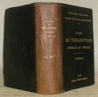
190177326Paris : Octave Doin 1901. 180x130mm. reliure percaline de lÕditeur. Tranches marbres. du possesseur sur la haut de la page de garde suprieure. Dos insol. Bel exemplaire. 738 Octave Doin unknown
1940121984Wolf 1940. Paperback. Very Good. #26 of 297 on Velin de Luxe total limitation is 400 softcover in original glassine jacket with Masson's initials to limitation page. Text is in French illustrated throughout including image tipped into front cover. Tight and unmarked with dime sized blemish to rear cover and last 2 pages. oversized and overweight. Please email for photos. Wolf paperback
1940388263Rouen: Wolf 1940. Softcover. Very Good. First edition. Quarto. Green wrappers with applied illustration. Copy number 254 of 297 on velin de Luxe initialed by Masson. Small nicks and tears spine sunned and with small chips at the extremities an about very good copy in chipped original unprinted glassine. Uncommon tribute volume with text by his famous artist contemporaries. Wolf unknown
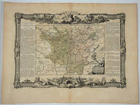
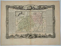
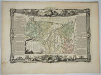
176818497Paris: Desnos 1768. Attractive map of this famed wine area of France. Includes Besancon Baumes Bourg Charillon Langres Tonnerre Dijon Auxonne. Long columns of descriptive text along the left and right of the map. Map measure 17 x 15.5" with large border. Attractive "military" motif border original color on the map. Very good condition. Desnos unknown
176522130Paris 1765. 4to. Grangé Guillyn Desnos et al. Contemporary gold- and blind-tooled marbled calf sewn on 5 supports with the corresponding raised bands on the spine a red morocco title label on the spine lettered in gold a blind-tooled triple fillet border on both boards gold-tooled board edges red edges marbled end papers. With a double-page frontispiece by Le Charpentier after De Sève with a view of the Place de la Concorde in Paris 2 large folding engraved maps of France by Rizzi Zannoni 40 double-page engraved maps and charts of France 10 folding road maps 2 "Cartes odographiques" with the distances between French cities and 3 double-page engraved part-titles all but the frontispiece and titles in a contemporary hand colouring. 2 works in 1 volume the first in 3 parts. 15 1 blank 3 1 blank 8 10; 16 pp. 56 plates First edition of a rare atlas of France mapping out the country from all possible useful points of view. The work includes "analytical" maps which divide France in many ways showing not only the various geographical and political divisions of the country but also the military ecclesiastical juridical genealogical commercial and financial divisions and even hunting territories. The atlas also includes a small sea-atlas with 3 charts showing the French coasts as well as a French road atlas mapping out all the travelling routes of France. The maps were all made under the direction of Louis Charles Desnos 1725-1805 but they were drawn by various mapmakers. Several of the analytical maps and all sea charts were drawn by Rizzi Zannoni and all the road maps by Michel Royal geographer and engineer of the Paris Observatoire. This important geographical compendium drawn primarily from the cartographic collections of Desnos is structured around three series of maps: the Tableau analytique de la France Le petit Neptune and L'indicateur fidèle. All maps 52 in total were newly made and dated 1763-5. In the present composition published by Louis Brion de la Tour ca. 1745-1823 the atlas is in first edition and exactly as issued with all maps including the part-titles dated 1765. Most maps are set within broad ornamental borders and are attractively hand-coloured. After the maps three additional texts follow: the Prospectus du guide des voyageurs pour des routes royales & particulières de la France & autres a Catalogue alphabetique des routes royales et particulières and a Catalogue alphabetique du supplement des 1380 villes de France. Of particular interest is the added catalogue of the stock of Mr. Desnos who was a Paris publisher bookseller and engineer geographer of globes and spheres at Paris. All parts of the present atlas are offered for sale in the catalogue separately as well. With remnants of 2 bookplates mounted on the front pastedown an ownership annotation "Mailly" on the title page. The boards are somewhat scratched with some loss of material. Two maps are browned. Otherwise in very good condition.l Cf. Phillips 2990-2993 all three parts separate with the "Neptune" and "L'Indicateur" dated 1766; Quérard I 515. hardcover
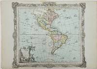
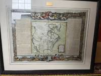
1786357069Brion. 1786. Short tear with no loss to centerfold marginal toning otherwise very good. 29x40.8x0.1 cm. Image size: 28x31.5 cm. Engraved map of the Americas with a decorative border. Old color. The details of the Pacific Northwest are speculative and poorly defined. Decorative title cartouche. Several ships sail the ocean. weight: 0.1 lb. Brion. unknown
1792005599Paris: Veuve Hérissant 1792. Half Calf. Very Good. Exceptionally richly hand-colored French atlas. Elephantine folio 56 by 44 cm. Following title page which contains table of contents as well six two paged hand-colored maps. The first map with its large allegorical cartouche is especially spectacular but all the maps are beautiful and noteworthy for the quality of their coloring. Scarce with copies held by BNF Bibliotheque Sainte-Genevieve Leiden and the National Library of Scotland according to OCLC and not clear whether all of these copies are hand-colored. Corner dampstains most pronounced on title then receding as progress. While unquestionably noticeable on the first map in our view it doesn't seriously detract from the beauty of the map. Other light scattered soiling which again we do not find disconcerting. Some scuffing of the binding. While half calf technically the calf coverage of the boards is minimal. Veuve Hérissant unknown
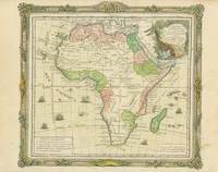
2503588<p>LAfrique dressee pour letude e la geographie with an attractive cartouche and decorative engraved Roccoco frame wholly intact which is quite unusual. This attractive map is based on Delisles modern 1700 map and is by Louis Brion de la Tour cartographer royal and published by Louis Desnos in 1776. Not in Tooley.</p><p>1766. 27.5 x 24 cm. Printed on heavy paper and in fine condition; later colouring. Book No: 2503588</p> unknown
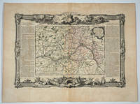
176820082Paris: Desnos 1768. Attractive map of this famed Loire River and chateaux area of France. Includes Angers Saumur Tours Blois Orleans and Sancerre. Long columns of descriptive text along the left and right of the map. Map measure 17 x 15.5" with large border. Attractive "military" motif border original color on the map. Very good condition. Desnos unknown
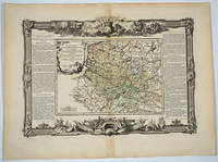
176820083Paris: Desnos 1768. Attractive map of this famed area of France. Includes the area from Normandie in the west to the champagne region of Rhiems in the east. Long columns of descriptive text along the left and right of the map. Map measure 17 x 15.5" with large border. Attractive "military" motif border original color on the map. Very good condition. Desnos unknown
176818494Paris: Desnos 1768. Attractive map of this area of southern France. Long columns of descriptive text along the left and right of the map. Map measure 17 x 15.5" with large border. Attractive "military" motif border original color on the map. Desnos unknown
176818496Paris: Desnos 1768. Attractive map of this area of France. Includes Beaujolais Clermont Riom Aurillac Roanne Montbrison. Long columns of descriptive text along the left and right of the map. Map measure 17 x 15.5" with large border. Attractive "military" motif border original color on the map. Very good condition. Desnos unknown
176818498Paris: Desnos 1768. Attractive map of this area of France. Includes Bordeaux La Rochelle Bayonne Limoges Angouleme Bourg. Long columns of descriptive text along the left and right of the map. Map measure 17 x 15.5" with large border. Attractive "military" motif border original color on the map. Very good condition. Desnos unknown
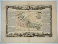
176618495Paris: Desnos 1766. Attractive map of this area of northeastern France. Includes Dunkirk Aire the Ardenne forest Maubeuge Philippeville Lille. Long columns of descriptive text along the left and right of the map. Map measure 17 x 15.5" with large border. Attractive "military" motif border original color on the map. Desnos unknown
1984258724Presses du monteil 1984. Etat Correct bords frottés couverture jaunie livres percé de 4 trous à chaque coins intérieur frais. in8. 1984. Broché. traduction de Erna Liebscher Presses du monteil unknown
176667669Paris: c.1766. A fine and handsome map of the British Isles with an inset of Orkneys and Shetland islands and a very ornate title cartouche. The map is flanked by informative text in French pertaining to the British Isles.The map is surrounded with a very pleasing "framed" effect border decoration. Published in the "Atlas Generale Civil et Ecclesiastique". Size: 390 x 575 mm. Copperplate engraving with later hand colour. Good condition. unknown
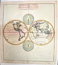
1780M1807Paris 1780. Very Good both right and left margins are extended. Notes: Louis Charles Desnos 1725-1805 was a French geographer of the 18th century. A Parisian map seller bookseller; and globe maker. He made globes for the King of Denmark Christian VII. Size : 262x305 mm 10.31x12.01 Inches Coloring: Hand Colored Category: Maps World unknown
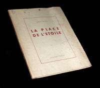
1945225011945. Rodez Collection Humour 1945. Un vol. au format pt in-4 242 x 192 mm de 91 pp. brochÂŽ sous couverture ˆ rabats rempliÂŽs. Edition originale pour laquelle il n'est pas fait mention d'un tirage en grands papiers. ''MÂŽconnue rarement jouÂŽe "La Place de l'ƒtoile" fut ÂŽcrite ˆ la fin des annÂŽes 1920 par Robert Desnos l'un de nos plus grands poÂtes surrÂŽalistes. Ce chef-d'Ãuvre de dr™lerie insolite se compose de neuf scÂnes o se croisent d'improbables personnages ˆ la fois proches et fuyants en une balade ÂŽtoilÂŽe aux multiples branches.'' Plats prÂŽsentant de discrÂtes rousseurs ainsi qu'un ÂŽclat lÂŽgÂrement altÂŽrÂŽ. Papier lÂŽgÂrement jauni. TrÂs rares rousseurs dans le texte. Nonobstant belle condition. b42961 unknown
1994021440Atlas 1994 168 pp. 4 surrealist novels. Covers have some light shelf wear. Atlas paperback
176620022Paris 1766. No Binding. Fine. Folio - over 12 - 15" tall. Artist: Desnos Louis Charles - 1805 Paris; issued in: Paris; dated: 1766 27x16 inches or 56x40cm plus matting and frame. <br/> <br/> unknown
2011758106.Gpaperback. Good. Access codes and supplements are not guaranteed with used items. May be an ex-library book. paperback