917 résultats
198260814Art Center. As New. 1982. Paperback. FREE UPGRADE to Courier/Priority Shipping Upon Request IN STOCK AND IMMEDIATELY AVAILABLE FOR SHIPMENT - AS NEW THE TEXT BLOCK IS PRISTINE CLEAN UNMARKED AND IN EXCELLENT CONDITION - - Text in English. 48 pp. With 20 ills. 7 col. . 24 x 21 cm. -- with a bonus offer-- . Art Center paperback
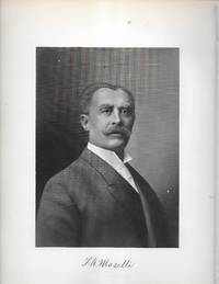
023850Print. VG. No Binding. No date circa 1900 sized about 9 x 12 inches very sharp clean and bright suitable for framing. Rochester NY businessman born in Italy married Rosa Andrews then Mary Hill. unknown
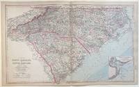
1884303738Philadelphia: O.W. Gray & Son 1884. unbound. Map. Engraving with original hand coloring. Image measures 17 1/4" x 28 3/8"<br/> <br/> Large double-page map of of the Carolinas divided into counties and townships. Shows all major towns and cities routes railroads and waterways. Topography and marshlands are impressively depicted with relief shown by hachure. The coastline is rendered in great detail with inlets shoals lighthouses and other features labeled. This map includes an inset of Charleston Harbor and its approaches including depths by soundings. <br> <br> Ormando W. Gray was a map publisher active in the later half of the 19th century. A civilian engineer and surveyor he worked with several other map publishers like Henry Walling and Colton. His state and county atlases are well known. Frank A. Gray presumably a relative produced many maps that were published by the family firm O.W. Gray & Sons. This map is a lovely example of their work.<br/> <br/> O.W. Gray & Son unknown
1993556331993. O'REILLY Frank A. The Fredericksburg Campaign. "Stonewall" Jackson at Fredericksburg. The Battle of Prospect Hill December 13 1862. Lynchburg VA: H. E. Howard 1993. 1st ed. 243 pp. Illus. portraits maps. Orig. pictorial cloth. Fine in d/j. One of 1000 signed numbered copies. Uses many letters and diaries to tell the story of Jackson's campaign. unknown
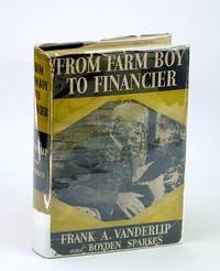
1935322H1616New York: D. Appleton-Century Company Incorporated 1935. Book. Good. Hardcover. First Edition. 8vo - over 7¾" - 9¾" tall. vi 2 312 pp. Index. Black and white photographic plates including frontis portrait of Vanderlip who rose from humble beginnings to become head of National City Bank. This work most notable for Chapter XXI entitled 'A Conclave on Jekyl Island' which states: "There was an occasion near the close of 1910 when I was as secretive indeed as furtive as any conspirator. I do not feel it any exaggeration to speak of our secret expedition to Jekyl Island as the occasion of the actual conception of what eventually became the Federal Reserve System." - page 210. Moderate wear to book. Binding intact. Slight lean to spine. Gift greetings dated 1935 upon front free endpaper. Above-average wear to dust jacket now in mylar which lacks a two-inch piece from bottom of spine. Includes news clipping detailing the settlement of Vanderlip's estate. A worthy copy of this historic reference. D. Appleton-Century Company Incorporated Hardcover
0983680329.Ghardcover. Good. Access codes and supplements are not guaranteed with used items. May be an ex-library book. hardcover
189648708Boston MA: Bradlee Whidden. VG. 1896. 1st Edition. Hardcover. Hardback in Very Good condition without dust jacket. . 8vo 8" - 9" tall. 118 pages. Chippping and tear to rear endpaper; ink ownership bookplate and signature. . Quick Shipping All Books Mailed in Boxes Free Tracking Provided . Bradlee Whidden hardcover
19372000040509McGraw-Hill Book 1937. McGraw-Hill Book 1937 First Edition Fine/ Charcoal cloth with gold spine lettering and lines. Sixth Impression. x344 pages with index. HEAVY OVER SIZE ITEM 2.0 Pounds. . First Edition. Hardcover. Fine. No Exp. McGraw-Hill Book Hardcover
1983Q-0890293112Morningside Bookshop 1983-09-01. Hardcover. New. In shrink wrap. Looks like an interesting title! Morningside Bookshop hardcover
112758Contstable 1924. Octavo royal blue buckram boards with gilt lettering and illus to front and spine xvi 432pp frontis illus; VG tanning moderate foxing light rubbing INSCRIBED BY AUTHOR Contstable 1924 hardcover
0805779035.Ghardcover. Good. Access codes and supplements are not guaranteed with used items. May be an ex-library book. hardcover
1138577898.Gpaperback. Good. Access codes and supplements are not guaranteed with used items. May be an ex-library book. paperback
2017x-1138577804Routledge 2017. Hardcover. New. 490 pages. 9.21x6.14x1.18 inches. Routledge hardcover
29774320like new. unknown
29774320-nnew. unknown
20192-1138577898Routledge 2019. Paperback. New. 490 pages. 9.21x6.14x1.06 inches. Routledge paperback
20121353604PN. New. 2012. Soft Cover. Date is original print. This is a reprint edition. . PN paperback
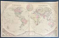
328201Washington: O.W. Gray & Son. William H. Holmes. Map. Hand colored engraving. Sheet measures 17" x 27 1/4"<br/> <br/> Fascinating double hemisphere map surrounded by infographics showing comparative rivers mountains and local times. The maps are highly detailed with countries regions major cities rivers and topography labeled. In the upper corners the world's rivers are unfurled and laid out in order of total length creating a triangular shape that is mirrored on the bottom half of the chart by an arrangement of the world's mountains. Divided by continent and hemisphere the mountains are arranged from smallest to tallest with peaks and heights labeled. Mountains of the United States of lower elevations than global mountain ranges are included along the center bottom. In the top center a time diagram that appears as a clock shows estimations of local time of the fifty principal cities of the world. <BR> The map is in very good condition with minor wear to centerfold. <br> <br> Ormando W. Gray was a map publisher active in the later half of the 19th century. A civilian engineer and surveyor he worked with several other map publishers like Henry Walling and Colton. His state and county atlases are well known. Frank A. Gray presumably a relative produced many maps that were published by the family firm O.W. Gray & Sons.<br/> <br/> O.W. Gray & Son unknown
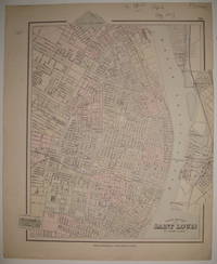
1883227686Philadelphia: O.W. Gray & Son 1883. unbound. very good. Map. Engraving with original hand coloring. Image measures 15 5/8" x 13".<br/> <br/> Beautifully detailed map of St. Louis colored according to wards. Shows street grid railroads parks reservoirs and public institutions. Small tear and crease to right edge light stain to left margin.<br/> <br/> O.W. Gray & Son unknown
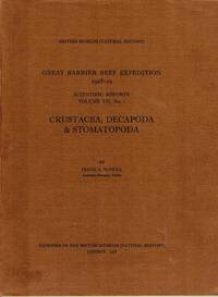
1968102850London: Trustees of the British Museum Natural History. 1968. Quarto original printed wraps chart text figures two b&w photographic plates pp 98 ii. Near-fine condition. Report on 212 species found on the reef. 1st Edition. Stiff Wraps. Trustees of the British Museum (Natural History) paperback
1528106334.Gpaperback. Good. Access codes and supplements are not guaranteed with used items. May be an ex-library book. paperback
1021096547.Ghardcover. Good. Access codes and supplements are not guaranteed with used items. May be an ex-library book. hardcover
1140488996New. Brand new and still unused unknown
1967012405New York: John Wiley and Sons 1967. Book. Very Good. Cloth. 8vo - over 7¾ - 9¾" tall. xi 168pp. index biblio. Some light wear and a few small blemishes to jacket. John Wiley and Sons Hardcover
2006Q-141292751XSAGE Publications Inc 2006-12-19. Paperback. New. In shrink wrap. Looks like an interesting title! SAGE Publications, Inc paperback