Brown, William/ Fleming, David HBiblio.com

2 805 résultats
2020x-147446372XEdinburgh Univ Pr 2020. Hardcover. New. 316 pages. 9.25x6.25x0.25 inches. Edinburgh Univ Pr hardcover
38609877-nnew. unknown
38609877like new. unknown
2025__0844495964Library of Congress 2025. Hardcover. New. 168 pages. 9.00x9.00x1.00 inches. Library of Congress hardcover
20251-0844495964Library of Congress 2025. Hardcover. New. 168 pages. 9.00x9.00x1.00 inches. Library of Congress hardcover
2002Q-0321100352Pearson 2002-08-24. Paperback. New. In shrink wrap. Looks like an interesting title! Pearson paperback
1990Q-0801301785Longman Pub Group 1990-01-01. Paperback. New. In shrink wrap. Looks like an interesting title! Longman Pub Group paperback
111484Paris, Puf, Presses Universitaires de France 1993, 240x175mm, 270pages, broché. Bel exemplaire.
342346Fernand Hazan Paris 1947 Fort in-8 ( 230 X 140 mm ) de 271 pages, broché sous couverture imprimée rempliée, chemise et étui. 5 eaux-fortes originales hors-texte, dont une en frontispice, de Hermine DAVID rehaussées au pochoir par Beaudin. Tirage à 2000 exemplaires sur vélin du Marais. Bel exemplaire.
332792-nnew. unknown
2001DADAX0786410957McFarland 2001-11-27. paperback. New. 6.00x0.56x9.00. Buy with confidence. Excellent Customer Service & Return policy. McFarland paperback
1993x-0582090970Addison-Wesley Longman Ltd 1993. Paperback. New. 3rd sub edition. 248 pages. 9.25x6.25x0.50 inches. Addison-Wesley Longman Ltd paperback
2026__0443249725Elsevier 2026. Hardcover. New. 10 edition. 1840 pages. 10.87x8.50 inches. Elsevier hardcover
20192-032354424XElsevier Science Health Science 2019. Hardcover. New. 9th har/psc edition. 1896 pages. 12.00x8.00x4.00 inches. Elsevier Science Health Science hardcover
1986Q-029270755XUniversity of Texas Press 1986-04-01. Paperback. New. In shrink wrap. Looks like an interesting title! University of Texas Press paperback
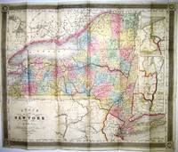
183821432New York: J.H. Colton 1838. 16mo cloth with title stamped in gilt on front board. Folding pocket map in full period color. 15.5" x 13." Near Fine pinsize closed split at a fold intersection with no loss. Insets of the Hudson River Valley and Niagara River are included. J.H. Colton unknown
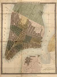
1832321720New York: David H Burr 1832. Map. Hand-colored engraving. 14 x 18.75 inches with original brown leather booklet.<br/> <br/> This important map of New York City was issued as a pocket map around 1832 by David Burr. It covers lower Manhattan from roughly 30th street south to include the northernmost parts of Brooklyn and Williamsburg which at the time were separate cities. Incredibly detailed it notes churches ferry lines government buildings parks squares and other important landmarks. Columbia College is noted on Murray Street. The old Fulton Fish Market St. Mark's Church in the East Village and the nation's first hospital at Bellevue are also identified. Burr's Map Store is noted near City Hall although we can't be sure if it was real or fictitious made up specifically for this map. The map is in good condition with some spotting and toning especially along the original fold lines. Some manuscript ink notations alone the top left margin. Backed with restoration paper for stability.<br> <br> David H. Burr 1803-1875 was a significant American cartographer and map publisher known best for his 1826 Atlas of the State of New York one of the most important state atlases in history. His rigorous research and surveying won him accolades particularly later in life when he was granted a number of civic offices in recognition of his high-quality work. He served as Topographer to the United States Post Office and Geographer to the House of Representatives and was widely known for his accuracy and attention to detail. This beautiful map is a fascinating piece of New York City history.<br/> <br/> David H Burr unknown
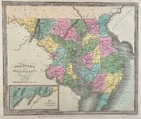
1833309705New York: Illman and Pilbrow 1833. unbound. Thomas Illman. Map. Engraving with original hand coloring. Image measures 10 1/2" x 12 5/8"<br/> <br/> Early map of Delaware and Maryland beautifully hand colored to show county divisions. Cities towns major routes topograhical features islands and waterways are labeled. An inset in the lower left shows the Western Part of Maryland. <br> <br> David H. Burr 1803-1875 served as Topographer to the United States Post Office and Geographer to the House of Representatives and was widely known for his accuracy and attention to detail. His "Universal Atlas" was the first to map each of the United States individually.<br/> <br/> Illman and Pilbrow unknown
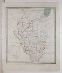
1836M2568New York: Illman Thomas & Pilbrow 1836. Excellent with tiny scratch in the middle left side of the map. Notes: From David Burr's "A new Universal Atlas comprising Separate Maps of all the Principal Empires Kingdoms & States Throughought the World" 1836 New York. Size : 332x296 mm 13x11.625 Inches Coloring: Original Outline Coloring Category: Maps United States Midwest States; Illman, Thomas & Pilbrow unknown
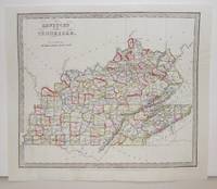
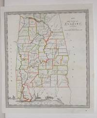
1836M2580New York: Illman Thomas 1836. Excellent. Notes: From David Burr's "A new Universal Atlas comprising Separate Maps of all the Principal Empires Kingdoms & States Throughought the World" 1836 New York. Size : 294x293 mm 11.625x11.5 Inches Coloring: Original Outline Coloring Category: Maps United States South States; Maps United States Midwest States; Illman, Thomas unknown
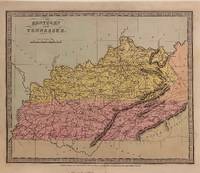
1834306029New York: Wm. Hall & Co 1834. unbound. Thomas Illman. Map. Engraving with original hand coloring. Image measures 10 3/8" x 12 5/8"<br/> <br/> Early map of Kentucky and Tennessee. Shows towns major routes waterways and topographical features. Published after the passage of the Indian Removal Act 1830 but before Cherokee Removal in 1838 this map does not label Cherokee Territory in the southeast territory as most maps from this time period do.<br> <br> David H. Burr 1803-1875 served as Topographer to the United States Post Office and Geographer to the House of Representatives and was widely known for his accuracy and attention to detail. His "Universal Atlas" was the first to map each of the United States individually.<br/> <br/> Wm. Hall & Co unknown
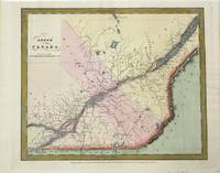
1834M10162New York: Illman & Pilbrow 1834. Very Good. Size : 293x350 mm 11.54x13.78 Inches Coloring: Hand Colored Category: Maps Canada East Quebec; Illman & Pilbrow unknown
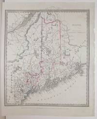
1836M2563New York: Illman Thomas 1836. Excellent. Notes: From David Burr's "A new Universal Atlas comprising Separate Maps of all the Principal Empires Kingdoms & States Throughought the World" 1836 New York. Size : 304x268 mm 12x10.5 Inches Coloring: Original Outline Coloring Category: Maps United States New England States; Illman, Thomas unknown
1836M2575New York: Illman Thomas & Pilbrow 1836. Excellent; Some scratching along the left side of the map. Notes: From David Burr's "A new Universal Atlas comprising Separate Maps of all the Principal Empires Kingdoms & States Throughought the World" 1836 New York. Size : 322x285 mm 12.625x11.25 Inches Coloring: Original Outline Coloring Category: Maps United States South States; Illman, Thomas & Pilbrow unknown
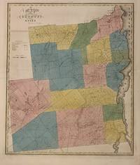
1829300575New York 1829. unbound. Rawdon Clark & Co. Map. Engraving with original hand outline color. Image measures 22 x 18 1/4 inches. Some chips to margins and repairs to left centerfold but otherwise in good condition.<br/> <br/> This 1829 map depicts Essex County in the high peaks region of the Adirondacks divided into 17 towns in full vivid color. Lake Champlain forms the right border of the region and Lake Placid yet unnamed appears in the upper left. The map denotes major routes waterways and topographical details and icons label villages flouring mills factories forges saw mills and churches. This first edition of Burr's county map appeared in his "Atlas of the State of New York" of the same year which was the second atlas of an individual state ever published. The map is in good condition with light foxing throughout and some ink stains in the lower right margin not affecting the image. Full original margins. <br> <br> David H. Burr 1803-1875 served as Topographer to the United States Post Office and Geographer to the House of Representatives and was widely known for his accuracy and attention to detail. His "Universal Atlas" was the first to map each of the United States individually. This map is a lovely rendering of a scenic area in New York State.<br/> <br/> unknown