Burr, David HBiblio.com
2 805 résultats
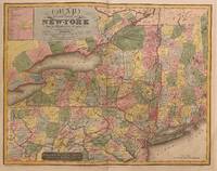
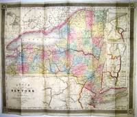
183821432New York: J.H. Colton 1838. 16mo cloth with title stamped in gilt on front board. Folding pocket map in full period color. 15.5" x 13." Near Fine pinsize closed split at a fold intersection with no loss. Insets of the Hudson River Valley and Niagara River are included. J.H. Colton unknown
1993x-0471591335Wiley-Interscience 1993. Hardcover. New. 416 pages. 9.75x6.75x1.25 inches. Wiley-Interscience hardcover
SLIVCN-9781616683412NOVA SCIENCE PUBLISHERS INC (10/2010)
1856RBURMAP00fpGovernment Printing Office 1856. Very Good. Burr David H. Map Showing the Extent of Surveys in the Territory of Utah 1856. Washington D.C.: Government Printing Office 1856. one folded sheetpp. 17 "" x 34"". Framed folded sheet map. Book condition: Very good. Light toning along folds. Framed under glass in frame with a few nicks and scratches. A Nice copy of a map extracted from a General Land Office Report. Map shows land surveyed along the Wahsatch front from the Bear River Valley to just south of Utah Lake. Government Printing Office unknown
1850526223New York: C.S. Francis & Co 1850. Hardcover. Very Good. 12mo. xvi 172 4pp. with a folded engraved map: “Map of the City of New York†drawn by D.H. Burr. Illustrated with an engraved frontispiece plate an added engraved title page and several other engraved plates of public buildings. The 1850 edition includes a new introduction and the map by Burr is accompanied with a letterpress street directory. Publisher’s red decorative cloth stamped in blind and gold on front cover and spine and in blind only on back cover cream endpapers. Contemporary owner’s name in light pencil on front free endpaper. The boards are rubbed with light wear at the spine ends and corners the folded map has a few small light creases and one short closed tear very good or better with some light foxing. An attractive well-preserved copy of an early New York City Stranger’s guide uncommon in such very good condition. OCLC locates only six copies. C.S. Francis & Co hardcover
59009Philadelphia: P. S. Duval & Son Lith. Map. Good . Published as part of Sen. Ex. Doc. No. 5. 3d. Sess. 34 Cong. Map 17 1/2" x 33 1/4" with fold tears and a complete horizontal tear through the lower third. There is a loss from the top border that measures 8 1/2" long by 1/2" deep does not affect image. Moffat 44. A grid map from one of the first significant American map publishers. He was responsible for producing the 1829 "Atlas of the State of New York" the second atlas of an individual U.S. state.<br /> <br /> Moffat notes "There are many different names on this map: Santaquin is 'Summit Cr.'; Pleasant Grove is 'Battle Cr.'; Alpine is 'Mountainville'; Draper is 'Willow Cr.'; Brigham City is 'Box Elder'; and North Ogden is 'Ogden Hole.' P. S. Duval & Son Lith unknown
1992__0471558842Wiley-Interscience 1992. Hardcover. New. volume 17 edition. 384 pages. 9.50x6.25x1.00 inches. Wiley-Interscience hardcover
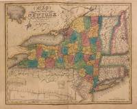
1840312198New York: Stone and Clark 1840. Rawdon Clark & Co. Map. Copper plate engraving with original hand coloring. Image measures 19 3/4" x 25"<br/> <br/> Rare map of New York state and parts of Pennsylvania Connecticut Massachusetts New Jersey Vermont and New Hampshire divided into counties and vibrantly colored. Denotes cities towns major routes waterways and topographical features all in beautiful detail. A table in the upper left lists Congressional and Senatorial districts. On the map Senatorial districts are outlined and numbered. Updated from the 1829 map with changes to the counties and Railroad routes are featured. In very good condition with minor wear to margins. Lower left corner creased and flattened. <br> <br> David H. Burr 1803-1875 served as Topographer to the United States Post Office and Geographer to the House of Representatives and was widely known for his accuracy and attention to detail. His "Universal Atlas" was the first to map each of the United States individually.<br/> <br/> Stone and Clark unknown
BN97453Bromeliaceae: Profile of an Adaptive Radiation. With contributions by B. Bennett G. Brown M. Dimmitt H. Luther I. Ramirez R. Terry W. Till. <br/><br/>Bromeliaceae: Profile of an Adaptive Radiation. With contributions by B. Bennett G. Brown M. Dimmitt H. Luther I. Ramirez R. Terry W. Till. unknown
2000BN129922Cambridge University Press 2000. 2000. Bromeliaceae: Profile of an Adaptive Radiation. With contributions by B. Bennett G. Brown M. Dimmitt H. Luther I. Ramirez R. Terry W. Till. <br/><br/>Bromeliaceae: Profile of an Adaptive Radiation. With contributions by B. Bennett G. Brown M. Dimmitt H. Luther I. Ramirez R. Terry W. Till. Benzing David H. Cambridge University Press unknown
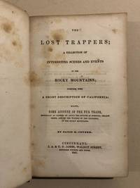
184753428Cincinnati: J. A. & U. P. James 1847. 1847. First edition. First Edition. 12mo. Original blind-stamped Cloth with title in gilt on spine. xv 16 - 255 pp. blank plus 7 pp. of Advertisements Introduction Appendix. Graff 897 says "Howes and Wagner-Camp suggest doubt about the veracity of the author the "lost trappers" were from the Lewis and Clark Expedition. Some statements in the work are demonstrably untrue but there are sections which may be proven authentic." Coyner a Presbyterian preacher sojourning in Missouri claims to have compiled this narrative on behalf of a Virginia newspaper seeking frontier material basing it on an old musty mutilated journal kept by Ezekial Williams a Kentucky-born trapper. The main incidents concern the wanderings and adventures and his colleagues in the Rocky Mountains from 1809 to 1813 and the overland journey of two of them - the "Lost Trappers" - to California in 1809-1810. One of the early pictures of California. Professionally rebacked with original cloth spine retained and a little touch-up to corners. Modest amount of foxing scattered throughout. In all a very good copy of a fur trade classic. Interesting small 1"x2" old label of merchant that sold this book affixed to upper front endpaper reads: A. D. Sproat Druggist Chillicothe O. J. A. & U. P. James, 1847. hardcover
1938291283france saint - lo imprimerie de la manche first edition 1938 softcover. very good signed one of 100 copies numbered a little rough page edges black mark crossing out some words below the cover date. very nice condition for this delicate book. small spine end chips but the spine is intact which is rare france, saint - lo, imprimerie de la manche paperback
1993DADAX0471591335Wiley 1993-05-14. 1. hardcover. New. 6.30x0.98x9.29. Buy with confidence. Excellent Customer Service & Return policy. Wiley hardcover
1829312199New York 1829. unbound. Rawdon Clark & Co. Map. Copper plate engraving with original hand coloring. Image measures 19 7/8" x 25.25".<br/> <br/> Stunning rare map of New York state divided into counties. Denotes towns major routes waterways and topographical features all in beautiful detail. Includes insets of three canal profiles Champlain Seneca and Erie. Part of Upper Canada and Lake Huron included. New England also included in outline color. In good condition with foxing and toning near center fold and surface dirt with a crease in the lower left portion. David H. Burr 1803-1875 served as Topographer to the United States Post Office and Geographer to the House of Representatives and was widely known for his accuracy and attention to detail. This atlas was among the first to map each of the United States individually.<br/> <br/> unknown
291285perri first edition stapled booklet style. 19498 10 b/w tipped in artworks by different artists to accompany the story almost near fine perri unknown
20192-032354424XElsevier Science Health Science 2019. Hardcover. New. 9th har/psc edition. 1896 pages. 12.00x8.00x4.00 inches. Elsevier Science Health Science hardcover
1993SONG0471591335Wiley 1993-05-14. 1. hardcover. Used: Good. 6.30x0.98x9.29. Buy with confidence. Excellent Customer Service & Return policy. Wiley hardcover
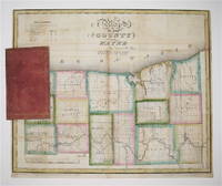
1829233728New York 1829. unbound. Rawdon Clark & Co. Map. Copper plate engraving with original hand outline color. Map attached to red leather binding as issued title stamped in gold. Image measures 12 1/2 x 15".<br/> <br/> This rare fold-out pocket map depicts Wayne County in northwest New York on Lake Ontario divided into 15 towns outlined in vivid color. The map denotes major routes waterways and topographical details. Icons label villages flouring mills factories forges saw mills and churches. The map was published in 1829 during the Second Great Awakening which brought attention to this region of the state as a major site of religious revival. In particular the village and town of Palmyra which appear on the map served as an important site of discovery for Joseph Smith later the founder of the Mormon Church. The map is in excellent condition with no tears of any kind. Some scattered staining especially along original folds. It is attached to its original leather cover and the watermark of the paper is visible. David H. Burr 1803-1875 served as Topographer to the United States Post Office and Geographer to the House of Representatives and was widely known for his accuracy and attention to detail. Burr was one of the first cartographers to map each of the United States individually. Issued separately rather than included in his seminal "Universal Atlas" this pocket map is a scarce version of Burr's celebrated work.<br/> <br/> unknown
1856RBURMAP00abs1856. Good. Burr David H. Map Showing the extent of Surveys in the Territory of Utah 1856 Wahsatch and Salt Lake. NP: NP 1856. 16.5"" x 35"". paper with matboard. Book condition: Good with slightly bumped edges. Slight soiling yellowing and creasing. Closed tears in center of map yet do not interrupt image. ""Examined and approved this 30th Sept. 1856 Sur Gen David H. Burr of Utah"". Extends from Mt Nebo up to Cache and Hansel Spring Valleys. Includes eastern shore of the Great Salt Lake. unknown
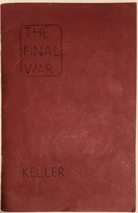
19491404Portland Oregon: Perri Press 1949. Good condition/None. Berry D. Bruce William Kroll Ralph Rayburn Phillips Con Pederson John Grossman Ken Brown John Cockroft Miles Eaton O. G. Estes and Donald B. Day. The Final War David H. Keller illustrators D. Bruce Berry William Kroll Ralph Rayburn Phillips Con Pederson John Grossman Ken Brown John Cockroft Miles Eaton O. G. Estes and Donald B. Day Perri Press Portland Oregon 1949. 8.5 x 5.5. Inches. 10pp only paginated on leaves with text. <br /> <br /> Ten tipped-in b&w illustrated postcards are faced by corresponding text. Each illustration was created by a different artist and two of the illustrations are signed by the artist. Artist signatures include Ralph Rayburn Phillips and Donald B. Day. Red staple-bound wraps have creasing and soiling and a quarter inch tear along the bottom edge. Paginated on leaves with text only; leaves with tipped-in illustrations are not paginated; previous owner's information on front endpaper. All content is present but one signature 2 leaves is detached. Leaves have minor creasing and soiling. Pamphlet is housed in a contemporary manila envelope which has moderate toning and chipping. Good condition. <br /> <br /> In 1948 a postcard illustration competition for "fan artists" was held by the Portland Science Fantasy Society in which ten winners were chosen; the winning illustrations were then reproduced as lithographed postcards. Following their publication the author of this booklet Dr. David H. Keller decided that a story could be written tying all the illustrations together. Keller wove together this diverse set of illustrations to create a strange and fantastical tale of a doomed earth. David H. Keller was a physician and author of science fiction and fantasy magazines. Signatures found in this booklet belong to Donald B. Day author illustrator and editor of the science fiction fanzine The Fanscient and Ralph Rayburn Phillips fantasy illustrator who contributed to publications such as Destiny: Tales in Science-Fantasy Challenge The Fanscient Shanadu and others. Perri Press unknown
1999Nov21-17new-978020518098Pearson 1999-01-25. Paperback. New. 0x0x0. New US Edition Textbook Ships with Emailed Tracking from USA Pearson paperback
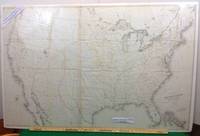
1855102New York: Ackerman Lith 1855. First edition thus. Map. Near Fine. A Near Fine map. 33 x 49 inches. Black and white engraving with hand-colored borders in yellow and red. Original folds present. A near fine example of a rare large size pre-civil war map. David H. Burr is listed as draftsman U.S. SENATE. Burr was 'Geographer and Draftsman to the Senate' between 1855-59 1855 Large map of the United States issued after the Gadsden Purchase and prior to the Pacific Railroad Survey. Shows Kansas and Nebraska possibly the first government map to do so. West Virginia is not separated from Virginia. . Ackerman Lith unknown
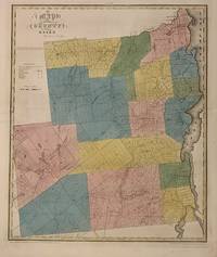
1829300575New York 1829. unbound. Rawdon Clark & Co. Map. Engraving with original hand outline color. Image measures 22 x 18 1/4 inches. Some chips to margins and repairs to left centerfold but otherwise in good condition.<br/> <br/> This 1829 map depicts Essex County in the high peaks region of the Adirondacks divided into 17 towns in full vivid color. Lake Champlain forms the right border of the region and Lake Placid yet unnamed appears in the upper left. The map denotes major routes waterways and topographical details and icons label villages flouring mills factories forges saw mills and churches. This first edition of Burr's county map appeared in his "Atlas of the State of New York" of the same year which was the second atlas of an individual state ever published. The map is in good condition with light foxing throughout and some ink stains in the lower right margin not affecting the image. Full original margins. <br> <br> David H. Burr 1803-1875 served as Topographer to the United States Post Office and Geographer to the House of Representatives and was widely known for his accuracy and attention to detail. His "Universal Atlas" was the first to map each of the United States individually. This map is a lovely rendering of a scenic area in New York State.<br/> <br/> unknown
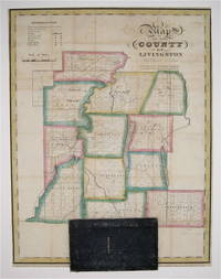
1829233726New York: David Burr 1829. First. unbound. Pocket map. Copper plate engraving with original hand-coloring. Map attached to blue leather binding as issued title stamped in gold. Image measures 15 1/2 x 12".<br/> <br/> This rare fold-out pocket map depicts Livingston County in the Finger Lakes region of New York divided into 12 towns outlined in vivid color. The map is centered around the town of Geneseo and denotes major routes waterways and topographical details. Icons label villages flouring mills factories forges saw mills and churches. The map is in excellent condition with no tears of any kind. Some scattered staining especially along original folds. It is attached to its original leather cover and the watermark of the paper is visible. David H. Burr 1803-1875 served as Topographer to the United States Post Office and Geographer to the House of Representatives and was widely known for his accuracy and attention to detail. Burr was one of the first cartographers to map each of the United States individually. Issued separately rather than included in his seminal "Universal Atlas" this pocket map is a scarce version of Burr's celebrated work.<br/> <br/> David Burr unknown
1856RBURMAP01abs1856. Good. Burr David H. Map Showing the Extent of Surveys in the Territory of Utah Wahsatch and Salt Lake. NP: NP 1856. 16.5"" x 35"". paper with matboard. Book condition: Good with bumped and torn edges. Slight yellowing soiling and creasing. ""Examined and approved this 30th Sept. 1856 Sur Gen David H. Burr of Utah"". Extends from Mt Nebo up to Cache and Hansel Spring Valleys. Includes eastern shore of the Great Salt Lake. unknown