BURR, David HBiblio.com
2 805 résultats
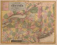
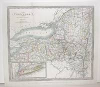
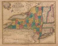
1840312198New York: Stone and Clark 1840. Rawdon Clark & Co. Map. Copper plate engraving with original hand coloring. Image measures 19 3/4" x 25"<br/> <br/> Rare map of New York state and parts of Pennsylvania Connecticut Massachusetts New Jersey Vermont and New Hampshire divided into counties and vibrantly colored. Denotes cities towns major routes waterways and topographical features all in beautiful detail. A table in the upper left lists Congressional and Senatorial districts. On the map Senatorial districts are outlined and numbered. Updated from the 1829 map with changes to the counties and Railroad routes are featured. In very good condition with minor wear to margins. Lower left corner creased and flattened. <br> <br> David H. Burr 1803-1875 served as Topographer to the United States Post Office and Geographer to the House of Representatives and was widely known for his accuracy and attention to detail. His "Universal Atlas" was the first to map each of the United States individually.<br/> <br/> Stone and Clark unknown
1829312199New York 1829. unbound. Rawdon Clark & Co. Map. Copper plate engraving with original hand coloring. Image measures 19 7/8" x 25.25".<br/> <br/> Stunning rare map of New York state divided into counties. Denotes towns major routes waterways and topographical features all in beautiful detail. Includes insets of three canal profiles Champlain Seneca and Erie. Part of Upper Canada and Lake Huron included. New England also included in outline color. In good condition with foxing and toning near center fold and surface dirt with a crease in the lower left portion. David H. Burr 1803-1875 served as Topographer to the United States Post Office and Geographer to the House of Representatives and was widely known for his accuracy and attention to detail. This atlas was among the first to map each of the United States individually.<br/> <br/> unknown
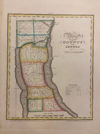
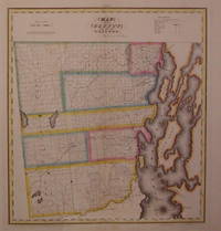
1829293671New York: David H. Burr 1829. unbound. Rawdon Clark & Co. Map. Copper plate engraving with original hand-coloring. Image measures 11 3/4 x 14 1/2 inches.<br/> <br/> This map depicts Seneca County in eastern New York divided into 9 towns outlined in vivid color. Seneca Falls is named as is the Cayuga%u2013Seneca Canal. The map denotes major routes waterways and topographical details and icons label villages flouring mills factories forges saw mills and churches. This first edition of Burr's county map appeared in his "Atlas of the State of New York" of the same year which was the second atlas of an individual state ever published.<br> <br> The map is in good condition with light foxing throughout. Full original margins.<br> <br> David H. Burr 1803-1875 served as Topographer to the United States Post Office and Geographer to the House of Representatives and was widely known for his accuracy and attention to detail. His "Universal Atlas" was the first to map each of the United States individually. This map is a lovely rendering of a hard-to-find county in New York State.<br/> <br/> David H. Burr unknown
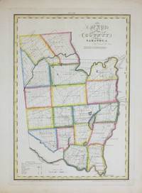
1829264493New York: David H. Burr 1829. unbound. Rawdon Clark & Co. Map. Copper plate engraving with original hand-coloring. Image measures 12 x 17 1/2".<br/> <br/> This map depicts Saratoga County in eastern New York divided into 18 towns outlined in vivid color. The county is bordered by the Hudson River in the east and the Mohawk River in the south. Saratoga Springs is identified. The map denotes major routes waterways and topographical details and icons label villages flouring mills factories forges saw mills and churches. This first edition of Burr's county map appeared in his "Atlas of the State of New York" of the same year which was the second atlas of an individual state ever published.<br> <br> The map is in good condition with light foxing throughout. Full original margins.<br> <br> David H. Burr 1803-1875 served as Topographer to the United States Post Office and Geographer to the House of Representatives and was widely known for his accuracy and attention to detail. His "Universal Atlas" was the first to map each of the United States individually. This map is a lovely rendering of a hard-to-find county in New York State.<br/> <br/> David H. Burr unknown
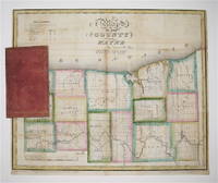
1829233728New York 1829. unbound. Rawdon Clark & Co. Map. Copper plate engraving with original hand outline color. Map attached to red leather binding as issued title stamped in gold. Image measures 12 1/2 x 15".<br/> <br/> This rare fold-out pocket map depicts Wayne County in northwest New York on Lake Ontario divided into 15 towns outlined in vivid color. The map denotes major routes waterways and topographical details. Icons label villages flouring mills factories forges saw mills and churches. The map was published in 1829 during the Second Great Awakening which brought attention to this region of the state as a major site of religious revival. In particular the village and town of Palmyra which appear on the map served as an important site of discovery for Joseph Smith later the founder of the Mormon Church. The map is in excellent condition with no tears of any kind. Some scattered staining especially along original folds. It is attached to its original leather cover and the watermark of the paper is visible. David H. Burr 1803-1875 served as Topographer to the United States Post Office and Geographer to the House of Representatives and was widely known for his accuracy and attention to detail. Burr was one of the first cartographers to map each of the United States individually. Issued separately rather than included in his seminal "Universal Atlas" this pocket map is a scarce version of Burr's celebrated work.<br/> <br/> unknown
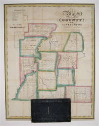
1829233726New York: David Burr 1829. First. unbound. Pocket map. Copper plate engraving with original hand-coloring. Map attached to blue leather binding as issued title stamped in gold. Image measures 15 1/2 x 12".<br/> <br/> This rare fold-out pocket map depicts Livingston County in the Finger Lakes region of New York divided into 12 towns outlined in vivid color. The map is centered around the town of Geneseo and denotes major routes waterways and topographical details. Icons label villages flouring mills factories forges saw mills and churches. The map is in excellent condition with no tears of any kind. Some scattered staining especially along original folds. It is attached to its original leather cover and the watermark of the paper is visible. David H. Burr 1803-1875 served as Topographer to the United States Post Office and Geographer to the House of Representatives and was widely known for his accuracy and attention to detail. Burr was one of the first cartographers to map each of the United States individually. Issued separately rather than included in his seminal "Universal Atlas" this pocket map is a scarce version of Burr's celebrated work.<br/> <br/> David Burr unknown
1829203497New York: DeWitt Simeon 1829. unbound. very good. Rawdon Clark & Co. Map. Copper plate engraving with original hand coloring. Image measures 18.5" x 17". Includes data text description.<br/> <br/> Fine antique map of Clinton County in northern New York State including part of Lake Champlain. Denotes townships major routes waterways and towns. In very good condition with some wear to corners. David H. Burr 1803-1875 served as Topographer to the United States Post Office and Geographer to the House of Representatives and was widely known for his accuracy and attention to detail. This atlas was among the first to map each of the United States individually. Included is a separate page with statistical information and a historical description of Clinton County. Please visit our Gallery for more Burr New York county maps.<br/> <br/> DeWitt, Simeon unknown
59009Philadelphia: P. S. Duval & Son Lith. Map. Good . Published as part of Sen. Ex. Doc. No. 5. 3d. Sess. 34 Cong. Map 17 1/2" x 33 1/4" with fold tears and a complete horizontal tear through the lower third. There is a loss from the top border that measures 8 1/2" long by 1/2" deep does not affect image. Moffat 44. A grid map from one of the first significant American map publishers. He was responsible for producing the 1829 "Atlas of the State of New York" the second atlas of an individual U.S. state.<br /> <br /> Moffat notes "There are many different names on this map: Santaquin is 'Summit Cr.'; Pleasant Grove is 'Battle Cr.'; Alpine is 'Mountainville'; Draper is 'Willow Cr.'; Brigham City is 'Box Elder'; and North Ogden is 'Ogden Hole.' P. S. Duval & Son Lith unknown
1856RBURMAP00fpGovernment Printing Office 1856. Very Good. Burr David H. Map Showing the Extent of Surveys in the Territory of Utah 1856. Washington D.C.: Government Printing Office 1856. one folded sheetpp. 17 "" x 34"". Framed folded sheet map. Book condition: Very good. Light toning along folds. Framed under glass in frame with a few nicks and scratches. A Nice copy of a map extracted from a General Land Office Report. Map shows land surveyed along the Wahsatch front from the Bear River Valley to just south of Utah Lake. Government Printing Office unknown
1856RBURMAP01abs1856. Good. Burr David H. Map Showing the Extent of Surveys in the Territory of Utah Wahsatch and Salt Lake. NP: NP 1856. 16.5"" x 35"". paper with matboard. Book condition: Good with bumped and torn edges. Slight yellowing soiling and creasing. ""Examined and approved this 30th Sept. 1856 Sur Gen David H. Burr of Utah"". Extends from Mt Nebo up to Cache and Hansel Spring Valleys. Includes eastern shore of the Great Salt Lake. unknown
1856RBURMAP00abs1856. Good. Burr David H. Map Showing the extent of Surveys in the Territory of Utah 1856 Wahsatch and Salt Lake. NP: NP 1856. 16.5"" x 35"". paper with matboard. Book condition: Good with slightly bumped edges. Slight soiling yellowing and creasing. Closed tears in center of map yet do not interrupt image. ""Examined and approved this 30th Sept. 1856 Sur Gen David H. Burr of Utah"". Extends from Mt Nebo up to Cache and Hansel Spring Valleys. Includes eastern shore of the Great Salt Lake. unknown
M2743New York: Thomas Illman 1836. Two tears in lower margin repaired otherwise in very good condition. Size : 270x310 mm 10.625x12.25 Inches Coloring: Original Hand Coloring Category: Maps United States New England States; Thomas Illman unknown
1836M2572New York: Burr David H. 1836. Very Good small tear 1" entering image in the upper left corner professionally repaired. Notes: From David Burr's "A new Universal Atlas comprising Separate Maps of all the Principal Empires Kingdoms & States Throughought the World" 1836 New York. Size : 261x298 mm 10.25x11.75 Inches Coloring: Original Outline Coloring Category: ; Maps United States East New York Burr, David H. unknown
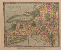
1835312196New York: David H. Burr 1835. unbound. Map. Engraving with original hand coloring. Image measures 10 3/8" x 12 1/4"<br/> <br/> Early map of New York beautifully hand colored to show county divisions. An inset in the lower left corner depicts Long Island and New York City. Cities towns major routes topographical features islands and waterways are labeled. In very good condition. Some wear and signs of aging at margins not affecting the image.<br> <br> David H. Burr 1803-1875 served as Topographer to the United States Post Office and Geographer to the House of Representatives and was widely known for his accuracy and attention to detail. His "Universal Atlas" was the first to map each of the United States individually.<br/> <br/> David H. Burr unknown
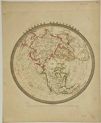
1836324310New York: Illman & Pilbrow 1836. unbound. Map. Engravings with original hand coloring. 15" x 12 1/8".<br/> <br/> This map features a polar projection of the Northern Hemisphere. Rivers major cities and islands are labeled. In very good condition with minor scuffs to outside margins not affecting the image. <Br> <Br> David H. Burr 1803-1875 served as Topographer to the United States Post Office and Geographer to the House of Representatives and was widely known for his accuracy and attention to detail. His "Universal Atlas" was the first to map each of the United States individually.<br/> <br/> Illman & Pilbrow unknown
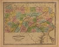
1834310002New York: Illman and Pilbrow 1834. unbound. Thomas Illman. Map. Engraving with original hand coloring. Image measures 10 1/2" x 12 5/8"<br/> <br/> Early map of Pennsylvania beautifully hand colored to show county divisions. Cities towns major routes topograhical features islands and waterways are labeled. In very good condition. Mat burn to margins.<br> <br> David H. Burr 1803-1875 served as Topographer to the United States Post Office and Geographer to the House of Representatives and was widely known for his accuracy and attention to detail. His "Universal Atlas" was the first to map each of the United States individually.<br/> <br/> Illman and Pilbrow unknown
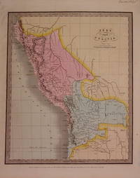
1835204780New York: Illman & Pilbrow 1835. unbound. very good. Map. Engraving with original hand coloring. Image measures 12.75" x 10.5".<br/> <br/> Shows Lake Titicaca as Bolivian whereas modern borders share it with Peru.<br/> <br/> Illman & Pilbrow unknown
1835324308New York: Illman & Pilbrow 1835. unbound. Map. Engravings with original hand coloring. 15" x 12 1/4".<br/> <br/> The first edition of this map features a polar projection of the Southern Hemisphere omitting the entirety of the Antarctic continent. Includes much of South America the southern half of Africa and Oceania - with Australia labeled as "New Holland." Dozens of islands are extensively labeled. The Pacific Ocean is mislabeled as Atlantic. In very good condition. <Br> <Br> David H. Burr 1803-1875 served as Topographer to the United States Post Office and Geographer to the House of Representatives and was widely known for his accuracy and attention to detail. His "Universal Atlas" was the first to map each of the United States individually.<br/> <br/> Illman & Pilbrow unknown
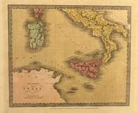
1835329965New York: Thomas Illman 1835. unbound. Map. Engraving with original hand coloring. Image measures 10 3/8" x 12 5/8"<br/> <br/> Unusual map of Italy depicting the Kingdom of Naples the islands of Sicily and Sardinia and parts of Corsica. The map extends from the northern coast of Africa to the Papal states. Major cities rivers roads and topographical features are labeled. Topography is depicted by hachure. In good condition with minor staining throughout. <br> <br> David H. Burr 1803-1875 served as Topographer to the United States Post Office and Geographer to the House of Representatives and was widely known for his accuracy and attention to detail. Burr was one of the first cartographers to map each of the United States individually.<br/> <br/> Thomas Illman unknown
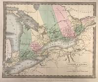
1835321534New York: Wm. Hall & Co 1835. unbound. Map. Engraving with original hand coloring. 12" x 15".<br/> <br/> Antique map of Upper Canada also known as Ontario divided into districts. Shows towns major routes waterways and topographical features. Based on Greenleaf's map of the area but does not include indigenous territories. Slight foxing in Lake Erie.<br> <br> David H. Burr 1803-1875 served as Topographer to the United States Post Office and Geographer to the House of Representatives and was widely known for his accuracy and attention to detail. Burr was one of the first cartographers to map each of the United States individually.<br/> <br/> Wm. Hall & Co unknown
1836M2577New York: Illman Thomas 1836. Good; some restoration in the lower left corner. Notes: From David Burr's "A new Universal Atlas comprising Separate Maps of all the Principal Empires Kingdoms & States Throughought the World" 1836 New York. Size : 340x290 mm 13.375x11.375 Inches Coloring: Original Outline Coloring Category: Maps United States New England States; Illman, Thomas unknown
031328945X.Ghardcover. Good. Access codes and supplements are not guaranteed with used items. May be an ex-library book. hardcover
1995Q-031328945XGreenwood Press 1995-02-14. Hardcover. New. New. In shrink wrap. Looks like an interesting title! Greenwood Press hardcover
410768-6Bloomsbury Publishing USA. Used - Good. Former library copy. Pages intact with minimal writing/highlighting. The binding may be loose and creased. Dust jackets/supplements are not included. Includes library markings. Stock photo provided. Product includes identifying sticker. Better World Books: Buy Books. Do Good. Bloomsbury Publishing USA unknown
1995SONG031328945XBloomsbury 1995-02-14. First Edition. hardcover. Used: Good. 5.50x0.56x8.50. Buy with confidence. Excellent Customer Service & Return policy. Bloomsbury hardcover