Farragut, David Glasgow (1801-1870)Antiquariat.de

14 résultats
185058269Leipzig, Zehl (Druck), um 1850. Darstellung ca. 8 x 8,5 cm, Blatt ca. 19 x 12,5 cm. 1 Blatt, verso weiß.
186514682New York: Harpers History of the Civil War. 1865. Non-Book. This wood engraving is in very good condition full borders as published text on reverse fine detail later beautiful hand-coloring. Images available. A stunning engraving. ; 22" x 16" . Harpers History of the Civil War unknown
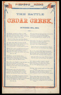
186430878Philadelphia: J. Magee 1864. Broadside. Single sheet folded. Printed in blue and red on the first page only. Thirteen verses with chorus red and blue ornamental border with American flags and the words Liberty and Union Forever. Blindstamp of the Southworth Co. paper company of Massachusetts on the top left edge. Measures approximately 20 x 25 cm 8 x 10". The red part of the ornamental border is printed out of register. Faint pencil markings on the top edge and on the lower edge of the last page mild soiling. Very good. J. Magee unknown
186618628Hartford, Conn., W. S. Williams, 1866. With Illustrations. Frontispiece engraved on steel by Geo. E. Perine. 12 disguises and other scenes, drawn and engraved on wood by R. O'Brien. 8°, ca. 21,5 x 14 cm, 384 p., blind- und goldgeprägter Lederband. Printed by Wiley, Waterman, & Eaton, Hartford. To the sick and wounded soldiers of the Army of the Potomac, this volume is respectfully inscribed by the author. Publishers' Notice: "The 'Nurse and Spy' is simply a record of events which have transpired in the experience and under the observation of one who has been on the field and participated in numerous battles - among which are the first and second Bull Run, Williamsburg, Fair Oaks, the seven days in front of Richmond, Antietam, and Fredericksburg, - serving in the capacity of 'Spy' and as 'Field Nurse' for over two years. The illustrations: Portrait of the author / Hospital tree at Fair Oaks / Catering for hospital / Disguised as a contraband / Making hoe-cake for a sick rebel / Acting orderly on the battle-field / Riding for Life / Relief for the famishing / Disguised as female contraband / An interesting patient / Playing Possum / Paying a debt of gratitude / Bursting of a shell in Vicksburg. Dedicated on the first leave: To Therese Rosenfeld with love from her aunt J. R., New York, January 22, 1867. Lederband mit goldgeprägtem Rückentitel und blindgeprägtem Deckel. Kleiner Einriss im Vorsatzfalz, Widmung auf fliegendem Blatt, Kanten etwas berieben, papierbedingt gebräunt, wenige Seiten im Randbereich etwas fleckig, sonst gut erhalten.
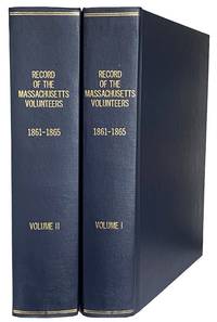
187044001Boston: Wright & Potter Printers to the State 1870. Thick4to. 29cm First Edition in 2 volumes 793 & 10851p. errata page rebound in full dark blue cloth gilt spine titles the paper is toned but sound marginal stain on the last few leaves on volume one the text is otherwise sound and clean a fine set. fine. Subjects<br /> A comprehensive two-volume official publication by the Adjutant General's Office documenting the service of state regiments during the Civil War. It details rosters service dates and histories for thousands of soldiers. ~ Content: contains roster lists battle summaries and records for soldiers in Massachusetts volunteer regiments. Volume I: Covers regiments 1-32 and 1st Heavy Artillery. Volume II: Covers regiments 33-62 2nd Heavy Artillery and various cavalry/light battery units. Wright & Potter, Printers to the State unknown
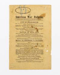
1870134066Port Elizabeth: Richards Impey & Co 1870. First Edition. Hardcover. Fair. Port Elizabeth Richards Impey & Co. circa 1870. One leaf 216 × 140 mm printed on both sides; paper tanned and marked with a few small holes and chips; mild signs of use; in decent condition now housed in a custom-made stiffened cloth folder. A rare South African handbill advertising a touring 'Diorama' of the American Civil War. The recto provides the sequence of events from the bombardment of Fort Sumter Bull Run the battle between the 'Kearsarge' and 'Alabama' the main battles from Gettysburg to General Lee's surrender at Appomattox and Lincoln's assassination and funeral. <p>The verso is headed 'For the Children visiting the American War Diorama' and contains a poem by Harry Stanley about an orphan boy at Christmas. This side has the imprint of T.H. Grocott Machine Printer Grahamstown. <p>Provenance: Geoffrey Ingleton with the G. & N. Ingleton bookplate inside the front flap of the portfolio and the Ingleton Collection catalogue inkstamp and number 10492 on the verso of the leaflet. Richards, Impey & Co hardcover
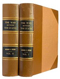
186843994Philadelphia; Cincinnati; Atlanta .: National Publishing Company 1868. 8vo. 23.2cm First Edition in 2 volumes 654 & xii5-827pp. plus engraved frontis view & 15 engraved portrait plates 1 plate being A Sketch of the Battleground of Manassas; And 3 facsimiles letters from Abraham Lincoln to Stephens on 6 page contemporary style half brown polished calf gilt ruled raised bands double crushed morocco black labels gilt titles and tan fine grain linen boards former owner's name of both title pages faint damp stain on the frontis portrait of Stephens otherwise in fine sound condition. fine. A contemporary account of the American Civil War by the former vice president of the Confederate States of America published in book form 1868-1870.Howes S-938: "Most elaborate - and best - argument for the constitutional validity of the doctrine of state sovereignty and the right of secession". ~ The portraits include Jefferson Washington Daniel Webster Andrew Jackson Lincoln Jefferson Davis Robert E. Lee Ulysses S. Grant. and a frontis view of Liberty Hall. National Publishing Company unknown
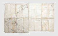
18611848021861-63. The Royal Navy visits the warring North and South Made aboard HMS Rinaldo the map charts its two-year voyage in which it visited the capitals of both sides during the Civil War and transported Confederate emissaries while surviving two serious weather incidents. The accomplished map shows the wide-ranging route of the ship and includes drawings of the early Confederate flag the "Stars and Bars". Rinaldo was a Camelion-class wooden screw sloop launched in 1860 and in operation until 1884. It was commanded by William Nathan Wrighte Hewett who won a Victoria Cross during the Crimean War. The ship sailed from Spithead on 2 June 1861 but as noted on the map "sprang a leak" 400 miles offshore and returned to Plymouth on 18 June. It set off again in July and arrived at Halifax Nova Scotia following a stop in Madeira. It then travelled on to New York. In December it went to Cape Cod to collect the Confederate emissaries John Slidell and James Murray Mason. Slidell and Mason had been forcibly removed from the British steamer Trent causing a diplomatic incident - the Trent Affair - between Britain and the Union government which came close to war. It then set off to Halifax where they could be transported back to Britain. However harsh conditions off the coast of Newfoundland ensured the ship instead travelled to Bermuda. After it failed to arrive at Halifax newspapers reported the ship was feared lost; some Union newspapers celebrated Slidell and Mason's likely demise. The passage on the map shows this abrupt detour. The ship arrived safely in Bermuda in late January 1862 where the emissaries switched to the La Plata for the voyage to Britain. From Bermuda Rinaldo travels along the Confederate coast visiting Charleston Mobile New Orleans and Galveston. The map maker has drawn the Union flag over New York and the early Confederate flag over Charleston Mobile and Galveston featuring the stars in the upper left and red and white bars across prior to the better-known flag used from 1863 onwards. For New Orleans he has drawn the flag of Louisiana in use from 1861 to 1865. While in New Orleans Commander Hewett succeeded in pressing General Butler to recognize the appointed British consul. Leaving America the Rinaldo travelled to Havana and then several stops across Mexico the West Indies and South America returning to Bermuda along the way. In March 1863 Hewett was relieved of his command and returned home. The chart is unfinished ending abruptly mid-Atlantic. Minutes of latitude and longitude are marked on the map. The Bahama Banks are shown in a pale wash marking a serious hazard to shipping and suggesting the sailor knew these waters well. Manuscript on waxed linen 752 x 431 mm. Slight soiling creased where folded. In very good condition. Regis A. Courtemanche No Need of Glory: the British Navy in American Waters 1860-1864 1977 covers the voyage in detail. unknown
18616001<p>Wood-engraved map with contemporary hand coloring engraved by Waters & Son New York with publisher's advertisement above map near contemporary marginal annotation to lower right margin which reads 'Position of Federal Army under General Maclellan sic July 1862 stretching towards the James River'; two closed tears in image carefully restored and barely visible a few other very minor repairs; a little fraying and some light discoloration at an old fold. 55.5 x 32.5 cms. Altogether a very nice example attractive.<br /></p><p>An attractive contemporary hand-colored very rare this edition not in the Library of Congress separately issued US Civil War map focusing on the area of Virginia and Maryland where the earliest battles were fought between the Union and Confederate armies and among the earliest broadside maps to specifically treat the battleground states in the growing conflict. Signaling its impartiality by prominently displaying both the Confederate and Federal flags the map represents the most recent news of the conflict in Virginia and Maryland from a British perspective as it was published in England and intended for a British audience. Britain was officially neutral in the American contest but had ardent sympathizers on both sides. Printed from a woodblock engraved by the New York firm Waters & Son the edition offered here is undated but must have appeared very early on around the time of the Battle of Bull Run the first important battle of the Civil War in July 1861. "Bull Run" the mapmaker states on the spot on the map where the actual battle was fought "is three miles from Manassas Junction between that point and Centreville." Water's engraving or its likeness would appear a number of times over the next several years with each edition or version bringing to the public's attention the most recent and sometimes climactic events of the war. Both American and British newspapers would report these events as they occurred and sometimes used an updated version of the Waters' woodblock as a full-page illustration. It is however particularly rare to find this map as a separately issued broadside printed on special paper such as the present contemporary hand colored example offered here. <br /></p><p>At the top of the sheet is text listing in separate columns the names of the Union and Confederate generals and a separate column for US exports in 1860. Notable is the enormous figure for US cotton which was exported primarily to England before the war nearly $192000 of $373000 of the total exports for the US economy – a statistic which must have reminded the British reader of the great cost the developing war would have on their textile industry. Much of the text is promotional. Bacon was perhaps the most important purveyor of American maps and atlases in England at the time and the representative for J.H. Colton one of the leading map publishers in the United States whose cartographic publications available from Bacon & Co. in England are prominently described and priced in the text.</p><p><b>A SHORT HISTORY OF THE MAP TO 1863</b></p><p>The earliest dated edition of Water's engraving which we were able to find appeared in the morning edition of the New York Herald on June 17 1861 Stevenson 451.3. Published a few weeks before the Battle of Bull Run specifically mentioned on our map but not in this newspaper version it notes in anticipation the number of troops amassing at Manassas Junction and on their way by train from the south. This edition was issued twice more on July 27 and September 11 the latter with no reference to the troops at Manassas. Another edition also entitled "Map of the Seat of War…." located at the BPL nearly identical to ours appeared in the London American Newspaper 1861. This version has an additional reference to the Battle of Bull Run below the map. All 3 of these maps found in <i>Stevenson's Civil War Maps</i> were published in newspapers. We find no reference to a separately issued broadside edition. Approximately a year later in an edition dated July 1862 Stevenson 452 the map once again appears this time updated to include Mc Clellan's position on the Peninsula which is shaded red as noted in several printed lines in the lower right corner. This latter is a handcolored broadside. The Library of Congress also has a similar example to ours though significantly modified published 2 years later in 1863 around the time of the invasion of Pennsylvania which replaces the historical and promotional text at the top of our sheet by extending the map north to include part of southern Pennsylvania and a list of Bacon's Shilling maps in the lower left hand corner Stevenson 476.5. This too is a colored broadside. In summary it appears that major battles or impending significant events such as Bull Run noted on ours and Mc Clellan's battle at Manassas may have been treated in a hand colored broadside publication. With the war continuing elsewhere the Waters' woodcut focusing on Virginia and Maryland became irrelevant to ongoing cartographic documentation of the war as battles moved from one locale to another in different parts of the country.</p><p>A handwritten contemporary annotation in the lower margin references a star added to the map by hand that updates it indicating the "Position of Federal Army under General Maclellan in July 1862 stretching towards the James River." Four minor punctures in the blank margins suggest that this copy was affixed to a wall at some point in its earlier history. A rare survival.</p><p>See Stephenson Richard. Civil War Maps An Annotated List of Maps and Atlases in the Library of Congress.</p>
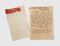
1861191066Camp Hardin Villa Ridge Illinois: 2 May 1861. A real Secession Flag. trampled it in the dirt. tore it in shreds A relic of one of the earliest captured Confederate flags taken in May 1861 and sent home by a young Union musician to his family. "Dear father Enclosed find a small piece of a real Secession Flag. It was torn down from a boat by our men. It is a real flag. When it was brought in camp we took it to the colonel's quarters. He made a short speech and trampled it in the dirt and the whole regiment tore it in shreds". On the verso he notes "Company A has the honor of tearing down the first Secession Flag". The letter was written by Christian Edmund Cotton 1846-1910 a musician in Company A 11th Illinois Infantry. The regiment was organized at Springfield mustered in on 30 April 1861 and ordered to Villa Ridge Illinois; Cotton was remustered on 30 July as principal musician and discharged in November 1863. He was 15 when he wrote this letter which has some crude spelling. The opening shots of the Civil War were fired at Fort Sumter on 12 April 1861. Though there are are reports of captured flags as early as April this is certainly an exceptionally early example from the first weeks of the rebellion. It is also from the earliest form of the Confederate flag: the initial "Stars and Bars" design had seven stars and three bars and was in use from 4 March to 18 May 1861 when a nine-star design was adopted. Single sheet 202 x 123 mm handwritten in pencil both sides fragment of flag pinned at head 102 x 28 mm. Together with manuscript transcript on letterhead of G. R. Vanhorne director of the Memorial Museum in Rockford Illinois circa 1900. Small patch of tape repair on verso toned slight splits along old folds. In good condition. unknown
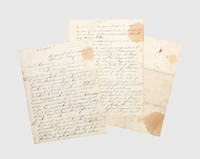
1865190638Charleston: 15 February 1865. It has been determined to evacuate the city of Charleston The military orders sent to the commander of the Confederate garrison in Charleston ordering the evacuation of the city as Sherman's army advanced. Charleston was a symbol of the Confederacy both the birthplace of secession and the site of the war's first shots. The city endured nearly two years under siege by the Union forces suffering heavy shelling from land and water. In February 1865 Union forces seized the South Carolina Rail Road leaving the Northeastern Rail Road as the Confederates' only escape route. On 15 February General Beauregard ordered the city to be evacuated immediately while the rail line remained open. These orders are marked "Confidential" and addressed the same day to Edward Clifford Anderson 1815-1883 who had commanded the post of Charleston since January. They open bluntly: "It has been determined to evacuate the city of Charleston". Thirteen detailed instructions follow including: "I. I desire you to make every preparation for the destruction early Friday night of your guns and gun carriages and such powder as may be left in your magazines as may be consistent with a safe retreat. To attempt to burst your guns or blow up your magazines would perhaps be a premature intimation of our intention to the enemy; therefore you will destroy the gun carriages as far as practicable by sawing and cutting them to pieces; your guns by spiking and shotting them and your powder by throwing it into the water". "IV. On the day of Friday you will cause all the small boats along the wharves to be destroyed by staving them". "V. You will cause the Ashley river bridge to be burned just before the time our troops leave town and you will take steps to provide yourself with combustibles beforehand for that purpose." "VII. When you move you will require your troops to march compactly commanding officers of companies in rear of their companies and permit no soldier to break ranks for any purpose without permission of the commanding officer of his company. Direct the officers to enforce this if necessary by shooting the offender". The evacuation proved chaotic. Jefferson Davis tried to postpone the order but was overruled. Cotton stores were burned and soon after Confederate troops departed the fires reached unexploded munitions causing a devastating explosion at the Northeastern Rail Road depot that killed about 150 people. Union forces entered the city on 18 February and Mayor Charles Macbeth surrendered Charleston to their control and protection. The Official Records vol. XLVII p. 1195 show orders sent the same day from General William B. Taliaferro to Brigadier General S. Elliott conveying similar instructions higher in the chain of command. Comparable orders may have been sent to several commanders in and around Charleston; however we have located no other copy. 3 sheets of lined paper 239 x 181 mm handwritten on 4 pages the final sheet has docketed title final page blank. Splits along old folds with minor repairs staining and foxing: in good condition given its wartime history. unknown
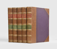
1861190985New York: Harper & Brothers 1861-65. A rich treasury for the historical investigator The complete run of Harper's Weekly from the American Civil War an essential primary source for the conflict containing thousands of woodcut illustrations portraits of military figures political cartoons maps and battle plans. Harper's Weekly was founded in 1857. The set is complete from January 1861 to December 1865 covering the entirety of the war April 1861 to April 1865 alongside the build up to it and beginnings of Reconstruction. All 260 weekly numbers are present together with the annual title pages which were supplied for binding into volumes. Though it had supported Stephen A. Douglas in 1860 and had earlier sought not to alienate Southern readers once war began Harper's Weekly became decisively Unionist; by 1863 it strongly backed Abraham Lincoln emancipation and the Republican cause. Many of the wood engravings were based on photographs which are otherwise lost while others were drawn by prominent artists including Winslow Homer and Thomas Nast. "The old files of Harper's Weekly are a delight to the casual reader and a rich treasury for the historical investigator. Here is a vital illustrated history. The combination of pictures politics essays and fiction lends variety; and the frequent excellence of contributions in all these kinds together with the known influence of the journal upon its times gives first-rate importance" Mott p. 469. 5 vols folio 398 x 283 mm. Recent half morocco twin red and green morocco labels purple cloth sides printed marbled endpapers. Contents toned with occasional repairs and a few instances of faint marginal staining running ink stain at foot of vol. II. In very good condition. Frank Luther Mott A History of American Magazines Volume II 1970. hardcover