8 361 résultats
238470LL. dd. [Paris, Quimper, Troyes et Dijon], 1790 - 1794 39 pièces in-4 ou in-8, brochées sous couvertures modernes de papier bleu imprimé. Mouillures claires à certaines pièces.
Very Good Turkish, Ottoman (1500-1928) Original color map. Very good and clean. Atlas folio. (73 x 59 cm). In Ottoman script. Map of New United States, Canada, Alaska; and South America. Scale: 1/35000000. Hegira: 1341 = Gregorian: 1925. Mehmed Neset Bey was born in Scutari, Istanbul. He served as colonel in World War 1 and Turkish National Struggle. He was a military origin map-maker. (Source: Savaslarda haritacilar, Harita Genel Komutanligi, Ank., 2017). Extremely rare.
Very Good French Original b/w map. Oblong folio. (30 x 34 cm). In French. [MAP of BATTLE of MOHACZ] Bataille de Mohacz entre Louis Roi de Hongrie et Souleman I. le 28 Aôut 1526 (20 Silkide 932). Grave par U. Muschani. Atlas des batailles et sieges pour servir a l'histoire de l'Empire Ottoman, Pl. VIII. From "Nouvel atlas physique, politique et historique de l'Empire ottoman et des États limitrophes. / dressé. par J.-J. Hellert ; revu, corrigé et accompagné d'un commentaire historique, géographique et statistique. par Ge Heck, et L[é]on Plée..." printed in 1843. Engraved. Rare.
Very Good French Original b/w map. Oblong folio. (25 x 37 cm). In French. Jean-Denis Barbié, dit Barbié du Bocage , né le 28 avril 1760 à Paris et mort dans cette ville le 28 décembre 1825, est un géographe et cartographe français, doyen de la Faculté de lettres de Paris, membre de l'Institut. It shows Black Sea and its shores with their old toponyms very detailed.
Very Good Turkish, Ottoman (1500-1928) Original color map. Chipped on folded places. Folded. Slightly toning on paper. Oblong atlas folio. (62 x 89 cm). In Ottoman script. Map of New Europe. Scale: 1/10.000.000. Gregorian: 1927. It's printed from 'Sudi Bey' Map Corpus. This was a map serie printed in the early Republican period in Turkish with Arabic letters. Very decorative map with its color flags of various countries longitudinal on right and left sides of map. Sudi printing house was an Ottoman / Turkish publisher who was one of the longest-running of Turkish publishers.
Very Good Turkish, Ottoman (1500-1928) Original color map. Chipped on folded places. Folded. Slightly toning on paper. Oblong atlas folio. (63 x 94 cm). In Ottoman script. Map of New Oceania. It shows Australia, Bahr-i Muhit-i Kebir, Pacific Ocean, New Zealand, Micronesia et alli. Scale: 1/20.000.000. Gregorian: 1927. It's printed from 'Sudi Bey' Map Corpus. This was a map serie printed in the early Republican period in Turkish with Arabic letters. Very decorative map with its color flags of various countries longitudinal on right and left sides of map. Sudi printing house was an Ottoman / Turkish publisher who was one of the longest-running of Turkish publishers.
Very Good Turkish, Ottoman (1500-1928) Original color map. Very good and clean. Atlas folio. (73 x 59 cm). In Ottoman script. Map of Oceania. It shows Australia, New Zealand, Micronesia etc. Scale: 1/20.000.000. Hegira: 1341 = Gregorian: 1925. Mehmed Neset Bey was born in Scutari, Istanbul. He served as colonel in World War 1 and Turkish National Struggle. He was a military origin map-maker. (Source: Savaslarda haritacilar, Harita Genel Komutanligi, Ank., 2017). Extremely rare.
Very Good French Original b/w map. Oblong folio. (30 x 34 cm). In French. [MAP of OTTOMAN CRIMEA] Crimee. Gravee par U. Muschani. Shows Crimean peninsula, shores of Black Sea, Azov Sea, Kerkinit Golf, with its old places names. From "Nouvel atlas physique, politique et historique de l'Empire ottoman et des États limitrophes. / dressé. par J.-J. Hellert ; revu, corrigé et accompagné d'un commentaire historique, géographique et statistique. par Ge Heck, et L[é]on Plée..." printed in 1843. Engraved. Rare.
Very Good Turkish, Ottoman (1500-1928) Original color map on cloth. Oblong: 67x75 cm. In Ottoman script. Folded originally. A very detailed map. Scale: 1:210.000. Shows Shkodra Lake, its shores, Bog Mountains, Karadag (Montenegro), Iakoh, Has etc. [MAP of OTTOMAN PROVINCE of BALKANS-ALBANIA] 52 Ipek (Peja). 53 Yakoh. 59 Akola. 60 Iskodra (Shkodra).
Very Good Turkish, Ottoman (1500-1928) Original color map. Folded. Very good. Large oblong 8vo. (21 x 26 cm). In Ottoman script. [MAP of OTTOMAN PROVINCE of DIYAR-I BEKR] Diyarbakir Vilâyeti. Province of Diyarbekir in Southeast Anatolia and its around. Many sandjaks and provinces with their detailed place names. Scale: 1/500.000.
Very Good Turkish, Ottoman (1500-1928) Original color map. Folded. Very good. Large oblong 8vo. (21 x 26 cm). In Ottoman script. [MAP of OTTOMAN PROVINCE of DIYAR-I BEKR] Diyarbakir Vilâyeti. Province of Diyarbekir in Southeast Anatolia and its around. Many sandjaks and provinces with their detailed place names. Scale: 1/1.500.000.
Very Good Turkish, Ottoman (1500-1928) Original color map. Folded. Very good. Large oblong 8vo. (21 x 26 cm). In Ottoman script. [MAP of OTTOMAN PROVINCE of EASTERN ROUMELI] Rumeli-yi Sarkî Vilâyeti, Bulgaristan Eyâleti, Edirne Vilâyeti, [Trakya], Selânik Vilâyeti. [East Roumeli, Salonica, Adrianople provinces; Old Zagra Sandjak, Bulgarian State]. Scale: 1/1.500.000. Ottoman Provinces in the Balkan Peninsula.
Very Good Turkish, Ottoman (1500-1928) Original color map. Folded. Very good. Large oblong 4to. (19 x 37 cm). In Ottoman script. [MAP of OTTOMAN PROVINCE of ERZURUM] Erzurum Vilâyeti. Province of Erzurum of east Anatolia and its around. Many sandjaks and provinces with their detailed place names. Scale: 1/1.500.000.
Very Good Turkish, Ottoman (1500-1928) Original color map. Folded. Very good. Oblong 4to. (21 x 42 cm). In Ottoman script. [MAP of OTTOMAN PROVINCE of KONIA] Konya Vlâyeti and around; Burdur, Isparta, Teke sandjaks, Hüdavendigâr Province Tozlu Ova, Tuz Gölü etc. Scale: 1/500.000.
Very Good Turkish, Ottoman (1500-1928) Original color map. Folded. Very good. Large oblong 8vo. (26 x 26 cm). In Ottoman script. [MAP of OTTOMAN PROVINCE of SIVAS] Sivas Vilâyeti, Trabzon Vilâyeti, Tokat Sancagi. [Sivas and Trabzon Provinces, Tokat Sandjak]. Scale: 1/1.500.000.
Very Good Turkish, Ottoman (1500-1928) Original color map. Folded. Very good. Obblong 4to. (21 x 38 cm). In Ottoman script. Scale:: 1/500.000. [MAP of OTTOMAN PROVINCE of TREBIZOND] Trabzon Vilâyeti, Trabzon Sancagi, Canik Sancagi, Sivas Vilâyeti. [Provinces of Trabzon and Sivas; Canik and Trebizond Sandjak]. Black Sea at north.
Very Good Turkish, Ottoman (1500-1928) Original color map. Folded. Very good. Large oblong 8vo. (21 x 26 cm). In Ottoman script. [MAP of OTTOMANT SALONICA -THESSALONIKI-] Selânik Vilâyeti. Ottoman Greece. Scale: 1/1.500.000. It shows Thessaloniki and its around. Manastir Vilayat, At north Kosovo, Siroz Sandjak etc.
164103LL. dd., 1815-1820 8 pièces en un vol. in-folio, demi-basane fauve, dos lisse, coins en vélin (reliure de l'époque). Manques de cuir aux deux coiffes sur 3 cm.
166259Paris, 1819-1833 11 pièces en un vol. in-8, basane fauve racinée, dos lisse orné de filets, guirlandes et larges fleurons dorés, tranches mouchetées (reliure de l'époque). Accrocs en coiffe sup., dos un peu frotté.
Very Good Turkish, Ottoman (1500-1928) Original engraved map on the silk handkerchief made in Yildiz Palace for the 'Iane Sergisi' [i.e. Exhibition of the Social Assistance] in the period of Sultan Abdülhamid II. In its decorative frame. Frame size: 53,5x53,5 cm; map size: 38x38 cm. In Ottoman script. Scale: 1/600.000. Several minimal splits, minor foxing, and slight stains on cloth. Otherwise in good condition. A rare and decorative 1897 silk handkerchief map of the Greco-Turkish War in 1897, which was the only war in which the Ottoman army was victorious during the reign of Abdulhamid 2, is a fine example of Ottoman / Turkish cartographic textiles made in Ottoman court (Yildiz Palace textile workshops). This beautiful map depicts an attractive war scene from the 1313 Greek War on the upper half, and it's engraved a map of Balkan & Greek lands on its lower half. War painting has 'Melona' signature in Ottoman script. The map shows Thessaloniki [i.e. Salonica] Bay on the west; Yanya [i.e. Ioanna] Vilayat on the east; lands of Greece, Galos Bay, Uzi Strait on the south and Dimetoka and Avalonia areas in the Serefiye, Ergiri sanjaks on the north in its period. Written on the map, "Baht-i himâye-yi feyzvâne-i cenâb-i hilâfetpenâhide evlad-i süheda ve mecrûhin-i asakir-i sâhâne", [i.e. It was printed for the "Iane Sergisi" (i.e. The Social Help Exhibition) in the high memory of our soldiers who were martyred and veterans in the Greek War under the patronage of the Sultan.]. The Greco-Turkish War of 1897, also called the Thirty Days' War and known in Greece as the Black '97 (Mauro '97), or the Unfortunate War (Atychis polemos), was a war fought between the Kingdom of Greece and the Ottoman Empire. Its immediate cause was the question over the status of the Ottoman province of Crete, whose Greek majority long-desired union with Greece. Despite the Ottoman victory on the field, an autonomous Cretan State under Ottoman suzerainty was established the following year (as a result of the intervention of the Great Powers after the war), with Prince George of Greece and Denmark as its first High Commissioner. This was the first war effort in which the military and political personnel of Greece were put to test since the Greek War of Independence in 1821. For the Ottoman Empire, this was also the first war effort in which the reorganized military personnel were put to test. The Ottoman army was under the guidance of a German military mission led by Colmar Freiherr von der Goltz, who had reorganized it after the defeat in the Russo-Turkish War (1877-1878). The conflict proved Greece was wholly unprepared for war. Plans, fortifications and weapons were non-existent, the mass of the officer corps was unsuited to its tasks, and training was inadequate. As a result, the numerically superior, better organized, equipped and led Ottoman forces pushed the Greek forces south out of Thessaly. Almost all of the aids made to the families or disabled people of those who were martyred in the 1897 Ottoman-Greek War (such as printing this map) were made within the framework of the donations of "Evlâd-i Süheda and Malûlîn-i Guzât-i Asâkir-i Sahane". People and citizens of all classes and beliefs, including members of the Ottoman court, ministers, bureaucrats, civil servants, merchants and tradesmen, participated in this aid campaign at the end of the 19th, beginning of the 20th century. Not in OCLC.
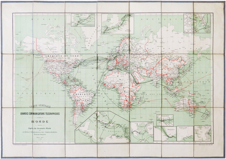
1901LBW-6826Berne, Kartographische Anstalt Lips, 1901. En 21 sections montées sur toile gris-bleu et pliées, formant une carte de 468 x 668 mm ; étiquette au dos portant le titre manuscrit.
19762080502106910829Not Available 1976. Soft Cover. Fine. The book is in fine condition. Not Available paperback
19762080502106912453Not Available 1976. Soft Cover. Fine. The book is in fine condition. Not Available paperback
2508P-13998A-1506EGovernment Printing Office 2017-11-15. paperback. Very Good. 7x0x10. This Book is in Very Good condition. See our picture for exact item you will receive. All items ship within 24 hours. Packaging is 100% Recyclable. Most items purchased from Charitable organizations. A portion of each sale is also donated to a monthly charity check your package for this month's charity. Reuse-Recycle-Rebook! Government Printing Office paperback